Category:United Kingdom photographs taken on 2009-09-01
Countries of Europe: Austria · Belarus · Czech Republic · Denmark · Finland · France‡ · Germany · Greece · Hungary · Italy · Latvia · Malta · Moldova · Netherlands‡ · Norway · Poland · Romania · Russia‡ · Slovakia · Spain‡ · Sweden · Switzerland · Turkey‡ · Ukraine · United Kingdom
‡: partly located in Europe
‡: partly located in Europe
| ← | 1 September 2009 | → | ||
| ← | September 2009 | → | ||

United Kingdom photographs taken on 1 September 2009.
Image files should be categorized here automatically using {{taken on}} template. Direct categorisation is also possible, if automatic is impossible.
Subcategories
This category has only the following subcategory.
Media in category "United Kingdom photographs taken on 2009-09-01"
The following 200 files are in this category, out of 833 total.
(previous page) (next page)-
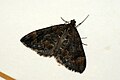 (1764) Common Marbled Carpet (Chloroclysta truncata) (3884541413).jpg 1,200 × 803; 699 KB
-
 2009 at Lancaster station - hydraulic buffer stops (153315).JPG 1,366 × 1,024; 409 KB
-
 37688 & 20306 Chesterfield.jpg 2,500 × 1,620; 1.93 MB
-
 A distant Bavelaw Castle - geograph.org.uk - 1468786.jpg 640 × 480; 106 KB
-
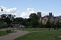 A park in Ely - geograph.org.uk - 1598794.jpg 640 × 428; 59 KB
-
 A Place in the Sun - geograph.org.uk - 1469861.jpg 640 × 480; 93 KB
-
 A Tight Squeeze in Beeston Lock - geograph.org.uk - 1469076.jpg 480 × 640; 90 KB
-
 A1033 Ryehill - geograph.org.uk - 1472632.jpg 640 × 480; 36 KB
-
 A2 High Street, Rainham - geograph.org.uk - 1469218.jpg 640 × 480; 58 KB
-
 A358 Henlade - geograph.org.uk - 1471210.jpg 640 × 480; 209 KB
-
 A4226 near Weycock Cross.jpg 640 × 480; 86 KB
-
 A48 in Taibach looking east - geograph.org.uk - 1471166.jpg 640 × 480; 81 KB
-
 Abstract (3879411280).jpg 3,090 × 2,318; 1.13 MB
-

-
 Aconbury Hill - geograph.org.uk - 1469025.jpg 640 × 480; 216 KB
-
 Across the field to Londesborough - geograph.org.uk - 1474157.jpg 640 × 480; 78 KB
-
 Across to the Eye Peninsula - geograph.org.uk - 1613210.jpg 640 × 480; 73 KB
-
 Aeshna.grandis.female.jpg 824 × 613; 365 KB
-
 Albion Street - geograph.org.uk - 1469063.jpg 640 × 469; 137 KB
-
 All Saints Church Granby Notts.JPG 3,376 × 2,440; 3.15 MB
-
 All Saints Church, Easington - geograph.org.uk - 1472544.jpg 640 × 480; 98 KB
-
 All Saints church, Rothbury - geograph.org.uk - 1513509.jpg 426 × 640; 173 KB
-
 All Saints church, Rothbury - geograph.org.uk - 1513514.jpg 640 × 426; 217 KB
-
 Ann`s Pasty Shop The Lizard well worth the drive - panoramio.jpg 2,048 × 1,536; 840 KB
-
 Apollo Cinema - geograph.org.uk - 1468777.jpg 640 × 428; 57 KB
-

-
 Ardwick Station - geograph.org.uk - 1469048.jpg 640 × 560; 128 KB
-
 Arriva Guildford & West Surrey 3733 GN54 MYR rear 2.JPG 3,328 × 1,872; 1.77 MB
-
 Arriva Guildford & West Surrey 3733 GN54 MYR.JPG 3,328 × 1,872; 2.09 MB
-
 Arriva Guildford & West Surrey 6402 GN04 UDP 2.JPG 3,328 × 1,872; 1.76 MB
-
 Arriva Guildford & West Surrey 6402 GN04 UDP rear (cropped).JPG 1,830 × 1,389; 882 KB
-
 Arriva Guildford & West Surrey 6402 GN04 UDP rear (cropped2).JPG 1,614 × 1,271; 709 KB
-
 Arriva Guildford & West Surrey 6402 GN04 UDP rear.JPG 3,328 × 1,872; 2.07 MB
-
 Arriva Guildford & West Surrey 6402 GN04 UDP.JPG 3,328 × 1,872; 2.01 MB
-
 Arriva Guildford & West Surrey 6403 GN04 UDS rear.JPG 3,328 × 1,872; 2.08 MB
-
 August crops at Bakewell Allotments - geograph.org.uk - 1468812.jpg 640 × 480; 131 KB
-
 Avenue of trees to Boreas Hall - geograph.org.uk - 1473910.jpg 640 × 480; 73 KB
-
 B1117 at Walpole Bridge - geograph.org.uk - 1472705.jpg 3,072 × 2,304; 1.47 MB
-
 BA Hangar, Cardiff Airport - geograph.org.uk - 1469223.jpg 640 × 480; 91 KB
-
 Bale stack off Newlands Lane - geograph.org.uk - 1472820.jpg 640 × 480; 48 KB
-
 Barrels at Old Bushmills Distillery - geograph.org.uk - 1478298.jpg 640 × 479; 97 KB
-
 Bass Point 01326 290212 look out - panoramio.jpg 2,048 × 1,536; 641 KB
-
 Bass point cottage the Lizard R42 - panoramio.jpg 2,048 × 1,536; 858 KB
-
 Beach at Spurn Warren - geograph.org.uk - 1472478.jpg 640 × 480; 61 KB
-
 Beehives, Warren Moor - geograph.org.uk - 1469935.jpg 640 × 427; 77 KB
-
 Bellcroft Lane - geograph.org.uk - 1473881.jpg 640 × 358; 47 KB
-
 Bench (3878434863).jpg 3,472 × 2,146; 1.58 MB
-
 Bench (3879234100).jpg 3,080 × 2,310; 1.35 MB
-
 Bench on the Knap - geograph.org.uk - 1470799.jpg 640 × 232; 45 KB
-
 Berry Street - geograph.org.uk - 1469717.jpg 640 × 480; 70 KB
-
 Between fields near Aconbury - geograph.org.uk - 1469033.jpg 480 × 640; 242 KB
-
 Birmingham New Street - Virgin 390009.jpg 1,024 × 768; 309 KB
-
 Blackberries by Hanney Road - geograph.org.uk - 1469378.jpg 640 × 489; 82 KB
-
 Blackbrook Tavern, Rushington - geograph.org.uk - 1471211.jpg 640 × 480; 208 KB
-
 Blue Damselfly (3878525966).jpg 822 × 1,344; 751 KB
-
 Boat leaving Harbour Pittenweem - geograph.org.uk - 1559087.jpg 640 × 480; 87 KB
-
 Boats in Carrickfergus Harbour - geograph.org.uk - 1584002.jpg 640 × 480; 106 KB
-
 Boatswain and Call, Chatham - geograph.org.uk - 1469088.jpg 640 × 480; 69 KB
-
 BOC Gases plant nr Margam - geograph.org.uk - 1471160.jpg 640 × 480; 53 KB
-
 Bodium Castle Front view.jpg 640 × 480; 53 KB
-
 Bridge and Refuge, Lindisfarne Causeway - geograph.org.uk - 1503043.jpg 640 × 427; 122 KB
-

-

-
 Bridge over the Coquet - geograph.org.uk - 1513543.jpg 640 × 427; 191 KB
-
 Bridge over Winestead Drain - geograph.org.uk - 1472798.jpg 640 × 480; 50 KB
-
 Bridge Street, Halesworth - geograph.org.uk - 1472621.jpg 3,072 × 2,304; 1.38 MB
-
 Brown Hawker Dragonfly 1 (3877792513).jpg 1,422 × 786; 821 KB
-
 Brown Hawker Dragonfly 2 (3877793227).jpg 1,362 × 852; 849 KB
-
 Brown Hawker Dragonfly 3 (3878589374).jpg 1,458 × 1,416; 1.52 MB
-
 Brown Hawker Dragonfly 4 (3878590410).jpg 1,434 × 918; 916 KB
-
 Brown Hawker Dragonfly in flight 1 (3877791535).jpg 1,200 × 1,122; 981 KB
-
 Brown Hawker Dragonfly in flight 11 (3877796893).jpg 1,242 × 1,074; 979 KB
-
 Brown Hawker Dragonfly in flight 5 (3877783529).jpg 870 × 576; 401 KB
-
 Brown Hawker Dragonfly in flight 7 (3877783853).jpg 744 × 582; 340 KB
-
 Brown Hawker Dragonfly in flight 8 (3878578910).jpg 954 × 726; 536 KB
-
 Buccleuch Hotel - geograph.org.uk - 1474734.jpg 640 × 480; 96 KB
-
 Burnby Church - geograph.org.uk - 1473936.jpg 640 × 480; 73 KB
-
 Burnley to Todmorden Railway - geograph.org.uk - 1469745.jpg 480 × 640; 98 KB
-

-
 Bus by the Giant's Causeway - geograph.org.uk - 1584742.jpg 640 × 480; 83 KB
-
 Cadogan Street, Belfast - geograph.org.uk - 1468957.jpg 640 × 450; 105 KB
-
 Caernethy Hill from Turnhouse Hill - geograph.org.uk - 1468835.jpg 640 × 360; 57 KB
-
 Cairnsmore of Fleet - geograph.org.uk - 1470653.jpg 640 × 384; 44 KB
-
 Nanna Mexico, Regent Street - geograph.org.uk - 1469393.jpg 640 × 480; 106 KB
-
 Car park near Carnlough harbour - geograph.org.uk - 1584245.jpg 640 × 480; 90 KB
-
 Car Park, Lindisfarne Nature Reserve - geograph.org.uk - 1503038.jpg 640 × 427; 130 KB
-
 Carlisle - Freightliner 66550.jpg 1,024 × 768; 244 KB
-
 Carnlough Harbour - geograph.org.uk - 1478052.jpg 640 × 616; 113 KB
-

-
 Castlefield Wharf - geograph.org.uk - 1469087.jpg 640 × 413; 132 KB
-
 Castlefield Wharves - geograph.org.uk - 1469084.jpg 640 × 543; 146 KB
-
 Castlelaw Hill - geograph.org.uk - 1468845.jpg 640 × 360; 61 KB
-
 Cattle Grid, Warren Moor - geograph.org.uk - 1469942.jpg 640 × 427; 76 KB
-
 Causeway, Plockton Harbour - geograph.org.uk - 1476165.jpg 640 × 480; 123 KB
-
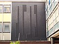
 Ceramic mural (3878616869).jpg 2,317 × 1,736; 687 KB
-

-
 Cherry Cobb Sands Road - geograph.org.uk - 1473717.jpg 640 × 480; 35 KB
-
 Cherry Cobb Sands Road - geograph.org.uk - 1473722.jpg 640 × 480; 31 KB
-
 Cherry Cobb Sands Road - geograph.org.uk - 1473742.jpg 640 × 480; 36 KB
-
 Cherry Cobb Sands Road - geograph.org.uk - 1473753.jpg 640 × 480; 39 KB
-
 Chestnut Drive off Spring Hill Road - geograph.org.uk - 1469748.jpg 640 × 480; 87 KB
-
 Chicago Avenue, Gillingham - geograph.org.uk - 1469093.jpg 640 × 480; 54 KB
-
 Chicken Head - geograph.org.uk - 1613216.jpg 640 × 480; 48 KB
-
 Childrey Brook by Venn Mill - geograph.org.uk - 1472303.jpg 427 × 640; 114 KB
-
 Childrey Brook from Venn Mill - geograph.org.uk - 1472317.jpg 640 × 427; 131 KB
-
 Church Lane, Ely - geograph.org.uk - 1598786.jpg 640 × 428; 100 KB
-
 Church of St Mary the Virgin, Lindisfarne - geograph.org.uk - 1503138.jpg 1,024 × 683; 153 KB
-
-
 Church Street - geograph.org.uk - 1513529.jpg 640 × 426; 204 KB
-
 Church Street, Gillingham - geograph.org.uk - 1469110.jpg 640 × 480; 61 KB
-
 Church Street, South Cave - geograph.org.uk - 1477238.jpg 640 × 397; 47 KB
-
 Class 395 interior.JPG 3,488 × 2,616; 4.35 MB
-
 Class 395 interior2.JPG 3,488 × 2,616; 4.35 MB
-
 Clock tower East face (3879416974).jpg 2,865 × 2,148; 917 KB
-
 Clock tower North face (3879418986).jpg 2,821 × 2,116; 654 KB
-
 Clock tower South face (3879415588).jpg 3,268 × 2,451; 937 KB
-
 Cloy School - geograph.org.uk - 1471640.jpg 640 × 427; 106 KB
-
 Coastline south of Camus Croise - geograph.org.uk - 1469027.jpg 640 × 476; 171 KB
-

-
 Colenso Court, Belfast - geograph.org.uk - 1468876.jpg 640 × 391; 67 KB
-
 Contemporary display - geograph.org.uk - 1805449.jpg 1,200 × 1,600; 659 KB
-
 Convenience store in Carnlough - geograph.org.uk - 1584260.jpg 640 × 522; 88 KB
-
 Cookley and Walpole Community Room - geograph.org.uk - 1472695.jpg 3,072 × 2,304; 1.47 MB
-
 Cookley Road - geograph.org.uk - 1472702.jpg 3,072 × 2,304; 1.5 MB
-
 Cookley Road - geograph.org.uk - 1472703.jpg 3,072 × 2,304; 1.63 MB
-
 Cookley Road Junction - geograph.org.uk - 1472713.jpg 3,072 × 2,304; 1.52 MB
-
 Copthorne shops - geograph.org.uk - 1468947.jpg 640 × 480; 83 KB
-
 Cornbrook Tram Station - geograph.org.uk - 1469068.jpg 640 × 456; 130 KB
-
 Cornbrook Tram Station - geograph.org.uk - 1469070.jpg 640 × 411; 99 KB
-
 Cornbrook Tram Station - geograph.org.uk - 1469073.jpg 640 × 435; 111 KB
-
 Cornish Coastal Path At St Anthony Head - geograph.org.uk - 1481094.jpg 640 × 480; 111 KB
-

-

-
 Cornish Coastal Path Near To St Anthony - geograph.org.uk - 1482230.jpg 640 × 480; 101 KB
-
 Cottage on Channel Road, Sunk Island - geograph.org.uk - 1472859.jpg 640 × 478; 43 KB
-
 Cottage on Yaugher Lane, near Yelsted - geograph.org.uk - 1469266.jpg 640 × 480; 126 KB
-
 Cottages on the Upper Chobham Road - geograph.org.uk - 1469310.jpg 640 × 480; 81 KB
-
 Countryliner DC37 KU02 YBG.JPG 3,328 × 1,872; 2.02 MB
-
 Crags and moorland above Rothbury - geograph.org.uk - 1513453.jpg 640 × 427; 189 KB
-
 Craig Highland Farm - geograph.org.uk - 1476216.jpg 640 × 480; 86 KB
-
 Craig Highland Farm - geograph.org.uk - 1476281.jpg 640 × 480; 106 KB
-
 Cross Drain off Stray Road - geograph.org.uk - 1472835.jpg 640 × 480; 50 KB
-
 Cut down former tram pole - geograph.org.uk - 1470372.jpg 640 × 427; 89 KB
-
 Dales Way footpath near Hadfield Farm - geograph.org.uk - 1475958.jpg 640 × 480; 177 KB
-
 Dalton - geograph.org.uk - 1474794.jpg 640 × 480; 83 KB
-
 Deansgate Station - geograph.org.uk - 1469184.jpg 640 × 482; 122 KB
-
 Detail of porch door to Woolpit church - geograph.org.uk - 1478340.jpg 640 × 499; 137 KB
-
 Dial Road, Gillingham - geograph.org.uk - 1469097.jpg 640 × 480; 67 KB
-

-

-
 Drain off Stray Road - geograph.org.uk - 1472845.jpg 640 × 480; 42 KB
-
 Drumlanrig Street - geograph.org.uk - 1474770.jpg 640 × 480; 119 KB
-
 Dukes Drive, Halesworth - geograph.org.uk - 1472584.jpg 3,072 × 2,304; 1.41 MB
-
 Dun Knock - geograph.org.uk - 1469039.jpg 640 × 480; 141 KB
-
 Duncraig Castle - geograph.org.uk - 1476189.jpg 640 × 480; 104 KB
-
 Dunwich Lane - geograph.org.uk - 1472688.jpg 3,072 × 2,304; 1.43 MB
-
 Early Gravestone, Lindisfarne - geograph.org.uk - 1503145.jpg 1,024 × 683; 189 KB
-
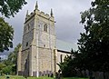
 Easington Parish Church - geograph.org.uk - 1472541.jpg 640 × 480; 48 KB
-
 Easington Parish Council Cemetery - geograph.org.uk - 1472536.jpg 640 × 480; 117 KB
-
 East Bank Farm Cottages - geograph.org.uk - 1472863.jpg 640 × 480; 47 KB
-
 Letcombe Brook in East Hanney - geograph.org.uk - 1472256.jpg 640 × 427; 103 KB
-
 Letcombe Brook in East Hanney - geograph.org.uk - 1472272.jpg 640 × 406; 103 KB
-
 Letcombe Brook in East Hanney - geograph.org.uk - 1472276.jpg 427 × 640; 115 KB
-
 Lower Mill in East Hanney - geograph.org.uk - 1472268.jpg 640 × 419; 92 KB
-
 Philberds Manor in East Hanney - geograph.org.uk - 1472241.jpg 640 × 411; 75 KB
-
 The War Memorial Hall in East Hanney - geograph.org.uk - 1472216.jpg 640 × 427; 48 KB
-
 Eastfield Road towards South Farm - geograph.org.uk - 1472531.jpg 640 × 480; 38 KB
-
 Edge of Graig Wood, Newport - geograph.org.uk - 1800688.jpg 640 × 480; 112 KB
-
 Eilean na Creige Duibhe - geograph.org.uk - 1476228.jpg 640 × 480; 104 KB
-
 Electricity not connected - geograph.org.uk - 1476109.jpg 640 × 480; 90 KB
-
 Electricity Pole in Peasenhall Road - geograph.org.uk - 1472687.jpg 2,315 × 2,304; 1.91 MB
-
-
 Electricity sub-station by Steventon - geograph.org.uk - 1469305.jpg 640 × 417; 51 KB
-
 Elizabeth II Postbox, Holy Island - geograph.org.uk - 1503128.jpg 427 × 640; 141 KB
-
 Elm Tree Gallery, Woolpit - geograph.org.uk - 1478321.jpg 427 × 640; 72 KB
-
 Ely Cathedral from the south - geograph.org.uk - 1598797.jpg 640 × 428; 71 KB
-
 End of Century Street - geograph.org.uk - 1469390.jpg 640 × 480; 128 KB
-
 Entering Patrington Haven - geograph.org.uk - 1472785.jpg 640 × 480; 37 KB
-
 Entering Paull - geograph.org.uk - 1473966.jpg 640 × 480; 55 KB
-
 Entering Skeffling - geograph.org.uk - 1472576.jpg 640 × 480; 77 KB
-
 Entering Winestead - geograph.org.uk - 1472738.jpg 640 × 480; 70 KB
-
 Erskine Ferry - geograph.org.uk - 1470782.jpg 640 × 480; 113 KB
-
 Etruria Lock No 39, Stoke-on-Trent - geograph.org.uk - 1599796.jpg 640 × 553; 158 KB
-

-
 Evans Street - geograph.org.uk - 1469714.jpg 640 × 480; 73 KB
-
 Exhibition Footbridge - geograph.org.uk - 1469134.jpg 640 × 461; 110 KB
-
 Exhibition Footbridge - geograph.org.uk - 1469149.jpg 640 × 464; 116 KB
-
 Exotic flower, Belfast - geograph.org.uk - 1469278.jpg 636 × 507; 100 KB
-
 Farm buildings near Gedding - geograph.org.uk - 1478073.jpg 640 × 427; 74 KB
-
 Farm track at Clopton Green - geograph.org.uk - 1478114.jpg 640 × 427; 90 KB
-
 Farm track near Eastrington Station - geograph.org.uk - 1477208.jpg 640 × 480; 86 KB
-
 Farm track near Gedding - geograph.org.uk - 1478060.jpg 640 × 427; 79 KB
-
 Farm track on Steventon Field - geograph.org.uk - 1469477.jpg 640 × 418; 81 KB
-
 Field and barn near East Hanney - geograph.org.uk - 1472278.jpg 640 × 418; 59 KB
-
 Field and barn near Garford - geograph.org.uk - 1472294.jpg 640 × 418; 68 KB
-
 Field boundary and ditch - geograph.org.uk - 1478056.jpg 427 × 640; 102 KB
-
 Field by East Hanney - geograph.org.uk - 1472220.jpg 640 × 414; 59 KB
-
 Field corner near Aconbury - geograph.org.uk - 1469037.jpg 640 × 480; 236 KB
-
 Field entrance off Mill Lane - geograph.org.uk - 1477205.jpg 640 × 480; 92 KB
-
 Field near East Hanney - geograph.org.uk - 1469492.jpg 640 × 414; 52 KB
_Common_Marbled_Carpet_(Chloroclysta_truncata)_(3884541413).jpg)
.JPG)


.jpg)


.JPG)
.JPG)


.jpg)
.jpg)


.jpg)


.jpg)
.jpg)
.jpg)
.jpg)
.jpg)
.jpg)
.jpg)
.jpg)
.jpg)


.jpg)


.jpg)
.jpg)
.jpg)


