Category:United Kingdom photographs taken on 2009-11-23
Countries of Europe: Austria · Bulgaria · Croatia · Czech Republic · Finland · France‡ · Germany · Greece · Italy · Latvia · Netherlands‡ · Poland · Russia‡ · Spain‡ · Sweden · Switzerland · United Kingdom
Limited recognition: Kosovo
‡: partly located in Europe
Limited recognition: Kosovo
‡: partly located in Europe
| ← | 23 November 2009 | → | ||
| ← | November 2009 | → | ||

United Kingdom photographs taken on 23 November 2009.
Image files should be categorized here automatically using {{taken on}} template. Direct categorisation is also possible, if automatic is impossible.
Subcategories
This category has the following 2 subcategories, out of 2 total.
Media in category "United Kingdom photographs taken on 2009-11-23"
The following 200 files are in this category, out of 491 total.
(previous page) (next page)-
 "Saraswati", The Palm House, Belfast - geograph.org.uk - 1593486.jpg 480 × 640; 123 KB
-
 "Top O' Th Bank" Roundhill Lane - geograph.org.uk - 1593684.jpg 640 × 480; 99 KB
-
 'Choristers', Studley Park - geograph.org.uk - 1595377.jpg 640 × 480; 82 KB
-
 A field of sheep by Hill Wootton Road - geograph.org.uk - 1594658.jpg 640 × 427; 107 KB
-

-
-
 A rainy day in mid-November - geograph.org.uk - 1593241.jpg 640 × 445; 139 KB
-
 A recent casualty, Boyton - geograph.org.uk - 1660789.jpg 640 × 480; 208 KB
-
 A seat by the path - geograph.org.uk - 1594156.jpg 640 × 480; 121 KB
-
 A small shop in The Street - geograph.org.uk - 1593685.jpg 640 × 455; 149 KB
-

-
 Acre Street, Haggate - geograph.org.uk - 1593115.jpg 640 × 480; 81 KB
-
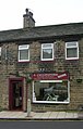
 Adress Ladies Fashion - Browgate - geograph.org.uk - 1593273.jpg 546 × 640; 110 KB
-
 Aire Way - Coach Road - geograph.org.uk - 1593750.jpg 640 × 480; 131 KB
-
 Airedale Greenway - Otley Road - geograph.org.uk - 1593901.jpg 640 × 480; 70 KB
-
 Airedale Greenway - Otley Road - geograph.org.uk - 1593904.jpg 640 × 480; 62 KB
-
 Airedale Way Footpath - Otley Road - geograph.org.uk - 1593870.jpg 480 × 640; 111 KB
-
 Aireview Crescent - Coach Road - geograph.org.uk - 1593734.jpg 640 × 480; 82 KB
-
 Aish Tor - geograph.org.uk - 1593488.jpg 640 × 427; 71 KB
-
 Allan Jefferies - Otley Road - geograph.org.uk - 1593877.jpg 640 × 483; 75 KB
-
 Andrew Johns Ltd - Westgate - geograph.org.uk - 1592718.jpg 640 × 525; 80 KB
-
 Andrews Electrical - Westgate - geograph.org.uk - 1594019.jpg 640 × 480; 101 KB
-
 Andrews House of Gas - Westgate - geograph.org.uk - 1594023.jpg 401 × 640; 87 KB
-
 Anti Tank Blocks at Kirkton Head - geograph.org.uk - 1594858.jpg 640 × 478; 45 KB
-

-
 Approach to Horkstow Bridge - geograph.org.uk - 1592574.jpg 640 × 422; 234 KB
-
 Approaching Starston from Railway Hill - geograph.org.uk - 1593338.jpg 640 × 480; 163 KB
-
 Arches at the roadside - geograph.org.uk - 1593546.jpg 640 × 480; 51 KB
-
 Armadale Birches. - geograph.org.uk - 1637250.jpg 427 × 640; 156 KB
-
 Arundell Arms, Lifton - geograph.org.uk - 1597128.jpg 640 × 411; 52 KB
-
 Asda Store Walsgrave Coventry - geograph.org.uk - 1592559.jpg 640 × 480; 53 KB
-
 Aspiration - geograph.org.uk - 1611166.jpg 480 × 640; 51 KB
-
 Atkinson Street - Westgate - geograph.org.uk - 1593923.jpg 640 × 480; 82 KB
-
 Attractive cottages in The Street - geograph.org.uk - 1593230.jpg 640 × 489; 140 KB
-

-
 Back street - geograph.org.uk - 1593139.jpg 640 × 480; 65 KB
-
 Bagpuss - Westgate - geograph.org.uk - 1592704.jpg 448 × 640; 83 KB
-

-

-

-
 Baildon Interiors - Northgate - geograph.org.uk - 1592552.jpg 640 × 578; 99 KB
-
 Baildon Off Licence - Coach Road - geograph.org.uk - 1593723.jpg 446 × 640; 89 KB
-
 Baildon Veterinary Centre - Browgate - geograph.org.uk - 1593281.jpg 640 × 547; 131 KB
-

-
 St Hugh's Centre - Coach Road - geograph.org.uk - 1593746.jpg 640 × 383; 65 KB
-
 Bales between the trees - geograph.org.uk - 1597321.jpg 640 × 480; 107 KB
-
 Balti House Restaurant - Browgate - geograph.org.uk - 1593278.jpg 466 × 640; 99 KB
-
 Bank Street past Briantiques - geograph.org.uk - 1594104.jpg 640 × 454; 95 KB
-
 Barn at High Royds Hall, Menston - geograph.org.uk - 1592647.jpg 640 × 425; 68 KB
-
 Barrs Brae - geograph.org.uk - 1600160.jpg 480 × 640; 125 KB
-
 Beautiful bay by Loch Ericht - geograph.org.uk - 1654338.jpg 640 × 480; 78 KB
-
 Beautiful bay by Loch Ericht 2 - geograph.org.uk - 1654340.jpg 640 × 480; 80 KB
-
 Beck Hall - geograph.org.uk - 1593335.jpg 640 × 505; 175 KB
-

-
 Beddington Street - geograph.org.uk - 1593140.jpg 640 × 480; 62 KB
-
 Bedford Street, Belfast - geograph.org.uk - 1593917.jpg 640 × 480; 57 KB
-
 Bedford Street, Belfast - geograph.org.uk - 1593975.jpg 640 × 480; 66 KB
-
 Benson at Shipley - Otley Road - geograph.org.uk - 1593873.jpg 640 × 480; 61 KB
-
 Birmingham Road - geograph.org.uk - 1593590.jpg 640 × 480; 92 KB
-
 Birnbeck Island boathouse 2009.jpg 1,024 × 768; 263 KB
-
 Black House Lane - geograph.org.uk - 1593104.jpg 640 × 406; 54 KB
-
 Blackdown Mill on the River Avon - geograph.org.uk - 1594570.jpg 512 × 640; 93 KB
-
 Blackstaff Square, Belfast - geograph.org.uk - 1593977.jpg 640 × 480; 95 KB
-
 Boer War Memorial, Omagh - geograph.org.uk - 1593462.jpg 640 × 480; 149 KB
-
 Boulder and new houses, Dechmont Law - geograph.org.uk - 1594008.jpg 640 × 359; 66 KB
-
 Bradford and Bingley - Northgate - geograph.org.uk - 1592558.jpg 403 × 640; 98 KB
-
 Bridge Farm Cottages - geograph.org.uk - 1592938.jpg 640 × 480; 131 KB
-
 Bridge over the Beck - geograph.org.uk - 1593245.jpg 640 × 455; 139 KB
-
 Browgate Pharmacy Ltd - Browgate - geograph.org.uk - 1593275.jpg 640 × 597; 133 KB
-
 Building with clock tower, Belfast - geograph.org.uk - 1593832.jpg 640 × 480; 46 KB
-
 Buildings in Lifton - geograph.org.uk - 1597084.jpg 640 × 471; 84 KB
-
 Buildings on Windmill Road, Launceston - geograph.org.uk - 1595831.jpg 640 × 499; 105 KB
-
 Christ Church, Burbage - geograph.org.uk - 1594268.jpg 640 × 480; 113 KB
-
 Burnley Road, Haggate - geograph.org.uk - 1593118.jpg 640 × 480; 57 KB
-
 Bush House at the end of Bush Row - geograph.org.uk - 1610530.jpg 640 × 480; 76 KB
-
 Butcher's Shop - Westgate - geograph.org.uk - 1593270.jpg 363 × 640; 75 KB
-
 Cadogan Street, Belfast - geograph.org.uk - 1593582.jpg 640 × 480; 56 KB
-
 Canal scene, Bradford-on-Avon - geograph.org.uk - 1660899.jpg 640 × 481; 113 KB
-
 Carleton House, Belfast - geograph.org.uk - 1593828.jpg 640 × 480; 53 KB
-
 Casa Bella - Northgate - geograph.org.uk - 1592546.jpg 380 × 640; 58 KB
-
 Cats - Westgate - geograph.org.uk - 1594030.jpg 640 × 516; 112 KB
-
 Cattle Brook joins the River Avon - geograph.org.uk - 1594313.jpg 640 × 480; 179 KB
-
 Cattle Brook north of Wootton Spinnies - geograph.org.uk - 1594306.jpg 640 × 427; 158 KB
-
 Chesford Bridge - geograph.org.uk - 1594370.jpg 640 × 480; 150 KB
-
 Chesford Grange Hotel from the garden - geograph.org.uk - 1594360.jpg 640 × 480; 135 KB
-
 Cliffe Avenue Chemist - Cliffe Avenue - geograph.org.uk - 1593286.jpg 515 × 640; 106 KB
-
 Clovelly Road Industrial Estate - geograph.org.uk - 1595432.jpg 640 × 427; 42 KB
-
 Coco spa - Westgate - geograph.org.uk - 1592694.jpg 640 × 548; 118 KB
-

-
 Conifers, Cairn Wood near Belfast (1) - geograph.org.uk - 1592387.jpg 640 × 438; 102 KB
-

-
-
 Coral - Northgate - geograph.org.uk - 1592555.jpg 554 × 640; 99 KB
-
-
 Cottage on Station Road - geograph.org.uk - 1594071.jpg 640 × 480; 162 KB
-
 Cottages in Bank Street - geograph.org.uk - 1594086.jpg 640 × 455; 109 KB
-
 Cottages in The Street - geograph.org.uk - 1593681.jpg 640 × 459; 94 KB
-
 Cottages on Orchard Meadow - geograph.org.uk - 1594113.jpg 640 × 471; 124 KB
-
 Cottages on Railway Hill - geograph.org.uk - 1593340.jpg 640 × 466; 140 KB
-
 Cottages on The Street - geograph.org.uk - 1593341.jpg 640 × 452; 149 KB
-
 Cottages on The Street - geograph.org.uk - 1593344.jpg 640 × 564; 169 KB
-
 Cottages on The Street - geograph.org.uk - 1593346.jpg 640 × 555; 185 KB
-
 Cottages, "Southview", Belfast - geograph.org.uk - 1593585.jpg 640 × 332; 32 KB
-
 Craigmore, Launceston - geograph.org.uk - 1595852.jpg 640 × 480; 121 KB
-
 Crown, The Crown Bar, Belfast - geograph.org.uk - 1593858.jpg 640 × 480; 104 KB
-
 Crystal Bridal - Northgate - geograph.org.uk - 1592537.jpg 376 × 640; 67 KB
-
 Cultivated fields west of Starston - geograph.org.uk - 1593365.jpg 640 × 480; 148 KB
-

-
 Curves Lingerie - Westgate - geograph.org.uk - 1593267.jpg 441 × 640; 86 KB
-
 Dacre, Son and Hartley - Westgate - geograph.org.uk - 1593268.jpg 523 × 640; 113 KB
-
 David's Gents Barbershop - Westgate - geograph.org.uk - 1593988.jpg 640 × 545; 121 KB
-
 Debbie's Hair Stylist - Westgate - geograph.org.uk - 1592707.jpg 640 × 630; 103 KB
-
 Deer Park - geograph.org.uk - 1594020.jpg 640 × 359; 99 KB
-
 Deer Park golf course - geograph.org.uk - 1594004.jpg 640 × 359; 75 KB
-
 Disused boathouse, Chesford Grange Hotel - geograph.org.uk - 1594367.jpg 512 × 640; 183 KB
-
 Dockfield Road - Otley Road - geograph.org.uk - 1593883.jpg 640 × 480; 67 KB
-
 Drama Queens Fancy Dress, Belfast - geograph.org.uk - 1593589.jpg 640 × 480; 86 KB
-
 Drayton House - geograph.org.uk - 1594062.jpg 640 × 455; 115 KB
-
 Drumragh Avenue, Omagh - geograph.org.uk - 1593452.jpg 640 × 480; 129 KB
-
 E B Shaw Watchmaker - Westgate - geograph.org.uk - 1592712.jpg 640 × 617; 107 KB
-
 East Drain in November - geograph.org.uk - 1592580.jpg 640 × 480; 312 KB
-
 Easter Rattray arches - geograph.org.uk - 1593538.jpg 640 × 480; 140 KB
-
 Ellite Beauty - Atkinson Street - geograph.org.uk - 1593981.jpg 374 × 640; 81 KB
-
 Elsie Russell - Westgate - geograph.org.uk - 1593996.jpg 640 × 506; 129 KB
-
 Emma - Westgate - geograph.org.uk - 1592679.jpg 480 × 640; 66 KB
-
 End of Burnt Tree Island - geograph.org.uk - 1593586.jpg 640 × 480; 60 KB
-
 Entrance to Beck Hall - geograph.org.uk - 1593334.jpg 640 × 485; 184 KB
-

-
 Entrance to Wellington School - geograph.org.uk - 1592601.jpg 640 × 480; 106 KB
-
 Enviro 400 double decker bus - geograph.org.uk - 1594155.jpg 640 × 398; 61 KB
-
 Farmland near Leadburn - geograph.org.uk - 1592611.jpg 640 × 480; 86 KB
-
 Fernbank Drive - Coach Road - geograph.org.uk - 1593756.jpg 640 × 480; 80 KB
-
 Fibber Magee, Belfast - geograph.org.uk - 1593910.jpg 640 × 480; 84 KB
-
 Field of stubble by Wootton Spinnies - geograph.org.uk - 1594299.jpg 640 × 427; 92 KB
-
 Fields and treeline at Blackthorpe - geograph.org.uk - 1593114.jpg 640 × 387; 76 KB
-
 Fields towards Drax Ash Tip - geograph.org.uk - 1594996.jpg 640 × 480; 58 KB
-
 Finesse - Northgate - geograph.org.uk - 1592535.jpg 418 × 640; 77 KB
-
 Fishing off the quay at Appledore - geograph.org.uk - 1595437.jpg 640 × 480; 28 KB
-
 Flooded Playground^ - Cliffe Avenue - geograph.org.uk - 1593294.jpg 640 × 480; 80 KB
-
-

-
 Footpath joins Hill Wootton Road - geograph.org.uk - 1594586.jpg 640 × 426; 109 KB
-
 Footpath marker in hedge - geograph.org.uk - 1593372.jpg 640 × 480; 188 KB
-
 Footpath to High Royds Hall - geograph.org.uk - 1592661.jpg 640 × 425; 77 KB
-
 Footpath to the Beck - geograph.org.uk - 1593234.jpg 640 × 445; 160 KB
-
 Footpath west of Starston - geograph.org.uk - 1593370.jpg 640 × 450; 119 KB
-
 Footpath, Launceston - geograph.org.uk - 1595615.jpg 640 × 453; 91 KB
-
 Fore Street, Lifton - geograph.org.uk - 1597090.jpg 640 × 480; 71 KB
-
 Former National School, Launceston - geograph.org.uk - 1596666.jpg 640 × 480; 79 KB
-
-
 Fremington Manor House - geograph.org.uk - 1595486.jpg 640 × 480; 86 KB
-
 Fry Carpets - Otley Road - geograph.org.uk - 1593774.jpg 640 × 395; 63 KB
-
 G Cullingford - Westgate - geograph.org.uk - 1592713.jpg 408 × 640; 80 KB
-
 Gallagher Road - geograph.org.uk - 1594017.jpg 640 × 359; 73 KB
-

-
 Gibbet Cottage - geograph.org.uk - 1593260.jpg 640 × 430; 87 KB
-
 Glassart Den Woodland - geograph.org.uk - 1597342.jpg 640 × 480; 82 KB
-
 Glenaire Drive - Coach Road - geograph.org.uk - 1593752.jpg 640 × 480; 59 KB
-
 Glenaire Fisheries - Coach Road - geograph.org.uk - 1593729.jpg 429 × 640; 90 KB
-
 Glenside Deli - Coach Road - geograph.org.uk - 1593725.jpg 354 × 640; 80 KB
-
 GR Postbox, Knaresborough - geograph.org.uk - 1593259.jpg 473 × 640; 97 KB
-

-

-
-
 Great Victoria Street, Belfast - geograph.org.uk - 1593855.jpg 480 × 640; 76 KB
-
 Greater London House Hampstead Road - geograph.org.uk - 1593052.jpg 640 × 480; 83 KB
-
 Green Lane - viewed from Coach Road - geograph.org.uk - 1593765.jpg 640 × 480; 96 KB
-
 Grosvenor Road - geograph.org.uk - 1602772.jpg 640 × 340; 46 KB
-
 Halifax Estates - Northgate - geograph.org.uk - 1592533.jpg 640 × 475; 92 KB
-
 Halifax station entrance by night - geograph.org.uk - 1607375.jpg 640 × 480; 107 KB
-
 Hall's Farm, from Ravensneuk - geograph.org.uk - 1592625.jpg 640 × 480; 79 KB
-
 Harleston Road past Drayton House - geograph.org.uk - 1594064.jpg 640 × 449; 125 KB
-
 Harrington Square Camden - geograph.org.uk - 1593060.jpg 640 × 480; 102 KB
-

-
 High Royds Hall, Menston - geograph.org.uk - 1592644.jpg 640 × 425; 89 KB
-
 High Street, Coedpoeth - geograph.org.uk - 1595392.jpg 640 × 480; 59 KB
-
 Hilary Farm, Hill Wootton - geograph.org.uk - 1594589.jpg 640 × 427; 99 KB
-
 Hill Wootton Farm - geograph.org.uk - 1594616.jpg 640 × 427; 89 KB
-
 Hill Wootton Road at Blackdown Mill - geograph.org.uk - 1594569.jpg 640 × 427; 117 KB
-
 Hill Wootton Road crosses the River Avon - geograph.org.uk - 1594578.jpg 640 × 480; 172 KB
-
 Hollow post windpump in Starston - geograph.org.uk - 1592942.jpg 512 × 640; 112 KB
-
 Hollow post windpump in Starston - geograph.org.uk - 1592947.jpg 640 × 465; 130 KB
-
 Hollow post windpump in Starston - geograph.org.uk - 1592950.jpg 640 × 573; 116 KB
-
 Horkstow Bridge - geograph.org.uk - 1595450.jpg 637 × 640; 316 KB
-
 House at the end of a track - geograph.org.uk - 1592880.jpg 640 × 471; 129 KB
-
 House in Bank Street - geograph.org.uk - 1594102.jpg 640 × 480; 112 KB
-
-
 Hut circles - geograph.org.uk - 1593503.jpg 640 × 427; 91 KB
-
 Inscription plaque, The Palm House - geograph.org.uk - 1593481.jpg 640 × 428; 94 KB
-
 Interlude Tea Rooms - Westgate - geograph.org.uk - 1593995.jpg 400 × 640; 86 KB
-
 Invest NI, Belfast - geograph.org.uk - 1593972.jpg 640 × 480; 67 KB
-
 James gray haidressing - Northgate - geograph.org.uk - 1592562.jpg 379 × 640; 70 KB
-

-
 Jay Beez - Westgate - geograph.org.uk - 1592690.jpg 393 × 640; 91 KB
-
 Jubilee Campus MMB 73 Djanogly LRC.jpg 2,943 × 1,907; 713 KB
-
 Jubilee Campus MMB 74.jpg 2,953 × 1,927; 933 KB
-
 Jubilee Campus MMB 75.jpg 2,947 × 1,936; 2.38 MB
-
 Jubilee Campus MMB 76 Djanogly LRC.jpg 2,883 × 1,834; 1.75 MB
-
 Jubilee Campus MMB 77 Melton Hall.jpg 2,959 × 1,951; 2.55 MB
-
 Jubilee Campus MMB 78 Melton Hall.jpg 2,952 × 1,897; 3.04 MB


_-_geograph.org.uk_-_1592387.jpg)
_-_geograph.org.uk_-_1592509.jpg)


