Category:United Kingdom photographs taken on 2010-02-19
Countries of Europe: Austria · Belgium · Bulgaria · Estonia · Finland · France‡ · Germany · Greece · Republic of Ireland · Italy · Latvia · Lithuania · Malta · Netherlands‡ · Poland · Russia‡ · Serbia · Slovenia · Spain‡ · Sweden · Switzerland · Turkey‡ · Ukraine · United Kingdom
‡: partly located in Europe
‡: partly located in Europe
| ← | 19 February 2010 | → | ||
| ← | February 2010 | → | ||

United Kingdom photographs taken on 19 February 2010.
Image files should be categorized here automatically using {{taken on}} template. Direct categorisation is also possible, if automatic is impossible.
Subcategories
This category has the following 2 subcategories, out of 2 total.
Media in category "United Kingdom photographs taken on 2010-02-19"
The following 200 files are in this category, out of 1,075 total.
(previous page) (next page)-
 "ERII" Post Box, Hadley - geograph.org.uk - 1716808.jpg 1,500 × 1,125; 1.56 MB
-
 "Royal Mail" sign, Belfast - geograph.org.uk - 1716095.jpg 640 × 425; 73 KB
-
 "Street Art", Hadley, Telford - geograph.org.uk - 1718411.jpg 1,500 × 1,072; 1.3 MB
-
 - panoramio - jlcwalker.jpg 2,560 × 1,920; 2.31 MB
-
 5224 at Alton - geograph.org.uk - 1719481.jpg 640 × 426; 70 KB
-
 5224 at Ropley - geograph.org.uk - 1717816.jpg 426 × 640; 75 KB
-
 A 34 at Chilton - geograph.org.uk - 1720385.jpg 1,600 × 1,200; 371 KB
-
 A bend in the track to Blatchford - geograph.org.uk - 1736448.jpg 640 × 480; 439 KB
-
 A cleugh near Threeburnford - geograph.org.uk - 1715306.jpg 640 × 480; 108 KB
-

-
 A low point on Howton Road - geograph.org.uk - 1724788.jpg 640 × 480; 460 KB
-

-
 A moorland lochan in winter - geograph.org.uk - 1725077.jpg 1,600 × 1,200; 886 KB
-
 A small ice covered lochan - geograph.org.uk - 1725052.jpg 1,600 × 1,067; 339 KB
-
 A small valley near Moorpark - geograph.org.uk - 1724790.jpg 640 × 480; 423 KB
-
 A wet field above Perry Farm - geograph.org.uk - 1724809.jpg 640 × 480; 404 KB
-
 A winding channel below Moorpark - geograph.org.uk - 1724793.jpg 640 × 480; 568 KB
-
 A49 at King's Thorn 1 - geograph.org.uk - 1715310.jpg 640 × 480; 220 KB
-
 A49 at King's Thorn 2 - geograph.org.uk - 1715311.jpg 640 × 480; 228 KB
-
 A55 approaching Penmaen bach - geograph.org.uk - 1724627.jpg 2,816 × 2,112; 1.46 MB
-
 A55 eastbound from junction 17 (Conwy) - geograph.org.uk - 1724517.jpg 2,816 × 2,112; 1.47 MB
-
 A55 passing Conwy Mountain - geograph.org.uk - 1724509.jpg 2,816 × 2,112; 1.07 MB
-
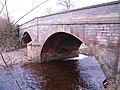 A695 Road Bridge at Dilston over the Devil's Water - geograph.org.uk - 1716468.jpg 1,600 × 1,200; 565 KB
-
 Abbey Gateway, Romsey - geograph.org.uk - 1721903.jpg 426 × 640; 76 KB
-
 Access to Stonehenge Farm - geograph.org.uk - 1724893.jpg 640 × 439; 66 KB
-
 Ad hoc development, Greycoat Lane - geograph.org.uk - 1730236.jpg 640 × 480; 352 KB
-
 Agricultural building in Suisnish - geograph.org.uk - 1716287.jpg 640 × 474; 212 KB
-
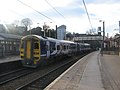
 Alexandra Palace Railway Station, London N22 - geograph.org.uk - 1723347.jpg 3,008 × 2,000; 3.08 MB
-
 All in a row. West Littleton Down - geograph.org.uk - 1722008.jpg 3,024 × 2,000; 1.74 MB
-
 All Saints' Church, Aston Upthorpe - geograph.org.uk - 1723735.jpg 640 × 480; 59 KB
-
 Alley rear of Wootton Bassett Road, Swindon - geograph.org.uk - 1716582.jpg 1,440 × 1,080; 578 KB
-
 Allotments, Bishopdown - geograph.org.uk - 1716332.jpg 640 × 481; 198 KB
-
 Allotments, Salisbury - geograph.org.uk - 1716323.jpg 640 × 480; 142 KB
-
 Along the valley of the By Brook - geograph.org.uk - 1722026.jpg 640 × 454; 82 KB
-
 Alton Station - geograph.org.uk - 1719426.jpg 640 × 426; 93 KB
-
 Ann's Hill Road, Gosport - geograph.org.uk - 1719047.jpg 800 × 600; 175 KB
-
 Apartments overlooking the Shimna River - geograph.org.uk - 1748727.jpg 1,024 × 769; 127 KB
-
 Approach to Compton - geograph.org.uk - 1723511.jpg 640 × 480; 80 KB
-
 Approach to Eynsham from the B4449 - geograph.org.uk - 1724920.jpg 640 × 480; 81 KB
-
 Approach to Goosey - geograph.org.uk - 1724218.jpg 640 × 480; 69 KB
-
 Approach to North Moreton - geograph.org.uk - 1724029.jpg 640 × 480; 84 KB
-
 Approach to Stanmore - geograph.org.uk - 1722258.jpg 640 × 480; 93 KB
-
 Approach to Stanton Harcourt - geograph.org.uk - 1724906.jpg 640 × 480; 92 KB
-
 Approach to Westridge Green - geograph.org.uk - 1723520.jpg 640 × 480; 104 KB
-
 Approaching Auchlean - geograph.org.uk - 1726238.jpg 1,600 × 1,200; 358 KB
-
 Approaching East Croydon (1) - geograph.org.uk - 1718381.jpg 3,872 × 2,592; 3.56 MB
-
 Approaching the A55 - geograph.org.uk - 1724527.jpg 2,816 × 2,112; 1.63 MB
-
 Arable land at Broughton - geograph.org.uk - 1769757.jpg 640 × 426; 102 KB
-
 Arable land near Broughton - geograph.org.uk - 1721473.jpg 640 × 426; 91 KB
-
 Arable land near Broughton - geograph.org.uk - 1769765.jpg 640 × 426; 77 KB
-
 Arable land, Pittleworth Dairy Farm - geograph.org.uk - 1769782.jpg 640 × 426; 115 KB
-
 B5321 Torrisholme Road - geograph.org.uk - 1719127.jpg 640 × 425; 140 KB
-
 B5321 Torrisholme Road - geograph.org.uk - 1719132.jpg 640 × 425; 171 KB
-
 Back o' th' Hill - geograph.org.uk - 1715732.jpg 640 × 480; 139 KB
-
 Badlake Hill, Dawlish - geograph.org.uk - 1715585.jpg 1,024 × 768; 216 KB
-
 Bangor Road - geograph.org.uk - 1723329.jpg 2,816 × 2,112; 1.51 MB
-
 Banterwick Barn Pumping Station - geograph.org.uk - 1715942.jpg 1,024 × 768; 386 KB
-
 Beach hut bases, Corbyn's Beach - geograph.org.uk - 1722968.jpg 480 × 640; 111 KB
-
 Beaulieu Road station - geograph.org.uk - 1717132.jpg 640 × 480; 87 KB
-
 Beaver Pool, Water Orton - geograph.org.uk - 1719776.jpg 576 × 768; 193 KB
-
 Belle Vue, Wakefield -geograph-1715232.jpg 640 × 383; 49 KB
-
 Belmount Bridge, Lancaster Canal - geograph.org.uk - 1716355.jpg 640 × 425; 224 KB
-
 Belvedere Road, Highweek - geograph.org.uk - 1729906.jpg 640 × 480; 345 KB
-
 Bends in the path - geograph.org.uk - 1736544.jpg 4,000 × 3,000; 3.94 MB
-
-

-
 Birchgrove post office, Cardiff - geograph.org.uk - 1715996.jpg 571 × 640; 106 KB
-
 Birchgrove Surgery, Cardiff - geograph.org.uk - 1716226.jpg 640 × 488; 71 KB
-
 Black Hill Gate - geograph.org.uk - 1716558.jpg 640 × 510; 120 KB
-
 Blind junction on Kingstanding Hill - geograph.org.uk - 1723527.jpg 640 × 480; 64 KB
-
 Bobath Centre, Whitchurch, Cardiff - geograph.org.uk - 1723878.jpg 640 × 468; 83 KB
-
 Boldre, bench - geograph.org.uk - 1715413.jpg 640 × 480; 108 KB
-
 Boldre, nurseries - geograph.org.uk - 1715410.jpg 640 × 480; 104 KB
-
 Bollards, Belfast - geograph.org.uk - 1716138.jpg 640 × 411; 84 KB
-
 Borehole and pumping station, Heath End - geograph.org.uk - 1715719.jpg 2,000 × 1,507; 314 KB
-
 Bossington Church - geograph.org.uk - 1721510.jpg 640 × 426; 91 KB
-
 Botleigh Grange Hotel - geograph.org.uk - 1721529.jpg 640 × 426; 58 KB
-
 Botleigh Grange Hotel - geograph.org.uk - 1721548.jpg 426 × 640; 63 KB
-
 Boundary Street, Belfast - geograph.org.uk - 1715856.jpg 640 × 387; 69 KB
-
 Bow Road meets the B4508 - geograph.org.uk - 1724242.jpg 640 × 480; 48 KB
-
 Branscombe Lane, near Dawlish - geograph.org.uk - 1715529.jpg 1,024 × 768; 227 KB
-
 Brickwork fragment, Route 45, Swindon - geograph.org.uk - 1716329.jpg 1,440 × 1,080; 1.38 MB
-
 Bridge carrying the coastal path - geograph.org.uk - 1715355.jpg 2,592 × 1,944; 2.27 MB
-
 Bridge over Redposts Drive, Swindon - geograph.org.uk - 1716339.jpg 1,440 × 1,080; 825 KB
-
 Bridge over River Feshie - geograph.org.uk - 1726265.jpg 1,067 × 1,600; 406 KB
-
 Bridge over the A4229, and stormy weather - geograph.org.uk - 1716103.jpg 1,167 × 1,600; 243 KB
-
 Bridleway by the side of the road - geograph.org.uk - 1715823.jpg 2,592 × 1,944; 2.39 MB
-
 Bridleway meets road - geograph.org.uk - 1735744.jpg 4,000 × 3,000; 3.68 MB
-
 Bridleway off Snitterfield Lane - geograph.org.uk - 1715672.jpg 2,000 × 1,508; 333 KB
-
 Bridleway on the ridge - geograph.org.uk - 1736552.jpg 4,000 × 3,000; 4.34 MB
-
 Bridleway past Haytor's Copse - geograph.org.uk - 1721461.jpg 640 × 426; 107 KB
-
 Bridleway to Pittleworth Dairy Farm - geograph.org.uk - 1769776.jpg 640 × 426; 99 KB
-

-
 Brightwell-cum-Sotwell village hall - geograph.org.uk - 1724020.jpg 640 × 480; 73 KB
-
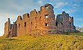 Brough Castle - geograph.org.uk - 2042942.jpg 800 × 477; 160 KB
-
 Buckingham Road - geograph.org.uk - 1715786.jpg 2,592 × 1,944; 2.17 MB
-
 Buckland, BandB - geograph.org.uk - 1715396.jpg 640 × 480; 146 KB
-
 Buckland, footpath - geograph.org.uk - 1715419.jpg 640 × 480; 137 KB
-
 Buckland, Passford Water - geograph.org.uk - 1715368.jpg 640 × 480; 148 KB
-
 Buckland, road junction - geograph.org.uk - 1715403.jpg 640 × 480; 118 KB
-
 Buckland, supermarket - geograph.org.uk - 1715426.jpg 640 × 480; 49 KB
-
 Buildings on Market Place, Romsey - geograph.org.uk - 1720493.jpg 640 × 426; 81 KB
-
 Buildings on Market Place, Romsey - geograph.org.uk - 1721906.jpg 640 × 426; 72 KB
-

-
 Burn beneath Hartside - geograph.org.uk - 1726331.jpg 640 × 359; 94 KB
-
 Burn confluence beneath Kirktonhill - geograph.org.uk - 1726325.jpg 640 × 480; 117 KB
-
 Caerleon Road, Cardiff - geograph.org.uk - 1716403.jpg 640 × 480; 82 KB
-
 Cafe at Corbyn's Beach - geograph.org.uk - 1723000.jpg 640 × 471; 74 KB
-
 Cambridge Heath Station - geograph.org.uk - 1719631.jpg 3,264 × 2,448; 5.09 MB
-
 Cambridge Heath Station - geograph.org.uk - 1719655.jpg 3,264 × 2,448; 5.16 MB
-
 Cambridge Heath Station, view to the north - geograph.org.uk - 1719553.jpg 2,816 × 2,112; 4.01 MB
-
 Cambridge Heath Station, View to the northwest - geograph.org.uk - 1719570.jpg 2,816 × 2,112; 3.82 MB
-
 Cambridge Heath Station, View to the west - geograph.org.uk - 1719611.jpg 3,264 × 2,448; 5.31 MB
-
 Canary Wharf from Britannia Hotel - panoramio.jpg 3,872 × 2,592; 5.61 MB
-
 Canary Wharf from Greenwich - panoramio.jpg 2,592 × 3,872; 5.58 MB
-

-
 Canolfan Beulah, Rhiwbina, Cardiff - geograph.org.uk - 1722966.jpg 640 × 459; 72 KB
-

-
 Car Park at Toilet Facilities at Castle Park - geograph.org.uk - 1748725.jpg 1,024 × 769; 176 KB
-
 Carlisle Train at Shipley - geograph.org.uk - 1737097.jpg 640 × 480; 62 KB
-
 Carved figure, Romsey Abbey - geograph.org.uk - 1722140.jpg 426 × 640; 62 KB
-
 Castell y Van - geograph.org.uk - 1729067.jpg 1,024 × 768; 277 KB
-
 Castle Vale School and Astral Centre - geograph.org.uk - 1727563.jpg 768 × 576; 140 KB
-
 Castle Vale, New Housing - geograph.org.uk - 1727567.jpg 768 × 576; 173 KB
-
 Castlehill Road - geograph.org.uk - 1716125.jpg 640 × 425; 287 KB
-
 Catkins over Whitehill Road - geograph.org.uk - 1733597.jpg 640 × 480; 542 KB
-
 Causeway, Old Exeter Road - geograph.org.uk - 1736443.jpg 640 × 480; 381 KB
-
 Cayley Arms - geograph.org.uk - 1724720.jpg 2,816 × 2,112; 594 KB
-
 Cemetery by St. Fillan's Priory.jpg 2,376 × 1,584; 1.67 MB
-
 Ceos with Loch Eireasort with the Harris hills behind - geograph.org.uk - 1725235.jpg 1,600 × 1,200; 441 KB
-
 Chatham Docklands YMCA Training Centre - geograph.org.uk - 1715108.jpg 3,072 × 2,304; 1.18 MB
-
 Cherry Tree Place, Wath Upon Dearne - geograph.org.uk - 1725184.jpg 640 × 480; 53 KB
-
 St Mary, Cholsey - geograph.org.uk - 1723576.jpg 640 × 480; 88 KB
-
 Church of Saint Mary and All Saints - geograph.org.uk - 1722903.jpg 2,624 × 1,968; 920 KB
-
 Church of St Mary and All Saints - geograph.org.uk - 1722899.jpg 1,973 × 2,630; 1.06 MB
-

-
 Churned-up field below Mount Pleasant - geograph.org.uk - 1736423.jpg 1,600 × 1,200; 402 KB
-
 Clarenden Way at Houghton - geograph.org.uk - 1739551.jpg 640 × 426; 65 KB
-
 Clarenden Way near Houghton - geograph.org.uk - 1739566.jpg 640 × 426; 84 KB
-
 Clay wagon nearing Mount Pleasant - geograph.org.uk - 1736436.jpg 640 × 480; 308 KB
-
 Clay waste near Moorpark - geograph.org.uk - 1724799.jpg 640 × 480; 340 KB
-
 Clay waste southeast of Perry Farm - geograph.org.uk - 1724814.jpg 640 × 480; 463 KB
-
 Cliff top path descends from Thornkip Hill - geograph.org.uk - 1716625.jpg 1,024 × 768; 223 KB
-
 Cliffs at Gillis Craig - geograph.org.uk - 1716710.jpg 768 × 1,024; 301 KB
-
 Cliffs west of Port O' Warren - geograph.org.uk - 1716611.jpg 1,024 × 768; 286 KB
-
 Close to Llandudno West Shore - geograph.org.uk - 1721555.jpg 2,816 × 2,112; 1,021 KB
-
 Clouds over the Thames valley - geograph.org.uk - 1724902.jpg 640 × 480; 53 KB
-

-
 Coastal Path - geograph.org.uk - 1723311.jpg 2,816 × 2,112; 1.22 MB
-
 Coastal path at West Thorney - geograph.org.uk - 1715369.jpg 2,592 × 1,944; 2.17 MB
-
 Coastal path near the marina - south of Prinsted - geograph.org.uk - 1715352.jpg 2,592 × 1,944; 2.3 MB
-
 Coastal path, The Beacons-Conwy Morfa - geograph.org.uk - 1724422.jpg 2,816 × 2,112; 953 KB
-
 Coastal scenery west of Glenstocken Sands - geograph.org.uk - 1716675.jpg 3,000 × 1,231; 1.06 MB
-
 Colebrooke Row, Islington - geograph.org.uk - 1717252.jpg 1,280 × 960; 341 KB
-
 Colley Lane Cross - geograph.org.uk - 1715959.jpg 1,024 × 768; 258 KB
-
 Colley Lane enters Haldon Forest - geograph.org.uk - 1716308.jpg 1,600 × 1,200; 854 KB
-
 Colvend Copper Mine - geograph.org.uk - 1716665.jpg 768 × 1,024; 345 KB
-
 Colwyn Bay - geograph.org.uk - 1724757.jpg 2,816 × 2,112; 846 KB
-
 Coming up from Calton Moor - geograph.org.uk - 1745006.jpg 640 × 427; 303 KB
-
 Communications map - geograph.org.uk - 1736221.jpg 4,000 × 3,000; 2.52 MB
-
 Compton Pumping Station - geograph.org.uk - 1717027.jpg 1,024 × 768; 291 KB
-
 Concrete structure on Route 45, Swindon - geograph.org.uk - 1716334.jpg 2,816 × 2,112; 3.3 MB
-

-

-

-
 Conwy (Caernarvonshire) Golf Links - geograph.org.uk - 1724408.jpg 2,816 × 2,112; 809 KB
-
 Conwy (Caernarvonshire) Golf Links - geograph.org.uk - 1724409.jpg 2,816 × 2,112; 770 KB
-
 Conwy (Caernarvonshire) Golf Links - geograph.org.uk - 1724432.jpg 2,816 × 2,112; 1.14 MB
-
 Conwy (Caernarvonshire) Golf Links - geograph.org.uk - 1724436.jpg 2,816 × 2,112; 1.04 MB
-
 Conwy (Caernarvonshire) Golf Links - geograph.org.uk - 1724440.jpg 2,816 × 2,112; 895 KB
-
 Conwy Bridge from the quay - geograph.org.uk - 1722797.jpg 2,816 × 2,112; 969 KB
-
 Conwy Castle and car park from Town Walls - geograph.org.uk - 1723358.jpg 2,816 × 2,112; 1.16 MB
-
 Conwy Castle and River - geograph.org.uk - 1724315.jpg 2,816 × 2,112; 912 KB
-
 Conwy Castle from the bridge - geograph.org.uk - 1722821.jpg 2,816 × 2,112; 961 KB
-
 Conwy Castle from the quay - geograph.org.uk - 1722815.jpg 2,816 × 2,112; 1,003 KB
-
 Conwy Castle from Town Walls - geograph.org.uk - 1723354.jpg 2,816 × 2,112; 1,013 KB
-
 Conwy Guildhall - geograph.org.uk - 1722884.jpg 2,816 × 2,112; 642 KB
-
 Conwy Harbour - geograph.org.uk - 1722842.jpg 2,816 × 2,112; 1.02 MB
-
 Conwy Marina - geograph.org.uk - 1724398.jpg 2,816 × 2,112; 1.28 MB
-
 Conwy Marina - geograph.org.uk - 1724400.jpg 2,816 × 2,112; 794 KB
-
 Conwy Marina - geograph.org.uk - 1724411.jpg 2,816 × 2,112; 706 KB
-
 Conwy Marina - geograph.org.uk - 1724415.jpg 2,816 × 2,112; 610 KB
-
 Conwy Morfa - geograph.org.uk - 1724496.jpg 2,816 × 2,112; 1.22 MB
-
 Conwy Morfa sand dunes - geograph.org.uk - 1724660.jpg 2,816 × 2,112; 1.47 MB
-
 Conwy Police Station - geograph.org.uk - 1723142.jpg 2,062 × 1,547; 568 KB
-
 Conwy Quay - geograph.org.uk - 1722848.jpg 2,816 × 2,112; 1.14 MB
-
 Conwy Sands - geograph.org.uk - 1724448.jpg 2,816 × 2,112; 1.07 MB
-
 Conwy Sands - geograph.org.uk - 1724453.jpg 2,816 × 2,112; 1.03 MB
-
 Conwy Sands-Conwy Bay - geograph.org.uk - 1724677.jpg 2,816 × 2,112; 1.06 MB
-
 Conwy Station - geograph.org.uk - 1724337.jpg 2,816 × 2,112; 1.11 MB
-
 Conwy Station - geograph.org.uk - 1724356.jpg 2,816 × 2,112; 1.3 MB
-
 Conwy Station from Town Walls - geograph.org.uk - 1724330.jpg 2,816 × 2,112; 1.82 MB
-
 Conwy Station, Rosemary Lane bridge - geograph.org.uk - 1724346.jpg 2,816 × 2,112; 1.11 MB
-
 Conwy Town Walls - geograph.org.uk - 1723345.jpg 2,112 × 2,816; 1.16 MB
-
 Conwy Town Walls - geograph.org.uk - 1723348.jpg 2,816 × 2,112; 1.81 MB
-
 Conwy, quay and bridge - geograph.org.uk - 1722792.jpg 2,816 × 2,112; 1,015 KB
-
 Conwy, quay from the bridge - geograph.org.uk - 1722835.jpg 2,816 × 2,112; 1.09 MB
-
 Cool Technic, Birchgrove, Cardiff - geograph.org.uk - 1716265.jpg 640 × 480; 73 KB
-

-
 Packhorse bridge, Coombe Bissett - geograph.org.uk - 1715829.jpg 640 × 480; 202 KB


_-_geograph.org.uk_-_1724517.jpg)


_-_geograph.org.uk_-_1718381.jpg)


,_Whitchurch,_Cardiff_-_geograph.org.uk_-_1725256.jpg)
,_Whitchurch,_Cardiff_-_geograph.org.uk_-_1725265.jpg)

_Golf_Links_-_geograph.org.uk_-_1724408.jpg)
_Golf_Links_-_geograph.org.uk_-_1724409.jpg)
_Golf_Links_-_geograph.org.uk_-_1724432.jpg)
_Golf_Links_-_geograph.org.uk_-_1724436.jpg)
_Golf_Links_-_geograph.org.uk_-_1724440.jpg)


