Category:United Kingdom photographs taken on 2010-03-17
Countries of Europe: Andorra · Armenia‡ · Austria · Belgium · Bosnia and Herzegovina · Denmark · Estonia · Finland · France‡ · Germany · Greece · Hungary · Italy · Latvia · Netherlands‡ · Norway · Poland · Portugal‡ · Romania · Russia‡ · Slovakia · Spain‡ · Sweden · Switzerland · Turkey‡ · Ukraine · United Kingdom
‡: partly located in Europe
‡: partly located in Europe
| ← | 17 March 2010 | → | ||
| ← | March 2010 | → | ||

United Kingdom photographs taken on 17 March 2010.
Image files should be categorized here automatically using {{taken on}} template. Direct categorisation is also possible, if automatic is impossible.
Subcategories
This category has the following 11 subcategories, out of 11 total.
A
B
C
L
O
Media in category "United Kingdom photographs taken on 2010-03-17"
The following 200 files are in this category, out of 577 total.
(previous page) (next page)-

-
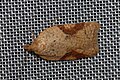
 (1025) Tortricodes alternella (4441570019).jpg 800 × 523; 475 KB
-
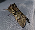
 (1044) Acleris ferrugana (4441573901).jpg 800 × 532; 499 KB
-
 (1659) Yellow Horned (Achlya flavicornis) (4441573497).jpg 800 × 685; 463 KB
-
 (1659) Yellow Horned (Achlya flavicornis) (4442352474).jpg 800 × 652; 535 KB
-
 (1659) Yellow Horned (Achlya flavicornis) (4442352960).jpg 800 × 690; 569 KB
-
 (1930) Oak Beauty (Biston strataria) (4441569615).jpg 800 × 696; 954 KB
-
 (2182) Small Quaker (Orthosia cruda) (4442348648).jpg 800 × 633; 575 KB
-
 (2187) Common Quaker (Orthosia cerasi) (4441570639).jpg 800 × 723; 719 KB
-
 (2187) Common Quaker (Orthosia cerasi) (4442351960).jpg 800 × 650; 671 KB
-
 (2189) Twin-spotted Quaker (Orthosia munda) (4442355266).jpg 800 × 591; 479 KB
-
 (2190) Hebrew Character (Orthosia gothica) (4441571337).jpg 800 × 761; 800 KB
-
 (2190) Hebrew Character (Orthosia gothica) (4441574845).jpg 800 × 559; 392 KB
-
 18 Century 'GPS' readout - geograph.org.uk - 1758140.jpg 1,024 × 768; 182 KB
-

-
 A culverted stream - geograph.org.uk - 1759411.jpg 640 × 480; 156 KB
-
 A John Deere track tractor - geograph.org.uk - 1759405.jpg 609 × 640; 198 KB
-

-
 A shed beside the footpath - geograph.org.uk - 1759364.jpg 640 × 480; 113 KB
-
 A394 to Penzance - geograph.org.uk - 1758023.jpg 640 × 480; 222 KB
-
 Above Kirkstone Beck - geograph.org.uk - 1759372.jpg 640 × 480; 62 KB
-
 Access To Stocken Farm - geograph.org.uk - 1759020.jpg 640 × 480; 178 KB
-
 Access Track To Club Hall - geograph.org.uk - 1758968.jpg 640 × 480; 181 KB
-
 Across The Fields To Stocking Barn Farm - geograph.org.uk - 1759015.jpg 640 × 480; 176 KB
-
 Aitkenhead Farm - geograph.org.uk - 1758532.jpg 1,024 × 768; 537 KB
-
 Almondell and Country Park Visitor Centre - geograph.org.uk - 1758163.jpg 1,024 × 768; 160 KB
-
 An asteroid in Waterside Meadows - geograph.org.uk - 1759150.jpg 1,024 × 768; 156 KB
-
 Approaching Basket's Gate Crossroads - geograph.org.uk - 1758957.jpg 640 × 480; 127 KB
-
 Approaching Ringinglow from the west - geograph.org.uk - 1757991.jpg 640 × 480; 84 KB
-

-

-

-
 Ardallie Kirk - geograph.org.uk - 1758042.jpg 640 × 391; 215 KB
-
 Ardallie Kirk - geograph.org.uk - 1758047.jpg 640 × 433; 215 KB
-
 Arum maculatum (4447824776).jpg 2,642 × 1,978; 1.03 MB
-
 Ashford Bowdler Level Crossing - geograph.org.uk - 1759185.jpg 640 × 480; 209 KB
-
 Ashwood Centre - geograph.org.uk - 1761969.jpg 640 × 480; 83 KB
-
 Aston Lane - geograph.org.uk - 1758973.jpg 640 × 480; 138 KB
-
 At The Boundary - geograph.org.uk - 1759275.jpg 640 × 480; 217 KB
-
 B4361 At Batchcott Crossroads - geograph.org.uk - 1759125.jpg 640 × 480; 205 KB
-
 B4362 Approaching Lucton Crossroads - geograph.org.uk - 1759023.jpg 640 × 480; 156 KB
-
 B4362 At Lucton School - geograph.org.uk - 1759022.jpg 640 × 480; 195 KB
-
 Ballivicar Farmhouse, Islay - geograph.org.uk - 1757844.jpg 640 × 426; 67 KB
-
 Ballychatrigan Farm, Islay - geograph.org.uk - 1757872.jpg 640 × 426; 59 KB
-
 Bank of snowdrops - geograph.org.uk - 1777030.jpg 1,024 × 768; 344 KB
-
 Bank of woodland, off Jerry Clay Lane - geograph.org.uk - 1760591.jpg 518 × 389; 160 KB
-

-

-
 Batchcott Fieldscape - geograph.org.uk - 1759107.jpg 640 × 480; 164 KB
-
 Batley Road, Kirkhamgate - geograph.org.uk - 1760509.jpg 518 × 389; 147 KB
-
 Beech Avenue - geograph.org.uk - 1758193.jpg 427 × 640; 312 KB
-
 Beech Avenue - geograph.org.uk - 1758229.jpg 640 × 427; 303 KB
-
 Beech Avenue - geograph.org.uk - 1758242.jpg 427 × 640; 284 KB
-
 Belle Isle - Round House - geograph.org.uk - 1760265.jpg 640 × 480; 73 KB
-
 Bench Mark, Ashmore - geograph.org.uk - 1758035.jpg 640 × 480; 178 KB
-
 Bench Mark, Ashmore - geograph.org.uk - 1758259.jpg 480 × 640; 178 KB
-
 Bench Mark, Ashmore - geograph.org.uk - 1758402.jpg 480 × 640; 206 KB
-
 Bench Mark, Damerham - geograph.org.uk - 1757937.jpg 480 × 640; 217 KB
-
 Bench Mark, Martin - geograph.org.uk - 1757683.jpg 481 × 640; 210 KB
-
 Bench Mark, Tisbury - geograph.org.uk - 1758299.jpg 640 × 480; 215 KB
-
 Bentra golf course, Whitehead - geograph.org.uk - 1757613.jpg 640 × 410; 68 KB
-
 Bicton Crossroads From The Southeast - geograph.org.uk - 1758946.jpg 640 × 480; 167 KB
-
 Big Field At Mill Turn - geograph.org.uk - 1759217.jpg 640 × 480; 181 KB
-

-
 Birds in Golspie - panoramio.jpg 3,120 × 2,083; 3.68 MB
-
 Blakeney High Street - geograph.org.uk - 1767948.jpg 640 × 480; 106 KB
-
 Blind Lane, off Woodhouse Lane - geograph.org.uk - 1760495.jpg 518 × 389; 123 KB
-
 Boats by Ardingly Reservoir - geograph.org.uk - 1757632.jpg 640 × 428; 117 KB
-
 Boulder under Little Hart Crag - geograph.org.uk - 1760270.jpg 640 × 480; 32 KB
-
 Bowness-on-Windermere - geograph.org.uk - 1758686.jpg 640 × 480; 70 KB
-
 Brandy Carr Road, Kirkhamgate - geograph.org.uk - 1760501.jpg 518 × 389; 141 KB
-
 Bridge Over Drain - geograph.org.uk - 1759494.jpg 800 × 600; 243 KB
-
 Bridge Over Drain - geograph.org.uk - 1759526.jpg 800 × 600; 230 KB
-
 Bridge over the M62 - geograph.org.uk - 1760103.jpg 2,816 × 2,112; 1.18 MB
-
 Bridge over the River Ythan - geograph.org.uk - 1757825.jpg 640 × 427; 287 KB
-
 Bridge under Stoney Lane - geograph.org.uk - 1757858.jpg 640 × 428; 167 KB
-
 Bridleway by Ardingly Reservoir - geograph.org.uk - 1757709.jpg 640 × 428; 107 KB
-
 Bridleway past farm sheds and silos - geograph.org.uk - 1758956.jpg 640 × 480; 128 KB
-
 British Heart Foundation, Bridge Street, Swindon - geograph.org.uk - 1758036.jpg 1,600 × 1,200; 401 KB
-
 Broad Lane - geograph.org.uk - 1760042.jpg 2,064 × 1,548; 398 KB
-
 Broxburn Community Woodland - geograph.org.uk - 1757984.jpg 1,024 × 768; 220 KB
-
 Broxburn Community Woodland - geograph.org.uk - 1758784.jpg 1,024 × 768; 192 KB
-

-
 Burnedge Farm - geograph.org.uk - 1760051.jpg 2,816 × 2,112; 1.17 MB
-
 Cairn at point 291 m Manor Hill - geograph.org.uk - 1757943.jpg 800 × 530; 222 KB
-
 Cairn Catto - geograph.org.uk - 1759240.jpg 640 × 427; 290 KB
-
 Cairn Catto - geograph.org.uk - 1759245.jpg 427 × 640; 276 KB
-
 Cairn Catto - geograph.org.uk - 1759253.jpg 640 × 427; 272 KB
-
 Cairn Catto - geograph.org.uk - 1759259.jpg 640 × 427; 275 KB
-
 Cairn on High Hartsop Dodd - geograph.org.uk - 1759734.jpg 640 × 480; 64 KB
-
 Caiston Beck - geograph.org.uk - 1759386.jpg 480 × 640; 92 KB
-
 Caiston Beck - geograph.org.uk - 1761651.jpg 640 × 480; 72 KB
-
 Caiston Beck - geograph.org.uk - 1761660.jpg 640 × 480; 52 KB
-
 Car park under the A41 - geograph.org.uk - 1759671.jpg 640 × 480; 200 KB
-
 Carved stone from Kirkhill House - geograph.org.uk - 1759174.jpg 1,024 × 768; 145 KB
-

-

-
 Causewayhead, Penzance - geograph.org.uk - 1757801.jpg 640 × 480; 249 KB
-
 Chichester Water-Ski Club, Ivy Lake - geograph.org.uk - 1758359.jpg 2,048 × 1,536; 658 KB
-

-
 Clearfell beside the track to Hockham - geograph.org.uk - 1759436.jpg 640 × 480; 128 KB
-
 Clola Kirk - geograph.org.uk - 1758266.jpg 640 × 507; 279 KB
-
 Coast in Golspie, wybrzeże w Golspie - panoramio.jpg 3,872 × 2,592; 2.78 MB
-
 Coastal railway, Whitehead - geograph.org.uk - 1758199.jpg 640 × 371; 92 KB
-
 Corbridge Station - geograph.org.uk - 1762644.jpg 600 × 450; 302 KB
-
 Corby Linn car park, Selkirk - geograph.org.uk - 1757915.jpg 640 × 424; 167 KB
-
 Cornish lane near Mevagissey - geograph.org.uk - 1758052.jpg 640 × 480; 255 KB
-
 Cottage Gardens - geograph.org.uk - 1757411.jpg 640 × 480; 69 KB
-
 Cottages at Balcombe Estate sawmills - geograph.org.uk - 1757548.jpg 640 × 428; 137 KB
-
 Cottages at Upper Ryelands Bridge - geograph.org.uk - 1757576.jpg 640 × 428; 111 KB
-

-
 Court Street Bridge, Tisbury - geograph.org.uk - 1758352.jpg 640 × 480; 152 KB
-
 Craters on the surface of Mercury - geograph.org.uk - 1758735.jpg 1,024 × 768; 258 KB
-
 Craven Park, Barrow Raiders RLFC - panoramio (1).jpg 2,592 × 1,944; 1.62 MB
-
 Craven Park, Barrow Raiders RLFC - panoramio.jpg 2,592 × 1,944; 1.5 MB
-
 Crocus (Crocus tommasinianus) (4440514883).jpg 2,318 × 1,736; 804 KB
-
 Crocus in the Sand (4441137838).jpg 2,160 × 2,656; 3.39 MB
-
 Croft Castle Parkland - geograph.org.uk - 1759056.jpg 640 × 480; 191 KB
-
 Croft Castle's Exit Road - geograph.org.uk - 1759055.jpg 640 × 480; 204 KB
-
 Cultivated field north of Illington Road - geograph.org.uk - 1758939.jpg 640 × 480; 107 KB
-

-
 CWL09.jpg 500 × 285; 64 KB
-
 Dedication stone in Almondell - 1784 - geograph.org.uk - 1758893.jpg 1,024 × 768; 204 KB
-
 Derelict barn at Lower Seafield - geograph.org.uk - 1765989.jpg 640 × 480; 170 KB
-
 Derelict Building at Kinmundy - geograph.org.uk - 1758071.jpg 640 × 415; 308 KB
-
 Derelict Cottage - geograph.org.uk - 1757867.jpg 640 × 427; 221 KB
-
 Derelict Mill - geograph.org.uk - 1758321.jpg 640 × 427; 320 KB
-
 Descending Red Screes - geograph.org.uk - 1761642.jpg 480 × 640; 29 KB
-
 Detail on canal bridge at Rotton Park - geograph.org.uk - 1759464.jpg 640 × 480; 185 KB
-
-
 Ditch - geograph.org.uk - 1758304.jpg 427 × 640; 313 KB
-
 Dog's Mercury (Mercurialis perennis) (4442462169).jpg 2,105 × 1,582; 652 KB
-
 Double entrances - geograph.org.uk - 1758099.jpg 640 × 480; 202 KB
-
 Drain At Old Gatehouse - geograph.org.uk - 1759401.jpg 800 × 600; 349 KB
-
 Drain Meets Wyre - geograph.org.uk - 1759533.jpg 800 × 600; 305 KB
-
 Drain Renovation - geograph.org.uk - 1759516.jpg 800 × 599; 276 KB
-
 Drain To The Wyre - geograph.org.uk - 1759543.jpg 800 × 600; 253 KB
-
 Drive leading to Dipton Cottage - geograph.org.uk - 1765636.jpg 600 × 450; 253 KB
-

-
 Dumblehole Lane - geograph.org.uk - 1759236.jpg 640 × 480; 144 KB
-
 Duns Strip - geograph.org.uk - 1766574.jpg 640 × 359; 121 KB
-
 Early morning view of Clumber Bridge - geograph.org.uk - 1758055.jpg 640 × 480; 95 KB
-
 Earth at Broxburn - geograph.org.uk - 1758206.jpg 1,024 × 768; 226 KB
-
 East Ardsley speed limit, Woodhouse Lane - geograph.org.uk - 1760500.jpg 518 × 389; 144 KB
-

-

-

-
 Easterton of Lenabo - geograph.org.uk - 1758362.jpg 640 × 427; 227 KB
-
 Eastleigh railway works.jpg 850 × 567; 667 KB
-
 Entrance To Bleathwood Manor Farm - geograph.org.uk - 1759283.jpg 640 × 480; 165 KB
-
 Entrance To Oaker Farm - geograph.org.uk - 1758933.jpg 640 × 480; 147 KB
-
 Entrance, Ferry Meadows Caravan Club site - geograph.org.uk - 1777346.jpg 3,648 × 2,736; 2.05 MB
-
 Estuary , ujście rzeki do morza - panoramio.jpg 3,872 × 2,592; 4.3 MB
-
 Eyton Common - geograph.org.uk - 1758928.jpg 640 × 480; 189 KB
-
 Fairview Inn - geograph.org.uk - 1760063.jpg 2,816 × 2,112; 1.08 MB
-
 Fairview Inn - geograph.org.uk - 1760068.jpg 2,816 × 2,112; 1.02 MB
-
 Fallen limb - geograph.org.uk - 1757796.jpg 640 × 428; 172 KB
-
 Farm Buildings at Long Moor - geograph.org.uk - 1757776.jpg 1,600 × 1,200; 269 KB
-
 Farm Buildings, Ashford Hall - geograph.org.uk - 1759141.jpg 640 × 480; 160 KB
-
 Farm Road and Footpath to Slaley. - geograph.org.uk - 1763831.jpg 600 × 450; 281 KB
-

-
 Farm sheds south of Illington Road - geograph.org.uk - 1758951.jpg 640 × 480; 108 KB
-
 Farm track and footpath - geograph.org.uk - 1758130.jpg 640 × 480; 236 KB
-

-
 Farm Track leading to High Town Farm - geograph.org.uk - 1762955.jpg 600 × 450; 309 KB
-
 Farmhouse at the west end of Illington - geograph.org.uk - 1759368.jpg 640 × 480; 140 KB
-
 Farmland at Lower Beobridge, Shropshire - geograph.org.uk - 1765427.jpg 640 × 450; 149 KB
-
 Farmyard At Coxall - geograph.org.uk - 1758927.jpg 640 × 480; 190 KB
-
 Farmyard, Lodgelands - geograph.org.uk - 1757540.jpg 640 × 428; 108 KB
-
 Felled plantation, Langtonlees - geograph.org.uk - 1764849.jpg 640 × 480; 117 KB
-
 Fence on High Hartsop Dodd - geograph.org.uk - 1759700.jpg 480 × 640; 63 KB
-
 Field above Ardingly Reservoir - geograph.org.uk - 1757765.jpg 640 × 428; 87 KB
-
 Field Access Near Gilbert's Farm - geograph.org.uk - 1758992.jpg 640 × 480; 174 KB
-
 Field and Roman Camp Cottages - geograph.org.uk - 1758029.jpg 1,024 × 768; 145 KB
-
 Field entrance, Castle Head Lane - geograph.org.uk - 1760485.jpg 518 × 389; 157 KB
-
 Field entrance, Shop Lane - geograph.org.uk - 1760476.jpg 518 × 389; 177 KB
-

-
 Field on Brandy Carr hill - geograph.org.uk - 1760569.jpg 518 × 389; 161 KB
-
 Field sloping down to Balne Beck valley - geograph.org.uk - 1760563.jpg 518 × 389; 163 KB
-
 Field, Langtonlees - geograph.org.uk - 1764854.jpg 640 × 441; 73 KB
-
 Fields At Lugg Mill - geograph.org.uk - 1759009.jpg 640 × 480; 177 KB
-
 Fields At Old Hill - geograph.org.uk - 1758930.jpg 640 × 480; 165 KB
-

-
 Fields Near The Serpent - geograph.org.uk - 1759266.jpg 640 × 480; 173 KB
-
 Fields Near Wheat Common - geograph.org.uk - 1759139.jpg 640 × 480; 203 KB
-
 Fields Of Burnthouse - geograph.org.uk - 1759281.jpg 640 × 480; 193 KB
-
 Fieldscape At The End Of The Road - geograph.org.uk - 1758925.jpg 640 × 480; 164 KB
-
 Fieldscape Near Croft Castle - geograph.org.uk - 1759058.jpg 640 × 480; 193 KB
-

-
 Footbridge across the Dipton Burn - geograph.org.uk - 1763972.jpg 600 × 450; 419 KB
-
 Footbridge across the Dipton Burn - geograph.org.uk - 1763980.jpg 600 × 450; 431 KB
-

-

-
 Footpath barrier near Roman Camp - geograph.org.uk - 1757963.jpg 1,024 × 768; 221 KB
-
 Footpath into Seventy Acre Wood - geograph.org.uk - 1762973.jpg 600 × 450; 290 KB
-
 Footpath near West Farm - geograph.org.uk - 1762963.jpg 600 × 450; 208 KB
-
 Footpath on the Edge of Dipton Wood - geograph.org.uk - 1763806.jpg 600 × 450; 393 KB
-
 Footpath post , Ringinglow Road - geograph.org.uk - 1757975.jpg 640 × 480; 56 KB
-
 Footpath sign near Roman Camp - geograph.org.uk - 1757973.jpg 1,024 × 768; 165 KB
-
 Footpath Sign near West Farm - geograph.org.uk - 1762967.jpg 600 × 450; 321 KB

_Tortricodes_alternella_(4441570019).jpg)
_Acleris_ferrugana_(4441573901).jpg)
_Yellow_Horned_(Achlya_flavicornis)_(4441573497).jpg)
_Yellow_Horned_(Achlya_flavicornis)_(4442352474).jpg)
_Yellow_Horned_(Achlya_flavicornis)_(4442352960).jpg)
_Oak_Beauty_(Biston_strataria)_(4441569615).jpg)
_Small_Quaker_(Orthosia_cruda)_(4442348648).jpg)
_Common_Quaker_(Orthosia_cerasi)_(4441570639).jpg)
_Common_Quaker_(Orthosia_cerasi)_(4442351960).jpg)
_Twin-spotted_Quaker_(Orthosia_munda)_(4442355266).jpg)
_Hebrew_Character_(Orthosia_gothica)_(4441571337).jpg)
_Hebrew_Character_(Orthosia_gothica)_(4441574845).jpg)


.jpg)


.jpg)

_(4440514883).jpg)
.jpg)


_(4442462169).jpg)


_-_geograph.org.uk_-_1758761.jpg)


