Category:United Kingdom photographs taken on 2010-04-01
Countries of Europe: Armenia‡ · Austria · Belgium · Cyprus‡ · Czech Republic · Finland · France‡ · Germany · Greece · Hungary · Republic of Ireland · Italy · Netherlands‡ · Norway · Poland · Portugal‡ · Russia‡ · Serbia · Spain‡ · Switzerland · Turkey‡ · Ukraine · United Kingdom
Specific status: Isle of Man
‡: partly located in Europe
Specific status: Isle of Man
‡: partly located in Europe
| ← | 1 April 2010 | → | ||
| ← | April 2010 | → | ||

United Kingdom photographs taken on 1 April 2010.
Image files should be categorized here automatically using {{taken on}} template. Direct categorisation is also possible, if automatic is impossible.
Subcategories
This category has the following 2 subcategories, out of 2 total.
K
Media in category "United Kingdom photographs taken on 2010-04-01"
The following 189 files are in this category, out of 189 total.
-
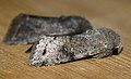 (2188) Clouded Drab (Orthosia incerta) (4483738322).jpg 1,200 × 733; 972 KB
-
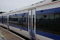
 Rugby railway station MMB 22.jpg 2,898 × 1,839; 1.38 MB
-
 Reading railway station MMB 59 458006.jpg 1,915 × 2,842; 1.82 MB
-
 Banbury railway station MMB 01 168217.jpg 3,008 × 2,000; 2.04 MB
-
 Banbury railway station MMB 02.jpg 2,944 × 1,824; 2.62 MB
-
 Beach at Ashaig - geograph.org.uk - 1804206.jpg 1,024 × 768; 152 KB
-
 Beach at Ashaig - geograph.org.uk - 1804207.jpg 1,024 × 768; 212 KB
-
 Blackaton Manor - geograph.org.uk - 1780652.jpg 1,024 × 683; 179 KB
-

-
 Bridleway towards the B2036 - geograph.org.uk - 1780705.jpg 640 × 428; 152 KB
-
 Bristol - First Great Western Train at Bristol Temple Meads - geograph.org.uk - 1785130.jpg 3,264 × 2,448; 3.17 MB
-
 Bristol MMB «D5 M4.jpg 2,953 × 1,864; 1.85 MB
-
 Bristol Parkway railway station MMB 20 43070 150233.jpg 2,948 × 1,822; 1.83 MB
-
 Bristol Temple Meads railway station MMB 32 950001.jpg 2,856 × 1,862; 1.51 MB
-
 Bronllwyd at Bressingham - geograph.org.uk - 1780591.jpg 800 × 531; 140 KB
-
 Burn above Alligin Shuas - geograph.org.uk - 1803839.jpg 640 × 480; 196 KB
-
 Bus stops, Donaghadee - geograph.org.uk - 1802543.jpg 438 × 584; 283 KB
-

-
 Corner protector, Newtownards - geograph.org.uk - 1803484.jpg 491 × 640; 287 KB
-
 Coventry MMB 01 Rugby-Birmingham-Stafford Line 390048.jpg 3,008 × 2,000; 1.98 MB
-
 Coventry railway station MMB 01 390048.jpg 2,974 × 1,910; 1.7 MB
-
 Coventry railway station MMB 02 390048 350110.jpg 2,966 × 1,889; 1.87 MB
-
 Coventry railway station MMB 03 350110.jpg 2,965 × 1,918; 2.08 MB
-
 Coventry railway station MMB 04 390007.jpg 2,986 × 1,923; 1.97 MB
-
 Coventry railway station MMB 05 390007.jpg 2,947 × 1,952; 2.09 MB
-
 Coventry railway station MMB 06 390007.jpg 2,942 × 1,850; 2.18 MB
-
 Coventry railway station MMB 07.jpg 2,989 × 1,957; 2.2 MB
-
 Coventry railway station MMB 08 390003.jpg 2,977 × 1,933; 2.6 MB
-
 Coventry railway station MMB 09 390003.jpg 2,948 × 1,953; 2.44 MB
-
 Coventry railway station MMB 10 220003.jpg 2,977 × 1,971; 2.24 MB
-
 Coventry railway station MMB 11 220003.jpg 3,008 × 1,860; 2.07 MB
-
 Crags above Loch Diabaigas Airde - geograph.org.uk - 1803866.jpg 640 × 480; 174 KB
-
 CS-DLG Revving up her engines - panoramio.jpg 3,264 × 2,448; 2.92 MB
-
 Derelict buildings, Newtownards - geograph.org.uk - 1803564.jpg 640 × 516; 279 KB
-
 Disused stile and one-fingered post - geograph.org.uk - 1780684.jpg 640 × 428; 172 KB
-
 Donaghadee Lifeboat - geograph.org.uk - 1780543.jpg 588 × 640; 126 KB
-
 Drive to Moonhill Place - geograph.org.uk - 1780714.jpg 640 × 428; 153 KB
-
 Eaton Green Road - panoramio.jpg 3,264 × 2,448; 3.1 MB
-
 ECJS 396 Royal Saloon - geograph.org.uk - 1780663.jpg 800 × 531; 107 KB
-
 Entrance to the new Airyhall Primary School - geograph.org.uk - 1780620.jpg 1,600 × 1,200; 531 KB
-
 Erratic boulders - geograph.org.uk - 1803977.jpg 640 × 480; 87 KB
-
 Feniton Railway Station - geograph.org.uk - 1780660.jpg 1,600 × 1,200; 418 KB
-
 Flush Bracket, Donaghadee - geograph.org.uk - 1780544.jpg 569 × 640; 770 KB
-
 Footbridge over the Allt an Uain - geograph.org.uk - 1803891.jpg 640 × 480; 151 KB
-
 Footbridge over the River Ouse - geograph.org.uk - 1780604.jpg 640 × 428; 166 KB
-
 Footpath north of Broadaford - geograph.org.uk - 1780616.jpg 1,024 × 683; 168 KB
-

-
 GER T26 LNER E4 Bressingham.jpg 800 × 472; 101 KB
-
 GNR 251 Large Boilered Atlantic.jpg 800 × 531; 91 KB
-
 Grey Park Wood - geograph.org.uk - 1780687.jpg 1,024 × 683; 304 KB
-
 Grey Park Wood - geograph.org.uk - 1780699.jpg 1,024 × 683; 341 KB
-
 Grey Park Wood - geograph.org.uk - 1780710.jpg 1,024 × 683; 320 KB
-
 Dower House Greys Court Geograph-1781611-by-don-cload.jpg 2,272 × 1,704; 2.72 MB
-
 Heading west alongside Strawberry Bank - geograph.org.uk - 1780689.jpg 1,024 × 768; 156 KB
-
 High Street, Donaghadee - geograph.org.uk - 1803393.jpg 640 × 473; 254 KB
-
 Insurance brokers, Newtownards - geograph.org.uk - 1803463.jpg 640 × 558; 296 KB
-
 Leamington Spa railway station MMB 01.jpg 2,946 × 1,927; 2.06 MB
-
 Leamington Spa railway station MMB 02 221127.jpg 3,008 × 1,744; 1.93 MB
-
 Leamington Spa railway station MMB 03 67014.jpg 2,988 × 1,964; 2.05 MB
-
 Leamington Spa railway station MMB 04 67014.jpg 2,864 × 1,748; 1.73 MB
-
 Loch a Bhealaich Mhòir - geograph.org.uk - 1801475.jpg 640 × 480; 210 KB
-
 LSWR B4 no. 102 Granville - geograph.org.uk - 1780642.jpg 800 × 531; 94 KB
-
 LTSR Thundersley No. 80 4-4-2T - geograph.org.uk - 1780648.jpg 800 × 531; 100 KB
-
 Lullings Farm - geograph.org.uk - 1780644.jpg 640 × 428; 90 KB
-
 Luton Airport Approach Lights - panoramio.jpg 3,264 × 2,448; 2.95 MB
-
 Manhole cover, Newtownards - geograph.org.uk - 1803553.jpg 640 × 583; 385 KB
-
 Market View - geograph.org.uk - 1806489.jpg 600 × 800; 144 KB
-
 Milestone by the A4104 - geograph.org.uk - 1780378.jpg 640 × 427; 312 KB
-
 Mingary Castle - geograph.org.uk - 1812851.jpg 3,150 × 1,632; 889 KB
-
 Mingary Castle - geograph.org.uk - 1812853.jpg 3,193 × 1,632; 948 KB
-
 Mini bus, Carrickfergus - geograph.org.uk - 1781249.jpg 640 × 367; 93 KB
-
 Moonhill farmhouse - geograph.org.uk - 1780726.jpg 640 × 428; 151 KB
-
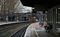
 New Hey Station 1st April 2010 - geograph.org.uk - 1780505.jpg 640 × 427; 318 KB
-
 New Street, Donaghadee - geograph.org.uk - 1803381.jpg 640 × 560; 266 KB
-
 Nottingham railway station MMB 16 158799.jpg 3,008 × 1,956; 2.04 MB
-
 Nottingham railway station MMB 17 158799 222103.jpg 2,959 × 1,809; 2.02 MB
-
 Nottingham railway station MMB 18 158799.jpg 2,836 × 1,876; 1.98 MB
-
 Nottingham railway station MMB 19 158799.jpg 2,848 × 1,960; 2.22 MB
-
 Nottingham railway station MMB 20.jpg 2,718 × 1,902; 1.72 MB
-
 Nottingham railway station MMB 21 43047.jpg 2,949 × 1,890; 1.47 MB
-
 Nottingham railway station MMB 22 66021.jpg 3,008 × 1,870; 1.83 MB
-
 Nottingham railway station MMB 23 66021.jpg 2,234 × 2,000; 1.31 MB
-
 Nottingham railway station MMB 24 66021.jpg 3,008 × 2,000; 2.34 MB
-
 Nottingham railway station MMB 25.jpg 2,972 × 1,970; 2.1 MB
-
 Nottingham railway station MMB 26 222103.jpg 2,942 × 1,670; 2.03 MB
-
 Nottingham railway station MMB 27 222103.jpg 2,922 × 1,694; 1.68 MB
-
 Old meander, River Ouse - geograph.org.uk - 1780629.jpg 640 × 428; 181 KB
-
 On the Diabaig coastal path - geograph.org.uk - 1801460.jpg 640 × 480; 199 KB
-
 Oxford railway station MMB 01 220013.jpg 2,942 × 1,916; 2.48 MB
-
 Oxford railway station MMB 02 165123 165114.jpg 2,979 × 1,858; 2.15 MB
-
 Oxford railway station MMB 03.jpg 2,903 × 1,806; 1.93 MB
-
 Oxford railway station MMB 04 165133.jpg 3,008 × 2,000; 1.77 MB
-
 Oxford railway station MMB 05 165133.jpg 3,008 × 2,000; 1.76 MB
-
 Oxford railway station MMB 06 166220.jpg 2,880 × 1,862; 1.97 MB
-
 Oxford railway station MMB 07 166220.jpg 2,945 × 1,913; 2.08 MB
-
 Park just off Eaton Green Road - panoramio.jpg 3,264 × 2,448; 3.02 MB
-
 Permissive Path to Hamel Down - geograph.org.uk - 1780661.jpg 1,024 × 683; 193 KB
-
 Play area by the old Braeside School - geograph.org.uk - 1780603.jpg 1,600 × 1,200; 533 KB
-
 Play equipment in new estate - geograph.org.uk - 1780597.jpg 1,600 × 1,200; 392 KB
-
 Postbox, Newtownards - geograph.org.uk - 1803421.jpg 640 × 584; 282 KB
-
 Postbox, Newtownards - geograph.org.uk - 1803440.jpg 576 × 640; 349 KB
-
 Postbox, Newtownards - geograph.org.uk - 1803527.jpg 480 × 640; 254 KB
-
 Postbox, Newtownards - geograph.org.uk - 1803539.jpg 480 × 640; 242 KB
-
 Public route to Hameldown - geograph.org.uk - 1780641.jpg 1,024 × 683; 240 KB
-
 Ramshackle barns, Laines Farm - geograph.org.uk - 1780657.jpg 640 × 428; 112 KB
-
 Reading railway station MMB 42 165102 165132.jpg 2,841 × 1,798; 1.81 MB
-
 Reading railway station MMB 43 43034.jpg 2,842 × 1,919; 1.85 MB
-
 Reading railway station MMB 44 220013.jpg 3,008 × 2,000; 2.28 MB
-
 Reading railway station MMB 45.jpg 2,822 × 1,840; 1.8 MB
-
 Reading railway station MMB 46 43017.jpg 3,008 × 2,000; 2.02 MB
-
 Reading railway station MMB 47 165116.jpg 2,910 × 1,884; 2.22 MB
-
 Reading railway station MMB 48 43017.jpg 2,977 × 1,932; 2.1 MB
-
 Reading railway station MMB 49 220013.jpg 2,956 × 1,936; 1.96 MB
-
 Reading railway station MMB 50 220013.jpg 2,940 × 1,851; 1.96 MB
-
 Reading railway station MMB 51 220013.jpg 2,970 × 1,971; 2.01 MB
-
 Reading railway station MMB 52 43158.jpg 3,008 × 2,000; 2.02 MB
-
 Reading railway station MMB 53 43158.jpg 2,968 × 1,970; 1.82 MB
-
 Reading railway station MMB 54 165116.jpg 2,955 × 1,787; 2.21 MB
-
 Reading railway station MMB 55 43193.jpg 2,972 × 1,955; 2.29 MB
-
 Reading railway station MMB 56 220013.jpg 2,969 × 1,962; 1.92 MB
-
 Reading railway station MMB 57 43002 458XXX 458006.jpg 2,928 × 1,776; 1.96 MB
-
 Reading railway station MMB 58 458006.jpg 2,985 × 1,862; 2.11 MB
-
 Reading railway station MMB 60 166218 458006 43131.jpg 2,865 × 1,834; 2.1 MB
-
 Reading railway station MMB 61 458013 458006 43131.jpg 3,008 × 1,934; 1.67 MB
-
 Reading railway station MMB 62 458013 458006.jpg 2,858 × 1,806; 1.72 MB
-
 Reading railway station MMB 63 458013 458006.jpg 2,937 × 1,907; 1.76 MB
-
 Reading railway station MMB 64 43070 458006.jpg 2,972 × 1,926; 1.97 MB
-
 Regent House, Newtownards - geograph.org.uk - 1803518.jpg 640 × 432; 195 KB
-
 Richmond 015 View from Richmond Hill early April.JPG 2,167 × 1,625; 2.24 MB
-
 Richmond 017 Richmond Bridge, early April afternoon.JPG 1,573 × 1,200; 1.27 MB
-
 Roadside bank - geograph.org.uk - 1803966.jpg 640 × 480; 98 KB
-
 Rowden (Dartmoor Expedition Centre) - geograph.org.uk - 1780627.jpg 1,024 × 683; 205 KB
-
 Rugby railway station MMB 16 221104.jpg 2,870 × 1,850; 2.07 MB
-
 Rugby railway station MMB 17.jpg 2,963 × 1,824; 2.04 MB
-
 Rugby railway station MMB 18.jpg 2,959 × 1,880; 2.19 MB
-
 Rugby railway station MMB 19 350250.jpg 3,008 × 2,000; 2.14 MB
-
 Rugby railway station MMB 20 66537.jpg 2,853 × 1,878; 2.25 MB
-
 Rugby railway station MMB 21 66537.jpg 2,940 × 1,816; 2.13 MB
-
 Rugby railway station MMB 23 390XXX.jpg 2,993 × 1,893; 2.27 MB
-
 Rugby railway station MMB 24 390028.jpg 2,970 × 1,760; 1.45 MB
-
 Rugby railway station MMB 25 390048.jpg 2,968 × 1,869; 2.16 MB
-
 Rugby railway station MMB 26 390048.jpg 3,008 × 2,000; 2.3 MB
-
 Rugby railway station MMB 27 390048.jpg 3,008 × 2,000; 1.66 MB
-
 Rusty chain (4518290585).jpg 2,427 × 1,618; 4.39 MB
-
 Sheep pasture - geograph.org.uk - 1803952.jpg 640 × 480; 89 KB
-

-
 Slip road junction, on the A30, near Patteson's Cross - geograph.org.uk - 1780639.jpg 1,600 × 1,242; 396 KB
-
 Station building, Feniton - geograph.org.uk - 1780683.jpg 1,600 × 1,200; 340 KB
-
 Stream in Cwm Bodringallt - geograph.org.uk - 1780724.jpg 640 × 480; 244 KB
-
 Tamworth railway station MMB 01 170107.jpg 2,968 × 1,963; 1.81 MB
-
 Tamworth railway station MMB 02 390XXX.jpg 2,834 × 1,750; 1.84 MB
-
 Tamworth railway station MMB 03 390XXX.jpg 2,900 × 1,826; 1.67 MB
-
 Tamworth railway station MMB 04.jpg 2,950 × 1,788; 2.22 MB
-
 Tamworth railway station MMB 05.jpg 3,008 × 2,000; 3.67 MB
-
 Tamworth railway station MMB 06 221142.jpg 2,947 × 1,869; 2.38 MB
-
 Tamworth railway station MMB 07 221142.jpg 2,992 × 1,954; 2.87 MB
-
 Tamworth railway station MMB 08 66432.jpg 2,956 × 1,902; 2.05 MB
-
 Tamworth railway station MMB 09 390XXX.jpg 2,944 × 1,817; 2.56 MB
-
 Tamworth railway station MMB 10 390XXX.jpg 2,931 × 1,890; 2.34 MB
-
 Tamworth railway station MMB 11.jpg 2,972 × 1,754; 2.19 MB
-
 Tamworth railway station MMB 12 221109.jpg 2,868 × 1,770; 2.25 MB
-
 Tamworth railway station MMB 13 350107.jpg 2,947 × 1,840; 2.05 MB
-
 Tamworth railway station MMB 14 390XXX.jpg 2,920 × 1,840; 2.25 MB
-
 Tamworth railway station MMB 14A 390XXX.jpg 2,720 × 1,360; 1.58 MB
-
 Tamworth railway station MMB 15.jpg 2,962 × 1,688; 2.13 MB
-
 Tamworth railway station MMB 16 350117.jpg 2,973 × 1,872; 2.14 MB
-
 Tamworth railway station MMB 17 350117.jpg 2,980 × 1,957; 2.05 MB
-
 The 'Otterbank' at Donaghadee - geograph.org.uk - 1780540.jpg 640 × 452; 96 KB
-
 The Donaghadee Road, Newtownards - geograph.org.uk - 1803428.jpg 640 × 473; 204 KB
-
 The head of Cwm Bodringallt - geograph.org.uk - 1780717.jpg 640 × 480; 227 KB
-
 The Locomotive Shed - geograph.org.uk - 1780656.jpg 800 × 531; 101 KB
-
 The Loughshore path at Jordanstown - geograph.org.uk - 1780681.jpg 640 × 373; 93 KB
-
 The Moat, Donaghadee - geograph.org.uk - 1802565.jpg 639 × 442; 294 KB
-
 The new Airyhall Primary School - geograph.org.uk - 1780607.jpg 1,600 × 1,200; 357 KB
-
 The new Airyhall Primary School - geograph.org.uk - 1780613.jpg 1,600 × 1,200; 445 KB
-
 The Nog Inn, Feniton - geograph.org.uk - 1780676.jpg 1,074 × 1,600; 256 KB
-
 The Red Lion Pub, Chester - geograph.org.uk - 1828928.jpg 2,048 × 1,536; 587 KB
-
 The road junction above Alligin Shuas - geograph.org.uk - 1803855.jpg 640 × 480; 188 KB
-
 The town wall, Carrickgergus (6) - geograph.org.uk - 1780711.jpg 640 × 386; 110 KB
-
 Tower and ruined wall, Grey's Court.jpg 2,272 × 1,704; 2.74 MB
-
 Tractor at Kenley Airfield, Surrey - geograph.org.uk - 1781726.jpg 3,872 × 2,592; 1.53 MB
-
 Upper Ridges - geograph.org.uk - 1780696.jpg 640 × 428; 103 KB
-
 View of Luton Airport - panoramio.jpg 3,264 × 2,448; 2.91 MB
-
 Watery scene at Devil's Bridge station - geograph.org.uk - 1780708.jpg 640 × 487; 167 KB
-
 William Street, Donaghadee - geograph.org.uk - 1803409.jpg 640 × 556; 239 KB
-
 Wrexham & Shropshire mk2 coach interior MMB 01.jpg 2,751 × 1,824; 1.52 MB
-
 Above Port Laire - geograph.org.uk - 1801483.jpg 640 × 480; 173 KB
-
 Access through a deer fence - geograph.org.uk - 1803880.jpg 640 × 480; 132 KB
-
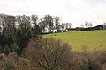
 April Fool's morning, 2010 - geograph.org.uk - 1780682.jpg 1,024 × 768; 143 KB
_Clouded_Drab_(Orthosia_incerta)_(4483738322).jpg)


_-_geograph.org.uk_-_1780627.jpg)


.jpg)


_-_geograph.org.uk_-_1780711.jpg)


