Category:United Kingdom photographs taken on 2020-05-12

Subcategories
This category has only the following subcategory.
Media in category "United Kingdom photographs taken on 2020-05-12"
The following 48 files are in this category, out of 48 total.
-
 Above the lake - geograph.org.uk - 6473913.jpg 1,024 × 683; 561 KB
-
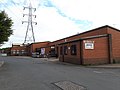 Andy Turner, Block C, Wyther Lane Industrial Estate (geograph 6474567).jpg 1,024 × 768; 122 KB
-
 Bone Valley - junction with Gear Lane.jpg 3,024 × 4,032; 6.2 MB
-
 Bridge Street, Taunton (2020) 45-55.JPG 1,366 × 910; 469 KB
-
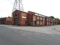 Buckley London, Unit C5, Wyther Lane Industrial Estate (geograph 6474578).jpg 1,024 × 768; 134 KB
-
 Carfury Quarry (1).jpg 3,024 × 4,032; 5.97 MB
-
 Carfury Quarry - water hawthorn.jpg 3,024 × 4,032; 2.7 MB
-
 Constantine College - geograph.org.uk - 6473904.jpg 1,024 × 683; 504 KB
-
 Cramlington Road substation - 2020-05-12 - Andy Mabbett - 01.jpg 3,872 × 2,592; 4.31 MB
-
 Cramlington Road substation - 2020-05-12 - Andy Mabbett - 02.jpg 3,872 × 2,592; 4.69 MB
-
 Cramlington Road substation - 2020-05-12 - Andy Mabbett - 03.jpg 3,872 × 2,592; 4.72 MB
-
 Cramlington Road substation - 2020-05-12 - Andy Mabbett - 04.jpg 3,872 × 2,592; 3.88 MB
-
 Dicranum scoparium 72432164.jpg 2,048 × 1,536; 2.07 MB
-
 Ding Dong - Greenburrow shaft (1).jpg 3,024 × 4,032; 4.46 MB
-
 Ding Dong - Greenburrow shaft (2).jpg 3,024 × 4,032; 4.25 MB
-
 Ding Dong - Greenburrow shaft (3).jpg 3,024 × 4,032; 5.23 MB
-
 Ding Dong - Greenburrow shaft (4).jpg 3,024 × 4,032; 4.91 MB
-
 Ding Dong Mine - Ishmael's shaft (1).jpg 3,024 × 4,032; 5.47 MB
-
 Ding Dong Mine - Ishmael's shaft (2).jpg 3,024 × 4,032; 5.21 MB
-
 Ding Dong Mine - Ishmael's shaft (3).jpg 3,024 × 4,032; 2.21 MB
-
 East campus CHP - geograph.org.uk - 6473903.jpg 683 × 1,024; 494 KB
-
 Eastern end of the lake - geograph.org.uk - 6473911.jpg 1,024 × 683; 559 KB
-
 Eastern limit of the lake - geograph.org.uk - 6473912.jpg 683 × 1,024; 511 KB
-
 Four Winds Pavillion detail.jpg 1,805 × 2,684; 2.21 MB
-
 Four Winds Pavillion.jpg 4,128 × 3,096; 2.38 MB
-
 Goodricke College and Algol - geograph.org.uk - 6474750.jpg 1,024 × 683; 450 KB
-
 Greylag geese on Heslington East - geograph.org.uk - 6473916.jpg 1,024 × 683; 489 KB
-
 Greylags by the lake - geograph.org.uk - 6473919.jpg 1,024 × 683; 446 KB
-
 Header lake - geograph.org.uk - 6473907.jpg 1,024 × 683; 491 KB
-
 Lake near Ron Cooke Hub - geograph.org.uk - 6473920.jpg 1,024 × 683; 466 KB
-
 Lake shoreline - geograph.org.uk - 6473910.jpg 683 × 1,024; 554 KB
-
 Lecidella elaeochroma 72516695.jpg 2,048 × 1,365; 1,018 KB
-
 Malacosoma neustria, Madron.jpg 3,024 × 4,032; 5.57 MB
-
 Mallards near Ron Cooke Hub - geograph.org.uk - 6474744.jpg 1,024 × 725; 499 KB
-
 Nest building - geograph.org.uk - 6474747.jpg 1,024 × 683; 616 KB
-
 Pochard near Ron Cooke Hub - geograph.org.uk - 6474742.jpg 1,024 × 572; 349 KB
-
 Primrose House, Primrose Hill, Wakefield (geograph 6472838).jpg 2,404 × 1,803; 1.3 MB
-
 Southern edge of the lake - geograph.org.uk - 6473908.jpg 683 × 1,024; 483 KB
-
 Swans near Ron Cooke Hub - geograph.org.uk - 6474746.jpg 1,024 × 683; 691 KB
-
 The Goat Walk 03.jpg 5,568 × 3,712; 12.17 MB
-
 The Goat Walk 04.jpg 5,568 × 3,712; 12.73 MB
-
 The Goat Walk 05.jpg 5,568 × 3,712; 12.78 MB
-
 The Goat Walk 06.jpg 5,568 × 3,712; 9.43 MB
-
 The New Bell, Birmingham - 2020-05 -12- Andy Mabbett - 01.jpg 3,872 × 2,592; 3.57 MB
-
 The New Bell, Birmingham - 2020-05 -12- Andy Mabbett - 02.jpg 3,872 × 2,592; 3.73 MB
-
 The New Bell, Birmingham - 2020-05 -12- Andy Mabbett - 03.jpg 2,592 × 3,872; 3.19 MB
-
 Towards the lake - geograph.org.uk - 6473905.jpg 1,024 × 683; 481 KB
-
 Trythall crossroad (May 2020).jpg 3,024 × 4,032; 5.31 MB

.jpg)

_45-55.JPG)
.jpg)
.jpg)


.jpg)
.jpg)
.jpg)
.jpg)
.jpg)
.jpg)
.jpg)


.jpg)


.jpg)