Category:United States photographs taken on 2013-09-19
Countries of North America: Canada · Costa Rica · El Salvador · Mexico · Panama · United States of America‡
‡: partly located in North America
‡: partly located in North America
| ← | 19 September 2013 | → | ||
| ← | September 2013 | → | ||

United States of America photographs taken on 19 September 2013.
Image files should be categorized here automatically using {{taken on}} template. Direct categorisation is also possible, if automatic is impossible.
Media in category "United States photographs taken on 2013-09-19"
The following 200 files are in this category, out of 286 total.
(previous page) (next page)-

-
 184th Force Support Squadron search and recovery training 130919-F-UB734-037.jpg 4,288 × 2,848; 6.56 MB
-
 2013-09-19 09 26 59 ASOS AWPAG precipitation gauge at Eureka Airport, Nevada.JPG 3,264 × 2,448; 3.76 MB
-
 2013-09-19 09 27 07 ASOS AWPAG precipitation gauge at Eureka Airport, Nevada.JPG 2,448 × 3,264; 2.84 MB
-
 2013-09-19 09 27 41 ASOS DTS-1 dewpoint sensor at Eureka Airport, Nevada.JPG 3,264 × 2,448; 2.27 MB
-
 2013-09-19 09 28 07 ASOS HO-1088 thermometer at Eureka Airport, Nevada.JPG 2,448 × 3,264; 1.72 MB
-
 2013-09-19 09 56 18 View of downtown Eureka, Nevada.JPG 3,264 × 2,448; 3.37 MB
-
 2013-09-19 09 56 20 View of downtown Eureka, Nevada.JPG 3,264 × 2,448; 2.02 MB
-
 2013-09-19 09 58 01 View of downtown Eureka, Nevada.JPG 3,264 × 2,448; 3.37 MB
-
 2013-09-19 10 01 52 View of downtown Eureka, Nevada.JPG 3,264 × 2,448; 3.03 MB
-
 2013-09-19 10 58 03 View south along Nevada State Route 376.JPG 3,264 × 2,448; 2.94 MB
-
 2013-09-19 11 43 59 View west from Nevada State Route 376 across Big Smoky Valley.JPG 3,264 × 2,448; 3.63 MB
-
 2013-09-19 11 44 46 View east from Nevada State Route 376 across Big Smoky Valley.JPG 3,264 × 2,448; 3.44 MB
-
 2013-09-19 12 23 09 Joshua Tree at Tonopah Airport, Nevada.JPG 2,448 × 3,264; 3.41 MB
-
 2013-09-19 12 24 23 Joshua Trees at Tonopah Airport, Nevada.JPG 3,264 × 2,448; 2.95 MB
-
 2013-09-19 12 25 31 Joshua Trees at Tonopah Airport, Nevada.JPG 3,264 × 2,448; 3 MB
-
 2013-09-19 12 35 16 Ruins at Tonopah Airport, Nevada.JPG 2,448 × 3,264; 2.87 MB
-
 2013-09-19 12 36 01 Ruins at Tonopah Airport, Nevada.JPG 2,448 × 3,264; 2.58 MB
-
 2013-09-19 12 37 26 Ruins at Tonopah Airport, Nevada.JPG 3,264 × 2,448; 3.19 MB
-
 2013-09-19 12 41 10 Abandoned hanger at Tonopah Airport, Nevada.JPG 3,264 × 2,448; 3.13 MB
-
 2013-09-19 12 42 10 Abandoned hanger at Tonopah Airport, Nevada.JPG 3,264 × 2,448; 2 MB
-
 2013-09-19 12 42 24 Abandoned hanger at Tonopah Airport, Nevada.JPG 3,264 × 2,448; 2.34 MB
-
 2013-09-19 12 59 58 View of downtown Tonopah, Nevada from the southwest.jpg 3,264 × 2,448; 2 MB
-
 2013-09-19 12 59 58 View of Tonopah, Nevada from the southwest.jpg 3,264 × 2,448; 3.32 MB
-
 2013-09-19 13 02 02 View of downtown Tonopah, Nevada.JPG 3,264 × 2,448; 2.02 MB
-
 2013-09-19 13 02 04 View of downtown Tonopah, Nevada.JPG 8,128 × 2,526; 13.06 MB
-
 2013-09-19 13 02 06 View of downtown Tonopah, Nevada.JPG 3,264 × 2,448; 2.01 MB
-
 2013-09-19 13 02 08 View of downtown Tonopah, Nevada.JPG 3,264 × 2,448; 2 MB
-
 2013-09-19 13 02 10 View of downtown Tonopah, Nevada.JPG 3,264 × 2,448; 1.99 MB
-
 2013-09-19 13 02 12 View of downtown Tonopah, Nevada.JPG 3,264 × 2,448; 2.01 MB
-
 2013-09-19 13 57 56 View west along US 6 at the western junction with US 95 in Nevada.JPG 3,264 × 2,448; 2.73 MB
-

-

-
 2013-09-19 14 25 37 View south from US 6 down Benton Valley.JPG 3,264 × 2,448; 2.7 MB
-

-
 2013-09-19 15 16 35 View west along California State Route 120 from Sagehen Summit.JPG 4,656 × 2,528; 7.49 MB
-
 2013-09-19 15 26 25 View of Mono Lake from California State Route 120.JPG 5,600 × 2,554; 9.1 MB
-
 2013-09-19 15 27 45 Coyote along California State Route 120 near Mono Lake.JPG 3,264 × 2,448; 4.27 MB
-
 2013-09-19 15 27 46 Coyote along California State Route 120 near Mono Lake.JPG 3,264 × 2,448; 4.31 MB
-
 2013-09-19 16 01 49 View down Lee Vining Canyon from California State Route 120.JPG 3,264 × 2,448; 3.33 MB
-
 2013-09-19 16 01 52 View across Lee Vining Canyon from California State Route 120.JPG 3,264 × 2,448; 2.25 MB
-
 2013-09-19 16 01 56 View up Lee Vining Canyon from California State Route 120.JPG 3,264 × 2,448; 2.83 MB
-
 2013-09-19 16 02 15 Panorama of Lee Vining Canyon from California State Route 120.JPG 7,616 × 2,482; 12.03 MB
-
 2013-09-19 16 08 37 View down Lee Vining Canyon from California State Route 120.JPG 3,264 × 2,448; 3.16 MB
-
 2013-09-19 16 08 42 View up Lee Vining Canyon from California State Route 120.JPG 3,264 × 2,448; 3.14 MB
-
 2013-09-19 16 09 00 Panorama of Lee Vining Canyon from California State Route 120.JPG 7,056 × 2,442; 10.96 MB
-
 2013-09-19 16 17 52 Entrance sign to Yosemite National Park at Tioga Pass.JPG 3,264 × 2,448; 2.24 MB
-
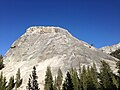
 2013-09-19 16 30 31 Lembert Dome in Yosemite National Park.JPG 3,264 × 2,448; 3.27 MB
-
 2013-09-19 16 45 11 Pywiack Dome in Yosemite National Park.jpg 3,264 × 2,448; 3.16 MB
-
 2013-09-19 16 45 14 Unnamed granite features near Pywiack Dome in Yosemite National Park.JPG 3,264 × 2,448; 3.29 MB
-
 2013-09-19 16 45 19 Unnamed granite features near Pywiack Dome in Yosemite National Park.JPG 3,264 × 2,448; 2.89 MB
-
 2013-09-19 16 45 50 Panorama of Pywiack Dome in Yosemite National Park.JPG 6,784 × 2,332; 10.07 MB
-
 2013-09-19 16 48 12 Panorama of Tenaya Lake in Yosemite National Park.JPG 8,176 × 2,498; 13 MB
-
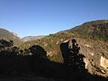
 2013-09-19 16 54 24 View northeast from Olmsted Point in Yosemite National Park.JPG 3,264 × 2,448; 2.64 MB
-
 2013-09-19 16 56 53 View southwest from Olmsted Point in Yosemite National Park.JPG 3,264 × 2,448; 2.43 MB
-
 2013-09-19 17 15 22 Smoke from the Rim Fire in Yosemite National Park.JPG 3,264 × 2,448; 2.67 MB
-
 2013-09-19 17 22 51 Smoke from the Rim Fire in Yosemite National Park.JPG 3,264 × 2,448; 2.55 MB
-
 2013-09-19 17 30 58 Smoke and burned trees from the Rim Fire in Yosemite National Park.JPG 3,264 × 2,448; 3.53 MB
-
 2013-09-19 17 31 02 Smoke and burned trees from the Rim Fire in Yosemite National Park.JPG 3,264 × 2,448; 3.29 MB
-
 2013-09-19 17 31 08 Smoke and burned trees from the Rim Fire in Yosemite National Park.JPG 3,264 × 2,448; 3.93 MB
-
 2013-09-19 17 32 54 Smoke and burned trees from the Rim Fire in Yosemite National Park.JPG 2,448 × 3,264; 2.31 MB
-

-

-
 2013-09-19 17 34 46 Smoke and burned trees from the Rim Fire in Yosemite National Park.JPG 2,448 × 3,264; 1.91 MB
-

-
 2013-09-19 18 04 11 View up Yosemite Valley from Big Oak Flat Road.JPG 3,264 × 2,448; 2.05 MB
-
 2013-09-19 18 04 27 View up Yosemite Valley from Big Oak Flat Road.JPG 3,264 × 2,448; 2.2 MB
-
 2013-09-19 18 05 18 View down Yosemite Valley from Big Oak Flat Road.JPG 3,264 × 2,448; 2.27 MB
-
 2013-09-19 18 05 57 Tunnel along Big Oak Flat Road in Yosemite National Park.JPG 3,264 × 2,448; 1.52 MB
-
 2013-09-19 18 08 37 View up Yosemite Valley from Big Oak Flat Road.JPG 3,264 × 2,448; 1.9 MB
-
 2013-09-19 18 11 47 Tunnel along Big Oak Flat Road in Yosemite National Park.JPG 3,264 × 2,448; 2.68 MB
-
 2013-09-19 18 18 27 Trees and El Capitan in Yosemite National Park.JPG 3,264 × 2,448; 1.8 MB
-
 2013-09-19 18 19 20 Trees and El Capitan in Yosemite National Park.JPG 3,264 × 2,448; 1.7 MB
-
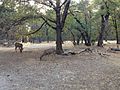 2013-09-19 18 22 47 Mule Deer in Yosemite Valley.JPG 3,264 × 2,448; 4.07 MB
-
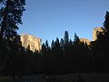
 2013-09-19 18 23 40 El Capitan in Yosemite National Park.JPG 3,264 × 2,448; 2.53 MB
-
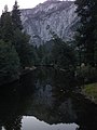
 2013-09-19 18 35 25 Half Dome and the Merced River in Yosemite National Park.JPG 3,264 × 2,448; 1.52 MB
-
 2013-09-19 18 38 36 Merced River in Yosemite National Park.JPG 2,448 × 3,264; 1.98 MB
-
 2013-09-19 18 40 06 Yosemite Falls in September in Yosemite National Park.JPG 3,264 × 2,448; 2.53 MB
-
 2013-09-19 18 46 28 Half Dome near sunset in Yosemite National Park.JPG 3,264 × 2,448; 1.54 MB
-

-
 2013-09-19 18 55 05 Cathedral Spires near sunset in Yosemite National Park.JPG 3,264 × 2,448; 1.32 MB
-
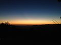 2013-09-19 19 26 11 Sunset in Yosemite National Park.JPG 3,264 × 2,448; 1.07 MB
-
 2013-09-19 19 27 14 Sunset in Yosemite National Park.JPG 3,264 × 2,448; 1.24 MB
-
 2013-365-263 Mega Thunderhead Ahead (9832599724).jpg 5,184 × 3,456; 4.3 MB
-
 P091913PS-0640 (11665791446).jpg 1,500 × 1,063; 255 KB
-
 48th IBCT XCTC 130919-Z-QM033-169.jpg 2,760 × 2,244; 2.56 MB
-
 48th Infantry Brigade XCTC 130919-A-AX030-878.jpg 2,518 × 3,791; 2.29 MB
-
 48th Infantry Brigade XCTC 130919-A-AX030-953.jpg 4,288 × 2,848; 4.66 MB
-
 737 W Belmont Ave. (formerly 1662 Belmont) in Chicago.JPG 2,448 × 3,264; 1.66 MB
-

-

-

-
 Aeromedical training mission 130919-F-RH756-734.jpg 4,928 × 3,280; 1.73 MB
-
 Aeromedical training mission 130919-F-RH756-822.jpg 4,928 × 3,280; 3.14 MB
-
 Aeromedical training mission 130919-F-RH756-856.jpg 4,928 × 3,280; 2.96 MB
-
 Aeromedical training mission 130919-F-RH756-885.jpg 4,928 × 3,280; 3.99 MB
-
 Air CAV on target 130919-A-UG106-203.jpg 4,288 × 2,848; 4.36 MB
-
 Air Force Wounded Warrior Adaptive Sports Camp 130919-F-GF928-030.jpg 2,332 × 3,264; 1.1 MB
-
 Aircrews complete flood rescue missions 130919-A-RI441-199.jpg 4,608 × 3,072; 9.83 MB
-
 Aloha - panoramio.jpg 4,010 × 2,869; 3.67 MB
-
 AnnieOakleyHsLRWalls.jpg 1,600 × 938; 734 KB
-

-
 Bradley Airport 2013 (9827625036).jpg 1,200 × 900; 545 KB
-
 Bradley Airport 2013 (9827692653).jpg 1,200 × 900; 619 KB
-
 Bradley Airport 2013 (9827702213).jpg 1,200 × 900; 479 KB
-
 Buffalo Lake National Wildlife Preserve.JPG 4,608 × 3,456; 3.22 MB
-
 Campbell-Whittlesey House.jpg 3,527 × 2,873; 998 KB
-
 Cape May vineyard.jpg 2,048 × 1,536; 418 KB
-
 Celebratory flyby 130919-A-RI441-989.jpg 4,608 × 3,072; 9.37 MB
-
 Coast Guard Station Port Huron, Mich. 130919-G-ZZ999-001.jpg 1,318 × 688; 724 KB
-
 Colorado flood response 130919-A-UV705-030.jpg 4,256 × 2,832; 5.32 MB
-
 Colorado flood response 130919-A-UV705-046.jpg 4,256 × 2,831; 6.62 MB
-
 Colorado flood response 130919-A-UV705-050.jpg 4,256 × 2,832; 6.32 MB
-
 Colorado flood response 130919-A-UV705-051.jpg 4,256 × 2,831; 4.32 MB
-
 Colorado flood response 130919-A-uv705-057.jpg 4,256 × 2,826; 6.16 MB
-
 Colorado flood response 130919-A-UV705-078.jpg 4,256 × 2,832; 5.83 MB
-
 Combined operations shop keeps vehicles on move 130919-A-FF538-103.jpg 1,800 × 1,196; 1.6 MB
-
 Crescent City Connection Bridge - panoramio.jpg 4,824 × 1,602; 980 KB
-
 Crescent Hill Reservoir.jpg 4,000 × 2,250; 1.05 MB
-
 Cyberdyne Systems (9848225175).jpg 3,996 × 2,730; 3.4 MB
-
 Death Valley (49012437376).jpg 8,126 × 3,818; 3.12 MB
-
 Deep Creek Locks (9817627056).jpg 1,200 × 1,600; 461 KB
-
 Ether Dome 2013-09-19 14-58-16.jpg 2,150 × 1,216; 1.42 MB
-
 Falcon 9 1.1 static fire test (9848253816).jpg 3,803 × 3,000; 2.99 MB
-
 Falcon Brigade rich in Sapper heritage 130919-A-DP764-109.jpg 4,115 × 2,733; 7.02 MB
-
 Filler up - panoramio.jpg 4,320 × 3,240; 2.53 MB
-
 First of the First strike first during urban warfare training 130919-M-XZ164-015.jpg 3,840 × 2,560; 3.45 MB
-
 First of the First strike first during urban warfare training 130919-M-XZ164-023.jpg 3,840 × 2,560; 3.33 MB
-
 First of the First strike first during urban warfare training 130919-M-XZ164-062.jpg 3,296 × 2,197; 3.04 MB
-
 First of the First strike first during urban warfare training 130919-M-XZ164-069.jpg 3,245 × 2,163; 3.8 MB
-
 First of the First strike first during urban warfare training 130919-M-XZ164-088.jpg 3,840 × 2,560; 3.14 MB
-
 First of the First strike first during urban warfare training 130919-M-XZ164-110.jpg 3,494 × 2,329; 3.43 MB
-
 First of the First strike first during urban warfare training 130919-M-XZ164-115.jpg 3,840 × 2,560; 2.69 MB
-
 First of the First strike first during urban warfare training 130919-M-XZ164-167.jpg 3,082 × 2,055; 2.4 MB
-
 First of the First strike first during urban warfare training 130919-M-XZ164-180.jpg 3,840 × 2,560; 7.76 MB
-
 First of the First strike first during urban warfare training 130919-M-XZ164-197.jpg 3,840 × 2,560; 3.82 MB
-
 First of the First strike first during urban warfare training 130919-M-XZ164-263.jpg 3,840 × 2,140; 3.32 MB
-
 Flight checks 130919-A-RI441-096.jpg 4,608 × 3,072; 7.7 MB
-
 Flying home 130919-A-RI441-086.jpg 4,608 × 2,539; 7.55 MB
-
 Former Central Trust Bank Building.jpg 4,293 × 2,759; 973 KB
-
 Former POW, 'Never give up' 130919-F-QY930-038.jpg 7,560 × 5,040; 4.35 MB
-
 Former POW, 'Never give up' 130919-F-QY930-067.jpg 7,560 × 5,040; 3.79 MB
-
 Former POW, 'Never give up' 130919-F-QY930-140.jpg 7,560 × 5,040; 2.52 MB
-
 Former POW, 'Never give up' 130919-F-QY930-161.jpg 7,560 × 5,040; 3.6 MB
-
 French Quarter, New Orleans, LA, USA - panoramio (7).jpg 4,608 × 3,072; 5.14 MB
-
 French Quarter, New Orleans, LA, USA - panoramio (8).jpg 4,608 × 3,072; 4.85 MB
-
 Georgia employers visit XCTC 130919-A-MV865-567.jpg 2,048 × 1,356; 2.9 MB
-
 Getting in line 130919-A-RI441-258.jpg 4,608 × 3,072; 9.08 MB
-
 GlasgowLRWalls.jpg 1,600 × 1,061; 1.18 MB
-
 Going home 130919-A-RI441-043.jpg 4,608 × 2,393; 8.27 MB
-
 Government Agency Freedom of Information Law Data Inspection (17217924248).jpg 2,448 × 3,264; 3.6 MB
-
 Graceland - panoramio (1).jpg 5,201 × 1,648; 2.51 MB
-
 Graceland - panoramio.jpg 5,168 × 1,430; 2.15 MB
-
 Grassland fog over hay bales at Missisquoi National Wildlife Refuge (9816896463).jpg 3,953 × 2,401; 2.57 MB
-
 Harvest Moon (9846106865).jpg 2,176 × 1,245; 1.13 MB
-
 Harvest Moon rises over Washington.jpg 3,722 × 2,799; 2.7 MB
-
 Hover test 130919-A-RI441-336.jpg 4,608 × 3,072; 8.96 MB
-
 Hovering 130919-A-RI441-382.jpg 4,608 × 3,072; 10.04 MB
-
 Hutchinson Sugar Mill.jpg 5,158 × 3,420; 3.54 MB
-
 Jean Lafitte National Park - panoramio.jpg 4,945 × 1,673; 1.07 MB
-
 Kellogg Public Library.jpg 5,947 × 3,965; 1.63 MB
-
 Left side of a QWERTY keyboard.jpg 2,448 × 3,264; 1.89 MB
-
 Lincoln Memorial Morning.jpg 3,456 × 5,184; 6.88 MB
-
 Lined up 130919-A-RI441-790.jpg 4,608 × 3,072; 9.52 MB
-
 Lining up 130919-A-RI441-743.jpg 4,608 × 3,072; 8.36 MB
-
 Little Rock airmen run for POW-MIA Recognition Day 130919-F-IY632-503.jpg 1,585 × 1,054; 547 KB
-
 Lowyhee - panoramio.jpg 4,320 × 3,240; 1.81 MB
-
 Mass casualty exercise 130919-F-RH756-060.jpg 4,256 × 2,832; 2.21 MB
-
 Mass casualty exercise 130919-F-RH756-081.jpg 4,256 × 2,832; 1.59 MB
-
 Mass casualty exercise 130919-F-RH756-198.jpg 4,256 × 2,832; 1.8 MB
-
 Mass casualty exercise 130919-F-RH756-227.jpg 2,832 × 4,256; 1.71 MB
-
 Mass casualty exercise 130919-F-RH756-302.jpg 4,256 × 2,832; 2.81 MB
-
 Mass casualty exercise 130919-F-RH756-343.jpg 4,928 × 3,280; 2.69 MB
-
 Mass casualty exercise 130919-F-RH756-381.jpg 4,928 × 3,280; 1.77 MB
-
 Mass casualty exercise 130919-F-RH756-392.jpg 4,928 × 3,280; 1.77 MB
-
 Mass casualty exercise 130919-F-RH756-431.jpg 3,814 × 2,538; 1.83 MB
-
 Mass casualty exercise 130919-F-RH756-486.jpg 4,928 × 3,280; 2.53 MB
-
 Mass casualty exercise 130919-F-RH756-574.jpg 4,928 × 3,280; 1.68 MB
-
 Mass casualty exercise 130919-F-RH756-589.jpg 4,469 × 2,512; 986 KB
-
 Mass casualty exercise 130919-F-RH756-638.jpg 4,928 × 3,280; 2.08 MB
-
 Mass casualty exercise 130919-F-RH756-662.jpg 4,928 × 3,280; 2.37 MB
-
 MCAA benefits Semper Fi Fund 130919-M-OK471-004.jpg 3,840 × 5,760; 5.27 MB
-
 MCAA benefits Semper Fi Fund 130919-M-OK471-005.jpg 5,760 × 3,840; 5.2 MB
-
 MCB Hawaii celebrates 'End of Summer' 130919-M-TH981-015.jpg 1,800 × 1,192; 1.3 MB
-
 Metropolitan Park Bathhouse and Pool Historic District 2013-09-19 09-25-13.jpg 3,264 × 1,836; 2.3 MB
-
 Metropolitan Park Bathhouse and Pool Historic District 2013-09-19 09-26-02.jpg 3,264 × 1,836; 2.63 MB
-
 Moving to the runway 130919-A-RI441-480.jpg 4,608 × 3,072; 10 MB
-
 Multipurpose canines train like they fight 130919-M-WY229-001.jpg 5,760 × 3,840; 1.46 MB
-
 Multipurpose canines train like they fight 130919-M-WY229-002.jpg 3,840 × 5,760; 1.64 MB
-
 Nashville - panoramio (1).jpg 5,861 × 1,719; 1,018 KB
-
 Natchez Vidalia Bridge - panoramio.jpg 6,025 × 1,615; 1.22 MB
-
 Neville Public Museum.jpg 5,289 × 3,526; 1.7 MB
-
 New Orleans - panoramio (3).jpg 4,312 × 1,580; 880 KB
-
 New York Skylines 13.JPG 3,648 × 2,736; 1.9 MB
-
 New York Skylines 14.JPG 3,648 × 2,736; 2.69 MB
-
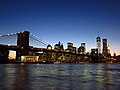 New York Skylines 15.JPG 3,648 × 2,736; 2.3 MB
-
 New York Skylines 16.JPG 3,648 × 2,736; 2.49 MB
-
 New York Skylines 17.JPG 3,648 × 2,736; 2.15 MB
-
 New York Skylines 18.JPG 3,648 × 2,736; 2.45 MB
-
 New York Skylines 19.JPG 3,648 × 2,736; 2.45 MB
_Veronica_Holliday_speaks_with_local_members_from_the_community.jpg)


.jpg)
.jpg)


_in_Chicago.JPG)


.jpg)
.jpg)
.jpg)


.jpg)
.jpg)
.jpg)

.jpg)


.jpg)
.jpg)


.jpg)
.jpg)
.jpg)


.jpg)
.jpg)
.jpg)