Category:United States photographs taken on 2020-10-17
Countries of North America: Canada · Costa Rica · Mexico · Panama · United States of America‡
‡: partly located in North America
‡: partly located in North America
| ← | 17 October 2020 | → | ||
| ← | October 2020 | → | ||

United States of America photographs taken on 17 October 2020.
Image files should be categorized here automatically using {{taken on}} template. Direct categorisation is also possible, if automatic is impossible.
Subcategories
This category has only the following subcategory.
Media in category "United States photographs taken on 2020-10-17"
The following 200 files are in this category, out of 294 total.
(previous page) (next page)-
 20201017 04 Michigan Ave. Gymnastics (51017245528).jpg 2,432 × 1,824; 2.08 MB
-
 20201017 05 MIchigan Ave. (51017244338).jpg 2,432 × 1,824; 2.03 MB
-
 20201017 10 Michigan Ave. @ Pearson St. (51017244293).jpg 2,432 × 1,824; 1.66 MB
-
 20201017 13 Wolf Point (51018068427).jpg 2,432 × 1,824; 1.6 MB
-
 40 Bedford Road.jpg 4,032 × 3,024; 11.2 MB
-
 Achillea millefolium 102455561.jpg 1,536 × 2,048; 1.96 MB
-
 Alter 2020.jpg 3,264 × 4,928; 6.79 MB
-
 Andrews Terrace Apartments, Rochester, New York - 20201017.jpg 4,032 × 3,024; 3.4 MB
-
 Angel's Dining Car; Palatka, Florida.jpg 3,648 × 2,736; 1.97 MB
-
 Ant Hill and The Scarlet Begonia.jpg 1,352 × 609; 405 KB
-
 Ardea alba (Great Egret) 163.jpg 4,163 × 2,602; 3.4 MB
-
 Argos Ready-Mix Xing @ Kingsland Subdivision.jpg 3,648 × 2,736; 2.05 MB
-
 Armillaria gallica 100773450.jpg 1,536 × 2,048; 1.13 MB
-
 Aureoboletus mirabilis 101099123.jpg 1,280 × 960; 1.67 MB
-
 Autumn sunset over the Coastal Range in Oregon - Flickr - Bonnie Moreland (free images).jpg 5,175 × 2,854; 2.21 MB
-
 Azolla filiculoides 100724346.jpg 2,048 × 1,365; 1.31 MB
-
 Azolla filiculoides 100724424.jpg 2,048 × 1,365; 1.57 MB
-
 Azolla filiculoides 101634270.jpg 1,536 × 2,048; 858 KB
-
 Azolla filiculoides 101634291.jpg 2,048 × 1,536; 855 KB
-
 Azolla filiculoides 101634337.jpg 2,048 × 1,536; 1.21 MB
-
 Bangor Episcopal Church street view.jpg 3,264 × 4,928; 4.66 MB
-
 Barber Bridge 1.jpg 2,049 × 1,536; 843 KB
-
 Barber Bridge 2.jpg 2,049 × 1,536; 1.15 MB
-
 Barber Bridge and Royal Palm Pointe.jpg 2,049 × 1,536; 875 KB
-
 Barber Bridge from Royal Palm Pointe.jpg 2,049 × 1,536; 807 KB
-
 Cardinal Tract VPA Information Kiosk.jpg 5,184 × 3,456; 9.89 MB
-
 Cardinal Tract VPA looking east.jpg 5,184 × 3,456; 8.61 MB
-
 Cardinal Tract VPA looking west.jpg 5,184 × 3,456; 10.03 MB
-
 Chlorophyllum molybdites 100716044.jpg 2,048 × 1,536; 1.62 MB
-
 Christ Hamilton United Lutheran Church.jpg 5,184 × 3,456; 7.4 MB
-
 Clashing rallies in Palmer - 50525854092.jpg 4,703 × 3,132; 7.91 MB
-
 Clashing rallies in Palmer.jpg 4,643 × 2,913; 6.12 MB
-
 Columbia Pioneer Cemetery, Portland, October 2020 - 06.jpg 4,000 × 3,000; 3.34 MB
-
 Columbia Pioneer Cemetery, Portland, October 2020 - 07.jpg 4,000 × 3,000; 3.48 MB
-
 Columbia Pioneer Cemetery, Portland, October 2020 - 12.jpg 3,000 × 4,000; 4.22 MB
-
 Cook County Airport runway view from Airport Rd.jpg 5,184 × 3,456; 6.32 MB
-
 CSX Kingsland Subdivision; South to old Yulee SAL Station.jpg 3,648 × 2,736; 2.06 MB
-
 Cyathus striatus 100753971.jpg 2,048 × 1,536; 878 KB
-
 Cyathus striatus 100754010.jpg 1,536 × 2,048; 1.19 MB
-
 Cyathus striatus 100754051.jpg 2,048 × 1,536; 976 KB
-
 Cyathus striatus 100754080.jpg 1,536 × 2,048; 1.34 MB
-
 Cyathus striatus 100754110.jpg 1,536 × 2,048; 708 KB
-
 Dioxyna picciola 101289105.jpg 2,048 × 1,536; 563 KB
-
 EB FL 100 @ US 17; Palatka.jpg 3,648 × 2,736; 2.06 MB
-
 EB FL 100 just before the US 17 overlap.jpg 3,648 × 2,736; 2.05 MB
-
 EB FL 100; JCT US 17.jpg 3,648 × 2,736; 2.06 MB
-
 EB FL 126 @ FEC RR Xing.jpg 3,648 × 2,736; 2.02 MB
-
 EB FL 126 @ US 1.jpg 3,648 × 2,736; 1.99 MB
-
 EB FL 206; 14 Miles to Crescent Beach.jpg 3,648 × 2,736; 2.08 MB
-
 EB FL 206; First Reassurance Shield.jpg 3,648 × 2,736; 2.05 MB
-
 EB FL 207 Enters Hastings, FL.jpg 3,648 × 2,736; 1.99 MB
-
 EB FL 207; JCT CR 13; Hastings (Close-Up).jpg 3,648 × 2,736; 2.04 MB
-
 EB FL 207; JCT CR 13; Hastings.jpg 3,648 × 2,736; 2.02 MB
-
 EB FL SR 243 @ NB I-95 On-Ramp.jpg 3,648 × 2,736; 2.05 MB
-
 Ensign College.jpg 2,480 × 2,336; 1.74 MB
-
 Esopus Creek at Marbletown, NY, town park.jpg 3,204 × 2,400; 6.58 MB
-
 Esopus Creek flood wall, Kingston, NY.jpg 3,072 × 1,860; 4.63 MB
-
 Esopus Creek from Hurley Mountain Road bridge, Lomontville, NY.jpg 2,694 × 2,094; 5.02 MB
-
 Esopus Creek meander S of Hurley, NY.jpg 3,048 × 2,082; 3.62 MB
-
 Esopus Creek with limestone bedrock bank at Hurley, NY.jpg 2,958 × 2,448; 6.39 MB
-
 Fomitopsis betulina 101275382.jpg 2,048 × 1,536; 924 KB
-
 Fomitopsis betulina 101275487.jpg 2,048 × 1,536; 988 KB
-
 Gambelia wislizenii 105025074.jpg 2,048 × 1,360; 1.82 MB
-
 Gambelia wislizenii 105025303.jpg 2,048 × 1,360; 2.75 MB
-
 Gambelia wislizenii 105025424.jpg 2,048 × 1,536; 3.25 MB
-
 Gazzam Lake Nature Preserve 01 - main trail.jpg 6,000 × 4,000; 12.98 MB
-
 Gazzam Lake Nature Preserve 02 - main trail.jpg 4,000 × 6,000; 12.98 MB
-
 Gazzam Lake Nature Preserve 03 - glacial erratic just off main trail.jpg 6,000 × 4,000; 13.1 MB
-
 Gazzam Lake Nature Preserve 04 - glacial erratic just off main trail.jpg 6,000 × 4,000; 12.87 MB
-
 Gazzam Lake Nature Preserve 05 - trail back from the lake.jpg 6,000 × 4,000; 11.38 MB
-
 Gazzam Lake Nature Preserve 06 - the lake.jpg 6,000 × 4,000; 13.79 MB
-
 Gazzam Lake Nature Preserve 07 - the lake.jpg 6,000 × 4,000; 11.04 MB
-
 Gazzam Lake Nature Preserve 08 - mushrooms in a tree stump.jpg 6,000 × 4,000; 12.96 MB
-
 Gazzam Lake Nature Preserve 09 - mushrooms in a tree stump.jpg 6,000 × 4,000; 12.41 MB
-
 Gazzam Lake Nature Preserve 10 - mushrooms in a tree stump.jpg 6,000 × 4,000; 12.72 MB
-
 Gazzam Lake Nature Preserve 11 - ducks in flight (cropped).jpg 3,014 × 1,742; 3.72 MB
-
 Gazzam Lake Nature Preserve 11 - ducks in flight.jpg 6,000 × 4,000; 9.78 MB
-
 Genesee River Panorama from Court Street Bridge, Rochester, New York - 20201017.jpg 8,681 × 3,573; 8.56 MB
-
 Graves between buildings.jpg 4,928 × 3,264; 8.43 MB
-
 Greater Israel United Missionary Baptist Church, Jacksonville, FL.jpg 3,648 × 2,736; 2.07 MB
-
 Haplorhynchites pseudomexicanus.jpg 1,251 × 939; 150 KB
-
 Hesperia meskei straton 100866959.jpg 1,039 × 693; 62 KB
-
 Hesperia meskei straton 100866974.jpg 1,266 × 844; 113 KB
-
 Hydropisphaera peziza 100763030.jpg 1,536 × 2,048; 1.52 MB
-
 Hydropisphaera peziza 100788132.jpg 640 × 480; 119 KB
-
 Hydropisphaera peziza 100788150.jpg 640 × 480; 123 KB
-
 Interstate 95 Rest Area 20332 Picnic Area-1.jpg 3,648 × 2,736; 2.04 MB
-
 Interstate 95 Rest Area 20332 Picnic Area-10.jpg 3,648 × 2,736; 2.08 MB
-
 Interstate 95 Rest Area 20332 Picnic Area-11.jpg 3,648 × 2,736; 2.03 MB
-
 Interstate 95 Rest Area 20332 Picnic Area-2.jpg 3,648 × 2,736; 2.06 MB
-
 Interstate 95 Rest Area 20332 Picnic Area-3.jpg 3,648 × 2,736; 2.05 MB
-
 Interstate 95 Rest Area 20332 Picnic Area-4.jpg 3,648 × 2,736; 2.02 MB
-
 Interstate 95 Rest Area 20332 Picnic Area-5.jpg 3,648 × 2,736; 2.11 MB
-
 Interstate 95 Rest Area 20332 Picnic Area-6.jpg 3,648 × 2,736; 2.08 MB
-
 Interstate 95 Rest Area 20332 Picnic Area-7.jpg 3,648 × 2,736; 2.06 MB
-
 Interstate 95 Rest Area 20332 Picnic Area-8.jpg 3,648 × 2,736; 2 MB
-
 Interstate 95 Rest Area 20332 Picnic Area-9.jpg 3,648 × 2,736; 2.01 MB
-
 Interstate 95 Rest Area 20332 Picnic Area; End.jpg 3,648 × 2,736; 2.12 MB
-
 Interstate 95 Rest Area 20332 Picnic Sign-1.jpg 3,648 × 2,736; 2.03 MB
-
 Interstate 95 Rest Area 20332 Picnic Sign-2.jpg 3,648 × 2,736; 2.02 MB
-
 Interstate 95 Rest Area 20332; Cars vs RVs.jpg 3,648 × 2,736; 2.07 MB
-
 Interstate 95 Rest Area 20332; Gore Sign.jpg 3,648 × 2,736; 2.04 MB
-
 Interstate 95 Rest Area 20332; Handicapped Picnic Shelter.jpg 3,648 × 2,736; 2.08 MB
-
 Interstate 95 Rest Area 20332; Main Building from Car Parking Lot.jpg 3,648 × 2,736; 2.14 MB
-
 Interstate 95 Rest Area 20332; Move Over for Emergency Vehicles.jpg 3,648 × 2,736; 2.02 MB
-
 Interstate 95 Rest Area 20332; Next Right.jpg 3,648 × 2,736; 2.09 MB
-
 Interstate 95 Rest Area 20332; No Overnight Trailer Parking or Camping.jpg 3,648 × 2,736; 2.07 MB
-
 Interstate 95 Rest Area 20332; One Mile.jpg 3,648 × 2,736; 2.07 MB
-
 Interstate 95 Rest Area 20332; Truck Parking Lot.jpg 3,648 × 2,736; 2.06 MB
-
 Interstate 95 Rest Area 20332; Trucks vs Cars.jpg 3,648 × 2,736; 2.04 MB
-
 Interstate 95 Rest Area 20332; Unofficial Solicitors.jpg 3,648 × 2,736; 2.05 MB
-
 John Wayne Howe (cropped).jpg 1,909 × 2,526; 2.66 MB
-
 John Wayne Howe.jpg 4,186 × 3,175; 6.98 MB
-
 Kickapoo Cavern State Park, landscape.jpg 4,928 × 3,264; 11.66 MB
-
 Kingsland and Fernandina Subdivision Jct with yard in the background.jpg 3,648 × 2,736; 2.06 MB
-
 Lactarius chelidonium 100709897.jpg 2,048 × 1,536; 1.26 MB
-
 Lactarius chelidonium 100709963.jpg 1,536 × 2,048; 1.06 MB
-
 Limacia mcdonaldi.jpg 1,917 × 1,438; 448 KB
-
 Marker on church.jpg 4,928 × 3,264; 3.29 MB
-
 Melrose Woman's Club.tif 7,529 × 5,022; 216.39 MB
-
 Melrose, Florida Episcopal Church.tif 5,732 × 3,823; 125.42 MB
-
 Mid-channel bar in Esopus Creek at Hurley, NY.jpg 3,264 × 2,382; 7.74 MB
-
 MLK Pkwy Exit for SB US 1 and US 17.jpg 3,648 × 2,736; 2.07 MB
-
 MLK Pkwy Service Rd before US 1 and 17.jpg 3,648 × 2,736; 2.09 MB
-
 N End US ALT 1 @ US 1 & 17 in Jacksonville.jpg 3,648 × 2,736; 2.32 MB
-
 N St Johns County NB I-95 Rest Area; Spanish Tile Picnic Shelters-1.jpg 3,648 × 2,736; 2.02 MB
-
 N St Johns County NB I-95 Rest Area; Spanish Tile Picnic Shelters-2.jpg 3,648 × 2,736; 2.05 MB
-
 N St Johns County NB I-95 Rest Area; Truck Parking Directional Sign.jpg 3,648 × 2,736; 2.1 MB
-
 N St Johns County NB I-95 Rest Area; Turned in Camper Sign.jpg 3,648 × 2,736; 2.06 MB
-
 NB FL 19 @ FL 100; Palatka.jpg 3,648 × 2,736; 2.04 MB
-
 NB FL 19 at Rodman Campground-Kirkpatrick Dam.jpg 3,648 × 2,736; 2.03 MB
-
 NB FL 19; Cross Florida Barge Canal Sign @ Bridge.jpg 3,648 × 2,736; 2.01 MB
-
 NB I-95 (FL) Exit 347 Gore Sign.jpg 3,648 × 2,736; 2.05 MB
-
 NB I-95 @ Exit 373 Gore Sign; Yulee, Florida.jpg 1,580 × 886; 152 KB
-
 NB I-95 @ Exit 373; FL 200-A1A, One Mile; Yulee, FL.jpg 1,575 × 882; 179 KB
-
 NB I-95 Enters Nassau County, FL.jpg 3,648 × 2,736; 2.01 MB
-
 NB I-95 Exit 366; FL 243; Right Arrow.jpg 3,648 × 2,736; 2.03 MB
-
 NB I-95 Off-Ramp @ US ALT 1 & FL 126.jpg 3,648 × 2,736; 2.35 MB
-
 NB I-95; Camping and Food at Exit 311.jpg 3,648 × 2,736; 2.03 MB
-
 NB I-95; Digital Sign south of Exit 373.jpg 3,648 × 2,736; 2.13 MB
-
 NB I-95; Exit 380 US 17 One Mile.jpg 3,648 × 2,736; 2.11 MB
-
 NB I-95; Exit 380; 4-Destination Sign.jpg 3,648 × 2,736; 2.02 MB
-
 NB I-95; Exit 380; Gore Sign.jpg 3,648 × 2,736; 2.04 MB
-
 NB I-95; Exit 380; Last Exit in Florida.jpg 3,648 × 2,736; 2.1 MB
-
 NB I-95; Flagler College & Anastasia State Park; Exit 311.jpg 3,648 × 2,736; 2.06 MB
-
 NB I-95; Gas and Lodging at Exit 347 in Jacksonville.jpg 3,648 × 2,736; 2.08 MB
-
 NB I-95; Lots of Food at Exit 347 in Jacksonville.jpg 3,648 × 2,736; 2.03 MB
-
 NB I-95; MM 372; Food at Exit 373.jpg 3,648 × 2,736; 2.06 MB
-
 NB I-95; No More Camping at Exit 380.jpg 3,648 × 2,736; 2.02 MB
-
 NB I-95; One Gas Station and No Food at Exit 380.jpg 3,648 × 2,736; 2.07 MB
-
 NB Main Truss of the FL-GA St Marys River US 17 Bridge.jpg 3,648 × 2,736; 2.09 MB
-
 NB US 17 @ Nassau CR 108.jpg 3,648 × 2,736; 2.06 MB
-
 NB US 17 @ Trout River Bridge; Jacksonville, FL-2.jpg 3,648 × 2,736; 2.05 MB
-
 NB US 17 @ Trout River Bridge; Jacksonville, FL-3.jpg 3,648 × 2,736; 2 MB
-
 NB US 17 @ Trout River Bridge; Jacksonville, FL-4.jpg 3,648 × 2,736; 2.05 MB
-
 NB US 17 Ag Inspection Shack from SB US 17 Pull-Over Lane.jpg 1,307 × 736; 319 KB
-
 NB US 17 Nassau Co, FL Weigh Station; Right Arrow.jpg 1,305 × 733; 377 KB
-
 NB US 17 near Trout River Bridge; Jacksonville, FL-1.jpg 3,648 × 2,736; 2.04 MB
-
 NB US 17 Truck Xing Warning Sign in Gross, Florida.jpg 3,648 × 2,736; 2.12 MB
-
 NB US 17; Agricultural Inspection Station; Half Mile.jpg 3,648 × 2,736; 2.07 MB
-
 NB US 17; Agricultural Inspection Station; White & Orange Sign.jpg 3,648 × 2,736; 2.06 MB
-
 NB US 17; Agricultural Inspection; All non-cars Stop 4 Inspection.jpg 3,648 × 2,736; 2.1 MB
-
 NB US 17; Draw Bridge Warning Sign @ Nassau Co, FL.jpg 3,648 × 2,736; 2.01 MB
-
 NB US 17; Georgia Bike Route 95.jpg 3,648 × 2,736; 2.07 MB
-
 NB US 17; JCT FL 111.jpg 3,648 × 2,736; 2.05 MB
-
 NB US 17; JCT FL 122.jpg 3,648 × 2,736; 2.07 MB
-
 NB US 17; Kingsland Subdivision; 53rd Street Xing.jpg 3,648 × 2,736; 2.02 MB
-
 NB US 17; Kingsland Subdivision; Trout River Xing.jpg 3,648 × 2,736; 2.09 MB
-
 NB US 17; Saint Marys River Sign.jpg 3,648 × 2,736; 2.09 MB
-
 NB US 17; Watch 4 Bicycles @ Nassau Co, FL.jpg 3,648 × 2,736; 2.07 MB
-
 NB US 17; West FL 111 Left Arrow.jpg 3,648 × 2,736; 2.08 MB
-
 NB US 17; West FL 122 Left Lane.jpg 3,648 × 2,736; 2.05 MB
-
 NB US 23 Begins in Jacksonville, FL.jpg 3,648 × 2,736; 2.05 MB
-
 NB US Alt 1; FL 10; Half Mile from Emerson Expwy.jpg 3,648 × 2,736; 2.04 MB
-
 NB US Alt 1; To I-95 (& FL 228) Left Lane.jpg 3,648 × 2,736; 2.07 MB
-
 NEB FL 200-A1A @ Kingsland Subdivision Xing.jpg 3,648 × 2,736; 2.05 MB
-
 NEB FL 200-A1A @ William Burgess Boulevard.jpg 3,648 × 2,736; 2.1 MB
-
 NEB FL-200-A1A; JCT US 17.jpg 3,648 × 2,736; 2.07 MB
-
 NEB FL-200-A1A; Park Signs @ US 17.jpg 3,648 × 2,736; 2.06 MB
-
 NEB FL-200-A1A; Route Signs @ US 17.jpg 3,648 × 2,736; 2.05 MB
-
 NEB US Alt 1-FL 126 @ SB I-95.jpg 3,648 × 2,736; 2.08 MB
-
 NEB US Alt 1-FL 126 Road Signs; October 2020.jpg 3,648 × 2,736; 2.1 MB
-
 Nick Begich Jr. (50525697796).jpg 1,996 × 1,434; 1.48 MB
-
 Northern NB I-95 St Johns Co (FLA) Rest Area; Location Sign.jpg 3,648 × 2,736; 2.04 MB
-
 Northern St Johns County NB I-95 Rest Area Pay Phone TTY.jpg 3,648 × 2,736; 2 MB
-
 Old FL 207 @ Vermont Heights Trailhead.jpg 3,648 × 2,736; 2.03 MB
-
 Orbilia vinosa 100788616.jpg 640 × 480; 192 KB
-
 Orbilia vinosa 100788624.jpg 640 × 480; 127 KB
-
 Orlando ACL-Amtrak Station; Baggage Cart Platform.jpg 3,648 × 2,736; 2.1 MB
-
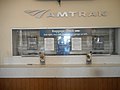 Orlando ACL-Amtrak Station; Closed Ticket Window.jpg 3,648 × 2,736; 2.01 MB
-
 Orlando ACL-Amtrak Station; Digital Schedule @ Old Ticket Windows.jpg 3,648 × 2,736; 2 MB
-
 Orlando ACL-Amtrak Station; Digital Schedule.jpg 3,648 × 2,736; 2.01 MB
-
 Orlando ACL-Amtrak Station; Engraved Track Sign.jpg 3,648 × 2,736; 2.05 MB
-
 Orlando ACL-Amtrak Station; Historical Marker-1.jpg 3,648 × 2,736; 2.05 MB
-
 Orlando ACL-Amtrak Station; Historical Marker-2.jpg 3,648 × 2,736; 2.05 MB
-
 Orlando ACL-Amtrak Station; Old Telephone Booths.jpg 3,648 × 2,736; 1.98 MB
-
 Orlando ACL-Amtrak Station; SunRail Platform @ Columbia Street-1.jpg 3,648 × 2,736; 2.06 MB
-
 Orlando ACL-Amtrak Station; SunRail Platforms from Columbia Street Xing.jpg 3,648 × 2,736; 2.08 MB
-
 Orlando ACL-Amtrak Station; SunRail Platforms-01.jpg 3,648 × 2,736; 2.07 MB
-
 Orlando ACL-Amtrak Station; SunRail Platforms-02.jpg 3,648 × 2,736; 2.06 MB
.jpg)
.jpg)
.jpg)
.jpg)


_163.jpg)


.jpg)


.jpg)


.jpg)


.jpg)


_Exit_347_Gore_Sign.jpg)


_Left_Lane.jpg)


.jpg)
_Rest_Area;_Location_Sign.jpg)


