Category:Utah State Route 185
 | number: | (one hundred eighty-five) |
|---|---|---|
| State highways in Utah: | 165 · 166 · 167 · 168 · 169 · 170 · 171 · 172 · 173 · 174 · 175 · 176 · 177 · 178 · 179 · 180 · 181 · 182 · 183 · 184 · 185 · 186 · 187 · 188 · 189 · 190 · 191 · 193 · 194 · 196 · 197 · 198 · 199 · 200 · 201 · 202 · 203 · 204 · 205 |
former state highway in Utah County, Utah, United States | |||||
| Upload media | |||||
| Instance of | |||||
|---|---|---|---|---|---|
| Location | Utah County, Utah | ||||
| Transport network | |||||
| Owned by |
| ||||
| Maintained by |
| ||||
| Inception |
| ||||
| Dissolved, abolished or demolished date |
| ||||
| Length |
| ||||
| Terminus | |||||
| Replaced by | |||||
 | |||||
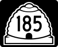
English: Media related to Utah State Route 185, a former 2.8264-mile (4.5486 km) state highway in American For and Pleasant Grove in Utah, United States, that connected Utah State Route 74 (at its former routing along North 200 East) in American Fork with the former Utah State Route 146 (Canyon Road) in Pleasant Grove. It mostly along East 700 North in American Fork and West 2600 North in Pleasant Grove and included the peripheral road around the American Fork Training Center (now known as the Utah State Developmental Center). The highway was deleted in 1969, with the peripheral road around the American Fork Training Center being renumbered as Utah State Route 296.
Subcategories
This category has only the following subcategory.
Media in category "Utah State Route 185"
The following 2 files are in this category, out of 2 total.
-
 Utah 185.svg 750 × 600; 73 KB
-
 Utah SR 185.svg 385 × 385; 9 KB
