Category:Voorhout
village and former municipality in South Holland, the Netherlands     | |||||
| Upload media | |||||
| Spoken text audio | |||||
|---|---|---|---|---|---|
| Instance of | |||||
| Location |
| ||||
| Population |
| ||||
| Area |
| ||||
 | |||||
Subcategories
This category has the following 14 subcategories, out of 14 total.
B
- Bloemencorso Bollenstreek 2006 (53 F)
G
K
- Kermis in Voorhout (9 F)
M
- Maps of Voorhout (4 F)
O
R
S
- Sculptures in Voorhout (27 F)
- Spoorlaan 25, Voorhout (29 F)
V
Media in category "Voorhout"
The following 82 files are in this category, out of 82 total.
-
 Voorhout gemeentewapen.svg 372 × 441; 13 KB
-
 Voorhout wapen.jpg 118 × 132; 4 KB
-
 Flag of Voorhout.svg 450 × 300; 328 bytes
-
 Voorhout flag outline.png 450 × 300; 2 KB
-
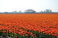 ..Bed of flowers...emmmm - panoramio.jpg 2,256 × 1,496; 1.73 MB
-
 2215 Voorhout, Netherlands - panoramio (1).jpg 4,884 × 2,020; 1,024 KB
-
 48, hoek Dinsdagsewetering. - Voorhout - 20525001 - RCE.jpg 1,200 × 900; 184 KB
-
 Arbeidershuisje - Voorhout - 20524998 - RCE.jpg 1,200 × 900; 170 KB
-
 Bakoven o.m. -zoek- - Voorhout - 20471535 - RCE.jpg 896 × 1,200; 202 KB
-
 Bloemencorso Bollenstreek 2019, Voorhout, aankondiger.JPG 3,264 × 2,448; 2.2 MB
-
 Bloemencorso Bollenstreek 2019, Voorhout, drumband 1.JPG 3,264 × 2,448; 2.5 MB
-
 Bloemencorso Bollenstreek 2019, Voorhout, drumband 2.JPG 3,264 × 2,448; 2.48 MB
-
 Bloemencorso Bollenstreek 2019, Voorhout, drumband 3.JPG 3,264 × 2,448; 2.8 MB
-
 Bloemencorso Bollenstreek 2019, Voorhout, Praalwagen 'De Schooier' - 1.JPG 3,264 × 2,448; 2.1 MB
-
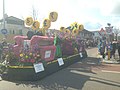 Bloemencorso Bollenstreek 2019, Voorhout, Praalwagen 'De Schooier' - 2.JPG 3,264 × 2,448; 2.25 MB
-
 Caert-bouck Clara van Sparwoude, SA Delft, inv.nr.136613.tif 8,201 × 2,780; 130.46 MB
-
 Dorpsgezicht - overzicht met boerderij - Voorhout - 20378902 - RCE.jpg 1,200 × 1,194; 283 KB
-
 Dorpsgezicht - Voorhout - 20378903 - RCE.jpg 1,200 × 1,191; 326 KB
-
 Gebogen bovendorpel - Voorhout - 20515348 - RCE.jpg 1,200 × 900; 93 KB
-
 Gedeelte gevel - Voorhout - 20245736 - RCE.jpg 791 × 1,200; 267 KB
-
 Gevel - Voorhout - 20504681 - RCE.jpg 1,200 × 900; 111 KB
-
 Gezicht op Voorhout bij Leiden PK-T-2874, PK-T-AW-5378r.tiff 2,211 × 1,772; 11.24 MB
-
 Houten venster met luiken - Voorhout - 20515349 - RCE.jpg 1,200 × 900; 127 KB
-
-

-
 Installatie burgemeester Voorhout. Aankomst gemeentehuis, Bestanddeelnr 902-1123.jpg 3,428 × 2,838; 1.64 MB
-
 Installatie burgemeester Voorhout. Burgemeester in rijtuig, Bestanddeelnr 902-1126.jpg 3,428 × 2,838; 1.89 MB
-
 Installatie burgemeester Voorhout. Rede na installatie, Bestanddeelnr 902-1122.jpg 3,428 × 2,838; 2.34 MB
-
 Installatie burgemeester Voorhout. Rede op stop, Bestanddeelnr 902-1124.jpg 2,838 × 3,428; 1.89 MB
-
 Installatie burgemeester Voorhout. Volk voor gemeentehuis, Bestanddeelnr 902-1125.jpg 3,428 × 2,838; 2.05 MB
-
 Jacob Braakman - Dorpsstraat Voorhout - 1895.jpg 3,328 × 2,120; 6.67 MB
-
 Jacob Braakman, Hageveld Voorhout 1895.jpg 3,280 × 2,096; 7 MB
-
 Kerkzicht", overzicht - Voorhout - 20245735 - RCE.jpg 1,200 × 794; 357 KB
-
 Leidse Vaart Caf‚ de Bonte Koe, overzicht - Voorhout - 20245821 - RCE.jpg 1,200 × 960; 326 KB
-
 Leidse Vaart Caf‚ de Bonte Koe, overzicht - Voorhout - 20245822 - RCE.jpg 1,200 × 960; 258 KB
-
Nl-Voorhout-article.ogg 1 min 31 s; 927 KB
-
 Noordwijkerhout ICMm 4044-4235 als IC 2130 Den Haag-Amsterdam - Flickr - Rob Dammers.jpg 5,372 × 3,022; 12.93 MB
-
 Noordwijkerhout Thalys TGV-PBA 4536 als THA 9315 Amsterdam Centraal - Flickr - Rob Dammers.jpg 5,660 × 3,184; 12.05 MB
-
 Noordwijkerhout VolkerRail 203-1 met werktrein r Leiden - Flickr - Rob Dammers.jpg 4,836 × 2,720; 11.19 MB
-
 Noordwijkertrekvaart te Voorhout, met Boekhorstmolen - J. Braakman 1895.jpg 3,304 × 2,088; 1.19 MB
-
 Overzicht - Voorhout - 20245777 - RCE.jpg 1,200 × 1,188; 356 KB
-
 Overzicht met boerderij - Voorhout - 20245816 - RCE.jpg 1,200 × 1,177; 338 KB
-
 Panorama Tulipland 27 maart 2005 1.JPG 1,617 × 1,536; 1.43 MB
-
 Panorama Tulipland 27 maart 2005 2.JPG 1,686 × 1,536; 1.44 MB
-
 Panorama Tulipland 27 maart 2005.JPG 2,025 × 444; 565 KB
-
 Pleurotus ostreatus 173212634.jpg 2,048 × 1,536; 583 KB
-
 Pleurotus ostreatus 173212640.jpg 2,048 × 1,536; 931 KB
-
 Pleurotus ostreatus 173393750.jpg 2,048 × 1,536; 221 KB
-
 Prosena siberita 147715825.jpg 2,048 × 1,536; 189 KB
-
 Snuiver -zoek- - Voorhout - 20471533 - RCE.jpg 896 × 1,200; 258 KB
-
 Stenen molen in de Boekhorsterpolder - Voorhout - 20245819 - RCE.jpg 795 × 1,200; 217 KB
-
 Valenzuela flavidus 160031664.png 2,048 × 1,523; 3.61 MB
-
 Voorgevel nr.GZ 6 - Voorhout - 20483186 - RCE.jpg 1,200 × 900; 186 KB
-
 Voorgevels - Voorhout - 20245789 - RCE.jpg 1,200 × 1,184; 300 KB
-
 Voorhout (VAB) RXP 9901 met Alpen Express Leiden (40593492152).jpg 5,845 × 3,284; 7.88 MB
-
 Voorhout (VAB) VIRMm 9416 IC 2151 Amsterdam - Den Haag (39922188544).jpg 5,992 × 3,368; 8.76 MB
-
 Voorhout - Andrena.jpg 2,365 × 1,775; 507 KB
-
 Voorhout - Calliphoridae.jpg 2,257 × 3,317; 1.36 MB
-
 Voorhout - Fietstunnel met paard.jpg 4,032 × 3,024; 2.58 MB
-
 Voorhout - Fietstunnel met tekening.jpg 4,032 × 3,024; 2.75 MB
-
 Voorhout - Fietstunnel v2.jpg 4,032 × 3,024; 2.91 MB
-
 Voorhout - Fietstunnel.jpg 4,032 × 3,024; 2.89 MB
-
 Voorhout - Lieveheersbeestje met weinig stippen.jpg 3,024 × 4,032; 923 KB
-
 Voorhout - Lieveheersbeestje.jpg 2,522 × 1,809; 271 KB
-
 Voorhout - Nieuwe Brug.jpg 4,032 × 3,024; 2.34 MB
-
 Voorhout A1910D.jpg 3,648 × 2,736; 5.67 MB
-
 Voorhout Bloemoord v2.jpg 3,648 × 2,736; 5.32 MB
-
 Voorhout Bloemoord.jpg 3,648 × 2,736; 4.2 MB
-
 Voorhout Jacoba van Beierenweg 142.jpg 3,648 × 2,736; 5.68 MB
-
 Voorhout Jacoba van Beierenweg 144.jpg 3,648 × 2,736; 4.51 MB
-
 Voorhout Jacoba van Beierenweg Boerderij met opkamer.jpg 2,291 × 1,720; 1.61 MB
-
 Voorhout Jacoba van Beierenweg Huis 1883.jpg 3,648 × 2,736; 5.72 MB
-
 Voorhout Loosterweg 23.jpg 3,648 × 2,736; 4.31 MB
-
 Voorhout SNG 2729 Sprinter Haarlem (48279454821).jpg 6,000 × 3,375; 17.52 MB
-
 Voorhout, veld met hyacinthen bij de Bergamolaan foto4 positie1 2017-04-09 13.27.jpg 4,281 × 2,755; 9.33 MB
-
 Voorhout, veld met hyacinthen bij de Bergamolaan foto4 positie2 2017-04-09 13.37.jpg 4,280 × 3,128; 11.06 MB
-
 Wedstrijdfoto.jpg 1,280 × 960; 226 KB
-
 Zij- en voorgevel Rapport nr. 64 - Voorhout - 20488029 - RCE.jpg 1,200 × 900; 268 KB
-
 Zij- en voorgevel Rapport nr. 64 - Voorhout - 20488030 - RCE.jpg 1,200 × 900; 289 KB
-
 Zijgevel boerderij met bijgebouwen nr. GZ 8 - Voorhout - 20483185 - RCE.jpg 1,200 × 900; 219 KB
-
 Zijgevel nr. KG 7 - Voorhout - 20483192 - RCE.jpg 1,200 × 900; 322 KB
-
 Zijgevel woonged. nr. KG 8 - Voorhout - 20483193 - RCE.jpg 896 × 1,200; 236 KB


.jpg)


_RXP_9901_met_Alpen_Express_Leiden_(40593492152).jpg)
_VIRMm_9416_IC_2151_Amsterdam_-_Den_Haag_(39922188544).jpg)


.jpg)


