Category:Warm Springs Mountain (Utah)
mountain in Utah County, Utah, United States  | |||||
| Upload media | |||||
| Instance of | |||||
|---|---|---|---|---|---|
| Named after | |||||
| Location | Utah County, Utah | ||||
| Located in or next to body of water | |||||
| Topographic prominence |
| ||||
| Elevation above sea level |
| ||||
 | |||||
English: Media related to Warm Springs Mountain (Utah), a mountain in southern Utah County, Utah, United States, that is partly located within the southern city limits of Genola.
Subcategories
This category has only the following subcategory.
T
- Tintic Standard Reduction Mill (43 F)
Media in category "Warm Springs Mountain (Utah)"
The following 15 files are in this category, out of 15 total.
-
 Antenna (2808003444).jpg 3,872 × 2,528; 5.08 MB
-

-
 East at US-6 & SR-68 junction, Elberta, Utah, May 16.jpg 2,592 × 1,944; 2.44 MB
-
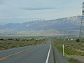 East on US-6 across Goshen Valley from Big Canyon, May 16.jpg 2,592 × 1,944; 2.37 MB
-
 East on US-6 from Elberta, Utah, May 16.jpg 2,592 × 1,944; 2.42 MB
-
 East-northeast on US-6 from east of Goshen, Utah, May 16.jpg 2,592 × 1,944; 2.32 MB
-
 Former gas station along US-6 & SR-68 in Elberta, May 16.jpg 2,592 × 1,944; 2.38 MB
-
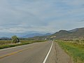
 Northwest along US-6 in west Santaquin, Utah, May 16.jpg 2,592 × 1,944; 2.35 MB
-
 South at US-6 & SR-141 junction, Genola, Utah, May 16.jpg 2,592 × 1,944; 2.42 MB
-
 Tintic Standard Mill.jpg 1,251 × 600; 194 KB
-
 Tintic Standard Reduction Mill, May 16.jpg 2,592 × 1,944; 2.35 MB
-

-
 Tintic Standard Reduction Mill.jpeg 3,296 × 2,472; 1.81 MB
-
 Track removal on Tintic Branch Line in Genola, Utah, May 16.jpg 2,592 × 1,944; 2.39 MB
-
 West on S State Rd toward Genola, Utah, May 16.jpg 2,592 × 1,944; 2.36 MB
.jpg)


