Category:Wasatch Plateau
plateau in central Utah, United States  | |||||
| Upload media | |||||
| Instance of | |||||
|---|---|---|---|---|---|
| Location |
| ||||
| Elevation above sea level |
| ||||
| Different from | |||||
 | |||||
English: Media related to the Wasatch Plateau, a plateau located southeast of the southernmost part of the Wasatch Range in central Utah, United States. The plateau is roughly bordered by the Spanish Fork Canyon on the north, the Price Canyon on the northeast, the Castle Valley on the east and southeast, Interstate 70 on the south, the Plateau Valley and the Sevier Plateau on the southwest, and the Sanpete Valley on the northwest.
- In the physiographic High Plateaus Section of the Colorado Plateau Province.
Subcategories
This category has the following 18 subcategories, out of 18 total.
C
- Clear Creek, Utah (5 F)
E
F
L
M
P
- Peerless, Utah (1 F)
S
T
U
- Upper Joes Valley (empty)
W
- Wattis, Utah (empty)
Media in category "Wasatch Plateau"
The following 16 files are in this category, out of 16 total.
-

-

-
 Gunnison, Gunnison Valley Wasatch Mountains in distance, Utah 1872 - NARA - 519737.jpg 3,000 × 1,918; 1.54 MB
-
 Moroni main street.jpg 1,600 × 886; 202 KB
-
 Mount pleasant evening.jpg 2,000 × 612; 258 KB
-
 Northwest on Emma Park Road at county line, May 17.jpg 2,592 × 1,944; 2.41 MB
-

-
 Site of Gunnison Massacre BHoU-p469.png 2,952 × 1,982; 137 KB
-
 Sterling Utah.jpg 1,500 × 998; 607 KB
-
 Uinta Piceance Basins geologic map.gif 1,782 × 1,115; 170 KB
-
 Uinta Piceance Basins geologic map.png 1,008 × 545; 185 KB
-
 Utah State Route 137 looking towards Wasatch Plateau Near Gunnison, Utah.jpg 4,000 × 3,000; 3.25 MB
-
 Wasatch Plateau panorama.jpg 10,525 × 2,471; 4.16 MB
-
 Wasatch Plateau.png 1,146 × 441; 47 KB
-
 West on Emma Park Road near east end, May 17.jpg 2,592 × 1,944; 2.42 MB
-
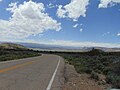 West on SR-157, May 17.jpg 2,592 × 1,944; 2.4 MB


.jpg)


