Category:Watt/I-80 (Sacramento RT)
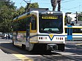
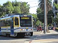
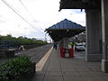
English: Media pertaining to the Watt/I-80 (Sacramento RT) light rail and bus station in North Highlands, California, USA.
| Object location | | View all coordinates using: OpenStreetMap |
|---|
Light rail station in North Highlands, California | |||||
| Upload media | |||||
| Instance of |
| ||||
|---|---|---|---|---|---|
| Location | North Highlands, Sacramento County, California, Pacific States Region | ||||
| Transport network | |||||
| Inception |
| ||||
| Connecting line | |||||
| Adjacent station |
| ||||
 | |||||
Media in category "Watt/I-80 (Sacramento RT)"
The following 9 files are in this category, out of 9 total.
-
 Downtrt.JPG 4,000 × 2,248; 3.35 MB
-
 RT CAF.JPG 1,600 × 1,200; 1.16 MB
-
 SacrRT.JPG 1,600 × 1,200; 769 KB
-
 Watt - I-80 4057 01.JPG 2,048 × 1,536; 679 KB
-
 Watt - I-80 4058 02.JPG 1,536 × 2,048; 823 KB
-
 Watt - I-80 4059 03.JPG 2,048 × 1,536; 675 KB
-
 Watt - I-80 4060 04.JPG 1,536 × 2,048; 1.14 MB
-
 Watt - I-80 4061 05.JPG 1,536 × 2,048; 893 KB
-
 WattRT.JPG 1,200 × 1,600; 502 KB


