Category:Welshampton and Lyneal

civil parish in Shropshire, United Kingdom | |||||
| Upload media | |||||
| Instance of | |||||
|---|---|---|---|---|---|
| Location | Shropshire, West Midlands, England | ||||
| official website | |||||
 | |||||
Subcategories
This category has the following 5 subcategories, out of 5 total.
Media in category "Welshampton and Lyneal"
The following 151 files are in this category, out of 151 total.
-

-
 'Shropshire Lady' near Lyneal - geograph.org.uk - 5868221.jpg 1,280 × 851; 497 KB
-
 A495 at entrance to Linden Croft - geograph.org.uk - 2899819.jpg 640 × 452; 77 KB
-
 A495 east of Newton Mere - geograph.org.uk - 4264773.jpg 640 × 480; 41 KB
-
 A528 south of Ellesmere - geograph.org.uk - 6178401.jpg 800 × 533; 687 KB
-
 Approaching Welshampton by footpath - geograph.org.uk - 5723696.jpg 1,080 × 810; 202 KB
-
 Avenue to Lyneal from Colemere - geograph.org.uk - 4267855.jpg 1,600 × 1,200; 1.44 MB
-
 B5063 at Balmer Heath - geograph.org.uk - 5868232.jpg 1,280 × 851; 505 KB
-
 B5063 at Blackhurst Ford Farm - geograph.org.uk - 4264791.jpg 640 × 480; 39 KB
-
 B5063 at Hampton Bank Bridge - geograph.org.uk - 4264788.jpg 640 × 481; 39 KB
-
 B5063 at Northwood village boundary - geograph.org.uk - 4264794.jpg 640 × 481; 36 KB
-
 Barn at Corner Farm - geograph.org.uk - 6471254.jpg 5,184 × 3,888; 4.41 MB
-
 Barn at Wellfield Farm - geograph.org.uk - 6427407.jpg 5,184 × 3,888; 4.34 MB
-
 Bishops House - geograph.org.uk - 225653.jpg 640 × 426; 133 KB
-
 Bluebells at Colemere - geograph.org.uk - 4938719.jpg 5,114 × 3,409; 5.96 MB
-

-
 Boardwalk, Yell Field - geograph.org.uk - 5749655.jpg 640 × 480; 105 KB
-
 Boathouse on Cole Mere - geograph.org.uk - 4267675.jpg 1,600 × 1,200; 1.37 MB
-
 Bulrushes at Oteley - geograph.org.uk - 3725014.jpg 1,600 × 1,200; 614 KB
-
 Canalside cottage at Hampton Bank, Shropshire - geograph.org.uk - 5245762.jpg 960 × 1,280; 948 KB
-

-
 Cattle in Welshampton and Lyneal, Shropshire, England.jpg 640 × 480; 53 KB
-
 Church Farm, Welshampton - geograph.org.uk - 5750290.jpg 640 × 435; 67 KB
-
 Church of St Michael and All Angels, Welshampton - geograph.org.uk - 6135489.jpg 1,080 × 810; 178 KB
-
 Cole Mere - geograph.org.uk - 5749567.jpg 640 × 480; 72 KB
-
 Cole Mere - geograph.org.uk - 5749661.jpg 640 × 480; 122 KB
-
 Cole Mere - geograph.org.uk - 5750225.jpg 640 × 480; 103 KB
-
 Cole Mere - geograph.org.uk - 5750227.jpg 640 × 385; 64 KB
-
 Cole Mere - geograph.org.uk - 5750256.jpg 480 × 640; 97 KB
-
 Cole Mere - geograph.org.uk - 5750260.jpg 640 × 480; 67 KB
-
 Cole Mere - geograph.org.uk - 6362901.jpg 1,080 × 810; 118 KB
-
 Cole Mere Sailing Club boathouse - geograph.org.uk - 5750266.jpg 640 × 480; 78 KB
-
 Cole Mere through the Trees - geograph.org.uk - 6178590.jpg 800 × 600; 1.1 MB
-
 Cole Mere, looking eastwards - geograph.org.uk - 4267712.jpg 1,600 × 1,200; 1.07 MB
-
 Cole Mere, with Yell Wood beyond - geograph.org.uk - 5213136.jpg 1,024 × 768; 171 KB
-
 Colemere Farm - geograph.org.uk - 5749556.jpg 640 × 480; 62 KB
-
 Colemere Farm - geograph.org.uk - 6178629.jpg 800 × 533; 621 KB
-
 Colemere, Fields of oil seed rape - geograph.org.uk - 6137269.jpg 640 × 427; 56 KB
-
 Cornerways, Lyneal - geograph.org.uk - 6178636.jpg 800 × 600; 833 KB
-
 Derelict house near Lea Wood - geograph.org.uk - 2742030.jpg 640 × 480; 87 KB
-

-
 Double bends near Kettle Mere - geograph.org.uk - 4436916.jpg 640 × 376; 61 KB
-
 Evening sunshine, Blake Mere - geograph.org.uk - 1892832.jpg 640 × 480; 201 KB
-

-
 Farmhouse near Spunhill, Shropshire - geograph.org.uk - 3724976.jpg 1,024 × 659; 159 KB
-
 Farmland and canal at Hampton Bank, Shropshire - geograph.org.uk - 5245875.jpg 1,280 × 813; 712 KB
-
 Farmland east of Welshampton, Shropshire - geograph.org.uk - 5245720.jpg 1,280 × 978; 845 KB
-
 Farmland east of Welshampton, Shropshire - geograph.org.uk - 5245746.jpg 1,280 × 864; 986 KB
-
 Farmland south of Balmer Heath - geograph.org.uk - 5868216.jpg 1,280 × 851; 435 KB
-
 Field adjacent to Lay-By - geograph.org.uk - 6450050.jpg 5,184 × 3,888; 3.77 MB
-
-
 Field east of Lyneal Lane - geograph.org.uk - 5750362.jpg 640 × 480; 86 KB
-
 Field footpath in Welshampton and Lyneal, in Shropshire, England.jpg 640 × 427; 66 KB
-
 Flooded field adjacent to Lyneal Lane - geograph.org.uk - 6427203.jpg 5,184 × 3,888; 4.27 MB
-
 Footbridge on the path around Cole Mere - geograph.org.uk - 5750212.jpg 640 × 480; 155 KB
-
 Footpath at western end of Cole Mere - geograph.org.uk - 4267698.jpg 1,600 × 1,200; 1.39 MB
-
 Footpath in Burns Wood - geograph.org.uk - 4643272.jpg 3,264 × 2,448; 3.25 MB
-
 Footpath in the woods by Cole Mere - geograph.org.uk - 4267677.jpg 1,200 × 1,600; 1.91 MB
-
 Footpath in woods by Cole Mere - geograph.org.uk - 4267691.jpg 1,600 × 1,200; 1.86 MB
-
 Footpath out of Welshampton - geograph.org.uk - 5723697.jpg 1,080 × 810; 233 KB
-
 Footpath to Welshampton - geograph.org.uk - 5343971.jpg 1,280 × 851; 529 KB
-
 Footpath to Welshampton - geograph.org.uk - 5723699.jpg 1,080 × 810; 211 KB
-
 Former lime kilns by Cole Mere - geograph.org.uk - 4267708.jpg 1,600 × 1,200; 1.88 MB
-
 Former Vicarage, Colemere - geograph.org.uk - 5750281.jpg 640 × 480; 85 KB
-
 Hampton Bank Farm - geograph.org.uk - 5213097.jpg 1,024 × 819; 215 KB
-
 Heading for Hampton Wood - geograph.org.uk - 6446927.jpg 3,888 × 5,184; 5.77 MB
-
 Hillside above Ellesmere - geograph.org.uk - 5028585.jpg 5,129 × 3,419; 5.7 MB
-

-
 Houses on lane to Balmer Heath - geograph.org.uk - 4264782.jpg 640 × 480; 37 KB
-
 Houses on Pikesend Road, Colemere - geograph.org.uk - 5749560.jpg 640 × 480; 81 KB
-
 Hummocky farmland south of Baysil Wood - geograph.org.uk - 5213157.jpg 1,024 × 768; 180 KB
-
 Isolated tree on a hilltop - geograph.org.uk - 2742051.jpg 640 × 480; 52 KB
-
 Kettle Mere near Ellesmere - geograph.org.uk - 2486981.jpg 640 × 327; 158 KB
-
 Kissing gate by Cole Mere - geograph.org.uk - 4267705.jpg 1,600 × 1,200; 1.91 MB
-
 Lane between Balmer and Balmer Heath - geograph.org.uk - 4264787.jpg 640 × 481; 52 KB
-
 Lay by near Linden Croft - geograph.org.uk - 4436957.jpg 640 × 334; 37 KB
-
 Little Mill - geograph.org.uk - 6178600.jpg 800 × 600; 779 KB
-
 Little Mill Cottage - geograph.org.uk - 6178598.jpg 800 × 600; 773 KB
-
 Little Mill Cottage.jpg 640 × 480; 99 KB
-
 Lyneal Activity Centre - geograph.org.uk - 5750286.jpg 640 × 480; 64 KB
-
 Lyneal Lane - geograph.org.uk - 5343966.jpg 1,280 × 851; 599 KB
-
 Lyneal Lane - geograph.org.uk - 5868281.jpg 1,280 × 851; 439 KB
-
 Making sand - geograph.org.uk - 4937215.jpg 640 × 427; 59 KB
-
 Minor Road to the west of Colemere - geograph.org.uk - 6178625.jpg 600 × 800; 794 KB
-

-
 Neo-Gothic tower at Oteley - geograph.org.uk - 6348186.jpg 3,888 × 5,184; 4.13 MB
-
 Newton Mere Cottages - geograph.org.uk - 4436922.jpg 640 × 310; 53 KB
-
 Oak tree at the end of a farm track - geograph.org.uk - 4267654.jpg 1,200 × 1,600; 1.42 MB
-

-

-

-

-

-
-

-
 On the path around Cole Mere - geograph.org.uk - 5749662.jpg 640 × 480; 135 KB
-
 Ordnance Survey Cut Mark - geograph.org.uk - 5142998.jpg 640 × 524; 106 KB
-

-
 Paddock Wood - geograph.org.uk - 5723700.jpg 1,080 × 810; 149 KB
-

-
 Pasture near Hampton Bank, Shropshire - geograph.org.uk - 5245860.jpg 1,280 × 869; 977 KB
-
 Path and steps from Yell Wood to the canal - geograph.org.uk - 4267763.jpg 1,200 × 1,600; 1.78 MB
-

-
 Path in Yell Wood - geograph.org.uk - 4267714.jpg 1,600 × 1,200; 2 MB
-
 Pond - geograph.org.uk - 6446705.jpg 5,184 × 3,888; 3.59 MB
-
 Postbox at Colemere - geograph.org.uk - 5213150.jpg 1,024 × 768; 162 KB
-
 Road from The Stocks - geograph.org.uk - 3214036.jpg 640 × 480; 56 KB
-
 Road near Colemere Farm - geograph.org.uk - 6178627.jpg 800 × 533; 906 KB
-
 Road over the Ellesmere canal - geograph.org.uk - 2542322.jpg 4,000 × 3,000; 2.25 MB
-
 Road to The Stocks - geograph.org.uk - 3214026.jpg 640 × 480; 71 KB
-
 Road works on Newton Bends - geograph.org.uk - 2899332.jpg 640 × 496; 65 KB
-
 Road, gate and pond - geograph.org.uk - 5723695.jpg 1,080 × 810; 128 KB
-
 Rose Cottage, Lyneal (geograph 6178638).jpg 800 × 533; 720 KB
-
 Scrub at the western end of Cole Mere - geograph.org.uk - 4267695.jpg 1,600 × 1,200; 1.71 MB
-
 Seat at the Edge of Cole Mere - geograph.org.uk - 6178584.jpg 800 × 600; 1,006 KB
-

-

-
 Small pond near Whitemere - geograph.org.uk - 5749554.jpg 640 × 480; 98 KB
-
 St John's Church, Colemere - geograph.org.uk - 6178634.jpg 800 × 533; 698 KB
-

-
 Stone bridge in Yell Wood - geograph.org.uk - 4267768.jpg 1,600 × 1,200; 1.79 MB
-
 Sun Inn and junction for Wem - geograph.org.uk - 2899803.jpg 640 × 483; 71 KB
-
 Swiss Cottage, Oteley Park.jpg 640 × 435; 93 KB
-
 The A495, Welshampton - geograph.org.uk - 6178782.jpg 800 × 533; 533 KB
-
 The boat club on Cole Mere - geograph.org.uk - 4267819.jpg 1,600 × 1,200; 1.39 MB
-
 The Boat House, Colemere - geograph.org.uk - 6178583.jpg 800 × 600; 1,010 KB
-
 The Church of St John the Evangelist - geograph.org.uk - 5750271.jpg 640 × 480; 85 KB
-

-

-
 The Gatehouse - geograph.org.uk - 4436933.jpg 640 × 321; 61 KB
-
 The Gatehouse from A495 east - geograph.org.uk - 2899793.jpg 640 × 493; 91 KB
-
 The Least Water Lily - geograph.org.uk - 5750249.jpg 640 × 480; 113 KB
-
 The Sun Inn, Welshampton - geograph.org.uk - 5343985.jpg 1,280 × 849; 406 KB
-
 The Sun Inn, Welshampton - geograph.org.uk - 5343992.jpg 851 × 1,280; 335 KB
-
 The Sun Inn, Welshampton - geograph.org.uk - 5750305.jpg 640 × 480; 54 KB
-
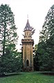 Tower, Oteley Park.jpg 423 × 640; 74 KB
-
 Trees at Oteley near Elsemere - geograph.org.uk - 3724996.jpg 1,024 × 383; 117 KB
-
 Two vintage caravans in a field - geograph.org.uk - 2742097.jpg 640 × 480; 67 KB
-

-
 View of Cole Mere through woodland - geograph.org.uk - 2898193.jpg 640 × 480; 142 KB
-
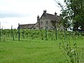
 Vineyard at Colemere - geograph.org.uk - 5749566.jpg 640 × 480; 95 KB
-
 Warmth in two derelict fireplaces - geograph.org.uk - 2742041.jpg 640 × 480; 67 KB
-
 Water Lily pads near Little Mill - geograph.org.uk - 5750242.jpg 640 × 409; 96 KB
-
 Welcome to Fernwood - geograph.org.uk - 1845999.jpg 640 × 480; 109 KB
-
 Well-scarred beech trunk - geograph.org.uk - 5750222.jpg 480 × 640; 136 KB
-
 Welshampton Methodist Church - geograph.org.uk - 5868242.jpg 1,280 × 851; 393 KB
-
 Welshampton, The Sun Inn - geograph.org.uk - 6178778.jpg 800 × 533; 526 KB
-
 Woodland above Colemere - geograph.org.uk - 4938711.jpg 5,138 × 3,425; 6.06 MB
-
 Woodland to the West of Cole Mere - geograph.org.uk - 6178587.jpg 800 × 600; 929 KB
-
 Brookmill Farm - geograph.org.uk - 225648.jpg 640 × 426; 121 KB
-
 Lower Farm - Breaden Heath - geograph.org.uk - 225639.jpg 640 × 426; 118 KB


.jpg)


