Category:West Malvern
village in the United Kingdom  | |||||
| Upload media | |||||
| Instance of | |||||
|---|---|---|---|---|---|
| Location | Malvern Hills, Worcestershire, West Midlands, England | ||||
 | |||||
Subcategories
This category has only the following subcategory.
W
Media in category "West Malvern"
The following 200 files are in this category, out of 495 total.
(previous page) (next page)-
 'Danger Keep Out' - geograph.org.uk - 6100907.jpg 1,024 × 768; 376 KB
-
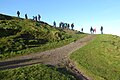
 A busy day on the Worcestershire Beacon - geograph.org.uk - 3090059.jpg 1,024 × 712; 234 KB
-
 A glimpse of Birches Farm - geograph.org.uk - 5628298.jpg 1,024 × 768; 375 KB
-
 A hillside bridleway - geograph.org.uk - 2668473.jpg 734 × 979; 463 KB
-
 A lonely trig point - geograph.org.uk - 2668484.jpg 979 × 1,306; 372 KB
-
 A reminder of things to come... - geograph.org.uk - 5982673.jpg 1,024 × 768; 362 KB
-
 A reminder to dog owners - geograph.org.uk - 6168467.jpg 1,024 × 683; 278 KB
-
 A rock crocodile - geograph.org.uk - 5898152.jpg 1,024 × 683; 245 KB
-
 A selfie on top of the Malvern Hills - geograph.org.uk - 6075125.jpg 1,024 × 768; 196 KB
-
 A very dry Worcestershire Beacon - geograph.org.uk - 5859832.jpg 1,024 × 768; 266 KB
-
 A walker approaching the trig - geograph.org.uk - 5976982.jpg 1,024 × 683; 151 KB
-
 A walker by the toposcope, Worcestershire Beacon - geograph.org.uk - 5702062.jpg 1,024 × 576; 170 KB
-
 Above St Ann's Well - geograph.org.uk - 1424723.jpg 640 × 469; 103 KB
-
 Above the clouds on North Hill - geograph.org.uk - 3190303.jpg 640 × 478; 211 KB
-
 Above the clouds on the Worcestershire Beacon - geograph.org.uk - 3190291.jpg 1,280 × 954; 440 KB
-
 Ascent of Summer Hill - geograph.org.uk - 3261601.jpg 640 × 427; 211 KB
-
 At the top - geograph.org.uk - 4778584.jpg 1,600 × 900; 613 KB
-
 At the top of the Malverns - geograph.org.uk - 2165480.jpg 4,117 × 2,156; 5.14 MB
-
 Azure Bluet, male, Coenagrion puella (28826491347).jpg 2,290 × 1,998; 1.06 MB
-
 B4232 south of Hay Slad Spring - geograph.org.uk - 4785275.jpg 1,600 × 1,200; 314 KB
-
 Barnards Green shopping area - geograph.org.uk - 3976948.jpg 1,600 × 1,050; 1.74 MB
-
 Belted Galloways on the Malvern Hills - geograph.org.uk - 6100881.jpg 1,024 × 768; 289 KB
-
 Belted Galloways on the Malvern Hills - geograph.org.uk - 6100884.jpg 1,024 × 768; 340 KB
-
 Bench and paths near the Worcestershire Beacon - geograph.org.uk - 4356582.jpg 1,600 × 1,200; 913 KB
-
 Bench by the path to Summer Hill (Upper Colwall) - geograph.org.uk - 6383623.jpg 3,648 × 2,056; 3.44 MB
-
 Bench by the path to Summer Hill (Upper Colwall) - geograph.org.uk - 6383631.jpg 3,648 × 2,056; 3.46 MB
-
 Bench by the path to Summer Hill (Upper Colwall) - geograph.org.uk - 6383654.jpg 3,648 × 2,056; 3.1 MB
-
 Bench on the west side of Summer Hill - geograph.org.uk - 2763809.jpg 4,356 × 2,500; 6.82 MB
-
 Bench seat, the Malverns - geograph.org.uk - 4122652.jpg 1,280 × 668; 560 KB
-
 Birches Farm - geograph.org.uk - 2339134.jpg 4,123 × 2,642; 6.28 MB
-
 Bluebells, West Malvern - geograph.org.uk - 1312761.jpg 640 × 427; 269 KB
-
-
 Bridleway below Hayslad (Spout) - geograph.org.uk - 2576877.jpg 640 × 480; 130 KB
-
 Building a Jubilee Beacon - geograph.org.uk - 2976886.jpg 1,024 × 680; 202 KB
-
 Building a Jubilee Beacon, Malvern Hills - geograph.org.uk - 2976890.jpg 1,024 × 680; 200 KB
-
 Camp fire, West Malvern Outdoor Education Centre - geograph.org.uk - 2349965.jpg 4,272 × 2,848; 7.37 MB
-
 Car park near Summer Hill - geograph.org.uk - 4356560.jpg 1,600 × 1,063; 615 KB
-

-
 Cattle grid in St James' Churchyard, West Malvern - geograph.org.uk - 1911558.jpg 1,708 × 1,153; 1.83 MB
-
 Cockshot Hill (Viewed from the path to Summer Hill) - geograph.org.uk - 6383590.jpg 3,648 × 2,056; 2.99 MB
-

-
 Col between Sugarloaf and The Beacon - geograph.org.uk - 4778607.jpg 1,600 × 901; 572 KB
-
 Conference round the Waymarker - geograph.org.uk - 4824142.jpg 4,000 × 3,000; 3.06 MB
-
 Confidence course - geograph.org.uk - 2349937.jpg 4,272 × 2,848; 7.6 MB
-

-
 Countryside at the Malvern Hills - geograph.org.uk - 6383637.jpg 3,648 × 2,056; 3.6 MB
-
 Countryside at the Malvern Hills - geograph.org.uk - 6383668.jpg 3,648 × 2,056; 3.16 MB
-
 Countryside by Summer Hill - geograph.org.uk - 6383614.jpg 3,648 × 2,056; 2.85 MB
-
 Croft Farm duckpond - geograph.org.uk - 838809.jpg 480 × 640; 92 KB
-

-
 Descending from Summer Hill - geograph.org.uk - 4088737.jpg 4,000 × 3,000; 3.95 MB
-

-
 Descent from Summer Hill - geograph.org.uk - 2153240.jpg 3,287 × 1,831; 3.93 MB
-
 Descent from the Diamond Jubilee Beacon - geograph.org.uk - 2978289.jpg 640 × 427; 192 KB
-

-

-

-
 Diamond Jubilee Beacon, Malvern Hills - geograph.org.uk - 2979798.jpg 1,024 × 680; 41 KB
-
 Diamond Jubilee Beacon, Malvern Hills - geograph.org.uk - 2979805.jpg 1,024 × 680; 89 KB
-
 Diamond Jubilee Toposcope - geograph.org.uk - 4372212.jpg 1,600 × 1,176; 587 KB
-
 Dog walkers on a misty Malvern Hills - geograph.org.uk - 6378237.jpg 1,024 × 768; 180 KB
-
 East of the Malvern Hills - geograph.org.uk - 5890403.jpg 1,600 × 1,200; 757 KB
-

-
 Elim Pentecostal Church Headquarters - geograph.org.uk - 5795563.jpg 640 × 427; 308 KB
-
 End Hill - geograph.org.uk - 4466488.jpg 800 × 531; 102 KB
-
 End Hill viewed from North Hill - geograph.org.uk - 5677010.jpg 1,024 × 683; 201 KB
-
 End Hill, The Malverns - geograph.org.uk - 4122612.jpg 1,024 × 629; 753 KB
-
 Ewes and lambs near Birches Farm - geograph.org.uk - 2350326.jpg 4,272 × 2,848; 5.47 MB
-
 Extended cottage near Bank Farm. - geograph.org.uk - 34558.jpg 640 × 479; 146 KB
-
 Farm buildings, Croft Farm - geograph.org.uk - 5628311.jpg 1,024 × 768; 261 KB
-
 Farmland at West Malvern - geograph.org.uk - 466635.jpg 640 × 480; 155 KB
-
 Field boundary and stream near Birches Farm - geograph.org.uk - 2350282.jpg 3,000 × 2,000; 5.19 MB
-
 Foxgloves at the Malvern Hills - geograph.org.uk - 4372388.jpg 1,600 × 1,200; 634 KB
-
 Foxgloves near Sugarloaf Hill - geograph.org.uk - 4372406.jpg 1,600 × 1,200; 1.02 MB
-
 From above the Quarry - geograph.org.uk - 5795269.jpg 640 × 419; 414 KB
-
 Gas Lamp on the Common - geograph.org.uk - 4826190.jpg 2,080 × 2,993; 2.15 MB
-
 Gate in the Malvern Hills - geograph.org.uk - 4088584.jpg 4,000 × 3,000; 3.85 MB
-
 Gorse bushes on south ridge of Worcestershire Beacon - geograph.org.uk - 4862442.jpg 1,500 × 973; 1.26 MB
-
 Gorse in flower in December, The Malvern Hills - geograph.org.uk - 4279271.jpg 1,600 × 850; 1.15 MB
-
 Gorse on Table Hill - geograph.org.uk - 5677019.jpg 1,024 × 683; 250 KB
-
 Great Malvern bowling green - geograph.org.uk - 3976937.jpg 1,024 × 583; 649 KB
-
 Great Malvern viewed from the Worcestershire Beacon - geograph.org.uk - 4372276.jpg 1,600 × 1,200; 475 KB
-
 Green Valley - geograph.org.uk - 4778603.jpg 1,600 × 901; 659 KB
-
 Green valley on the Malvern Hills - geograph.org.uk - 5959590.jpg 1,024 × 768; 394 KB
-
 Greening memorial, St James' Church, West Malvern - geograph.org.uk - 1911562.jpg 2,095 × 3,410; 5.04 MB
-
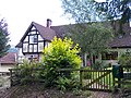
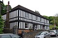 Half-timbered House - geograph.org.uk - 5795560.jpg 640 × 427; 270 KB
-
 Happy Valley Sewer Gas Vent - geograph.org.uk - 4184445.jpg 2,748 × 3,664; 1.93 MB
-
 Hay Slad - 2007 Well Dressing - Elgar - geograph.org.uk - 423369.jpg 640 × 445; 333 KB
-
 Hay Slad Spring, West Malvern - geograph.org.uk - 4785274.jpg 1,200 × 1,600; 376 KB
-
 Hayslad - Well Dressing 2010 - Celebration - geograph.org.uk - 1841279.jpg 3,500 × 2,047; 5.94 MB
-
 Hayslad Spout, West Malvern.jpg 3,041 × 4,748; 11.64 MB
-
 Hayslad Spring (Upper Colwall) - geograph.org.uk - 6383746.jpg 3,648 × 2,056; 3.44 MB
-
 Hayslad Spring (Upper Colwall) - geograph.org.uk - 6383747.jpg 3,648 × 2,736; 4.68 MB
-
 Hayslad Spring (Upper Colwall) - geograph.org.uk - 6383755.jpg 2,048 × 1,536; 1.13 MB
-
 Hayslad Spring (Upper Colwall) - geograph.org.uk - 6383757.jpg 2,048 × 1,019; 659 KB
-

-
 Hayslad Water Spout West Malvern Road - geograph.org.uk - 1895486.jpg 640 × 480; 114 KB
-
 Horse and foal at Mathon Lodge - geograph.org.uk - 466621.jpg 640 × 480; 149 KB
-
 Horses grazing at West Malvern - geograph.org.uk - 466626.jpg 640 × 480; 147 KB
-
 Houses along Worcester Road in Malvern - geograph.org.uk - 4372350.jpg 1,600 × 1,175; 533 KB
-
 Houses and farmland - geograph.org.uk - 6016164.jpg 1,024 × 683; 215 KB
-
 Houses in Harcourt Road, Mathon - geograph.org.uk - 4279264.jpg 1,600 × 1,045; 1.58 MB
-
 Houses on Park Lane - geograph.org.uk - 2164214.jpg 4,272 × 2,848; 6.01 MB
-
 Jubilee Beacon on the Malvern Hills 1 - geograph.org.uk - 2979775.jpg 1,024 × 680; 69 KB
-
 Jubilee Beacon under construction, Malvern Hills - geograph.org.uk - 2976904.jpg 1,024 × 680; 160 KB
-
 Lady Howard de Walden Drive - geograph.org.uk - 675526.jpg 640 × 427; 304 KB
-
 Lady Howard de Walden's Mansion - geograph.org.uk - 251755.jpg 640 × 427; 134 KB
-
 Lady Howard de Walden's Mansion. - geograph.org.uk - 5516.jpg 640 × 479; 67 KB
-
 Landing time - geograph.org.uk - 1424748.jpg 640 × 468; 84 KB
-
 Large white. Pieris brassicae (43762589201).jpg 3,163 × 2,561; 1.55 MB
-
 Litter bin - geograph.org.uk - 2165499.jpg 3,500 × 2,334; 7.48 MB
-
 Looking down Shire Ditch - geograph.org.uk - 4088728.jpg 4,000 × 3,000; 3.42 MB
-
 Looking north to Sugarloaf, Table and North Hills - geograph.org.uk - 4088673.jpg 4,000 × 3,000; 3.09 MB
-
 Looking on to Table Hill and North Hill - geograph.org.uk - 4088629.jpg 4,000 × 3,000; 3.27 MB
-
 Looking to End Hill from the foot of Table Hill - geograph.org.uk - 6122280.jpg 3,776 × 2,520; 3.23 MB
-

-
 Looking up Sugarloaf Hill - geograph.org.uk - 4088634.jpg 4,000 × 3,000; 3.01 MB
-
 Looking west from Sugarloaf Hill - geograph.org.uk - 4088657.jpg 4,000 × 3,000; 3.45 MB
-
-
 Low winter solstice sun - geograph.org.uk - 5634535.jpg 1,024 × 768; 90 KB
-
 Low winter sun over the Malvern Hills - geograph.org.uk - 4321200.jpg 800 × 531; 120 KB
-

-
 Malvern Hills , Footpath - geograph.org.uk - 3974490.jpg 2,848 × 4,288; 7.21 MB
-
 Malvern Hills , Footpath - geograph.org.uk - 3974492.jpg 4,288 × 2,848; 5.34 MB
-
 Malvern Hills , Footpaths ^ Hillside - geograph.org.uk - 3972686.jpg 4,288 × 2,848; 6.5 MB
-
 Malvern Hills , Great Malvern Scenery - geograph.org.uk - 3972700.jpg 4,070 × 2,704; 5.11 MB
-
 Malvern Hills , Great Malvern Scenery - geograph.org.uk - 3972711.jpg 3,868 × 2,569; 5.06 MB
-
 Malvern Hills , Great Malvern Scenery - geograph.org.uk - 3972731.jpg 4,288 × 2,848; 5.94 MB
-
 Malvern Hills , Hillside Scenery - geograph.org.uk - 3972684.jpg 4,288 × 2,848; 6.41 MB
-
 Malvern Hills , Hillside Scenery - geograph.org.uk - 3972691.jpg 4,288 × 2,848; 6.39 MB
-
 Malvern Hills , Hillside Scenery - geograph.org.uk - 3972693.jpg 4,288 × 2,848; 6.25 MB
-
 Malvern Hills , Hillside Scenery - geograph.org.uk - 3972719.jpg 4,208 × 2,795; 5.89 MB
-
 Malvern Hills , Hillside Scenery - geograph.org.uk - 3974484.jpg 4,288 × 2,848; 7.16 MB
-
 Malvern Hills , Hillside Scenery ^ Footpath - geograph.org.uk - 3974486.jpg 4,288 × 2,848; 6.69 MB
-
 Malvern Hills , Worcestershire Beacon - geograph.org.uk - 3972716.jpg 4,288 × 2,848; 7.02 MB
-
 Malvern Hills , Worcestershire Beacon - geograph.org.uk - 3972721.jpg 2,848 × 4,288; 6.67 MB
-
 Malvern Hills , Worcestershire Beacon - geograph.org.uk - 3972724.jpg 4,288 × 2,848; 7.68 MB
-
 Malvern Hills - geograph.org.uk - 5692954.jpg 2,048 × 1,360; 298 KB
-
 Malvern Hills District , A House - geograph.org.uk - 3972650.jpg 4,288 × 2,848; 6.37 MB
-
 Malvern Hills District , Dandelions ^ Weeds - geograph.org.uk - 3974547.jpg 2,848 × 4,288; 6 MB
-
 Malvern Hills District , Footpath - geograph.org.uk - 3972652.jpg 4,288 × 2,848; 6.03 MB
-
 Malvern Hills District , Grassy Path - geograph.org.uk - 3972640.jpg 4,288 × 2,848; 6.63 MB
-
 Malvern Hills District , Hillside Scenery - geograph.org.uk - 3972657.jpg 4,288 × 2,848; 6.32 MB
-
 Malvern Hills District , Hillside Scenery ^ Indicator - geograph.org.uk - 3972680.jpg 4,288 × 2,848; 4.95 MB
-
 Malvern Hills District , Malvern Well - geograph.org.uk - 3974542.jpg 4,288 × 2,848; 7.25 MB
-
 Malvern Hills District , Malvern Well - geograph.org.uk - 3974544.jpg 4,288 × 2,848; 5.22 MB
-
 Malvern Hills District , West Malvern Road - geograph.org.uk - 3970756.jpg 4,154 × 2,759; 5.55 MB
-
 Malvern Hills District , West Malvern Road B4232 - geograph.org.uk - 3974533.jpg 4,288 × 2,848; 7.06 MB
-
 Malvern Hills District , West Malvern Road B4232 - geograph.org.uk - 3974534.jpg 4,091 × 2,717; 6.16 MB
-
 Malvern Hills District , West Malvern Road B4232 - geograph.org.uk - 3974535.jpg 4,288 × 2,848; 7.14 MB
-
 Malvern Hills District , West Malvern Road B4232 - geograph.org.uk - 3974536.jpg 4,288 × 2,848; 6.71 MB
-
 Malvern Hills looking West - geograph.org.uk - 2838848.jpg 9,081 × 1,998; 2.34 MB
-
 Malvern Hills, view south from Worcestershire Beacon - geograph.org.uk - 2836486.jpg 1,600 × 1,066; 166 KB
-
 Malvern Hills, Worcestershire - geograph.org.uk - 1946619.jpg 1,024 × 768; 181 KB
-
 Malvern Hills, Worcestershire Beacon - geograph.org.uk - 6280002.jpg 640 × 480; 86 KB
-
 Malvern's lonely height - geograph.org.uk - 2158613.jpg 4,272 × 2,848; 4.61 MB
-
 Mathon Road, West Malvern - geograph.org.uk - 4988673.jpg 1,024 × 768; 272 KB
-
 Meet Adam - geograph.org.uk - 2123371.jpg 4,272 × 2,848; 6.69 MB
-
 Merodon equestris, Hoverfly whose larvae eat daffodil bulbs (28826484107).jpg 1,443 × 1,348; 548 KB
-
 Merodon equestris, Hoverfly whose larvae eat daffodil bulbs (43762585561).jpg 2,729 × 2,120; 814 KB
-
 Miniature Granite Quarry, Table Hill - geograph.org.uk - 252959.jpg 640 × 427; 100 KB
-
 Mist above St. John the Baptist Church (Mathon) - geograph.org.uk - 6383658.jpg 2,258 × 1,006; 688 KB
-
 Mist in Mathon - geograph.org.uk - 6383618.jpg 2,119 × 852; 266 KB
-
 Misty Christmas Day on the Malvern Hills - geograph.org.uk - 6008017.jpg 1,024 × 683; 112 KB
-
 Misty Malvern Hills - geograph.org.uk - 6378243.jpg 1,024 × 768; 107 KB
-

-

-
 Nearly at the top - geograph.org.uk - 2668481.jpg 1,142 × 857; 287 KB
-
 Nephrotoma appendiculata male ? (43046810434).jpg 2,772 × 2,422; 1,021 KB
-
 North End of North Hill - geograph.org.uk - 4826132.jpg 4,000 × 3,000; 3.05 MB
-
 North Hill (The Malvern Hills) - geograph.org.uk - 6383715.jpg 3,648 × 2,056; 3.31 MB
-
 North Hill (The Malvern Hills) - geograph.org.uk - 6383738.jpg 3,648 × 2,056; 3.09 MB
-
 North Hill - geograph.org.uk - 5130486.jpg 3,648 × 2,736; 2.79 MB
-
 North Hill from Worcestershire Beacon - geograph.org.uk - 5890414.jpg 1,600 × 1,200; 718 KB
-
 North Hill in the Malverns - geograph.org.uk - 4372366.jpg 1,600 × 1,200; 544 KB
-
 Not quite Malvern spring water^ - geograph.org.uk - 1424910.jpg 640 × 426; 84 KB
-
 Octagon, Elim Conference Centre - geograph.org.uk - 2123552.jpg 4,272 × 2,848; 6.68 MB
-
 Old cider press at Park Farm - geograph.org.uk - 2576879.jpg 640 × 480; 164 KB
-
 Old Hollow, West Malvern - geograph.org.uk - 2349810.jpg 4,272 × 2,848; 4.67 MB
-
 Old quarry workings - geograph.org.uk - 6100904.jpg 768 × 1,024; 380 KB
-
 On Summer Hill - geograph.org.uk - 2976909.jpg 1,024 × 680; 225 KB
-
 On Summer Hill - geograph.org.uk - 4822073.jpg 4,000 × 3,000; 2.65 MB
-
 On top of the Worcestershire Beacon - geograph.org.uk - 3190298.jpg 640 × 480; 227 KB
-
 On Worcestershire Beacon - geograph.org.uk - 3630192.jpg 2,560 × 1,920; 2.05 MB
-
 On Worcestershire Beacon - geograph.org.uk - 4088686.jpg 4,000 × 3,000; 3.17 MB
-
 Ordnance Survey Bracket - geograph.org.uk - 5795347.jpg 381 × 640; 390 KB
-
-
 Overlooking West Malvern - geograph.org.uk - 1386516.jpg 640 × 480; 111 KB
-
 Overlooking West Malvern - geograph.org.uk - 1604233.jpg 640 × 475; 128 KB
-
 Overlooking West Malvern - geograph.org.uk - 906899.jpg 640 × 480; 76 KB
-
 Pallets for the Diamond Jubilee Beacon - geograph.org.uk - 2976404.jpg 640 × 427; 259 KB
-
 Panorama picture of the Malvern Hills - geograph.org.uk - 5667656.jpg 1,024 × 241; 93 KB
-
 Paraglider at the Worcestershire Beacon - geograph.org.uk - 4369771.jpg 1,316 × 1,600; 260 KB
-
 Paraglider at the Worcestershire Beacon - geograph.org.uk - 4369867.jpg 1,600 × 1,199; 409 KB
-
 Paraglider over West Malvern - geograph.org.uk - 4369894.jpg 1,600 × 968; 325 KB
-
 Paragliders over the Malvern Hills - geograph.org.uk - 4369795.jpg 1,600 × 1,100; 251 KB
-
 Parasol toadstool - geograph.org.uk - 5959561.jpg 768 × 1,024; 423 KB
-
 Part of West of England Quarries - geograph.org.uk - 4297931.jpg 5,400 × 3,600; 3.63 MB
-
 Path approaching Summer Hill - geograph.org.uk - 5669675.jpg 1,024 × 683; 273 KB
-
 Path approaching Summer Hill - geograph.org.uk - 5702046.jpg 1,024 × 576; 193 KB


.jpg)


_-_geograph.org.uk_-_6383623.jpg)
_-_geograph.org.uk_-_6383631.jpg)
_-_geograph.org.uk_-_6383654.jpg)


_-_geograph.org.uk_-_2576877.jpg)


_-_geograph.org.uk_-_6383590.jpg)
_-_geograph.org.uk_-_6383653.jpg)


_-_geograph.org.uk_-_6383746.jpg)
_-_geograph.org.uk_-_6383747.jpg)
_-_geograph.org.uk_-_6383755.jpg)
_-_geograph.org.uk_-_6383757.jpg)


.jpg)


.jpg)
.jpg)

_-_geograph.org.uk_-_6383658.jpg)


.jpg)

_-_geograph.org.uk_-_6383715.jpg)
_-_geograph.org.uk_-_6383738.jpg)


_-_geograph.org.uk_-_6383665.jpg)
_-_geograph.org.uk_-_6383661.jpg)