Category:Weston-super-Mare
town in Somerset, England .JPG) | |||||
| Upload media | |||||
| Instance of | |||||
|---|---|---|---|---|---|
| Location | Weston-Super-Mare, North Somerset, Somerset, South West England, England | ||||
| Population |
| ||||
| official website | |||||
 | |||||
Subcategories
This category has the following 25 subcategories, out of 25 total.
B
E
H
J
- Jill's Garden (5 F)
K
M
- Marine Lake, Weston-super-Mare (71 F)
P
- Postcards of Weston-super-Mare (33 F)
R
S
T
W
- Weston Arch (7 F)
- Weston Bay (10 F)
- Weston Eye, Weston-super-Mare (48 F)
Media in category "Weston-super-Mare"
The following 200 files are in this category, out of 1,839 total.
(previous page) (next page)-
 "Ghost sign", Upper Church Road, Weston super Mare - geograph.org.uk - 5066637.jpg 1,600 × 1,067; 465 KB
-
 "The Bristol Hotel", Weston super Mare - geograph.org.uk - 5080987.jpg 1,600 × 1,067; 348 KB
-
 "The Old Stable" public house, Weston super Mare - geograph.org.uk - 5082403.jpg 1,468 × 1,600; 478 KB
-
 'Closed indefinitely' - geograph.org.uk - 3403252.jpg 1,704 × 2,304; 1.4 MB
-
 'Continuum Diatom' - geograph.org.uk - 3743519.jpg 1,704 × 2,304; 1.41 MB
-
 'Ever Forward' - geograph.org.uk - 2901287.jpg 2,304 × 1,704; 1.64 MB
-
 'My life is an endless path...' - geograph.org.uk - 3743250.jpg 1,704 × 2,304; 1.71 MB
-
 'Paintjam^' - geograph.org.uk - 3404010.jpg 2,304 × 1,704; 1.18 MB
-
 'Pier to pier' transport - geograph.org.uk - 4080112.jpg 5,380 × 3,653; 5.76 MB
-
 'The Four Seasons' - geograph.org.uk - 2901487.jpg 2,304 × 1,704; 1.7 MB
-
 'Wave' - geograph.org.uk - 3743629.jpg 2,304 × 1,704; 1.71 MB
-
-
 168 Medical Centre, Weston-Super-Mare - geograph.org.uk - 5667322.jpg 1,024 × 768; 118 KB
-
 Weston-Super-Mare, from the Esplanade (10723872515).jpg 1,000 × 705; 499 KB
-
 19 of 'A new Guide to Weston-super-Mare' (11224225313).jpg 1,359 × 785; 336 KB
-
 191 Milton Road, Worle, Weston Super Mare - geograph.org.uk - 6328693.jpg 576 × 1,024; 86 KB
-
 1GL Boltmark, Emmanuel Parish church - geograph.org.uk - 2861433.jpg 1,704 × 2,304; 2.47 MB
-
 2022 at Weston-super-MareBus Hub (1).JPG 1,366 × 910; 300 KB
-
 2022 at Weston-super-MareBus Hub (2).JPG 1,366 × 910; 294 KB
-
 33-35 Queens Road - geograph.org.uk - 3631974.jpg 640 × 427; 95 KB
-

-
 49 Social Club in Weston-super-Mare - geograph.org.uk - 5896869.jpg 891 × 1,024; 212 KB
-
 A bend on Bridgwater Road - geograph.org.uk - 3046149.jpg 1,024 × 768; 151 KB
-
 A change of scenery - geograph.org.uk - 3544035.jpg 1,704 × 2,304; 2.06 MB
-
 A different kind of fish shop - geograph.org.uk - 3544164.jpg 2,304 × 1,704; 1.48 MB
-
 A good time for a seaside holiday - geograph.org.uk - 5141335.jpg 2,304 × 1,704; 993 KB
-
 A helicopter called Gordon - geograph.org.uk - 4534054.jpg 1,704 × 2,304; 1.71 MB
-
 A high tee for a well-judged flight - geograph.org.uk - 3589978.jpg 2,304 × 1,704; 1.61 MB
-
 A long walk on a summer's afternoon - geograph.org.uk - 5432808.jpg 2,304 × 1,704; 1.08 MB
-

-

-
 A new benchmark for a new church - geograph.org.uk - 3418695.jpg 1,704 × 2,304; 2.05 MB
-
 A new dawn^ - geograph.org.uk - 3403205.jpg 1,704 × 2,304; 1.03 MB
-
 A new movement^ - geograph.org.uk - 3268463.jpg 1,704 × 2,304; 1.85 MB
-
 A new place to park - geograph.org.uk - 3269101.jpg 2,304 × 1,704; 1.24 MB
-
 A prince riding to the castle - geograph.org.uk - 3930821.jpg 1,200 × 1,600; 681 KB
-
 A salty air - geograph.org.uk - 3403299.jpg 2,304 × 1,704; 1.77 MB
-
 A stylish tower - geograph.org.uk - 3418663.jpg 1,704 × 2,304; 1.35 MB
-
 A sunny position - geograph.org.uk - 3269039.jpg 2,304 × 1,704; 1.41 MB
-
 A tree with a tale - geograph.org.uk - 3743254.jpg 2,304 × 1,704; 1.63 MB
-

-

-

-
 A wasp at Weston - geograph.org.uk - 4534067.jpg 2,304 × 1,704; 1.67 MB
-
 A welcome shady corner in this pony paddock in Summer Lane - geograph.org.uk - 2419976.jpg 3,072 × 2,304; 4.79 MB
-
 A well preserved limekiln at Uphill - geograph.org.uk - 4751868.jpg 2,048 × 3,648; 2.37 MB
-
 A wet day at Weston-super-Mare - geograph.org.uk - 3153301.jpg 1,024 × 755; 122 KB
-

-
 A370 South of Uphill - geograph.org.uk - 3801465.jpg 640 × 427; 236 KB
-
 A370 viaduct - geograph.org.uk - 5627212.jpg 640 × 461; 81 KB
-
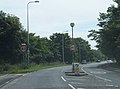
 A370, approaching West Wick Roundabout - geograph.org.uk - 3806768.jpg 640 × 480; 234 KB
-
 A370, Bridgwater Road - geograph.org.uk - 3801463.jpg 640 × 480; 328 KB
-
 A370, Somerset Avenue - geograph.org.uk - 3806763.jpg 640 × 480; 229 KB
-
 A370, West Wick - geograph.org.uk - 3806773.jpg 640 × 480; 303 KB
-
 A371 at Locking Moor Road - geograph.org.uk - 5814586.jpg 1,024 × 769; 100 KB
-

-
 Access ramps at Worle railway station - geograph.org.uk - 6214688.jpg 1,024 × 768; 191 KB
-
 Across Hildesheim Bridge, Weston-super-Mare - geograph.org.uk - 5948800.jpg 1,024 × 671; 130 KB
-
 Addiscombe Rd. W-S-M - geograph.org.uk - 5716914.jpg 1,600 × 1,069; 329 KB
-
 Admiralty Chart No 1176 Newport and Weston-super-Mare to Chepstow and Bristol, Published 1928.jpg 11,094 × 16,244; 72.94 MB
-
 Advertising space - geograph.org.uk - 3402718.jpg 2,304 × 1,704; 1.49 MB
-

-
 Alexandra House, Weston-super-Mare - geograph.org.uk - 2715977.jpg 627 × 640; 90 KB
-
 Alfred Court, Weston-super-Mare - geograph.org.uk - 5900591.jpg 1,024 × 889; 178 KB
-
 Alfred Street houses, Weston-super-Mare - geograph.org.uk - 5900646.jpg 1,024 × 804; 145 KB
-
 All quiet on the Grand Pier - geograph.org.uk - 3801747.jpg 3,648 × 2,736; 1.94 MB
-
 All Saints Road, Weston-Super-Mare - geograph.org.uk - 3623141.jpg 3,488 × 2,616; 3.28 MB
-
 Anchor Head Hotel - geograph.org.uk - 4999564.jpg 2,000 × 1,333; 1.41 MB
-
 Anchor Head, Weston-super-Mare - geograph.org.uk - 4999498.jpg 2,000 × 1,333; 1.09 MB
-
 Ann-Marie Guest House in Weston-super-Mare - geograph.org.uk - 5913706.jpg 817 × 1,024; 210 KB
-
-

-
 Apple Central Taxis office in Weston-super-Mare - geograph.org.uk - 5929596.jpg 1,024 × 910; 188 KB
-
 Apple Tree Farm now derelict - geograph.org.uk - 2063133.jpg 640 × 480; 132 KB
-
 Approach to Hildesheim Bridge, Weston-super-Mare - geograph.org.uk - 5948775.jpg 1,024 × 763; 128 KB
-
 Approaching Airport Roundabout - geograph.org.uk - 3044435.jpg 1,024 × 755; 116 KB
-
 Approaching West Wick Roundabout - geograph.org.uk - 3046034.jpg 1,024 × 699; 130 KB
-
 Approaching Winterstoke Roundabout - geograph.org.uk - 3046042.jpg 1,024 × 799; 132 KB
-
 Are you going to leave me here^ - geograph.org.uk - 2106811.jpg 640 × 480; 65 KB
-
 Arosfa Hotel, 10-16, Lower Church Road - geograph.org.uk - 4957303.jpg 3,264 × 2,448; 1.96 MB
-
 Art Deco house - detail, Station Road, Weston-Super-Mare - geograph.org.uk - 2216104.jpg 1,685 × 1,171; 1.62 MB
-
 Arthur Eddington.jpg 3,991 × 2,752; 6.29 MB
-
 Arundel Road - geograph.org.uk - 2839754.jpg 640 × 427; 268 KB
-
 As clean as the streets - geograph.org.uk - 5141330.jpg 2,304 × 1,704; 1.63 MB
-
 Asda carpark, Weston-Super-Mare - geograph.org.uk - 6034805.jpg 4,288 × 3,216; 3.71 MB
-
 Asda superstore, Weston-Super-Mare - geograph.org.uk - 6034730.jpg 3,944 × 2,957; 1.31 MB
-
 Ashcombe Park - geograph.org.uk - 5667252.jpg 1,024 × 768; 268 KB
-
 Ashcombe Park entrance - geograph.org.uk - 6328678.jpg 1,024 × 576; 272 KB
-
 Ashcombe Park Rd entrance to park - geograph.org.uk - 6328733.jpg 1,024 × 576; 264 KB
-
 Ashcombe Park Weston-S-M.jpg 5,472 × 3,648; 14.9 MB
-
 Aspen Park Road Locking Castle - geograph.org.uk - 2386204.jpg 1,600 × 1,200; 251 KB
-
 Atlantic Broadway, Weston-super-Mare - geograph.org.uk - 2562597.jpg 640 × 480; 71 KB
-

-
 Au revoir Weston - geograph.org.uk - 2104029.jpg 480 × 640; 45 KB
-
 AW Leisure, Weston-super-Mare - geograph.org.uk - 2562594.jpg 640 × 480; 76 KB
-

-
 Bait digging - geograph.org.uk - 6392460.jpg 1,024 × 678; 606 KB
-
 Baker Street Launderette, Weston-super-Mare - geograph.org.uk - 5896665.jpg 950 × 1,024; 159 KB
-

-
 Balcony without a view - geograph.org.uk - 3402734.jpg 2,304 × 1,704; 1.58 MB
-
 Bandstand, Grove Park, Weston super Mare - geograph.org.uk - 5080931.jpg 1,600 × 1,408; 533 KB
-
 Bare Grills - geograph.org.uk - 4534120.jpg 2,304 × 1,704; 1.46 MB
-
 Beach and pier, Weston super Mare - geograph.org.uk - 5067900.jpg 1,600 × 1,067; 416 KB
-
 Beach at low tide, Weston Super Mare - geograph.org.uk - 6334409.jpg 800 × 600; 63 KB
-
 Beach at Weston-super-Mare - geograph.org.uk - 4996910.jpg 2,000 × 2,000; 1.32 MB
-
 Beach at Weston-super-Mare - geograph.org.uk - 4996954.jpg 2,000 × 2,000; 1.19 MB
-
 Beach at Weston-Super-Mare - geograph.org.uk - 6334418.jpg 800 × 574; 100 KB
-

-
 Beach car park off Marine Drive - geograph.org.uk - 4996867.jpg 2,000 × 1,333; 1.55 MB
-
 Beach car parking - geograph.org.uk - 5716951.jpg 2,048 × 1,368; 656 KB
-

-
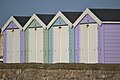
 Beach huts on Marine Parade - geograph.org.uk - 4999226.jpg 2,000 × 2,000; 1.2 MB
-
 Beach huts on Marine Parade - geograph.org.uk - 6079175.jpg 1,024 × 683; 111 KB
-

-
 Beach huts, Weston Super Mare - geograph.org.uk - 6031639.jpg 1,024 × 768; 140 KB
-
 Beach Lawns, Weston Super Mare - geograph.org.uk - 6031645.jpg 1,024 × 768; 183 KB
-
 Beach Road, Weston-Super-Mare at Clevedon Road - geograph.org.uk - 5162385.jpg 3,058 × 1,813; 1,023 KB
-
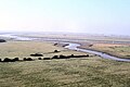
 Beach, Sand Bay - geograph.org.uk - 5163884.jpg 3,072 × 2,048; 1.14 MB
-
 Beachlands - geograph.org.uk - 4996719.jpg 2,000 × 1,333; 1.27 MB
-
 Beaconsfield Road, Weston-Super-Mare - geograph.org.uk - 3623280.jpg 3,488 × 2,616; 2.56 MB
-
 Beaufighter Road - geograph.org.uk - 6171984.jpg 2,000 × 1,358; 2.08 MB
-
 Beaufighter Road - geograph.org.uk - 6171988.jpg 2,000 × 1,088; 1.39 MB
-
 Bedford Road. W-S-M - geograph.org.uk - 5717128.jpg 1,600 × 1,069; 335 KB
-
 Bedfordshire by night^ - geograph.org.uk - 4682730.jpg 2,304 × 1,704; 1.37 MB
-

-
 Beer's the thing^ - geograph.org.uk - 3743275.jpg 1,704 × 2,304; 1.81 MB
-
 Bend ahead on Kewstoke Road - geograph.org.uk - 3788693.jpg 800 × 670; 175 KB
-
 Beneath the skin - geograph.org.uk - 4682725.jpg 2,304 × 1,704; 1.77 MB
-
 Beware^ - geograph.org.uk - 3404015.jpg 2,304 × 1,704; 1.45 MB
-
 Birkett Road junction above Spring Cove - geograph.org.uk - 2942531.jpg 600 × 800; 344 KB
-
 Birnbeck Pier, Weston-super-Mare at high tide - geograph.org.uk - 6410139.jpg 1,800 × 1,200; 299 KB
-
 Birnbeck Road, Weston-super-Mare - geograph.org.uk - 4513845.jpg 640 × 480; 59 KB
-
 Birnbeck Road, Weston-super-Mare - geograph.org.uk - 5005991.jpg 2,000 × 2,000; 1.19 MB
-
 Black Rock and Brean Down - geograph.org.uk - 6078838.jpg 1,024 × 683; 151 KB
-

-

-
 Blackburn Way, West Wick - geograph.org.uk - 4538807.jpg 1,024 × 768; 148 KB
-
 Bleadon Level - geograph.org.uk - 5029027.jpg 2,400 × 1,600; 553 KB
-
 Bleadon sunset - panoramio.jpg 4,928 × 3,264; 6.23 MB
-
 Blenheim Court, Weston-super-Mare - geograph.org.uk - 5916504.jpg 1,024 × 867; 202 KB
-
 Blooming lovely - geograph.org.uk - 3743616.jpg 1,704 × 2,304; 1.48 MB
-

-
 Blue plaque presentation.jpg 4,032 × 2,268; 2.02 MB
-
 BMX course in Weston Woods near Kewstoke - geograph.org.uk - 3788723.jpg 800 × 600; 219 KB
-
 Boarded-up former corner shop, Weston-super-Mare - geograph.org.uk - 5900632.jpg 710 × 1,024; 138 KB
-

-
 Boats at Weston - geograph.org.uk - 2400949.jpg 1,024 × 634; 123 KB
-
 Boats moored near Weston's Grand Pier - geograph.org.uk - 4541257.jpg 2,662 × 1,997; 1.22 MB
-
 Bonds Wine Bar and Glentworth office, Weston-super-Mare - geograph.org.uk - 5898048.jpg 1,015 × 1,024; 193 KB
-
 Bones of a beach shop, Weston-super-Mare - geograph.org.uk - 5162532.jpg 1,911 × 1,388; 330 KB
-
 Boneyard at the helicopter museum - geograph.org.uk - 5162182.jpg 2,000 × 1,333; 1.49 MB
-
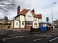
 Boro Social Club in Weston-super-Mare - geograph.org.uk - 5913699.jpg 1,024 × 770; 156 KB
-
 Bottom of the cliff at Uphill - geograph.org.uk - 6078802.jpg 1,024 × 683; 228 KB
-
 Boundary Close, Weston-super-Mare - geograph.org.uk - 2716010.jpg 640 × 480; 66 KB
-
 Boundary wall outside the Grand Atlantic Hotel - geograph.org.uk - 6327788.jpg 1,024 × 576; 197 KB
-

-
 Bransby Way, West Wick - geograph.org.uk - 6335097.jpg 640 × 480; 70 KB
-
 Brass Niagara^ - geograph.org.uk - 3403213.jpg 2,304 × 1,704; 1.55 MB
-
 Braving the sea air - geograph.org.uk - 3403149.jpg 1,704 × 2,304; 1.39 MB
-
 Brean , Sandy Beach - geograph.org.uk - 6287486.jpg 6,000 × 4,000; 4.75 MB
-
 Brean , Weston Bay - geograph.org.uk - 6287430.jpg 6,000 × 4,000; 3.14 MB
-
 Brean , Weston Bay - geograph.org.uk - 6287453.jpg 6,000 × 4,000; 4.73 MB
-
 Brean , Weston Bay - geograph.org.uk - 6287454.jpg 6,000 × 4,000; 4.78 MB
-
 Brean , Weston-Super-Mare Scenery - geograph.org.uk - 6287265.jpg 6,000 × 4,000; 4.46 MB
-
 Brean , Weston-Super-Mare Scenery - geograph.org.uk - 6287298.jpg 6,000 × 4,000; 4.06 MB
-
 Brean , Weston-Super-Mare Scenery - geograph.org.uk - 6287304.jpg 6,000 × 4,000; 4.57 MB
-
 Brean , Weston-Super-Mare Scenery - geograph.org.uk - 6287393.jpg 6,000 × 4,000; 3.71 MB
-
 Brean Down - geograph.org.uk - 6031572.jpg 1,024 × 768; 80 KB
-
 Brean down from Weston Pier - geograph.org.uk - 2143756.jpg 1,024 × 768; 81 KB
-
 Brean Down Rd. and postbox - geograph.org.uk - 5716917.jpg 1,600 × 1,069; 575 KB
-
 Brean Down sunset - geograph.org.uk - 2789983.jpg 2,304 × 1,704; 909 KB
-
 Bricks made of sand - geograph.org.uk - 3930844.jpg 1,200 × 1,600; 512 KB
-
 Bridge at Ebdon - geograph.org.uk - 85089.jpg 640 × 425; 67 KB
-
 Bridge Road, Weston-Super-Mare - geograph.org.uk - 2555395.jpg 640 × 412; 75 KB
-
 Bridge Road, Weston-Super-Mare - geograph.org.uk - 2555408.jpg 640 × 415; 56 KB
-

-

-
 Bridgwater Road - geograph.org.uk - 3046143.jpg 1,024 × 758; 152 KB
-

-
 Brighton Road, Weston-super-Mare - geograph.org.uk - 2524942.jpg 640 × 505; 73 KB
-
 Bristol Hotel, Weston-super-Mare - geograph.org.uk - 5948771.jpg 1,024 × 706; 153 KB
-
 Bristol House, Milton - geograph.org.uk - 5667257.jpg 1,024 × 768; 160 KB
-
 Bristol Queen in Weston - geograph.org.uk - 4541224.jpg 4,000 × 3,000; 3.32 MB
-
 Bristol Queen in Weston - geograph.org.uk - 4541226.jpg 4,000 × 3,000; 4.37 MB
-

-
 Bristol Road Bridge over railway - geograph.org.uk - 2935034.jpg 800 × 600; 299 KB
-

-
 Bristol Road Lower - geograph.org.uk - 2839757.jpg 640 × 427; 300 KB
-
 Bristol Road Lower - geograph.org.uk - 3741913.jpg 2,304 × 1,704; 1.37 MB
-
 Bristol Road-Lower, Weston-super-Mare - geograph.org.uk - 6334749.jpg 800 × 600; 130 KB
-
 Bristol Road-Lower, Weston-super-Mare - geograph.org.uk - 6334752.jpg 800 × 600; 138 KB
-
 Bristol Road-Lower, Weston-super-Mare - geograph.org.uk - 6334762.jpg 800 × 600; 142 KB
-
 Broadcasting to the town - geograph.org.uk - 3543974.jpg 1,704 × 2,304; 1.52 MB
-
 Buildings at Anchor Head - geograph.org.uk - 5162737.jpg 1,963 × 2,947; 1.04 MB
-
 Bungalows - geograph.org.uk - 5627233.jpg 640 × 330; 41 KB
-

-
 Bungalows in the suburbs - geograph.org.uk - 1721049.jpg 1,024 × 768; 130 KB
-

-
 Bus stop - Uphill Rd. North - geograph.org.uk - 5717051.jpg 1,600 × 1,069; 576 KB
-
 Bus stop and post box together - geograph.org.uk - 5717112.jpg 2,048 × 1,368; 775 KB


.jpg)
.jpg)


.JPG)
.JPG)


_towards_Weston-super-Mare_-_geograph.org.uk_-_6334304.jpg)
,_Weston-Super-Mare_-_geograph.org.uk_-_3801446.jpg)


