Category:Worlebury hill
upland area in North Somerset, England, UK  | |||||
| Upload media | |||||
| Instance of | |||||
|---|---|---|---|---|---|
| Location | Weston-super-Mare, Weston-Super-Mare, North Somerset, Somerset, South West England, England | ||||
| Has part(s) | |||||
| Mountain range |
| ||||
 | |||||

Media in category "Worlebury hill"
The following 28 files are in this category, out of 28 total.
-
 19 of 'A new Guide to Weston-super-Mare' (11224225313).jpg 1,359 × 785; 336 KB
-
 Baytree Rec - geograph.org.uk - 1651038.jpg 640 × 480; 63 KB
-
 Bristol Channel from Penarth cliffs - geograph.org.uk - 1167276.jpg 640 × 480; 48 KB
-
 Cycle Path - geograph.org.uk - 1651064.jpg 640 × 480; 87 KB
-
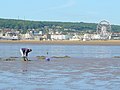 Digging for lugworm - geograph.org.uk - 1401627.jpg 640 × 481; 284 KB
-
 Fine Houses on Kew Road - geograph.org.uk - 1079609.jpg 640 × 477; 84 KB
-
 Footpath to Kewstoke - geograph.org.uk - 1026894.jpg 640 × 480; 140 KB
-
 Highest point on Worlebury Hill (geograph 4100778).jpg 1,024 × 768; 194 KB
-
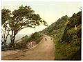 Kewstoke Road, Weston-super-Mare, England-LCCN2002708223.jpg 3,659 × 2,738; 3.05 MB
-
 Kewstoke Road, Weston-super-Mare, England-LCCN2002708223.tif 3,659 × 2,738; 28.67 MB
-
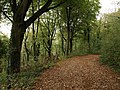
 Oval wood, Worlebury Park Road - geograph.org.uk - 1026922.jpg 640 × 480; 144 KB
-
 Quarry on Worlebury Hill OS ST320624.jpg 3,264 × 2,448; 1.53 MB
-
 Royal Air Force Airbus A400M ZM400 in flight over west of England (45158517).jpg 3,000 × 1,992; 1,016 KB
-
 Royal Air Force Airbus A400M ZM400 in flight over west of England (45158518).jpg 3,000 × 2,082; 829 KB
-
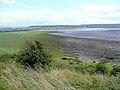 Sand Bay from Middle Hope 1 - geograph.org.uk - 1403600.jpg 640 × 480; 232 KB
-
 Sand Bay from Middle Hope 4 - geograph.org.uk - 1403619.jpg 640 × 480; 223 KB
-
 Single Line Railway in Weston Super Mare - geograph.org.uk - 1718420.jpg 1,600 × 1,200; 420 KB
-
 Steps to Worlebury Hill - geograph.org.uk - 1026849.jpg 480 × 640; 116 KB
-
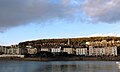
 The three piers, Weston-super-Mare (2022).JPG 2,732 × 820; 728 KB
-
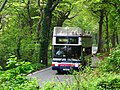
 Weston Woods - Crosville 400 (V125LGC).JPG 1,366 × 910; 835 KB
-
 Weston Woods - Crosville DFG81 (891VFM).JPG 1,366 × 910; 742 KB
-
 Weston Woods 39920.jpg 1,024 × 768; 467 KB
-
 Weston-super-Mare from Worlebury Hill - geograph.org.uk - 896240.jpg 640 × 479; 91 KB
-
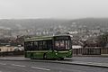 Weston-super-Mare Heidelsheim Bridge - Crosville 325 (MX08ZFA).JPG 1,366 × 910; 428 KB
-
 Weston-Super-Mare Kewstoke Road.jpg 3,614 × 2,683; 2.42 MB
-
 Worlebury - Bristol 2800 NHU2C.jpg 1,024 × 768; 377 KB
-
 Worlebury Hill - geograph.org.uk - 3276098.jpg 2,560 × 1,920; 4.56 MB
-
 Worlebury Hill from Marine Lake.jpg 1,366 × 820; 250 KB
.jpg)


.jpg)


.jpg)
.jpg)


.JPG)
.JPG)


.JPG)


.JPG)