Category:Whittington, Shropshire
village and civil parish in Shropshire, England, UK  | |||||
| Upload media | |||||
| Instance of | |||||
|---|---|---|---|---|---|
| Location | Shropshire, West Midlands, England | ||||
| Different from | |||||
 | |||||
Subcategories
This category has the following 7 subcategories, out of 7 total.
Media in category "Whittington, Shropshire"
The following 200 files are in this category, out of 249 total.
(previous page) (next page)-
 'Communication' trench at Park Hall - geograph.org.uk - 5111863.jpg 1,600 × 1,064; 460 KB
-
 'Greek Key' trenches at Park Hall - geograph.org.uk - 5111858.jpg 1,600 × 1,064; 551 KB
-
 'Romantic Lady' at Maestermyn - geograph.org.uk - 5344313.jpg 1,280 × 851; 427 KB
-
 'Ye Olde Boote Inn' at Whittington - geograph.org.uk - 1027760.jpg 640 × 480; 94 KB
-
 67016 Wittington LC.jpg 4,683 × 3,040; 2.64 MB
-
 A clump of trees - geograph.org.uk - 4468215.jpg 640 × 426; 49 KB
-
 A long straight stretch on Berghill Lane - geograph.org.uk - 6060456.jpg 4,000 × 3,000; 2.87 MB
-
 A tight squeeze - geograph.org.uk - 6060397.jpg 2,938 × 1,907; 1.45 MB
-
 A view across the trenches towards 'No Man's Land' - geograph.org.uk - 5111827.jpg 1,600 × 1,064; 405 KB
-

-

-
 A495 at entrance to Halston Hall - geograph.org.uk - 2898939.jpg 640 × 430; 80 KB
-
 A495 entering Whittington - geograph.org.uk - 4436318.jpg 640 × 341; 66 KB
-
 A495 just east of Hindford junction - geograph.org.uk - 2899150.jpg 640 × 417; 83 KB
-
 A495 leaving Whittington eastbound - geograph.org.uk - 2898935.jpg 640 × 417; 80 KB
-
 A495 passing Halston Gardens - geograph.org.uk - 4436405.jpg 640 × 276; 50 KB
-
 A495 passing Narrow Boat Inn - geograph.org.uk - 4436745.jpg 640 × 383; 55 KB
-
 A495 through Whittington - geograph.org.uk - 4436332.jpg 640 × 325; 53 KB
-

-

-

-

-
 A5 (A483) near Park Hall - geograph.org.uk - 2248794.jpg 640 × 480; 51 KB
-
 A5 east of Oswestry - geograph.org.uk - 3291350.jpg 640 × 481; 54 KB
-
 A5 Level Crossing southeast of Pentre Clawdd - geograph.org.uk - 3771811.jpg 3,513 × 2,613; 1.51 MB
-
 A5 looking north - geograph.org.uk - 3291379.jpg 640 × 481; 46 KB
-
 A5 passing Oswestry Showground - geograph.org.uk - 3134328.jpg 640 × 388; 60 KB
-

-
 Another junction on another narrow lane - geograph.org.uk - 1442594.jpg 640 × 426; 299 KB
-
 Approaching Whittington village - geograph.org.uk - 2920124.jpg 640 × 480; 74 KB
-
 Arable land near Babbins Wood - geograph.org.uk - 3924458.jpg 640 × 480; 239 KB
-
 B Junction - geograph.org.uk - 2534879.jpg 4,000 × 3,000; 5.85 MB
-
 B5009 junction with minor road - geograph.org.uk - 2154308.jpg 640 × 480; 81 KB
-
 B5009 near Hendre Cottage - geograph.org.uk - 3540557.jpg 640 × 469; 44 KB
-
 Babbinswood across a field - geograph.org.uk - 4468189.jpg 640 × 426; 49 KB
-
 Barns at Perrymoor Farm - geograph.org.uk - 2920100.jpg 640 × 480; 100 KB
-
 Bends on the old A5 north of Whittington - geograph.org.uk - 4481911.jpg 1,600 × 1,064; 375 KB
-
 Berghill Cottages - geograph.org.uk - 2920084.jpg 640 × 480; 64 KB
-

-
 British Telecoms at Oswestry - geograph.org.uk - 6060415.jpg 3,812 × 2,859; 2.37 MB
-
 Bryn-y-plentyn from behind the hedge - geograph.org.uk - 204047.jpg 640 × 480; 78 KB
-
 BT regional headquarters in Whittington, Shropshire, England.jpg 640 × 426; 375 KB
-
 Canal and farmland east of Hindford, Shropshire - geograph.org.uk - 4849270.jpg 1,280 × 807; 607 KB
-
 Canalside grazing east of Hindford, Shropshire - geograph.org.uk - 4850507.jpg 1,280 × 780; 972 KB
-
 Canalside grazing east of Hindford, Shropshire - geograph.org.uk - 4850553.jpg 1,280 × 850; 908 KB
-
 Canalside grazing east of Hindford, Shropshire - geograph.org.uk - 4850694.jpg 1,280 × 894; 952 KB
-
 Canalside grazing near Welsh Frankton, Shropshire - geograph.org.uk - 5460841.jpg 1,280 × 877; 1,022 KB
-
 Canalside scene below Frankton Locks - geograph.org.uk - 2920062.jpg 640 × 480; 65 KB
-
 Cattle feeding trough and a muck heap - geograph.org.uk - 6060452.jpg 4,000 × 3,000; 2.69 MB
-
 Cattle pasture, north-west of Hawkswood Farm - geograph.org.uk - 5183349.jpg 1,024 × 768; 149 KB
-
 Church and pub at Whittington - geograph.org.uk - 5772254.jpg 1,080 × 810; 197 KB
-
 Churchyard gates on Boot Street - geograph.org.uk - 6062323.jpg 4,000 × 3,000; 2.8 MB
-

-
 Converted chapel at Babbinswood - geograph.org.uk - 2920121.jpg 640 × 480; 82 KB
-
 Cul-de-sac at Henlle - geograph.org.uk - 1442258.jpg 640 × 426; 305 KB
-
 Daisy Lane, Whittington - geograph.org.uk - 2920139.jpg 640 × 480; 72 KB
-

-
 Drained farmland, Lower Frankton - geograph.org.uk - 5182081.jpg 1,024 × 768; 174 KB
-
 Drenewydd, Park Hall - geograph.org.uk - 6060395.jpg 3,578 × 2,333; 1.9 MB
-
 Entrance to Bryn-y-plentyn - geograph.org.uk - 3540460.jpg 640 × 352; 82 KB
-
 Entrance to Halston Hall estate (geograph 6715361).jpg 4,032 × 3,024; 1.37 MB
-
 Entrance to The Oaks from B5009 - geograph.org.uk - 3540551.jpg 640 × 392; 82 KB
-
 Entrance to Whittington Castle - geograph.org.uk - 4436347.jpg 640 × 448; 54 KB
-

-
 Farming landscape - geograph.org.uk - 4468182.jpg 640 × 426; 42 KB
-
 Farmland at Lower Frankton - geograph.org.uk - 5182044.jpg 1,024 × 615; 148 KB
-
 Farmland east of Decoy Farm - geograph.org.uk - 5182142.jpg 1,024 × 768; 224 KB
-
 Farmland near Whittington - geograph.org.uk - 4468191.jpg 640 × 426; 44 KB
-
 Farmland west of Whittington - geograph.org.uk - 4468201.jpg 640 × 426; 40 KB
-
 Farmland, Decoy Farm - geograph.org.uk - 4468176.jpg 640 × 426; 43 KB
-
 Feggy Coppice - geograph.org.uk - 366618.jpg 640 × 480; 63 KB
-
 Field access track - geograph.org.uk - 2920070.jpg 640 × 480; 115 KB
-
 Field near Babbinswood Farm - geograph.org.uk - 2920106.jpg 640 × 480; 102 KB
-

-
 Fields south of Whittington Road - geograph.org.uk - 3213795.jpg 640 × 480; 71 KB
-
 Footbridge across a ditch - geograph.org.uk - 2920143.jpg 640 × 480; 85 KB
-
 Footpath across fields in April - geograph.org.uk - 2920065.jpg 640 × 480; 100 KB
-
 Former road junction in Whittington - geograph.org.uk - 6313147.jpg 1,600 × 1,200; 570 KB
-
 Gate and start of footpath - geograph.org.uk - 3540562.jpg 640 × 521; 117 KB
-

-
 Gates near Whittington - geograph.org.uk - 2486853.jpg 640 × 379; 184 KB
-
 Gateway entrance to the Halston Estate - geograph.org.uk - 6060457.jpg 3,055 × 2,058; 1.87 MB
-
 Gateway to Halston Hall - geograph.org.uk - 5929946.jpg 4,748 × 3,539; 2.61 MB
-
 Gently rolling countryside - geograph.org.uk - 4468221.jpg 640 × 426; 40 KB
-
 Grassland field north of Aston Square - geograph.org.uk - 6060445.jpg 4,000 × 3,000; 2.92 MB
-
 Grazing by Frankton Locks, Shropshire - geograph.org.uk - 5248887.jpg 1,280 × 902; 1.06 MB
-
 Grazing east of Frankton Locks, Shropshire - geograph.org.uk - 5248893.jpg 1,280 × 883; 1.22 MB
-
 Gunners' Oak - geograph.org.uk - 6062315.jpg 4,000 × 3,000; 2.84 MB
-
 Halston Hall entrance from A495 - geograph.org.uk - 4436729.jpg 640 × 310; 51 KB
-
 Heading towards Hinford - geograph.org.uk - 5929950.jpg 4,896 × 3,672; 7.3 MB
-
 Hide, near Yew Tree House, Lower Frankton - geograph.org.uk - 5182062.jpg 1,024 × 768; 294 KB
-
 Hindford - geograph.org.uk - 5947485.jpg 1,280 × 851; 447 KB
-

-
 In the trenches at Park Hall - geograph.org.uk - 5111835.jpg 1,064 × 1,600; 296 KB
-
 Isolated Barn - geograph.org.uk - 366630.jpg 640 × 480; 49 KB
-
 It is flat around here - geograph.org.uk - 4468185.jpg 640 × 426; 39 KB
-
 Jack Mytton Inn - geograph.org.uk - 5752979.jpg 640 × 480; 109 KB
-
 Laid hedge near the Graham Palmer Lock - geograph.org.uk - 4993384.jpg 3,264 × 2,448; 3.63 MB
-
 Lane past Fern Lees - geograph.org.uk - 5947490.jpg 1,280 × 851; 346 KB
-
 Lay-by on the A495 - geograph.org.uk - 6384793.jpg 4,000 × 3,000; 2.89 MB
-
 Leaving Whittington on A495 - geograph.org.uk - 4436396.jpg 640 × 404; 76 KB
-
 Level crossing at Whittington (geograph 6313100).jpg 1,600 × 1,200; 571 KB
-
 Level crossing on A5 Oswestry bypass - geograph.org.uk - 4481786.jpg 1,600 × 1,279; 1.36 MB
-

-

-
 Lock on the Llangollen Canal - geograph.org.uk - 4936566.jpg 640 × 480; 83 KB
-

-
-
 Lower Berghill Farm - geograph.org.uk - 6454664.jpg 5,184 × 3,888; 3.92 MB
-
 Lower Berghill Farm, Berghill - geograph.org.uk - 5183211.jpg 1,024 × 768; 134 KB
-
 Maestermyn bridge from A495 east - geograph.org.uk - 2899174.jpg 640 × 446; 60 KB
-
 Main road to Whittington - geograph.org.uk - 1442198.jpg 640 × 426; 285 KB
-
 Main Street through Whittington ^ Castle moat near Oswestry - geograph.org.uk - 5608450.jpg 5,184 × 2,920; 5.85 MB
-
 Memorial cross to a Bishop - geograph.org.uk - 6062318.jpg 4,000 × 3,000; 2.84 MB
-
 Milepost at Frankton Locks - geograph.org.uk - 2920051.jpg 640 × 480; 129 KB
-
 Milepost plaque - geograph.org.uk - 2920054.jpg 640 × 480; 107 KB
-
 Minor Road between Aston Square and Babbinswood - geograph.org.uk - 6060439.jpg 4,000 × 3,000; 2.93 MB
-
 Minor road west of Hindford - geograph.org.uk - 6432484.jpg 5,184 × 3,888; 3.97 MB
-
 Montgomery Canal 0 mile milepost - geograph.org.uk - 580203.jpg 640 × 480; 111 KB
-
 Montgomery Canal 1 mile milepost - geograph.org.uk - 580221.jpg 640 × 480; 164 KB
-
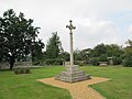 Monument at Whittington to Walsham How, 1st Bishop of Wakefield.jpg 1,600 × 1,200; 609 KB
-
 Muddy farmland - geograph.org.uk - 4468178.jpg 640 × 426; 45 KB
-
 Narrow boat moored by Pollett's Bridge - geograph.org.uk - 5976712.jpg 5,184 × 3,888; 5.48 MB
-
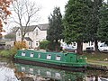 Narrow boat moored by The Narrow Boat pub - geograph.org.uk - 5976716.jpg 5,184 × 3,888; 5.78 MB
-
 Narrowboat at Frankton Junction, Shropshire - geograph.org.uk - 5251157.jpg 1,280 × 887; 972 KB
-

-
 Narrowboats moored above Frankton Locks - geograph.org.uk - 5248810.jpg 1,280 × 960; 804 KB
-
 Near Lockgate Bridge - geograph.org.uk - 2920064.jpg 640 × 480; 57 KB
-
 Nesting Coots at Whittington Castle - geograph.org.uk - 2920132.jpg 640 × 480; 82 KB
-
 Nicholas Bridge, Llangollen Canal - geograph.org.uk - 5949501.jpg 1,280 × 851; 415 KB
-
 North Drive Inglis road junction - geograph.org.uk - 2154300.jpg 640 × 480; 86 KB
-
 Oakwood Veterinary Centre - geograph.org.uk - 6060448.jpg 4,000 × 3,000; 2.85 MB
-
 Oil storage depot at Babbinswood - geograph.org.uk - 188277.jpg 640 × 480; 86 KB
-

-

-
 Old Toll House, Babbinswood - geograph.org.uk - 6114613.jpg 700 × 525; 329 KB
-
 Ordnance Survey Cut Mark - geograph.org.uk - 5234254.jpg 4,000 × 3,000; 2.61 MB
-
 Ordnance Survey Flush Bracket G3035 - geograph.org.uk - 5234247.jpg 4,000 × 3,000; 2.88 MB
-
 Ordnance Survey Flush Bracket G3036 - geograph.org.uk - 5234261.jpg 3,839 × 2,879; 1.85 MB
-
 Oswestry Boys ^ Girls Football Club - geograph.org.uk - 5929927.jpg 3,359 × 2,471; 2.39 MB
-
 Park Crescent and Inglis Road junction - geograph.org.uk - 2154297.jpg 640 × 480; 112 KB
-
 Park Hall Farm - geograph.org.uk - 647743.jpg 640 × 480; 73 KB
-
 Park Issa - geograph.org.uk - 4468206.jpg 640 × 426; 46 KB
-

-
 Pasture by Maestermyn Bridge, Shropshire - geograph.org.uk - 5252416.jpg 1,280 × 900; 1.01 MB
-
 Pasture east of Hindford, Shropshire - geograph.org.uk - 4850498.jpg 1,280 × 932; 942 KB
-
 Pasture near Lower Frankton in Shropshire - geograph.org.uk - 5461045.jpg 1,280 × 712; 792 KB
-
 Pasture near Lower Frankton, Shropshire - geograph.org.uk - 5248891.jpg 1,280 × 960; 934 KB
-
 Pasture north of Hindford in Shropshire - geograph.org.uk - 4851429.jpg 1,280 × 930; 903 KB
-
 Pasture north of Hindford in Shropshire - geograph.org.uk - 4851435.jpg 1,280 × 711; 1,017 KB
-
 Pasture south-west of Welsh Frankton, Shropshire - geograph.org.uk - 5460844.jpg 1,280 × 830; 1.03 MB
-
 Pasture west of Lower Frankton, Shropshire - geograph.org.uk - 5251536.jpg 1,280 × 856; 872 KB
-
 Pentre Clawdd Level Crossing, A5 - geograph.org.uk - 3134312.jpg 640 × 430; 67 KB
-

-
 Perry Cottages - geograph.org.uk - 2920085.jpg 640 × 480; 85 KB
-
 Perry Farm house - geograph.org.uk - 2920092.jpg 640 × 480; 93 KB
-
 Perrymoor Farm - geograph.org.uk - 2920104.jpg 640 × 480; 79 KB
-
 Pollarded tree - geograph.org.uk - 4468230.jpg 640 × 426; 99 KB
-

-
 Postbox and Road sign in Hindford - geograph.org.uk - 1911999.jpg 640 × 465; 144 KB
-
 Public footpath, heading west at bridge 73 - geograph.org.uk - 5183169.jpg 1,024 × 768; 173 KB
-
 Puddle on the lane - geograph.org.uk - 2920081.jpg 640 × 480; 91 KB
-

-
 Railway crossing the A5 - geograph.org.uk - 5507817.jpg 4,685 × 3,123; 4.46 MB
-
 Relocated gravestones, Whittington - geograph.org.uk - 6062310.jpg 4,000 × 3,000; 2.87 MB
-
 Resident at Whittington Castle pool - geograph.org.uk - 2920136.jpg 640 × 480; 120 KB
-
 River Perry at Halston Gardens - geograph.org.uk - 193950.jpg 640 × 480; 160 KB
-
 Road between Aston and Babbins Wood - geograph.org.uk - 3924446.jpg 640 × 480; 238 KB
-

-
 Road junction at Kinsall - geograph.org.uk - 4436740.jpg 640 × 320; 51 KB
-
 Road through Babbinswood - geograph.org.uk - 2086860.jpg 640 × 480; 70 KB
-
 Road, pylon, pub and canal near Welsh Frankton - geograph.org.uk - 5252624.jpg 1,280 × 847; 1.03 MB
-
 Robert Jones and Agnes Hunt Orthopaedic Hospital - geograph.org.uk - 4197980.jpg 1,600 × 1,200; 279 KB
-
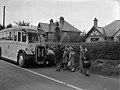 School bus dispute at Whittington (7928575150).jpg 601 × 449; 53 KB
-
 Section of disused Gobowen-Oswestry railway line - geograph.org.uk - 4197985.jpg 1,200 × 1,600; 585 KB
-
 Section of disused Gobowen-Oswestry railway line - geograph.org.uk - 4197998.jpg 1,600 × 1,200; 640 KB
-
 Sheep grazing - geograph.org.uk - 4468218.jpg 640 × 426; 47 KB
-
 Sheep pasture near Paddock Bridge - geograph.org.uk - 2919434.jpg 640 × 480; 59 KB
-
 Shropshire farmland east of Hindford - geograph.org.uk - 4678664.jpg 1,024 × 605; 434 KB
-

-
 Shropshire farmland south-west of Welsh Frankton - geograph.org.uk - 5252633.jpg 1,280 × 913; 847 KB
-
 Sign for the Jack Mytton Inn, Hindford - geograph.org.uk - 5947281.jpg 1,280 × 851; 426 KB
-
 Signpost at Hindford - geograph.org.uk - 5947462.jpg 1,280 × 851; 556 KB
-

-
 Spring comes to Whittington Pool - geograph.org.uk - 2920138.jpg 640 × 480; 56 KB
-
 St John the Baptist, Whittington - geograph.org.uk - 6062244.jpg 4,000 × 3,000; 3.04 MB
-
 Standing traffic approaching the Whittington Roundabout - geograph.org.uk - 5507837.jpg 6,000 × 4,000; 6.99 MB
-
 Stubble field east of Hindford, Shropshire - geograph.org.uk - 4849325.jpg 1,280 × 861; 974 KB
-
 Stubble field east of Hindford, Shropshire - geograph.org.uk - 4849331.jpg 1,024 × 768; 609 KB
-
 Swan nesting - geograph.org.uk - 1276219.jpg 640 × 480; 99 KB
-
 Swan Petroleum - geograph.org.uk - 5929921.jpg 4,708 × 3,406; 5.5 MB
-

-
 The A495 Ellesmere Road - geograph.org.uk - 6062324.jpg 4,000 × 3,000; 2.87 MB
-
 The A495 to Oswestry, Shropshire - geograph.org.uk - 5252420.jpg 1,280 × 724; 932 KB
-
 The B5009 - geograph.org.uk - 2534880.jpg 4,000 × 3,000; 6.04 MB
-
-
 The Big House, Whittington - geograph.org.uk - 5929941.jpg 4,786 × 3,589; 3.09 MB
-
 The Church of St John the Baptist at Whittington - geograph.org.uk - 5234258.jpg 4,000 × 3,000; 2.5 MB
-
 The hills of the Isle of Man from Curraghard - geograph.org.uk - 4247757.jpg 1,600 × 1,200; 150 KB
-
 The Jack Mytton Inn, Hindford - geograph.org.uk - 5947566.jpg 1,280 × 851; 429 KB


_-_some_typical_traffic_around_Oswestry_-_geograph.org.uk_-_2248788.jpg)
_approaching_the_A495_roundabout_-_geograph.org.uk_-_2248791.jpg)
_at_Pentre_Clawdd_level_crossing_-_geograph.org.uk_-_2248803.jpg)
_in_cutting_north_of_Middleton_Road_-_geograph.org.uk_-_2248780.jpg)
_near_Park_Hall_-_geograph.org.uk_-_2248794.jpg)


.jpg)


.jpg)


.jpg)


