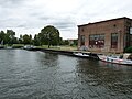
Category:Wiemannwerft Brandenburg
| Object location | | View all coordinates using: OpenStreetMap |
|---|
 | |||||
| Upload media | |||||
| Instance of | |||||
|---|---|---|---|---|---|
| Location | Brandenburg an der Havel, Brandenburg, Germany | ||||
| Heritage designation | |||||
 | |||||
This is the category of the Brandenburger Baudenkmal (cultural heritage monument) with the ID 09145446 (Wikidata)
|
Media in category "Wiemannwerft Brandenburg"
The following 4 files are in this category, out of 4 total.
-
 Historischer Hafen Brandenburg.JPG 3,648 × 2,736; 3.95 MB
-
 Werft brandenburg.JPG 2,816 × 2,112; 1.46 MB
-
 Werft Brandenburg.jpg 3,648 × 2,736; 5.74 MB
-
 Wiemannwerft Brandenburg.JPG 2,560 × 1,920; 2.33 MB


