Category:Willersley and Winforton
civil parish in Herefordshire, England | |||||
| Upload media | |||||
| Instance of | |||||
|---|---|---|---|---|---|
| Location | Herefordshire, West Midlands, England | ||||
 | |||||
Subcategories
This category has the following 2 subcategories, out of 2 total.
W
Media in category "Willersley and Winforton"
The following 52 files are in this category, out of 52 total.
-

-
 1856 Willersley & Winforton Post Office Directory of Herefordshire pp.101-2.jpg 1,130 × 469; 487 KB
-

-
 1885 Willersley and Winforton Kelly's Directory of Herefordshire pp.1246-47.jpg 1,200 × 886; 942 KB
-
 Willersley and Winforton Herefordshire OS Sheet XXIV.SE, Surveyed and published 1886.jpg 4,672 × 3,292; 5.87 MB
-

-
-

-
 1913 Willersley & Winforton Kelly's Directory of Herefordshire pp.205-06.jpg 1,219 × 1,021; 1.06 MB
-
 A Winforton Churchyard Yew - geograph.org.uk - 5367526.jpg 960 × 1,439; 833 KB
-
 A438 between Winforton and Willersley - geograph.org.uk - 4822918.jpg 1,600 × 901; 704 KB
-
 Arable land at Winforton - geograph.org.uk - 2783747.jpg 1,024 × 680; 236 KB
-
 Arable land in the Wye valley - geograph.org.uk - 2783609.jpg 1,024 × 680; 239 KB
-
 Arable land north of the A438 - geograph.org.uk - 4822908.jpg 1,600 × 901; 729 KB
-
 Art by St. Michael's Church (Altar ^ Winforton) - geograph.org.uk - 6303377.jpg 3,648 × 2,736; 2.62 MB
-
 Bend in the A438, 1 - geograph.org.uk - 4822896.jpg 1,600 × 901; 576 KB
-
 Bend in the A438, 2 - geograph.org.uk - 4822904.jpg 1,600 × 901; 574 KB
-
 Boathouse - geograph.org.uk - 4607611.jpg 3,089 × 2,048; 2.79 MB
-
 Cattle grid entrance to meadowland - geograph.org.uk - 2783758.jpg 1,024 × 680; 193 KB
-
 Entrance Gates to St. Michael's Church (Winforton) - geograph.org.uk - 6303402.jpg 3,648 × 2,736; 4.94 MB
-
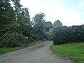 Lane by St. Michael's Church (Winforton) - geograph.org.uk - 6303405.jpg 3,648 × 2,736; 4.44 MB
-
 Memorial of William Domvile (Winforton) - geograph.org.uk - 6301678.jpg 3,648 × 2,736; 2.66 MB
-
 Milestone near Winforton - geograph.org.uk - 2784126.jpg 680 × 1,024; 296 KB
-
 Old Airfield Hangar - geograph.org.uk - 1544884.jpg 640 × 431; 93 KB
-
 Ordnance Survey 1GL Bolt - geograph.org.uk - 4758269.jpg 640 × 480; 123 KB
-
 Plaque inside St. Michael's Church (Nave ^ Winforton) - geograph.org.uk - 6300455.jpg 3,648 × 2,736; 3.05 MB
-
 Rainwater lake - geograph.org.uk - 4822353.jpg 1,600 × 901; 696 KB
-
 St. Michael's Church (Bell Tower ^ Winforton) - geograph.org.uk - 6300201.jpg 2,056 × 3,648; 3.57 MB
-
 St. Michael's Church (Bell Tower ^ Winforton) - geograph.org.uk - 6300319.jpg 2,736 × 3,648; 4.7 MB
-
 St. Michael's Church (Chancel ^ Winforton) - geograph.org.uk - 6303344.jpg 3,648 × 2,736; 3.26 MB
-
 St. Michael's Church (Font ^ Winforton) - geograph.org.uk - 6303354.jpg 3,648 × 2,736; 3.09 MB
-
 St. Michael's Church (Nave ^ Winforton) - geograph.org.uk - 6303348.jpg 3,648 × 2,736; 2.58 MB
-
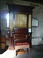 St. Michael's Church (Organ ^ Winforton) - geograph.org.uk - 6303341.jpg 2,736 × 3,648; 3.29 MB
-
 St. Michael's Church (Organ ^ Winforton) - geograph.org.uk - 6303385.jpg 2,736 × 3,648; 3.27 MB
-
 St. Michael's Church (Porch ^ Winforton) - geograph.org.uk - 6300206.jpg 3,648 × 2,736; 4.7 MB
-
 St. Michael's Church (Porch ^ Winforton) - geograph.org.uk - 6300217.jpg 3,648 × 2,736; 4.62 MB
-
 St. Michael's Church (Pulpit ^ Winforton) - geograph.org.uk - 6300711.jpg 3,648 × 2,736; 2.76 MB
-
 St. Michael's Church (Reredos ^ Winforton) - geograph.org.uk - 6303363.jpg 3,648 × 2,736; 2.55 MB
-
 St. Michael's Church (Screen ^ Winforton) - geograph.org.uk - 6300636.jpg 3,648 × 2,736; 2.49 MB
-
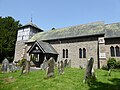
 St. Michael's Church (Winforton) - geograph.org.uk - 6300330.jpg 3,648 × 2,056; 2.53 MB
-
 St. Michael's Church (Winforton) - geograph.org.uk - 6303397.jpg 3,648 × 2,736; 4.32 MB
-
 The A438 and milestone - geograph.org.uk - 2784128.jpg 1,024 × 680; 241 KB
-
 The A438 near Winforton - geograph.org.uk - 2784124.jpg 1,024 × 680; 196 KB
-
 The Sun Inn (3) - beer garden, Winforton, Herefs - geograph.org.uk - 4701600.jpg 1,024 × 683; 209 KB
-
 Timber-framed building in Winforton - geograph.org.uk - 3943125.jpg 4,320 × 3,240; 3.78 MB
-
 Track to Winforton Woods - geograph.org.uk - 378192.jpg 640 × 480; 82 KB
-
 Trees by St. Michael's Church (Winforton) - geograph.org.uk - 6303387.jpg 3,648 × 2,736; 4.12 MB
-
 Window inside St. Michael's Church (Nave ^ Winforton) - geograph.org.uk - 6300437.jpg 3,648 × 2,736; 2.92 MB
-

-
 Winforton, St Michael - geograph.org.uk - 6361570.jpg 4,000 × 3,000; 4.49 MB
-
 Yew Tree at St. Michael's Church (Winforton) - geograph.org.uk - 6300279.jpg 3,648 × 2,736; 4.78 MB
-
 Bridleway down to the river - geograph.org.uk - 378185.jpg 640 × 480; 118 KB
.jpg)


.jpg)


_-_geograph.org.uk_-_6303377.jpg)


_-_geograph.org.uk_-_6303402.jpg)
_-_geograph.org.uk_-_6303405.jpg)
_-_geograph.org.uk_-_6301678.jpg)


_-_geograph.org.uk_-_6300455.jpg)

_-_geograph.org.uk_-_6300201.jpg)
_-_geograph.org.uk_-_6300319.jpg)
_-_geograph.org.uk_-_6303344.jpg)
_-_geograph.org.uk_-_6303354.jpg)
_-_geograph.org.uk_-_6303348.jpg)
_-_geograph.org.uk_-_6303341.jpg)
_-_geograph.org.uk_-_6303385.jpg)
_-_geograph.org.uk_-_6300206.jpg)
_-_geograph.org.uk_-_6300217.jpg)
_-_geograph.org.uk_-_6300711.jpg)
_-_geograph.org.uk_-_6303363.jpg)
_-_geograph.org.uk_-_6300636.jpg)
_-_geograph.org.uk_-_6300330.jpg)
_-_geograph.org.uk_-_6303397.jpg)


_-_beer_garden,_Winforton,_Herefs_-_geograph.org.uk_-_4701600.jpg)


_-_geograph.org.uk_-_6303387.jpg)
_-_geograph.org.uk_-_6300437.jpg)
_-_geograph.org.uk_-_6300617.jpg)

_-_geograph.org.uk_-_6300279.jpg)
