Category:Wisconsin in the 1950s
States of the United States: Alabama · Alaska · Arizona · Arkansas · California · Colorado · Connecticut · Delaware · Florida · Georgia · Hawaii · Idaho · Illinois · Indiana · Iowa · Kansas · Kentucky · Louisiana · Maine · Maryland · Massachusetts · Michigan · Minnesota · Mississippi · Missouri · Montana · Nebraska · Nevada · New Hampshire · New Jersey · New Mexico · New York · North Carolina · North Dakota · Ohio · Oklahoma · Oregon · Pennsylvania · Rhode Island · South Carolina · South Dakota · Tennessee · Texas · Utah · Vermont · Virginia · Washington · West Virginia · Wisconsin · Wyoming – Washington, D.C.
American Samoa · Guam · Northern Mariana Islands · Puerto Rico · United States Virgin Islands – Midway Atoll · Wake Island
American Samoa · Guam · Northern Mariana Islands · Puerto Rico · United States Virgin Islands – Midway Atoll · Wake Island
Wikimedia category | |||||
| Upload media | |||||
| Instance of | |||||
|---|---|---|---|---|---|
| Category combines topics | |||||
| Follows | |||||
| Followed by | |||||
| Wisconsin | |||||
state of the United States of America      | |||||
| Pronunciation audio | |||||
| Instance of | |||||
| Part of | |||||
| Named after | |||||
| Location |
| ||||
| Located in or next to body of water | |||||
| Capital | |||||
| Legislative body | |||||
| Executive body | |||||
| Highest judicial authority | |||||
| Anthem |
| ||||
| Head of government |
| ||||
| Inception |
| ||||
| Highest point | |||||
| Population |
| ||||
| Area |
| ||||
| Elevation above sea level |
| ||||
| Maximum temperature record |
| ||||
| Minimum temperature record |
| ||||
| official website | |||||
 | |||||
Subcategories
This category has the following 13 subcategories, out of 13 total.
*
N
Media in category "Wisconsin in the 1950s"
The following 34 files are in this category, out of 34 total.
-
 1931 WI Cong 01.svg 245 × 262; 43 KB
-
 1931 WI Cong 02.svg 245 × 262; 43 KB
-
 1931 WI Cong 03.svg 245 × 262; 43 KB
-
 1931 WI Cong 04.svg 245 × 262; 43 KB
-
 1931 WI Cong 05.svg 245 × 262; 43 KB
-
 1931 WI Cong 06.svg 245 × 262; 43 KB
-
 1931 WI Cong 07.svg 245 × 262; 43 KB
-
 1931 WI Cong 08.svg 245 × 262; 43 KB
-
 1931 WI Cong 09.svg 245 × 262; 43 KB
-
 1931 WI Cong 10.svg 245 × 262; 43 KB
-
 GeneMonclaT33atTruaxField.jpg 597 × 741; 146 KB
-
 Milwaukee, Wisconsin 1955 Yellow Book.jpg 800 × 1,020; 326 KB
-
 WI Assembly 1951.svg 360 × 185; 6 KB
-
 WI Assembly 1955.svg 360 × 185; 6 KB
-
 WI Assembly 1957.svg 360 × 185; 6 KB
-
 WI Assembly 1959.svg 360 × 185; 6 KB
-
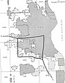
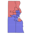 WI Assembly Partisan Map 1951 MilwaukeeCo.svg 471 × 502; 29 KB
-
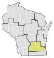
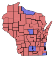 WI Assembly Partisan Map 1951.svg 245 × 262; 76 KB
-
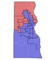
 WI Assembly Partisan Map 1953 MilwaukeeCo.svg 471 × 502; 30 KB
-
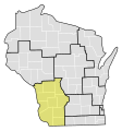
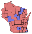
 WI Assembly Partisan Map 1953.svg 245 × 262; 76 KB
-
 WI Assembly Partisan Map 1955 MilwaukeeCo.svg 471 × 502; 34 KB
-
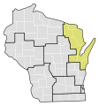
 WI Assembly Partisan Map 1955.svg 245 × 262; 75 KB
-
 WI Assembly Partisan Map 1957 MilwaukeeCo.svg 471 × 502; 34 KB
-
 WI Assembly Partisan Map 1957.svg 245 × 262; 75 KB
-
 WI Assembly Partisan Map 1959 MilwaukeeCo.svg 471 × 502; 36 KB
-
 WI Assembly Partisan Map 1959.svg 245 × 262; 75 KB
-
 WI Senate 1951.svg 360 × 185; 3 KB
-
 WI Senate 1955.svg 360 × 185; 3 KB
-
 WI Senate 1957.svg 360 × 185; 3 KB
-
 WI Senate 1959.svg 360 × 185; 3 KB
-
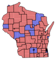
 WI Senate Partisan Map 1951.svg 245 × 262; 52 KB
-
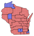
 WI Senate Partisan Map 1955.svg 245 × 262; 51 KB
-
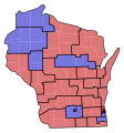
 WI Senate Partisan Map 1957.svg 245 × 262; 51 KB
-
 WI Senate Partisan Map 1959.svg 245 × 262; 51 KB


