Category:Wohnhaus Karl Band, Köln
| Object location | | View all coordinates using: OpenStreetMap |
|---|
This is the category for an architectural monument.
It is on the list of cultural monuments of Köln, no. 6990.
It is on the list of cultural monuments of Köln, no. 6990.
.jpg) | |||||
| Upload media | |||||
| Instance of | |||||
|---|---|---|---|---|---|
| Location | Altstadt-Nord, Cologne-Innenstadt, Cologne, Cologne Government Region, North Rhine-Westphalia, Germany | ||||
| Architect | |||||
| Heritage designation | |||||
 | |||||
Media in category "Wohnhaus Karl Band, Köln"
The following 5 files are in this category, out of 5 total.
-
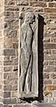 Kunibertsklostergasse 1 Relief Eingangstür.jpg 1,484 × 2,829; 2.08 MB
-
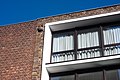 Kunibertsklostergasse 1-3 Details Fassade.jpg 3,888 × 2,592; 2.91 MB
-
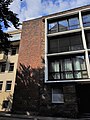 Kunibertsklostergasse 3.jpg 3,024 × 4,032; 3.08 MB
-
 Wohnhaus Kunibertsklostergasse 1 Köln (8509-11).jpg 3,200 × 2,200; 2.62 MB
-
 Wohnhaus Kunibertsklostergasse 1, KAP-Plakette - 8064.jpg 6,000 × 4,000; 14.12 MB


