Category:Wrinehill
English: Wrinehill, is a village in the civil parish of Betley in north-west Staffordshire, England, and on the A531 road lying adjacent to the southern border of Cheshire in the Borough of Newcastle-under-Lyme. For many years it was claimed by both counties but reportedly came under official Staffordshire administration in 1965. It lies 1 mile south of and forms a continuous linear settlement with Betley.
village in the United Kingdom  | |||||
| Upload media | |||||
| Instance of | |||||
|---|---|---|---|---|---|
| Location | Betley, Newcastle-under-Lyme, Staffordshire, West Midlands, England | ||||
 | |||||
Media in category "Wrinehill"
The following 16 files are in this category, out of 16 total.
-
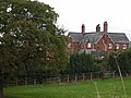
 Adderley Green Farm - geograph.org.uk - 545359.jpg 640 × 480; 101 KB
-
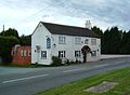 Blue bell inn.JPG 1,892 × 1,390; 399 KB
-
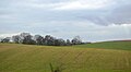
 Cheshire Plains - geograph.org.uk - 4967548.jpg 640 × 340; 35 KB
-
 Looking west along the A531 - geograph.org.uk - 549291.jpg 640 × 480; 96 KB
-
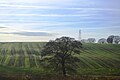
 Rolling countryside - geograph.org.uk - 4967545.jpg 640 × 353; 31 KB
-
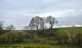
 Rolling countryside - geograph.org.uk - 5349625.jpg 640 × 426; 48 KB
-
 Ruined Building near Bowseywood Farm - geograph.org.uk - 598116.jpg 640 × 400; 109 KB
-
 Small wooded quarry - geograph.org.uk - 4967546.jpg 640 × 376; 42 KB
-
 The Summer House on Main Road, Wrinehill, Staffordshire.jpg 640 × 427; 135 KB
-
 Wrinehill Summerhouse.jpg 1,361 × 1,098; 278 KB
-

-
 A few miles to go - geograph.org.uk - 153405.jpg 640 × 480; 142 KB
-
 A quiet road - geograph.org.uk - 153345.jpg 640 × 480; 78 KB
-
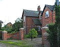
 Checkley - The Grange - geograph.org.uk - 275754.jpg 639 × 480; 149 KB
-
 Heighley Castle - geograph.org.uk - 236153.jpg 640 × 427; 170 KB
-
 Yew Tree Farm, Blakenhall - geograph.org.uk - 249678.jpg 640 × 503; 171 KB


