Category:Wrockwardine Wood and Trench
English: Wrockwardine Wood and Trench is a civil parish in the Telford and Wrekin district, in the county of Shropshire, England.

civil parish in Telford and Wrekin, Shropshire, England | |||||
| Upload media | |||||
| Instance of | |||||
|---|---|---|---|---|---|
| Location | Telford and Wrekin, Shropshire, West Midlands, England | ||||
 | |||||
Subcategories
This category has the following 2 subcategories, out of 2 total.
T
W
Media in category "Wrockwardine Wood and Trench"
The following 45 files are in this category, out of 45 total.
-

-

-

-
 Biddulph Park Place, Oakengates - geograph.org.uk - 2503257.jpg 640 × 468; 69 KB
-
 Bridleway and track crossing in Cockshutt woods - geograph.org.uk - 2233228.jpg 1,296 × 972; 551 KB
-
 Cockshutt woods trig point - geograph.org.uk - 2233233.jpg 972 × 1,296; 497 KB
-
 Friendly locals at The Dun Cow - geograph.org.uk - 3024388.jpg 986 × 1,186; 299 KB
-
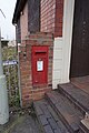 George VI postbox - geograph.org.uk - 4893065.jpg 799 × 1,200; 326 KB
-
 Granville roundabout - geograph.org.uk - 5265657.jpg 1,469 × 1,102; 418 KB
-
 Granville Roundabout - geograph.org.uk - 6236080.jpg 800 × 600; 85 KB
-
 Hortonwood Industrial Estate - geograph.org.uk - 3024421.jpg 1,338 × 1,004; 315 KB
-
 Industrial units on Hortonwood Park - geograph.org.uk - 3024415.jpg 1,240 × 930; 302 KB
-

-

-

-
 Old Meets New - geograph.org.uk - 827085.jpg 640 × 480; 99 KB
-
 OS flush bracket G9620 - Trench - geograph.org.uk - 4161516.jpg 857 × 1,142; 508 KB
-
 Relaid Railway Track, Trench Crossing - geograph.org.uk - 1261832.jpg 640 × 480; 378 KB
-

-
 Teagues Crescent and Wombridge Road - geograph.org.uk - 2320371.jpg 1,280 × 960; 322 KB
-
 The 'Blue Pig', Trench, Shropshire - geograph.org.uk - 645422.jpg 640 × 551; 58 KB
-

-
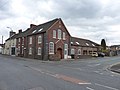 The Bethesda Primitive Methodist Chapel, Trench - geograph.org.uk - 2317122.jpg 1,280 × 960; 306 KB
-
 The Bull's Head Inn, Wrockwardine Wood - geograph.org.uk - 6004659.jpg 3,264 × 2,448; 1.99 MB
-
 The former Trench Tavern - geograph.org.uk - 5065831.jpg 1,306 × 979; 376 KB
-
 The line into the Telford Railfreight Terminal - geograph.org.uk - 3024412.jpg 857 × 1,142; 341 KB
-
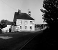
 The Old Mill - geograph.org.uk - 2320365.jpg 1,280 × 960; 301 KB
-
 The Old Shawbirch - geograph.org.uk - 4893045.jpg 1,200 × 799; 272 KB
-
 The Old Shawbirch - geograph.org.uk - 4893048.jpg 1,200 × 799; 260 KB
-
 The Old Shawbirch - geograph.org.uk - 4893050.jpg 1,045 × 1,200; 430 KB
-
 The Old Shawbirch pub - geograph.org.uk - 3024386.jpg 1,306 × 979; 335 KB
-
 The Rectory, Wrockwardine Wood - geograph.org.uk - 6004650.jpg 2,611 × 1,958; 2.21 MB
-
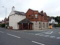
 The Red Lion, Wrockwardine Wood - geograph.org.uk - 981856.jpg 640 × 480; 67 KB
-
 The White Horse - geograph.org.uk - 2320339.jpg 1,280 × 960; 295 KB
-
 Trench Pool - geograph.org.uk - 1354506.jpg 640 × 532; 64 KB
-
 Trench Pool Bank - geograph.org.uk - 1352088.jpg 640 × 564; 92 KB
-
 Trench Pool, Shropshire - geograph.org.uk - 481557.jpg 640 × 536; 196 KB
-
 Trench Tavern - geograph.org.uk - 1174085.jpg 640 × 386; 336 KB
-
 White Horse Tavern looking from rear of pub - geograph.org.uk - 5252086.jpg 3,664 × 2,748; 2.56 MB
-
 White Horse Tavern Wrockwardine Wood Telford - geograph.org.uk - 5252070.jpg 3,664 × 2,748; 2.26 MB
-
 White Horse Tavern Wrockwardine Wood Telford - geograph.org.uk - 5252077.jpg 3,664 × 2,748; 2.55 MB
-

-
 Teagues Bridge, Trench, Shropshire - geograph.org.uk - 334624.jpg 640 × 522; 108 KB
-

-


