Category:Yu Ji Tu
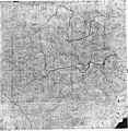
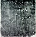
A 12th-century map of China and its waterways preserved on a Xi'an stele, the first to use the Chinese cartographic style of 100-li squares for drafting and location  | |||||
| Upload media | |||||
| Instance of | |||||
|---|---|---|---|---|---|
| Depicts | China, Yellow River, Huai River, Yangtze, Pearl River and Grand Canal | ||||
| Location | Xi'an, Shaanxi | ||||
| Collection | |||||
| |||||
Map of the 11th/12th century, named after Category:Yu the Great
Media in category "Yu Ji Tu"
The following 7 files are in this category, out of 7 total.
-
 Yuji tu - BEFEO.png 4,747 × 5,349; 8.47 MB
-
 Yuji tu - enhanced contrast.png 9,849 × 10,117; 2.77 MB
-
 Pearl River Yujitu (cropped).png 640 × 800; 87 KB
-
 Pearl River Yujitu.png 693 × 849; 147 KB
-
 Yu-ji-tu-map.jpg 1,232 × 1,265; 752 KB
-
 Song Dynasty Map.JPG 756 × 768; 436 KB
-
 Yu Chi Thu.jpg 507 × 646; 198 KB

.png)


