Name
Heritage list
Place
Street address
Coordinates
place_id
Image
Adelaide General Post Office (Q38162479 )
Commonwealth
Adelaide
34°55′37″S 138°35′58″E / 34.926906°S 138.599323°E / -34.926906; 138.599323
Australian Cornish Mining Sites: Burra (Q38166058 )
National
Burra
33°40′36″S 138°55′51″E / 33.6767°S 138.9309°E / -33.6767; 138.9309
Australian Cornish Mining Sites: Moonta (Q38154455 )
National
34°04′29″S 137°36′24″E / 34.0746°S 137.6066°E / -34.0746; 137.6066
Australian Fossil Mammal Sites (Naracoorte) (Q38163848 )
National
Naracoorte
37°03′36″S 140°48′35″E / 37.059995°S 140.809836°E / -37.059995; 140.809836
Cape Northumberland Lighthouse (Q38164440 )
Commonwealth
Port MacDonnell
38°03′23″S 140°40′03″E / 38.056365°S 140.66739°E / -38.056365; 140.66739
Cape St Albans lighthouse (Q28211308 )
Commonwealth
Cape St AlbansPenneshaw
35°48′13″S 138°07′29″E / 35.8036°S 138.1248°E / -35.8036; 138.1248 35°48′14″S 138°07′32″E / 35.803858°S 138.125429°E / -35.803858; 138.125429
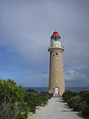
Cape du Couedic Lighthouse (Q15207441 )
Commonwealth
Parndana
36°03′29″S 136°42′19″E / 36.057944444444°S 136.70516666667°E / -36.057944444444; 136.70516666667 36°03′31″S 136°42′16″E / 36.058649°S 136.704311°E / -36.058649; 136.704311
Great Artesian Basin Springs: Witjira-Dalhousie (Q38164677 )
National
Oodnadatta
26°30′47″S 135°28′00″E / 26.5131°S 135.4667°E / -26.5131; 135.4667
Headquarters Building 32, Keswick Barracks (Q38161218 )
Commonwealth
Keswick
34°56′38″S 138°34′57″E / 34.943824°S 138.582398°E / -34.943824; 138.582398
Koonalda Cave (Q38155743 )
National
Cook
31°24′11″S 129°50′13″E / 31.403°S 129.837°E / -31.403; 129.837
Murray Mallee - Calperum Station and Taylorville Station (Q38152210 )
Commonwealth
Renmark
33°49′49″S 140°28′03″E / 33.830207°S 140.467574°E / -33.830207; 140.467574
North Adelaide Post Office (Q38153359 )
Commonwealth
North Adelaide
34°54′22″S 138°35′38″E / 34.906003°S 138.593999°E / -34.906003; 138.593999 34°54′22″S 138°35′38″E / 34.906°S 138.594°E / -34.906; 138.594
Parafield Airport Air Traffic Control Tower (Q38167266 )
Commonwealth
Parafield
34°47′27″S 138°38′11″E / 34.790791°S 138.636261°E / -34.790791; 138.636261
Port Pirie Post Office (Q38155309 )
Commonwealth
Port Pirie
33°10′34″S 138°00′38″E / 33.1761°S 138.010496°E / -33.1761; 138.010496
Renmark Post Office (Q38156732 )
Commonwealth
Renmark
34°10′14″S 140°45′00″E / 34.170521°S 140.750112°E / -34.170521; 140.750112
South Australian Old and New Parliament Houses (Q38165474 )
National
34°55′16″S 138°35′55″E / 34.921133°S 138.598629°E / -34.921133; 138.598629
Strathalbyn Post Office (Q38161382 )
Commonwealth
Strathalbyn
35°15′33″S 138°53′25″E / 35.25916°S 138.890206°E / -35.25916; 138.890206
The Adelaide Park Lands and City Layout (Q38165097 )
National
34°54′52″S 138°36′36″E / 34.9145°S 138.6101°E / -34.9145; 138.6101
The Burke, Wills, King and Yandruwandha National Heritage Place (Q38141164 )
National
27°42′00″S 140°50′10″E / 27.7°S 140.836°E / -27.7; 140.836
![]() , or
, or ![]() if there is already an image, then follow the instructions. To add an uploaded image to the list follow the Wikidata link and add the image (property P18). Then wait for the list to be updated or click on "Manually update list".
if there is already an image, then follow the instructions. To add an uploaded image to the list follow the Wikidata link and add the image (property P18). Then wait for the list to be updated or click on "Manually update list".


