File:חלר מהמתקן החקלאי בשטח G באושא העתיקה ברקע כביש 70.jpg

Size of this preview: 479 × 600 pixels. Other resolutions: 192 × 240 pixels | 383 × 480 pixels | 613 × 768 pixels | 817 × 1,024 pixels | 1,635 × 2,048 pixels | 2,994 × 3,750 pixels.
Original file (2,994 × 3,750 pixels, file size: 4.33 MB, MIME type: image/jpeg)
Captions
Captions
Add a one-line explanation of what this file represents
Summary edit
| Description |
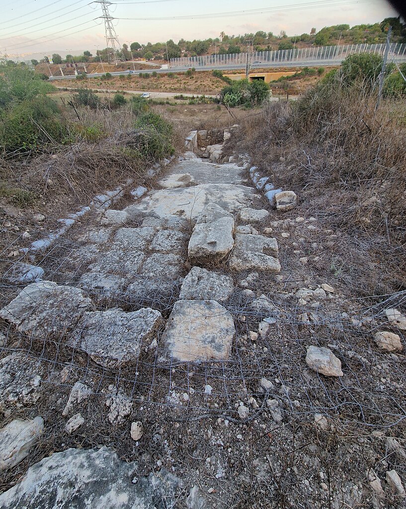
עברית: אושא הייתה עיר יהודית חשובה שהגיעה לשיאה בתקופת המשנה ותחילת תקופת התלמוד, בין המאה ה-1 לבין המאה ה-4 לספירה. העיר שכנה באזור הגליל התחתון, באזור שבין קריית אתא לשפרעם, סמוך לכביש 70 של היום. היא שימשה כמקום מושבה של הסנהדרין במשך כ-10 שנים. התמונה משטח החפירה G המשקיף על כביש 70 הכולל מתקן חקלאי גדול עם בתי בדף גתות ומקווה טהרה שהפך למקלט בתקופה מאוחרת יותר. הגישה אל השטח חסומה בגדר. התמונה צולמה במסגרת סיור מודרך של רשות העתיקות באתר |
| Date | |
| Source | Own work |
| Author | Hanay |
Licensing edit
I, the copyright holder of this work, hereby publish it under the following license:
This file is licensed under the Creative Commons Attribution-Share Alike 3.0 Unported license.
- You are free:
- to share – to copy, distribute and transmit the work
- to remix – to adapt the work
- Under the following conditions:
- attribution – You must give appropriate credit, provide a link to the license, and indicate if changes were made. You may do so in any reasonable manner, but not in any way that suggests the licensor endorses you or your use.
- share alike – If you remix, transform, or build upon the material, you must distribute your contributions under the same or compatible license as the original.
File history
Click on a date/time to view the file as it appeared at that time.
| Date/Time | Thumbnail | Dimensions | User | Comment | |
|---|---|---|---|---|---|
| current | 14:16, 31 July 2023 | | 2,994 × 3,750 (4.33 MB) | Hanay (talk | contribs) | Cropped 6 % horizontally, < 1 % vertically using CropTool with precise mode. |
| 08:08, 31 July 2023 |  | 3,000 × 4,000 (5.24 MB) | Hanay (talk | contribs) | Uploaded own work with UploadWizard |
You cannot overwrite this file.
File usage on Commons
There are no pages that use this file.