File:(Decennial) Census of Population and Housing, 2010- Reference Map for American Indians and Alaska Natives Areas in the United States, 2010 - DPLA - 97a2040ee190ac083cdfa4aa3c628681.pdf

Size of this JPG preview of this PDF file: 800 × 600 pixels. Other resolutions: 320 × 240 pixels | 640 × 480 pixels | 1,024 × 768 pixels | 1,280 × 960 pixels | 2,560 × 1,920 pixels | 7,200 × 5,400 pixels.
Original file (7,200 × 5,400 pixels, file size: 5.17 MB, MIME type: application/pdf)
Captions
Captions
Add a one-line explanation of what this file represents
Summary
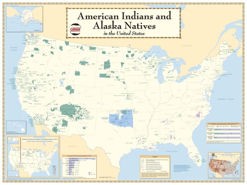
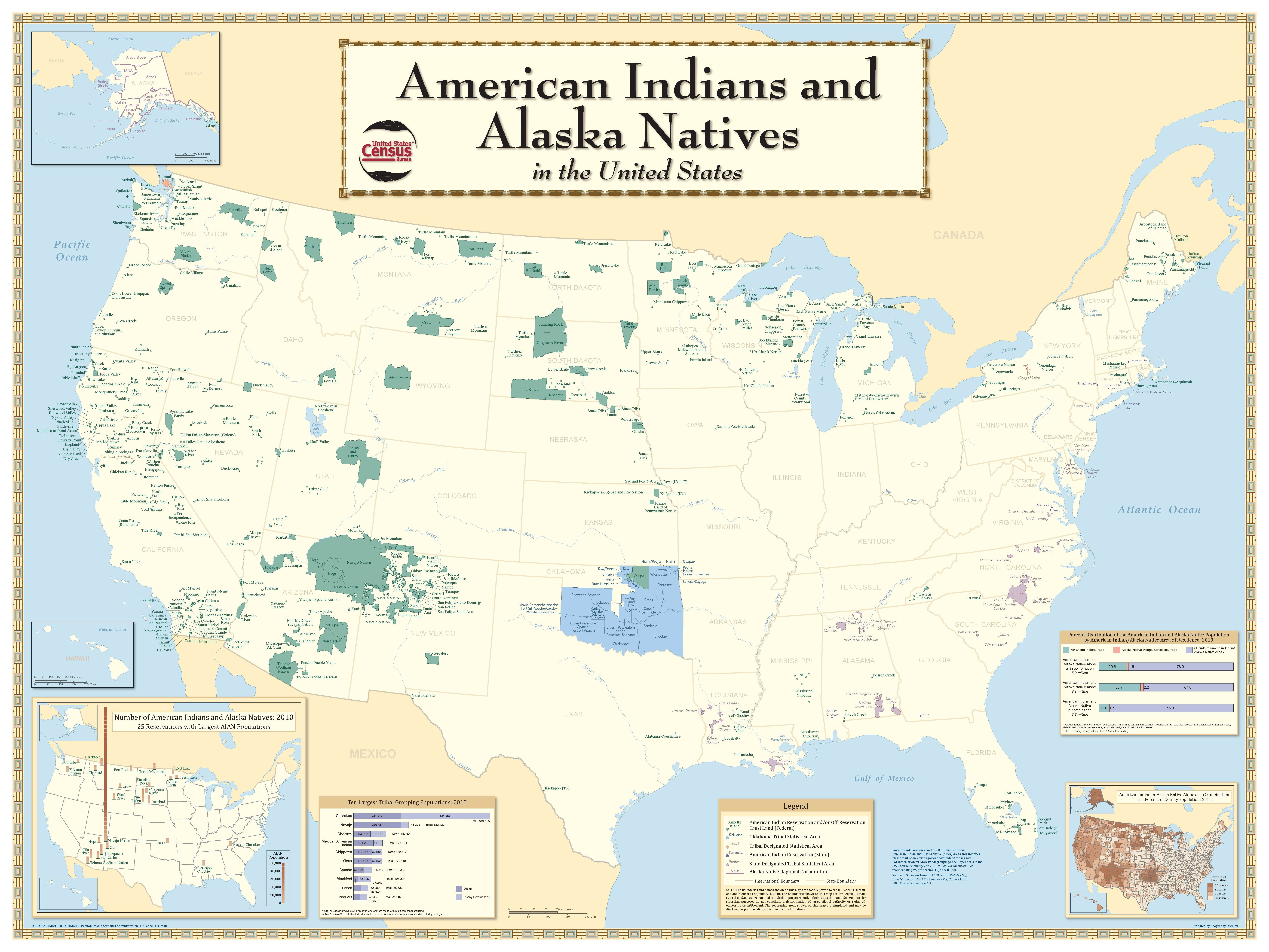
edit| [Decennial] Census of Population and Housing, 2010: Reference Map for American Indians and Alaska Natives Areas in the United States, 2010
( |
||||||||||||||
|---|---|---|---|---|---|---|---|---|---|---|---|---|---|---|
| Creator | Department of Commerce. Bureau of the Census. Office of the Associate Director for Decennial Census. Geography Division. (1/1987 - 7/15/2011) | |||||||||||||
| Title |
[Decennial] Census of Population and Housing, 2010: Reference Map for American Indians and Alaska Natives Areas in the United States, 2010 |
|||||||||||||
| Collection |
|
|||||||||||||
| Source/Photographer |
|
|||||||||||||
| Permission (Reusing this file) |
|
|||||||||||||
| Standardized rights statement |
|
|||||||||||||


File history
Click on a date/time to view the file as it appeared at that time.
| Date/Time | Thumbnail | Dimensions | User | Comment | |
|---|---|---|---|---|---|
| current | 23:27, 9 November 2022 |  | 7,200 × 5,400 (5.17 MB) | DPLA bot (talk | contribs) | Uploading DPLA ID 97a2040ee190ac083cdfa4aa3c628681 |
You cannot overwrite this file.
File usage on Commons
The following page uses this file: