File:(mapa)ElevadorMunicípio.png

Original file (621 × 621 pixels, file size: 197 KB, MIME type: image/png)
Captions
Captions
Summary
editElevadorMunic%C3%ADpio.png&action=edit§ion=1)
| Description |
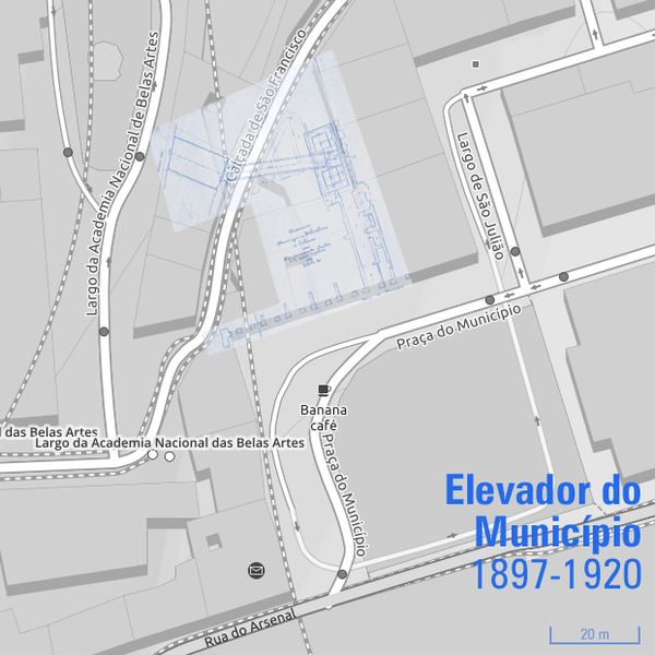
Português: Área de implantação do Elevador do Município (1897-1920), em Lisboa, Portugal, sobre mapa de 2019. |
| Date |
|
| Source | |
| Author |
|
| Permission (Reusing this file) |
Open Street Map copyright See below. |
| 1st uploaded as the | 52,644,126th file in Wikimedia Commons |
| Object location | | View this and other nearby images on: OpenStreetMap |
|---|
ElevadorMunic%C3%ADpio.png¶ms=038.708390_N_-009.139850_E_globe:Earth_class:object_type:object__&language=en)
Licensing
editElevadorMunic%C3%ADpio.png&action=edit§ion=2)
|
This work is in the public domain in its country of origin and other countries and areas where the copyright term is the author's life plus 70 years or fewer.
| |
| This file has been identified as being free of known restrictions under copyright law, including all related and neighboring rights. | |
| This work is licensed under the Open Database License (summary). |
File history
Click on a date/time to view the file as it appeared at that time.
| Date/Time | Thumbnail | Dimensions | User | Comment | |
|---|---|---|---|---|---|
| current | 17:19, 12 March 2019 | | 621 × 621 (197 KB) | Tuvalkin (talk | contribs) | == {{int:filedesc}} == {{Information | description = {{pt|Área de implantação do Elevador do Município (1897-1920), em Lisboa, Portugal, sobre mapa de 2019.}} | source = * File:Elevsjuliao2.JPG * https://www.openstreetmap.org/#map=19/38.70839/-9.13985&layers=C | date = * 1897 * 2019.03.12 | author = * {{user|Tuvalkin}} * Category:Raul Ponsard * Open Street Map | permission = {{see below}} | other_versions= | other_fields={{Information_field... |
ElevadorMunic%C3%ADpio.png#Lic)
You cannot overwrite this file.
File usage on Commons
The following 2 pages use this file:
ElevadorMunicípio.png&oldid=734429248)