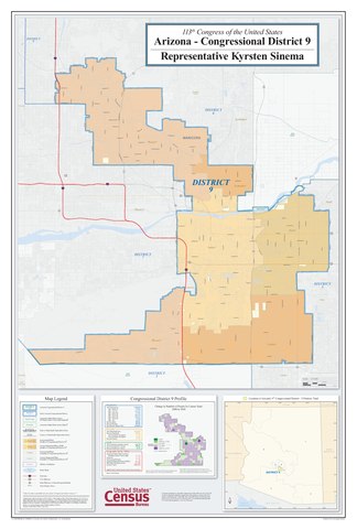
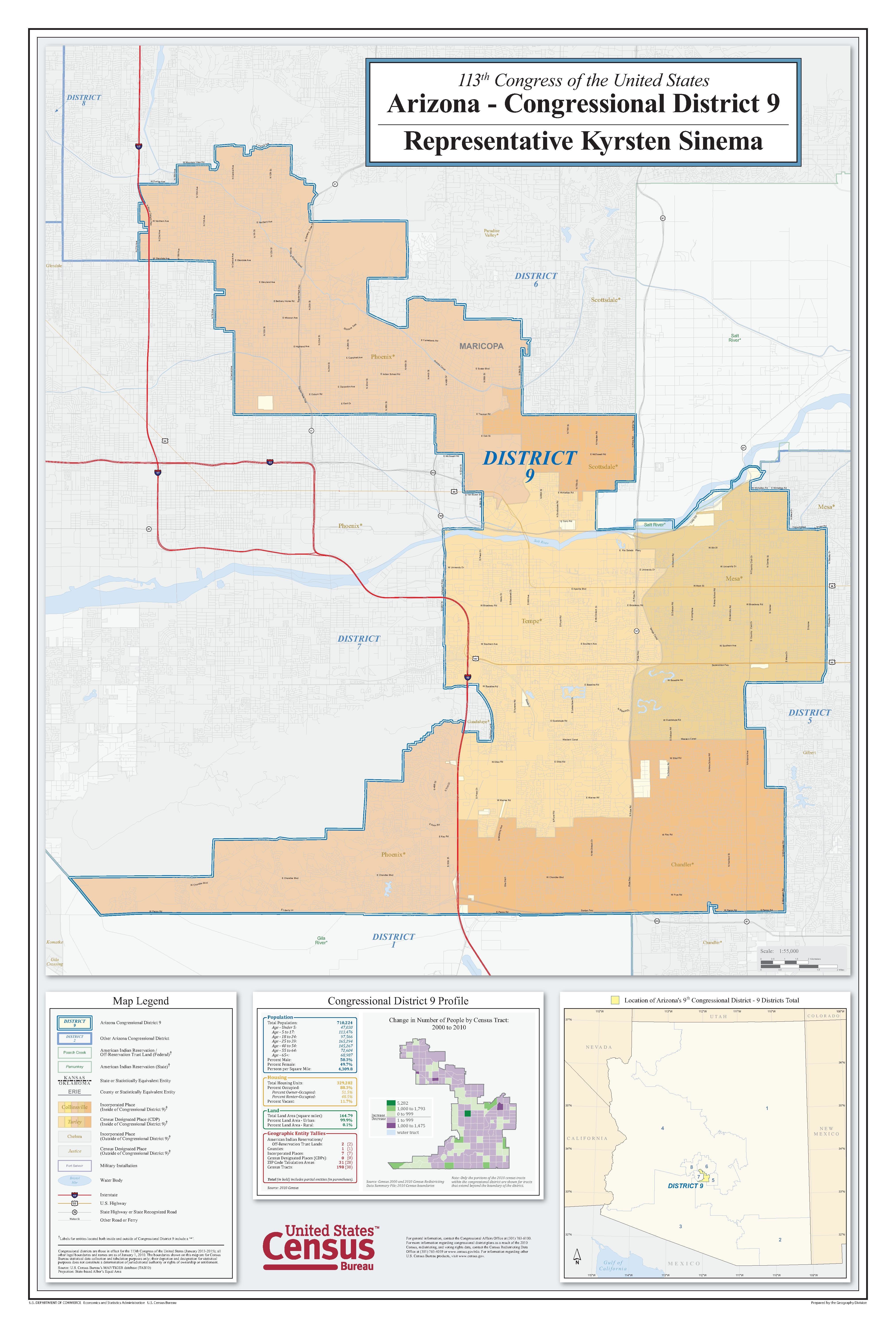
File:113th Congress of the United States, Arizona Congressional District 9 Map - DPLA - 672ec93529b1d5fbc9d74ecd44367d55.pdf

Size of this JPG preview of this PDF file: 405 × 600 pixels. Other resolutions: 162 × 240 pixels | 324 × 480 pixels | 518 × 768 pixels | 691 × 1,024 pixels | 1,382 × 2,048 pixels | 4,050 × 6,000 pixels.
Original file (4,050 × 6,000 pixels, file size: 1.82 MB, MIME type: application/pdf)
Captions
Captions
Add a one-line explanation of what this file represents
Summary
edit| 113th Congress of the United States, Arizona Congressional District 9 Map
( |
||||||||||||||
|---|---|---|---|---|---|---|---|---|---|---|---|---|---|---|
| Creator | Department of Commerce. Bureau of the Census. Office of the Associate Director for Decennial Census. Geography Division. (1/1987 - 7/15/2011) | |||||||||||||
| Title |
113th Congress of the United States, Arizona Congressional District 9 Map |
|||||||||||||
| Date | 2010-01-01/2010-12-31 | |||||||||||||
| Collection |
|
|||||||||||||
| Source/Photographer |
|
|||||||||||||
| Permission (Reusing this file) |
|
|||||||||||||
| Standardized rights statement |
|
|||||||||||||


File history
Click on a date/time to view the file as it appeared at that time.
| Date/Time | Thumbnail | Dimensions | User | Comment | |
|---|---|---|---|---|---|
| current | 17:13, 14 March 2021 |  | 4,050 × 6,000 (1.82 MB) | DPLA bot (talk | contribs) | Uploading DPLA ID 672ec93529b1d5fbc9d74ecd44367d55 |
You cannot overwrite this file.
File usage on Commons
The following page uses this file: