File:1780 Raynal and Bonne Map of China, Korea, and Japan - Geographicus - Chine-bonne-1780.jpg
Size of this preview: 404 × 599 pixels. Other resolutions: 162 × 240 pixels | 324 × 480 pixels | 518 × 768 pixels | 690 × 1,024 pixels | 1,686 × 2,500 pixels.
Original file (1,686 × 2,500 pixels, file size: 1.24 MB, MIME type: image/jpeg)
Captions
Captions
Add a one-line explanation of what this file represents
Summary
edit
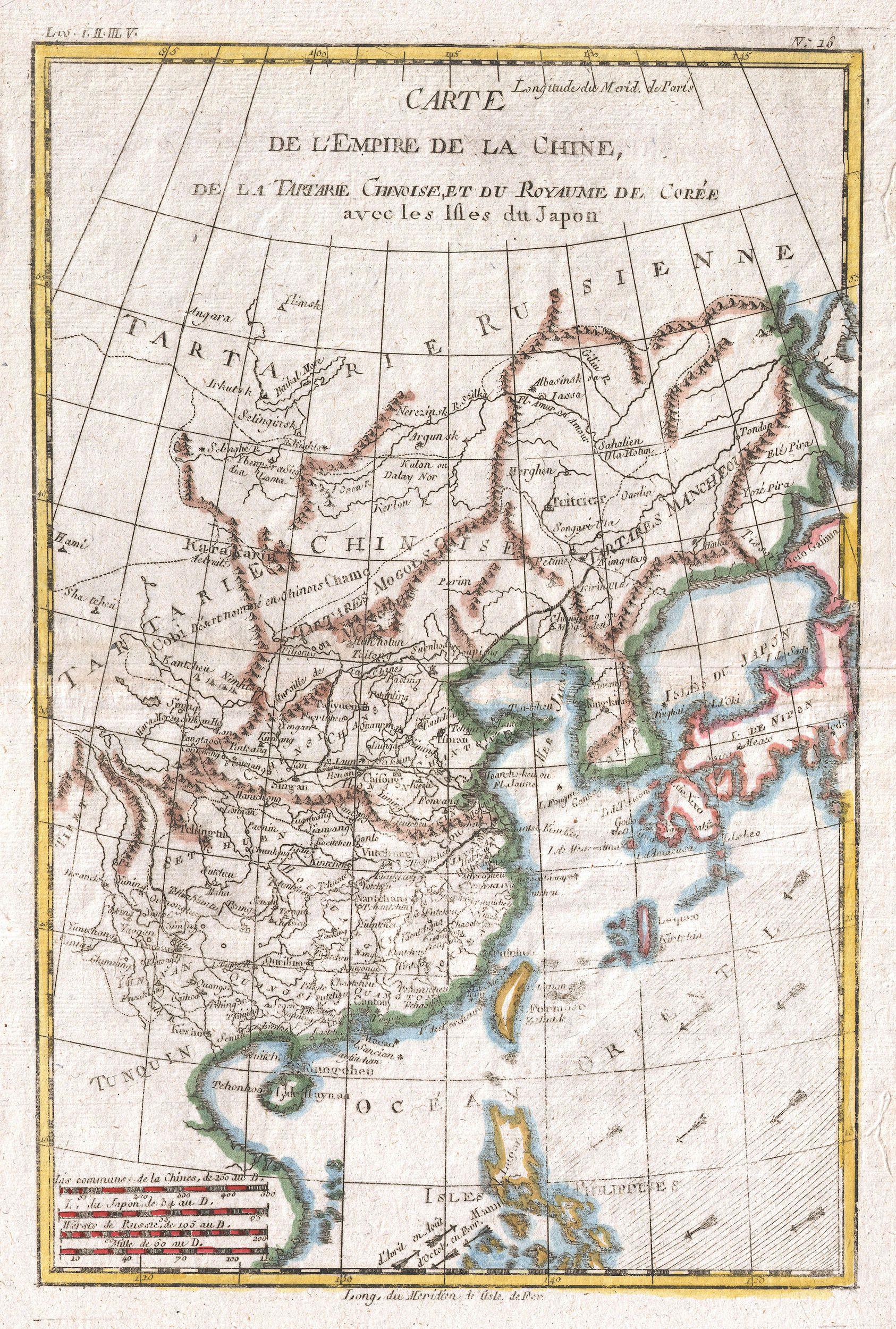
| Rigobert Bonne: Carte De L'Empire De La Chine
( |
|||||||||||||||||||||||
|---|---|---|---|---|---|---|---|---|---|---|---|---|---|---|---|---|---|---|---|---|---|---|---|
| Artist |
|
||||||||||||||||||||||
| Title |
Carte De L'Empire De La Chine |
||||||||||||||||||||||
| Description |
English: A fine example of Rigobert Bonne and G. Raynal’s 1780 map of China, Japan, and Korea. Extends from Tartary (Mongolia) south as far as the Philippines, roughly corresponds to modern day countries Vietnam, North Korea, South Korea, China, Japan and the Philippines. Offers considerable inland detail on the mainland, especially in China and Tartary, however, the interiors of Japan, Taiwan (Formosa) and the Philippines are entirely unknown. Shows some ocean currents and trade winds. Drawn by R. Bonne for G. Raynal’s Atlas de Toutes les Parties Connues du Globe Terrestre, Dressé pour l'Histoire Philosophique et Politique des Établissemens et du Commerce des Européens dans les Deux Indes . |
||||||||||||||||||||||
| Date | 1780 (undated) | ||||||||||||||||||||||
| Dimensions | height: 13 in (33 cm); width: 9 in (22.8 cm) | ||||||||||||||||||||||
| Accession number |
Geographicus link: Chine-bonne-1780 |
||||||||||||||||||||||
| Source/Photographer |
Raynal, G., Atlas de Toutes les Parties Connues du Globe Terrestre, Dressé pour l'Histoire Philosophique et Politique des Établissemens et du Commerce des Européens dans les Deux Indes, 1780.
|
||||||||||||||||||||||
| Permission (Reusing this file) |
|
||||||||||||||||||||||
File history
Click on a date/time to view the file as it appeared at that time.
| Date/Time | Thumbnail | Dimensions | User | Comment | |
|---|---|---|---|---|---|
| current | 08:57, 24 March 2011 | | 1,686 × 2,500 (1.24 MB) | BotMultichillT (talk | contribs) | {{subst:User:Multichill/Geographicus |link=http://www.geographicus.com/P/AntiqueMap/Chine-bonne-1780 |product_name=1780 Raynal and Bonne Map of China, Korea, and Japan |map_title=Carte De L'Empire De La Chine |description=A fine example of Rigobert Bonne |
You cannot overwrite this file.
File usage on Commons
The following 2 pages use this file: