File:1801 Cary Map of Turkey, Iraq, Armenia and Sryia - Geographicus - TurkeyAsia-cary-1801.jpg

Size of this preview: 673 × 600 pixels. Other resolutions: 269 × 240 pixels | 539 × 480 pixels | 862 × 768 pixels | 1,149 × 1,024 pixels | 2,299 × 2,048 pixels | 4,000 × 3,564 pixels.
Original file (4,000 × 3,564 pixels, file size: 3.13 MB, MIME type: image/jpeg)
Captions
Captions
Add a one-line explanation of what this file represents
Summary
edit
| John Cary: A New Map of Turkey in Asia, Divided into its Provinces, from the Best Authorities.
( |
||||||||||||||||||||||||||
|---|---|---|---|---|---|---|---|---|---|---|---|---|---|---|---|---|---|---|---|---|---|---|---|---|---|---|
| Artist |
|
|||||||||||||||||||||||||
| Title |
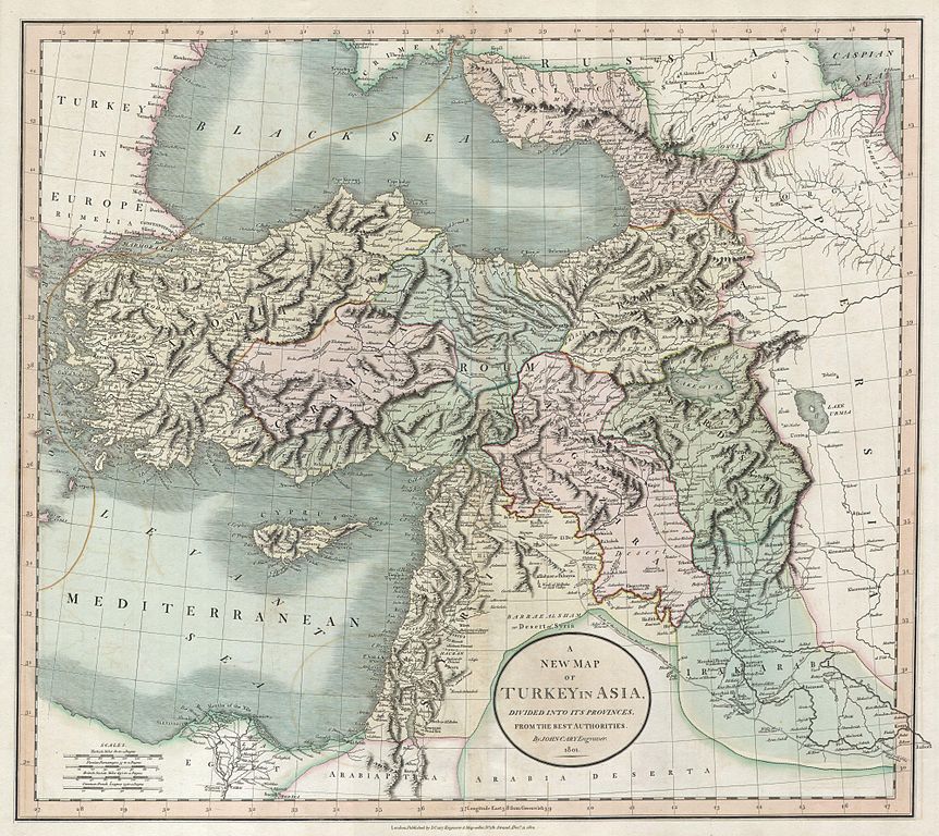
A New Map of Turkey in Asia, Divided into its Provinces, from the Best Authorities. |
|||||||||||||||||||||||||
| Description |
English: This is a stunning 1801 map of Turkey in Asia by English Cartographer John Cary. Depicts the vast regions in Asia controlled by the Ottoman Empire at the close of the 18th century. Includes the modern day nations of Turkey, Iraq, Syria, Lebanon, Palestine / Israel and Jordan. Wonderful detail down to the level of individual salt mines, dams, river crossing, and caravan routes. Dated 1801. |
|||||||||||||||||||||||||
| Date | 1801 | |||||||||||||||||||||||||
| Dimensions | height: 19 in (48.2 cm); width: 21 in (53.3 cm) | |||||||||||||||||||||||||
| Accession number |
Geographicus link: TurkeyAsia-cary-1801 |
|||||||||||||||||||||||||
| Source/Photographer |
|
|||||||||||||||||||||||||
| Other versions |
.jpg) |
|||||||||||||||||||||||||
Licensing
edit
|
This is a faithful photographic reproduction of a two-dimensional, public domain work of art. The work of art itself is in the public domain for the following reason:
The official position taken by the Wikimedia Foundation is that "faithful reproductions of two-dimensional public domain works of art are public domain".
This photographic reproduction is therefore also considered to be in the public domain in the United States. In other jurisdictions, re-use of this content may be restricted; see Reuse of PD-Art photographs for details. | ||||
File history
Click on a date/time to view the file as it appeared at that time.
| Date/Time | Thumbnail | Dimensions | User | Comment | |
|---|---|---|---|---|---|
| current | 20:14, 24 March 2011 | | 4,000 × 3,564 (3.13 MB) | BotMultichillT (talk | contribs) | {{subst:User:Multichill/Geographicus |link=http://www.geographicus.com/P/AntiqueMap/TurkeyAsia-cary-1801 |product_name=1801 Cary Map of Turkey, Iraq, Armenia and Sryia |map_title=A New Map of Turkey in Asia, Divided into its Provinces, from the Best Autho |
You cannot overwrite this file.
File usage on Commons
The following 2 pages use this file:
File usage on other wikis
The following other wikis use this file:
- Usage on ar.wikipedia.org
- Usage on en.wikipedia.org
- Usage on he.wikipedia.org
- Usage on it.wikipedia.org
- Usage on ko.wikipedia.org
- Usage on tr.wikipedia.org