File:1807 Cary Map of Nova Scotia and Newfoundland, Canada - Geographicus - NovaScotiaNewfoundland-cary-1807.jpg

Size of this preview: 677 × 600 pixels. Other resolutions: 271 × 240 pixels | 542 × 480 pixels | 867 × 768 pixels | 1,156 × 1,024 pixels | 2,312 × 2,048 pixels | 5,000 × 4,429 pixels.
Original file (5,000 × 4,429 pixels, file size: 6.77 MB, MIME type: image/jpeg)
Captions
Captions
Add a one-line explanation of what this file represents
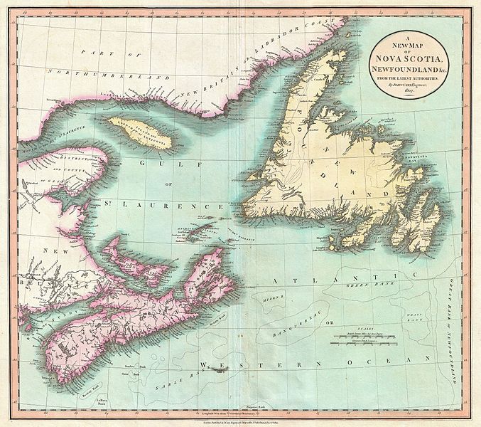
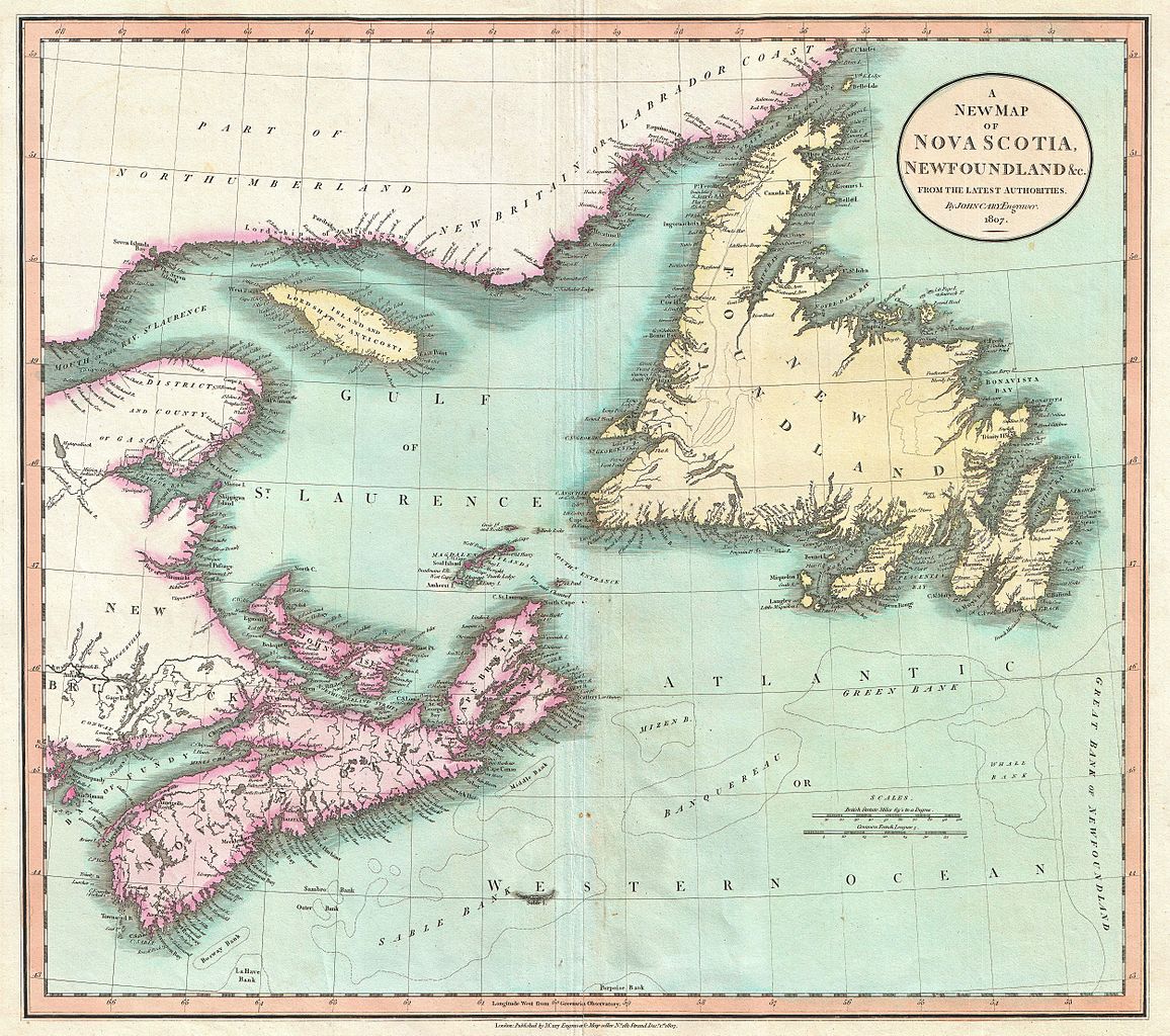
| John Cary: A New Map of Nova Scotia, Newfoundland & c., From the Latest Authorities.
( |
||||||||||||||||||||||||||
|---|---|---|---|---|---|---|---|---|---|---|---|---|---|---|---|---|---|---|---|---|---|---|---|---|---|---|
| Artist |
|
|||||||||||||||||||||||||
| Title |
A New Map of Nova Scotia, Newfoundland & c., From the Latest Authorities. |
|||||||||||||||||||||||||
| Description |
English: An exceptionally beautiful example of John Cary’s important 1807 map of Nova Scotia and Newfoundland. Covers the Maritime Provinces from New Brunswick and the Mouth of the St. Lawrence eastward as far as Newfoundland. Shows many of the offshore Cod Fishing Banks that made this area an important fishing center for hundreds of years. All in all, one of the most interesting and attractive atlas maps of Nova Scotia and Newfoundland to appear in first years of the 19th century. Prepared in 1807 by John Cary for issue in his magnificent 1808 New Universal Atlas . |
|||||||||||||||||||||||||
| Date | 1807 (dated) | |||||||||||||||||||||||||
| Dimensions | height: 18.5 in (46.9 cm); width: 20.5 in (52 cm) | |||||||||||||||||||||||||
| Accession number |
Geographicus link: NovaScotiaNewfoundland-cary-1807 |
|||||||||||||||||||||||||
| Source/Photographer |
Cary, John, Cary's New Universal Atlas, containing distinct maps of all the principal states and kingdoms throughout the World. From the latest and best authorities extant. London: Printed for J. Cary, Engraver and Map-seller, No. 181, near Norfolk Street, Strand, 1808.
|
|||||||||||||||||||||||||
| Permission (Reusing this file) |
|
|||||||||||||||||||||||||
File history
Click on a date/time to view the file as it appeared at that time.
| Date/Time | Thumbnail | Dimensions | User | Comment | |
|---|---|---|---|---|---|
| current | 10:42, 22 March 2011 | | 5,000 × 4,429 (6.77 MB) | BotMultichillT (talk | contribs) | {{subst:User:Multichill/Geographicus |link=http://www.geographicus.com/P/AntiqueMap/NovaScotiaNewfoundland-cary-1807 |product_name=1807 Cary Map of Nova Scotia and Newfoundland, Canada |map_title=A New Map of Nova Scotia, Newfoundland & c., From the Lates |
You cannot overwrite this file.
File usage on Commons
The following page uses this file: