File:1820 Yates Map of Albany circa 1770 - Geographicus - Albany-yates-1820.jpg
Size of this preview: 800 × 555 pixels. Other resolutions: 320 × 222 pixels | 640 × 444 pixels | 1,024 × 710 pixels | 1,280 × 888 pixels | 2,560 × 1,776 pixels | 3,000 × 2,081 pixels.
Original file (3,000 × 2,081 pixels, file size: 961 KB, MIME type: image/jpeg)
Captions
Captions
Add a one-line explanation of what this file represents
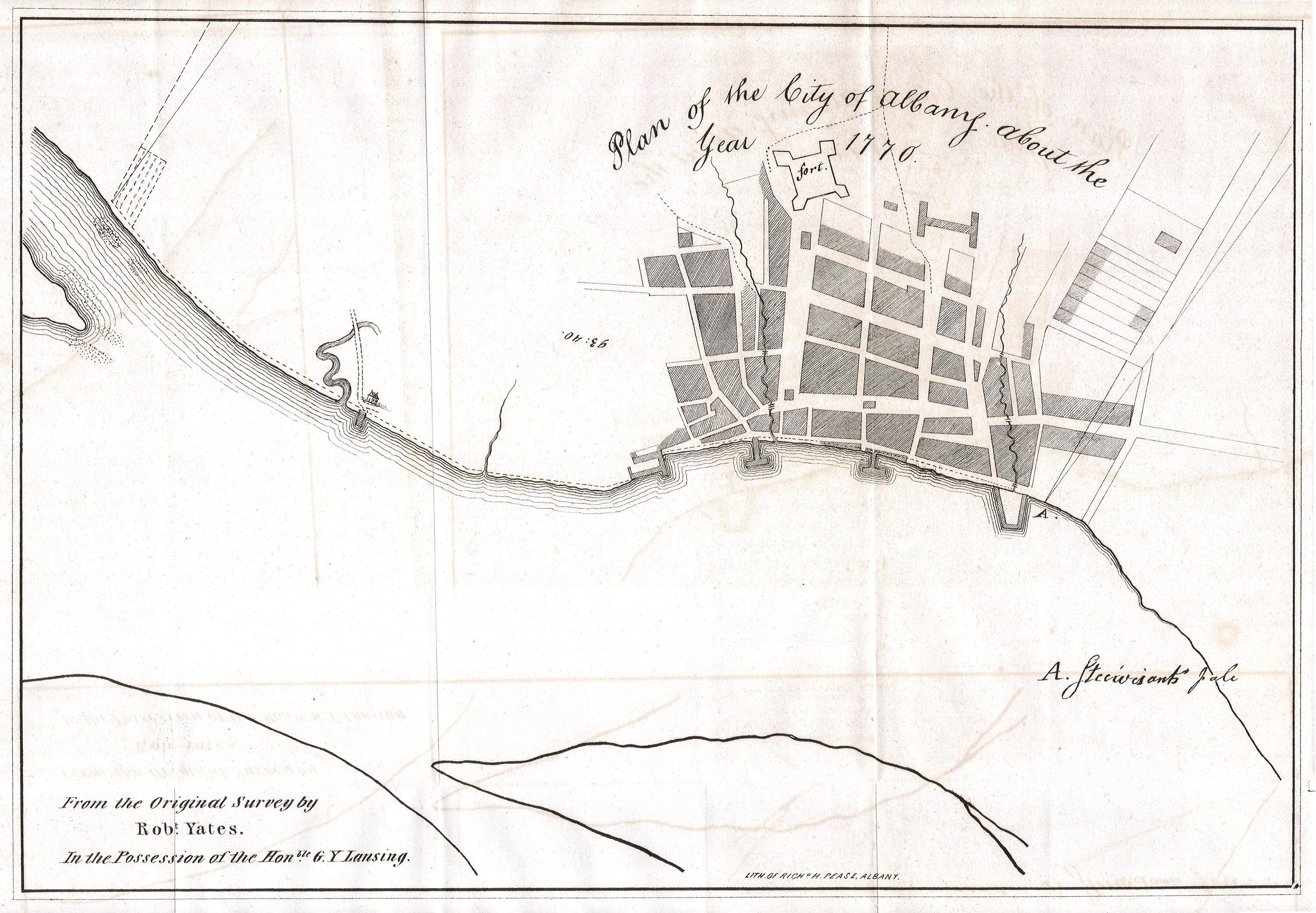
| Plan of the City of Albany about the Year 1770. | ||||||
|---|---|---|---|---|---|---|
| Artist |
Unknown author |
|||||
| Title |
Plan of the City of Albany about the Year 1770. |
|||||
| Description |
English: This is a fascinating 1770 map of the City of Albany, capitol of New York state. Map was drawn from an original survey by Robert Yates from the collection of the Honorable G. Y. Lansing. Drawn and engraved by Richard Pease of Albany. Show the fort and port areas. Undated but given the paper and style we can accurately say it is an early 19th century reprint. |
|||||
| Date | 1820 | |||||
| Dimensions | height: 8.5 in (21.5 cm); width: 12 in (30.4 cm) | |||||
| Accession number |
Geographicus link: Albany-yates-1820 |
|||||
| Source/Photographer |
|
|||||
| Permission (Reusing this file) |
|
|||||
File history
Click on a date/time to view the file as it appeared at that time.
| Date/Time | Thumbnail | Dimensions | User | Comment | |
|---|---|---|---|---|---|
| current | 11:37, 16 March 2011 | | 3,000 × 2,081 (961 KB) | BotMultichill (talk | contribs) | {{subst:User:Multichill/Geographicus |link=http://www.geographicus.com/P/AntiqueMap/Albany-yates-1820 |product_name=1820 Yates Map of Albany circa 1770 |map_title=Plan of the City of Albany about the Year 1770. |description=This is a fascinating 1770 ma |
You cannot overwrite this file.
File usage on Commons
The following page uses this file: