File:1827 Finley Map of the West Indies, Caribbean, and Antilles - Geographicus - WestIndies-finley-1827.jpg

Size of this preview: 761 × 600 pixels. Other resolutions: 305 × 240 pixels | 609 × 480 pixels | 975 × 768 pixels | 1,280 × 1,009 pixels | 2,560 × 2,017 pixels | 3,000 × 2,364 pixels.
Original file (3,000 × 2,364 pixels, file size: 2.12 MB, MIME type: image/jpeg)
Captions
Captions
Add a one-line explanation of what this file represents
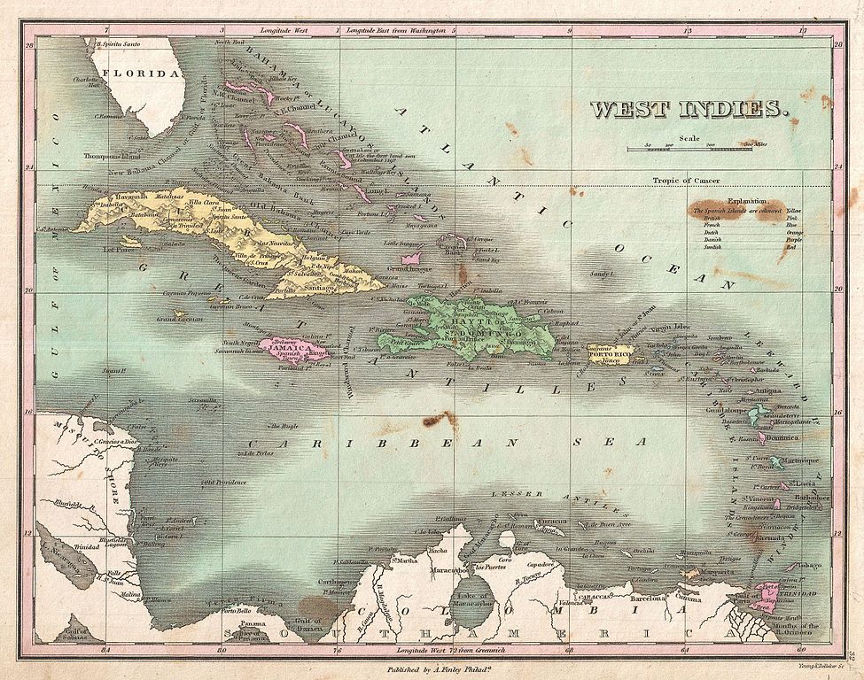
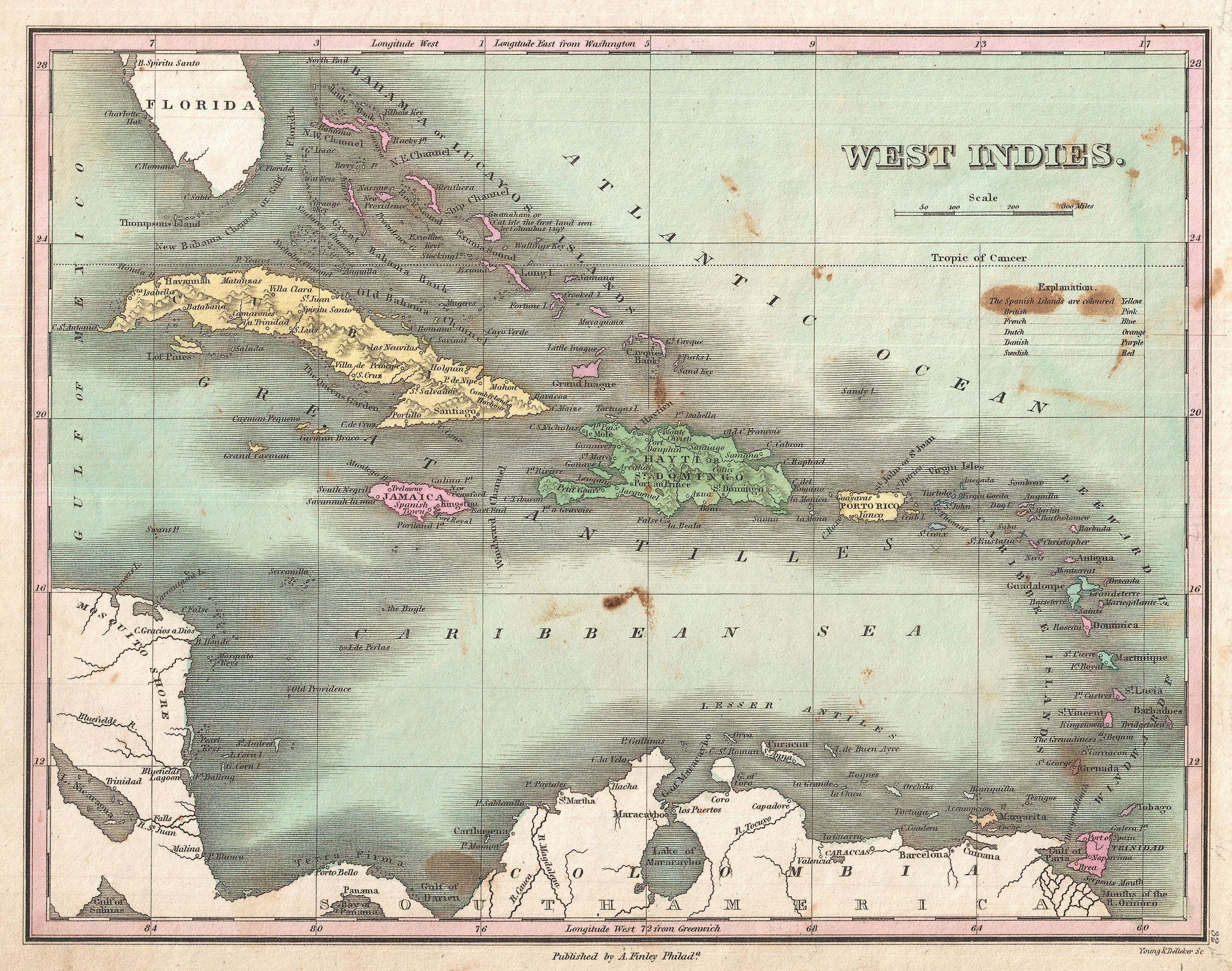
| Anthony Finley: West Indies.
( |
||||||||||||||
|---|---|---|---|---|---|---|---|---|---|---|---|---|---|---|
| Artist |
|
|||||||||||||
| Title |
West Indies. |
|||||||||||||
| Description |
English: This is Finley’s desirable 1827 map of the West Indies and Caribbean. Shows the Greater and LEsser Antilles as well as the Bahamas and portions of the Spanish Main. Islands are color coded according to their European claimants. Shows cities, forts, bays, rivers, roads, and some topographical features. It the Bahamas, Finley identifies Guanaham or Cat Isle, the first land in the America to be sighted by Columbus. Mile scales and title in upper right quadrant. Engraved by Young and Delleker for the 1827 edition of Anthony Finley's General Atlas . |
|||||||||||||
| Date | 1827 (undated) | |||||||||||||
| Dimensions | height: 9 in (22.8 cm); width: 11.5 in (29.2 cm) | |||||||||||||
| Accession number |
Geographicus link: WestIndies-finley-1827 |
|||||||||||||
| Source/Photographer |
Finley, Anthony, A New General Altas, Comprising a Complete Set of Maps, representing the Grand Divisions of the Globe, Together with the several Empires, Kingdoms and States in the World; Compiled from the Best Authorities, and corrected by the Most Recent Discoveries, Philadelphia, 1827.
|
|||||||||||||
| Permission (Reusing this file) |
|
|||||||||||||
| Other versions | ||||||||||||||

See also edit
- Alternative map of early 1800s West Indies:

File history
Click on a date/time to view the file as it appeared at that time.
| Date/Time | Thumbnail | Dimensions | User | Comment | |
|---|---|---|---|---|---|
| current | 09:17, 23 March 2011 | | 3,000 × 2,364 (2.12 MB) | BotMultichillT (talk | contribs) | {{subst:User:Multichill/Geographicus |link=http://www.geographicus.com/P/AntiqueMap/WestIndies-finley-1827 |product_name=1827 Finley Map of the West Indies, Caribbean, and Antilles |map_title=West Indies. |description=This is Finley’s desirable 1827 map |
You cannot overwrite this file.
File usage on Commons
The following 3 pages use this file:
File usage on other wikis
The following other wikis use this file:
- Usage on en.wikipedia.org