File:1837 Malte-Brun Map of the British Isles ( England, Scotland, Ireland ) - Geographicus - BritishIsles-mb-1837.jpg
Original file (1,659 × 2,244 pixels, file size: 625 KB, MIME type: image/jpeg)
Captions
Captions
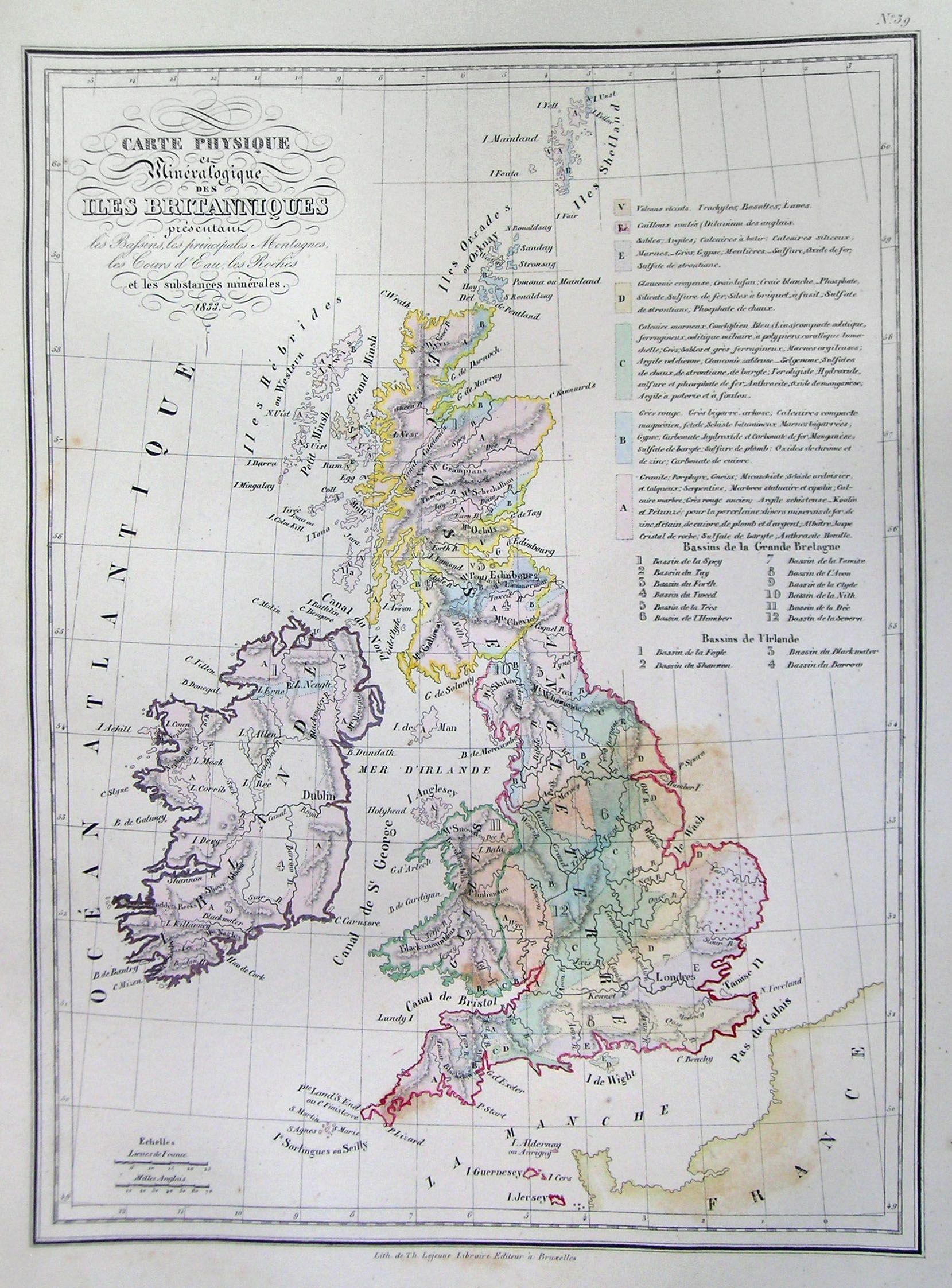
| Carte Physique et Mineralogiquedes iles Brittanique… | ||||||
|---|---|---|---|---|---|---|
| Artist | ||||||
| Title |
Carte Physique et Mineralogiquedes iles Brittanique… |
|||||
| Description |
English: This is a beautiful 1837 copperplate lithograph map of the British Isles, including England, Scotland and Ireland. All text is in French. |
|||||
| Date | 1837 | |||||
| Dimensions | height: 9.5 in (24.1 cm); width: 12 in (30.4 cm) | |||||
| Accession number |
Geographicus link: BritishIsles-mb-1837 |
|||||
| Source/Photographer |
|
|||||
| Permission (Reusing this file) |
|
|||||
File history
Click on a date/time to view the file as it appeared at that time.
| Date/Time | Thumbnail | Dimensions | User | Comment | |
|---|---|---|---|---|---|
| current | 11:38, 16 March 2011 | | 1,659 × 2,244 (625 KB) | BotMultichill (talk | contribs) | {{subst:User:Multichill/Geographicus |link=http://www.geographicus.com/P/AntiqueMap/BritishIsles-mb-1837 |product_name=1837 Malte-Brun Map of the British Isles ( England, Scotland, Ireland ) |map_title=Carte Physique et Mineralogiquedes iles Brittanique� |
You cannot overwrite this file.
File usage on Commons
The following page uses this file:
_-_Geographicus_-_BritishIsles-mb-1837.jpg)
_-_Geographicus_-_BritishIsles-mb-1837.jpg&oldid=887546745)