File:1857 Dufour Map of Algeria - Geographicus - Algerie-dufour-1857.jpg
Original file (5,000 × 3,637 pixels, file size: 5.7 MB, MIME type: image/jpeg)
Captions
Captions
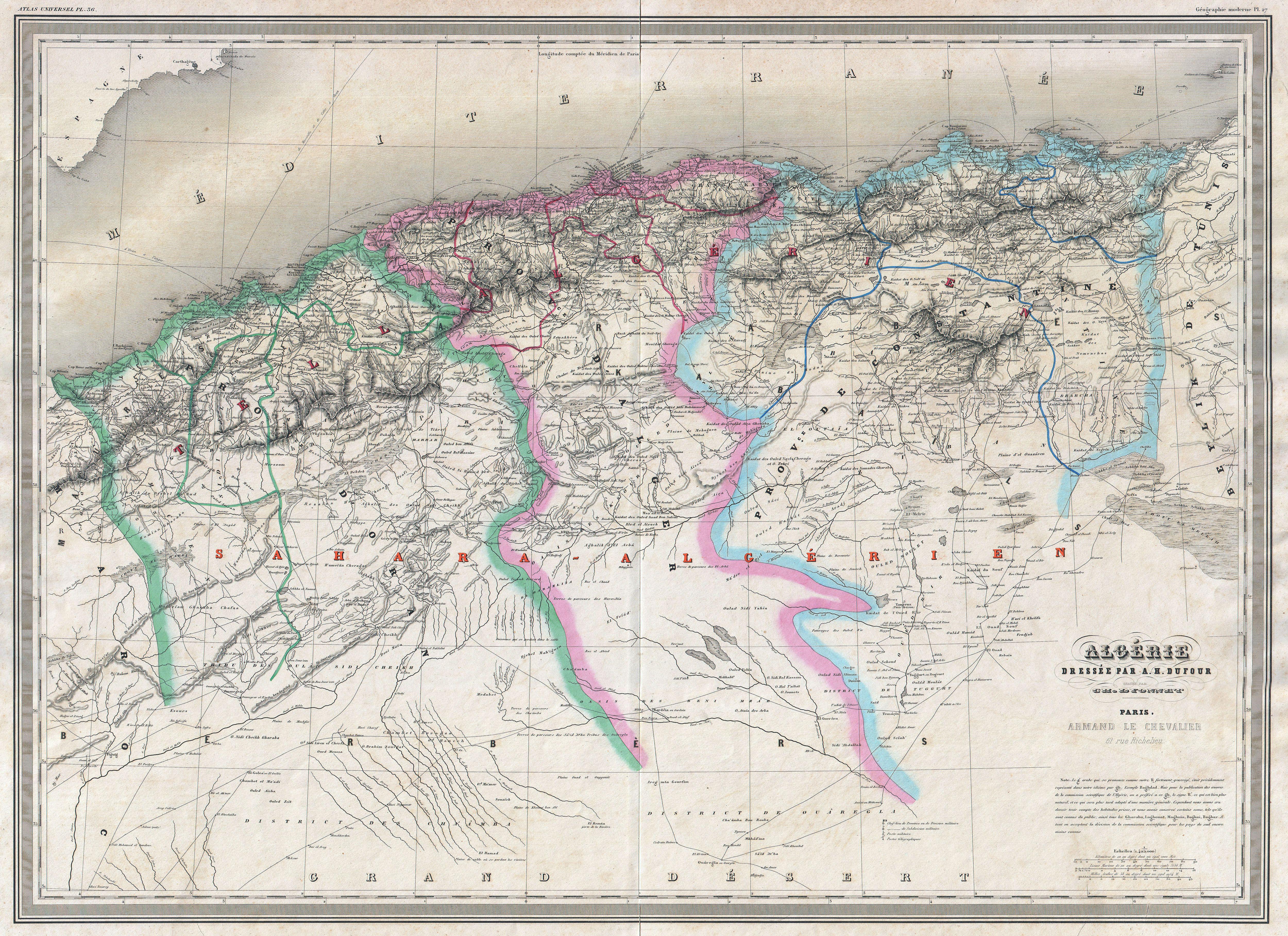
| Auguste Henri Dufour: Algerie.
( |
||||||||||||||||||||
|---|---|---|---|---|---|---|---|---|---|---|---|---|---|---|---|---|---|---|---|---|
| Artist |
|
|||||||||||||||||||
| Title |
Algerie. |
|||||||||||||||||||
| Description |
English: An extremely attractive and monumentally proportioned 1857 map of Algeria by the French cartographer A. H. Dufour. Algeria is depicted divided into the administrative districts of Oran, Alger and Constantine. Shows roads, rivers, caravan routes, cities, and topographical features. Also details several nautical routes between different Algerian cities and Europe. Prepared by Dyonnet as plate no. 37 in A. H. Dufour’s 1857 issued of the impressive elephant folio Atlas Universel . |
|||||||||||||||||||
| Date | 1857 (undated) | |||||||||||||||||||
| Dimensions | height: 22.5 in (57.1 cm); width: 30 in (76.2 cm) | |||||||||||||||||||
| Accession number |
Geographicus link: Algerie-dufour-1857 |
|||||||||||||||||||
| Source/Photographer |
Dufour, A. H., Grand atlas Universel physique, historique et politique geographie ancienne et moderne. (1857 issue).
|
|||||||||||||||||||
| Permission (Reusing this file) |
|
|||||||||||||||||||
File history
Click on a date/time to view the file as it appeared at that time.
| Date/Time | Thumbnail | Dimensions | User | Comment | |
|---|---|---|---|---|---|
| current | 18:59, 22 March 2011 | | 5,000 × 3,637 (5.7 MB) | BotMultichillT (talk | contribs) | {{subst:User:Multichill/Geographicus |link=http://www.geographicus.com/P/AntiqueMap/Algerie-dufour-1857 |product_name=1857 Dufour Map of Algeria |map_title=Algerie. |description=An extremely attractive and monumentally proportioned 1857 map of Algeria by |
You cannot overwrite this file.
File usage on Commons
The following page uses this file: