File:1860 Black Map of the World - Geographicus - TheWorld-black-1860.jpg
Original file (3,500 × 2,164 pixels, file size: 1.88 MB, MIME type: image/jpeg)
Captions
Captions
| The World | ||||||
|---|---|---|---|---|---|---|
| Artist | ||||||
| Title |
The World |
|||||
| Description |
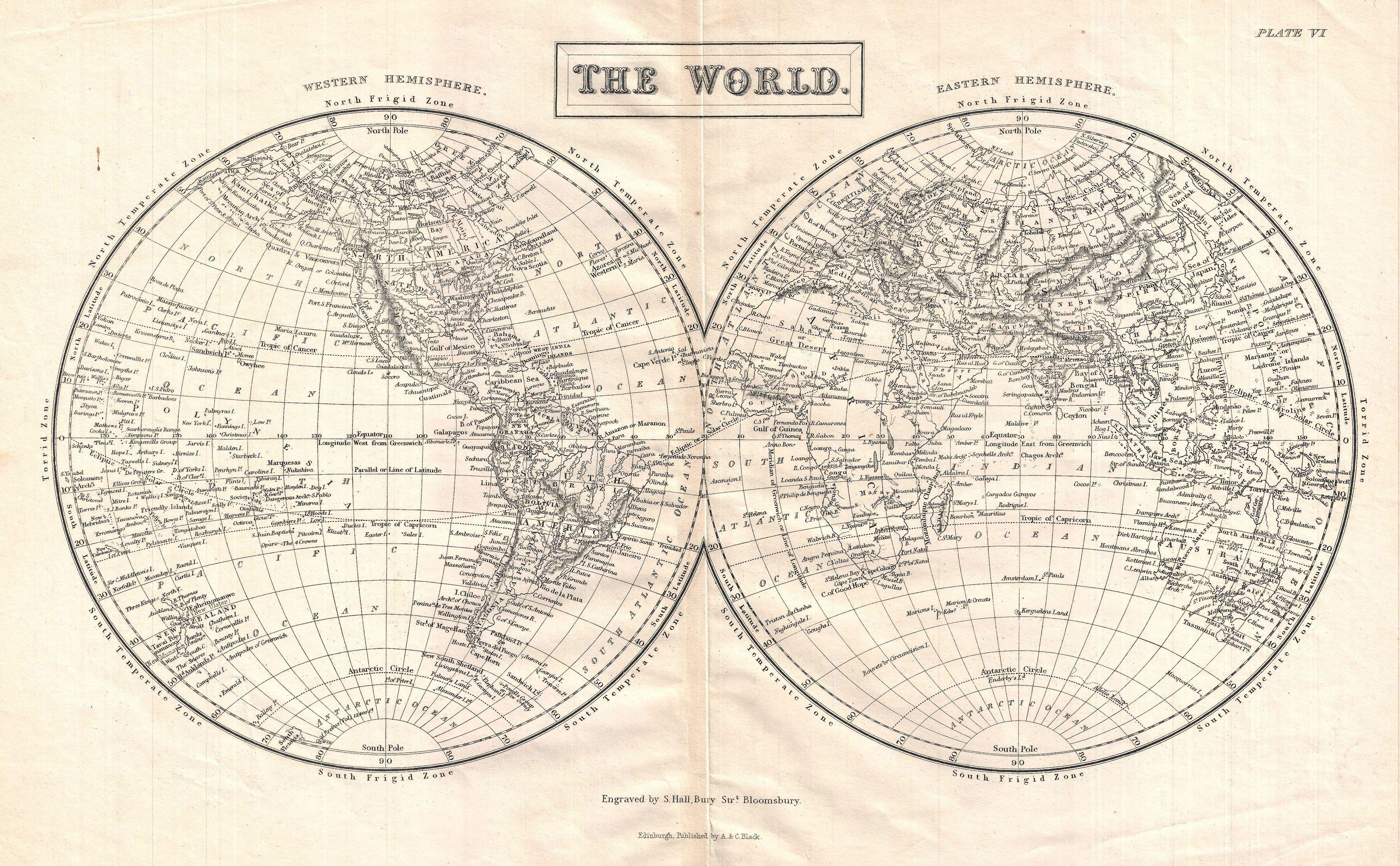
English: A highly detailed mis-19th century map of the World in Hemispheres Divided into the Western Hemisphere and Eastern Hemisphere, this map shows and labels islands, continents, major cities, oceans, capes, gulfs and mountains. Also shows latitudinal and longitudinal degrees and temperate, frigid, and torrent zones. Engraved by S. Hall and published by Adam and Charles Black. |
|||||
| Date | circa 1800(undated) | |||||
| Dimensions | height: 11 in (27.9 cm); width: 16 in (40.6 cm) | |||||
| Accession number |
Geographicus link: TheWorld-black-1860 |
|||||
| Source/Photographer |
|
|||||
| Permission (Reusing this file) |
|
|||||
File history
Click on a date/time to view the file as it appeared at that time.
| Date/Time | Thumbnail | Dimensions | User | Comment | |
|---|---|---|---|---|---|
| current | 23:59, 24 March 2011 | | 3,500 × 2,164 (1.88 MB) | BotMultichillT (talk | contribs) | {{subst:User:Multichill/Geographicus |link=http://www.geographicus.com/P/AntiqueMap/TheWorld-black-1860 |product_name=1860 Black Map of the World |map_title=The World |description=A highly detailed mis-19th century map of the World in Hemispheres Divided |
You cannot overwrite this file.
File usage on Commons
The following page uses this file: