File:1860 Mackenzie Map of Waterfalls and Lakes - Geographicus - WaterfallsLakes-mackenzie-1860.jpg

Original file (3,500 × 2,770 pixels, file size: 2.13 MB, MIME type: image/jpeg)
Captions
Captions
| Waterfalls. Lakes. | ||||||
|---|---|---|---|---|---|---|
| Artist | ||||||
| Title |
Waterfalls. Lakes. |
|||||
| Description |
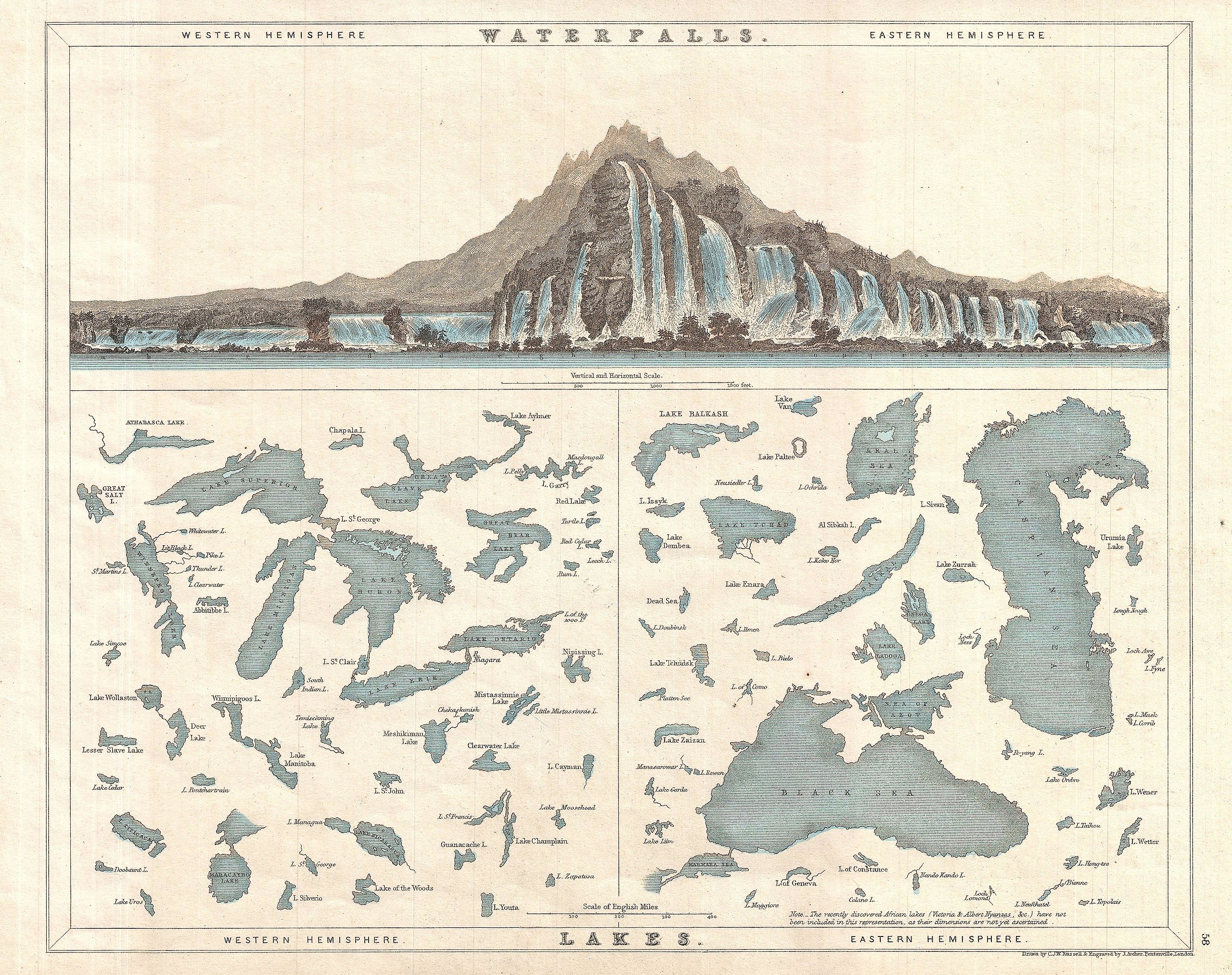
English: A very interesting and attractive comparative chart of waterfalls and lakes in the eastern and western hemispheres. The top portion of the map is beautifully illustrated with waterfalls of the world, with those in the west on the left and those found in the east to the right. Below that are lakes of the world, including the Great Lakes in the west, and the Black Sea in the east. Each lake is labeled. A note in the lower right quadrant states that “recently discovered African Lakes (Victoria and Albert Nyanzas) have not been included in this representation, as their dimensions are not yet ascertained.” Drawn by C.J.W Russel and engraved by J. Archer. Published by William Mackenzie. |
|||||
| Date | 1860 (undated) | |||||
| Dimensions | height: 10.5 in (26.6 cm); width: 15 in (38.1 cm) | |||||
| Accession number |
Geographicus link: WaterfallsLakes-mackenzie-1860 |
|||||
| Source/Photographer |
|
|||||
| Permission (Reusing this file) |
|
|||||
File history
Click on a date/time to view the file as it appeared at that time.
| Date/Time | Thumbnail | Dimensions | User | Comment | |
|---|---|---|---|---|---|
| current | 19:28, 24 March 2011 | | 3,500 × 2,770 (2.13 MB) | BotMultichillT (talk | contribs) | {{subst:User:Multichill/Geographicus |link=http://www.geographicus.com/P/AntiqueMap/WaterfallsLakes-mackenzie-1860 |product_name=1860 Mackenzie Map of Waterfalls and Lakes |map_title=Waterfalls. Lakes. |description=A very interesting and attractive compa |
You cannot overwrite this file.
File usage on Commons
The following 2 pages use this file: