File:1864 Johnson's Map of Maryland and Delaware - Geographicus - DEMD-j-64.jpg
Size of this preview: 749 × 599 pixels. Other resolutions: 300 × 240 pixels | 600 × 480 pixels | 960 × 768 pixels | 1,279 × 1,024 pixels | 2,500 × 2,001 pixels.
Original file (2,500 × 2,001 pixels, file size: 1.7 MB, MIME type: image/jpeg)
Captions
Captions
Add a one-line explanation of what this file represents
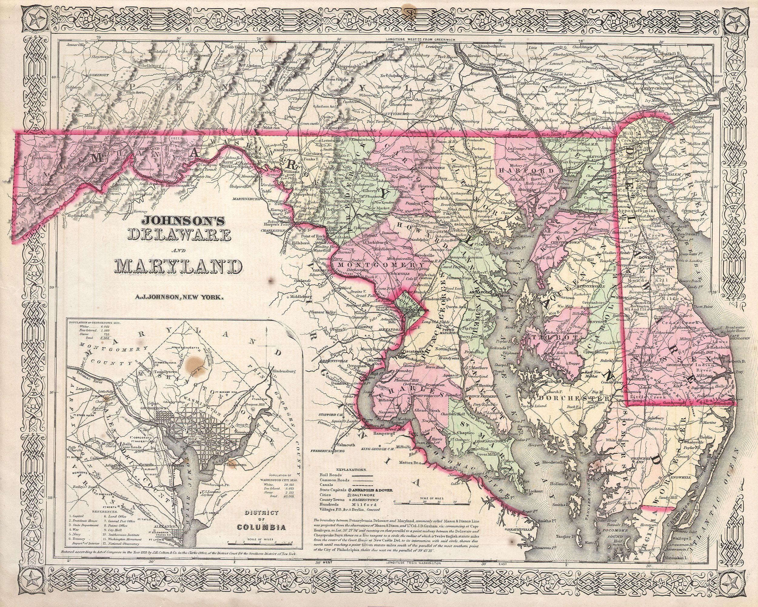
| Alvin Jewett Johnson: Johnson’s Delaware and Maryland.
( |
|||||||||||||||||||||||
|---|---|---|---|---|---|---|---|---|---|---|---|---|---|---|---|---|---|---|---|---|---|---|---|
| Artist |
|
||||||||||||||||||||||
| Title |
Johnson’s Delaware and Maryland. |
||||||||||||||||||||||
| Description |
English: This is a magnificent 1864 hand colored map of the states of Maryland and Delaware by the important American map Publisher A. J. Johnson. Depicts the two states in considerable detail. Includes a large inset map of the District of Columbia or Washington D.C. Made during the Civil war, this map includes a paragraph notation on the surveying of the boundary between Pennsylvania, Delaware, and Maryland, commonly called the “Mason Dixon Line”. This line marked the geographical division between the Northern from the Southern states at the outset of the Civil War. |
||||||||||||||||||||||
| Date | 1864 | ||||||||||||||||||||||
| Dimensions | height: 13 in (33 cm); width: 16.5 in (41.9 cm) | ||||||||||||||||||||||
| Accession number |
Geographicus link: DEMD-j-64 |
||||||||||||||||||||||
| Source/Photographer |
|
||||||||||||||||||||||
| Permission (Reusing this file) |
|
||||||||||||||||||||||
File history
Click on a date/time to view the file as it appeared at that time.
| Date/Time | Thumbnail | Dimensions | User | Comment | |
|---|---|---|---|---|---|
| current | 09:51, 16 March 2011 | | 2,500 × 2,001 (1.7 MB) | BotMultichill (talk | contribs) | {{subst:User:Multichill/Geographicus |link=http://www.geographicus.com/P/AntiqueMap/DEMD-j-64 |product_name=1864 Johnson's Map of Maryland and Delaware |map_title=Johnson’s Delaware and Maryland. |description=This is a magnificent 1864 hand colored map |
You cannot overwrite this file.
File usage on Commons
The following page uses this file: