File:1864 Johnson's Map of New Brunswick, Nova Scotia and Newfoundland (Canada) - Geographicus - NewBrunswick-j-1864.jpg
Size of this preview: 754 × 599 pixels. Other resolutions: 302 × 240 pixels | 604 × 480 pixels | 966 × 768 pixels | 1,280 × 1,017 pixels | 2,560 × 2,035 pixels | 4,000 × 3,179 pixels.
Original file (4,000 × 3,179 pixels, file size: 2.6 MB, MIME type: image/jpeg)
Captions
Captions
Add a one-line explanation of what this file represents
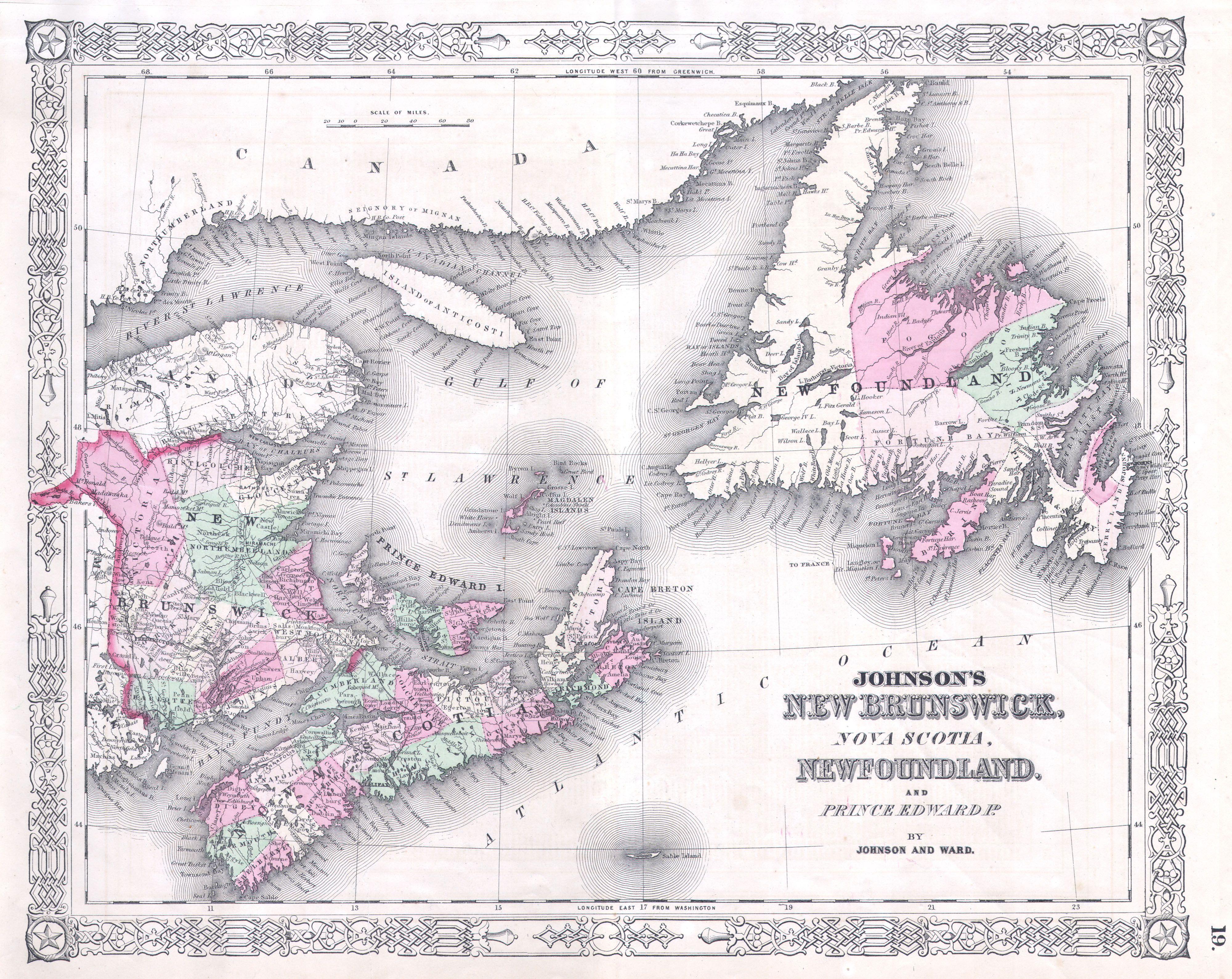
| Alvin Jewett Johnson: Johnson’s New Brunswick, Nova Scotia, Newfoundland and Prince Edward Id.
( |
|||||||||||||||||||||||
|---|---|---|---|---|---|---|---|---|---|---|---|---|---|---|---|---|---|---|---|---|---|---|---|
| Artist |
|
||||||||||||||||||||||
| Title |
Johnson’s New Brunswick, Nova Scotia, Newfoundland and Prince Edward Id. |
||||||||||||||||||||||
| Description |
English: A fine map of the Canadian provinces of New Brunswick, Nova Scotia, Newfoundland and Prince Edward Island. Cartographically this map is based upon the earlier work of J. H. Colton who himself may have referenced early 19th century British material, possibly Wyld’s 1836 map. Page no. 19 in the 1864 Johnson and Ward edition of Johnson’s Family Atlas. |
||||||||||||||||||||||
| Date | 1864 | ||||||||||||||||||||||
| Dimensions | height: 13 in (33 cm); width: 16.5 in (41.9 cm) | ||||||||||||||||||||||
| Accession number |
Geographicus link: NewBrunswick-j-1864 |
||||||||||||||||||||||
| Source/Photographer |
|
||||||||||||||||||||||
| Permission (Reusing this file) |
|
||||||||||||||||||||||
File history
Click on a date/time to view the file as it appeared at that time.
| Date/Time | Thumbnail | Dimensions | User | Comment | |
|---|---|---|---|---|---|
| current | 08:00, 16 March 2011 | | 4,000 × 3,179 (2.6 MB) | BotMultichill (talk | contribs) | {{subst:User:Multichill/Geographicus |link=http://www.geographicus.com/P/AntiqueMap/NewBrunswick-j-1864 |product_name=1864 Johnson's Map of New Brunswick, Nova Scotia and Newfoundland (Canada) |map_title=Johnson’s New Brunswick, Nova Scotia, Newfoundlan |
You cannot overwrite this file.
File usage on Commons
The following page uses this file:
_-_Geographicus_-_NewBrunswick-j-1864.jpg)
_-_Geographicus_-_NewBrunswick-j-1864.jpg&oldid=799492694)