File:1865 Spruner Map of the British Isles (England, Scotland, Ireland) - Geographicus - Britannia-spruner-1865.jpg

Size of this preview: 542 × 600 pixels. Other resolutions: 217 × 240 pixels | 434 × 480 pixels | 694 × 768 pixels | 925 × 1,024 pixels | 1,850 × 2,048 pixels | 3,500 × 3,874 pixels.
Original file (3,500 × 3,874 pixels, file size: 2.83 MB, MIME type: image/jpeg)
Captions
Captions
Add a one-line explanation of what this file represents
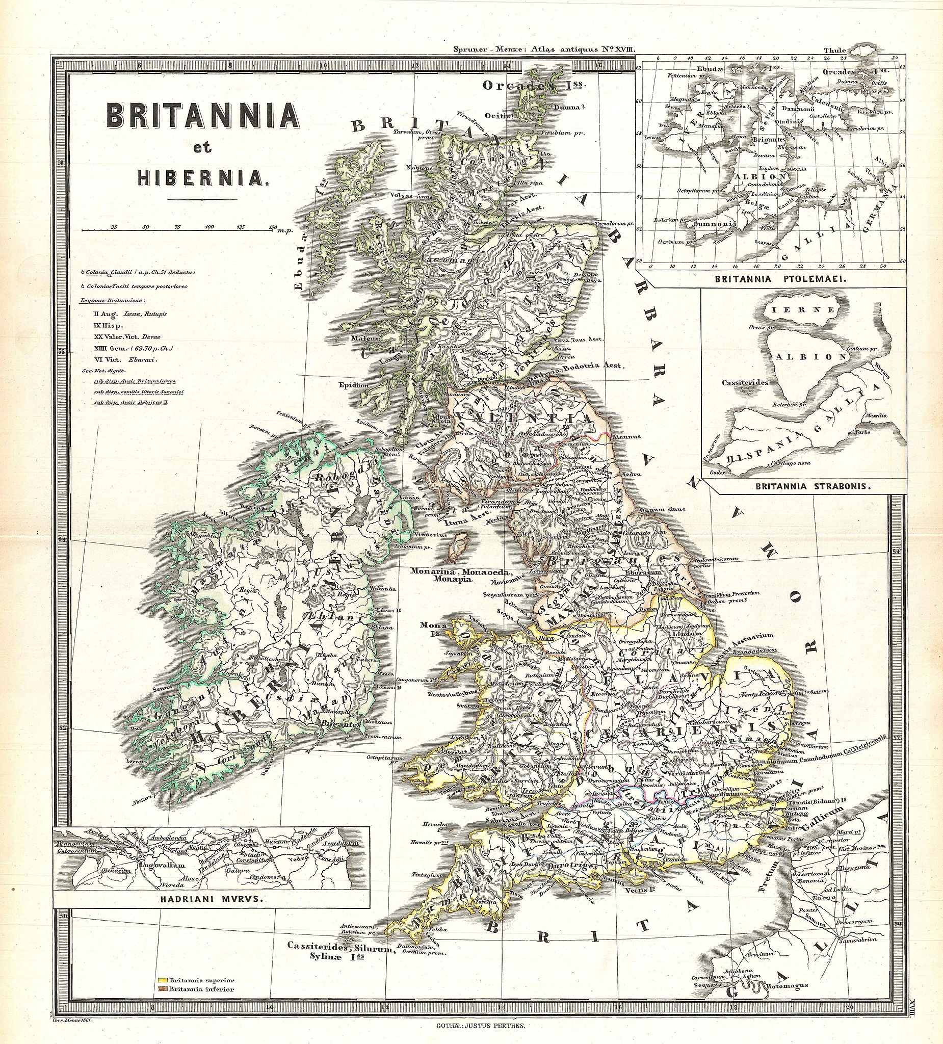
| Karl Spruner von Merz: Britannia et Hibernia.
( |
||||||||||||||||||||
|---|---|---|---|---|---|---|---|---|---|---|---|---|---|---|---|---|---|---|---|---|
| Artist |
|
|||||||||||||||||||
| Title |
Britannia et Hibernia. |
|||||||||||||||||||
| Description |
English: This is Karl von Spruner’s 1865 map of England, Scotland, and Ireland (Britannia et Hibernia) in antiquity. Shows names of ancient tribes and peoples and the areas they inhabited. In addition to the main map there are three insets detailing Hadrian’s Wall, Britannia according to the Alexandrian cartographer Ptolemy, and Britannia according to Strabo. Map includes a scale and a legend in the upper-left quadrant. Map notes important cities, rivers, mountain ranges and other minor topographical detail. Territories and countries outlined in color. The whole is rendered in finely engraved detail exhibiting throughout the fine craftsmanship of the Perthes firm. |
|||||||||||||||||||
| Date | 1865 (undated) | |||||||||||||||||||
| Dimensions | height: 16 in (40.6 cm); width: 13 in (33 cm) | |||||||||||||||||||
| Accession number |
Geographicus link: Britannia-spruner-1865 |
|||||||||||||||||||
| Source/Photographer |
Spruner, Karl von, Spruner-Menke Atlas Antiquus,, (Gotha: Justus Perthes), 1865.
|
|||||||||||||||||||
| Permission (Reusing this file) |
|
|||||||||||||||||||
| Other versions |
|
|||||||||||||||||||
.jpg)
File history
Click on a date/time to view the file as it appeared at that time.
| Date/Time | Thumbnail | Dimensions | User | Comment | |
|---|---|---|---|---|---|
| current | 05:55, 25 March 2011 | | 3,500 × 3,874 (2.83 MB) | BotMultichillT (talk | contribs) | {{subst:User:Multichill/Geographicus |link=http://www.geographicus.com/P/AntiqueMap/Britannia-spruner-1865 |product_name=1865 Spruner Map of the British Isles (England, Scotland, Ireland) |map_title=Britannia et Hibernia. |description=This is Karl von Spr |
You cannot overwrite this file.
File usage on Commons
The following page uses this file:
_-_Geographicus_-_Britannia-spruner-1865.jpg)
File usage on other wikis
The following other wikis use this file:
- Usage on it.wikipedia.org
_-_Geographicus_-_Britannia-spruner-1865.jpg&oldid=745877500)