File:1865 Spruner Map of the Roman Empire under Constantine - Geographicus - ImperiumRomanorum-spruner-1865.jpg

Size of this preview: 675 × 599 pixels. Other resolutions: 270 × 240 pixels | 541 × 480 pixels | 865 × 768 pixels | 1,154 × 1,024 pixels | 2,307 × 2,048 pixels | 3,500 × 3,107 pixels.
Original file (3,500 × 3,107 pixels, file size: 2.9 MB, MIME type: image/jpeg)
Captions
Captions
Add a one-line explanation of what this file represents
| Karl Spruner von Merz: Imperium Romanorum inde a Constantini Magni tempore.
( |
||||||||||||||||||||
|---|---|---|---|---|---|---|---|---|---|---|---|---|---|---|---|---|---|---|---|---|
| Artist |
|
|||||||||||||||||||
| Title |
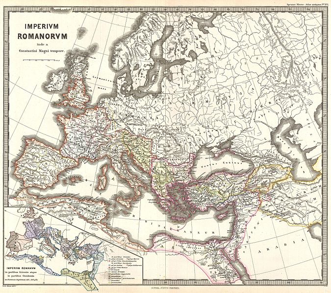
Imperium Romanorum inde a Constantini Magni tempore. |
|||||||||||||||||||
| Description |
English: This is Karl von Spruner’s 1865 map of the Roman Empire under the emperor Constantine. This detailed covers the entirety of Europe but focuses the Roman lands in modern day England, France, Spain, Greece, Italy, Turkey, and north Africa. An inset in the lower left quadrant focuses on the parts of the Roman Empire divided between East and West. The map shows important cities, rivers, mountain ranges and other minor topographical detail. Countries and territories are designated with colored borders and each map includes a key or legend. The whole is rendered in finely engraved detail exhibiting throughout the fine craftsmanship of the Perthes firm. |
|||||||||||||||||||
| Date | 1865 (undated) | |||||||||||||||||||
| Dimensions | height: 13 in (33 cm); width: 16 in (40.6 cm) | |||||||||||||||||||
| Accession number |
Geographicus link: ImperiumRomanorum-spruner-1865 |
|||||||||||||||||||
| Source/Photographer |
Spruner, Karl von, Spruner-Menke Atlas Antiquus,, (Gotha: Justus Perthes), 1865.
|
|||||||||||||||||||
| Permission (Reusing this file) |
|
|||||||||||||||||||
File history
Click on a date/time to view the file as it appeared at that time.
| Date/Time | Thumbnail | Dimensions | User | Comment | |
|---|---|---|---|---|---|
| current | 04:46, 25 March 2011 | | 3,500 × 3,107 (2.9 MB) | BotMultichillT (talk | contribs) | {{subst:User:Multichill/Geographicus |link=http://www.geographicus.com/P/AntiqueMap/ImperiumRomanorum-spruner-1865 |product_name=1865 Spruner Map of the Roman Empire under Constantine |map_title=Imperium Romanorum inde a Constantini Magni tempore. |descri |
You cannot overwrite this file.
File usage on Commons
The following page uses this file: