File:1872 U.S. Coast Survey Map of Burlington, Vermont - Geographicus - BurlingtonVermont-uscs-1872.jpg
Size of this preview: 560 × 599 pixels. Other resolutions: 224 × 240 pixels | 449 × 480 pixels | 718 × 768 pixels | 957 × 1,024 pixels | 1,914 × 2,048 pixels | 4,000 × 4,280 pixels.
Original file (4,000 × 4,280 pixels, file size: 2.88 MB, MIME type: image/jpeg)
Captions
Captions
Add a one-line explanation of what this file represents
| Burlington Vermont. | ||||||
|---|---|---|---|---|---|---|
| Artist | ||||||
| Title |
Burlington Vermont. |
|||||
| Description |
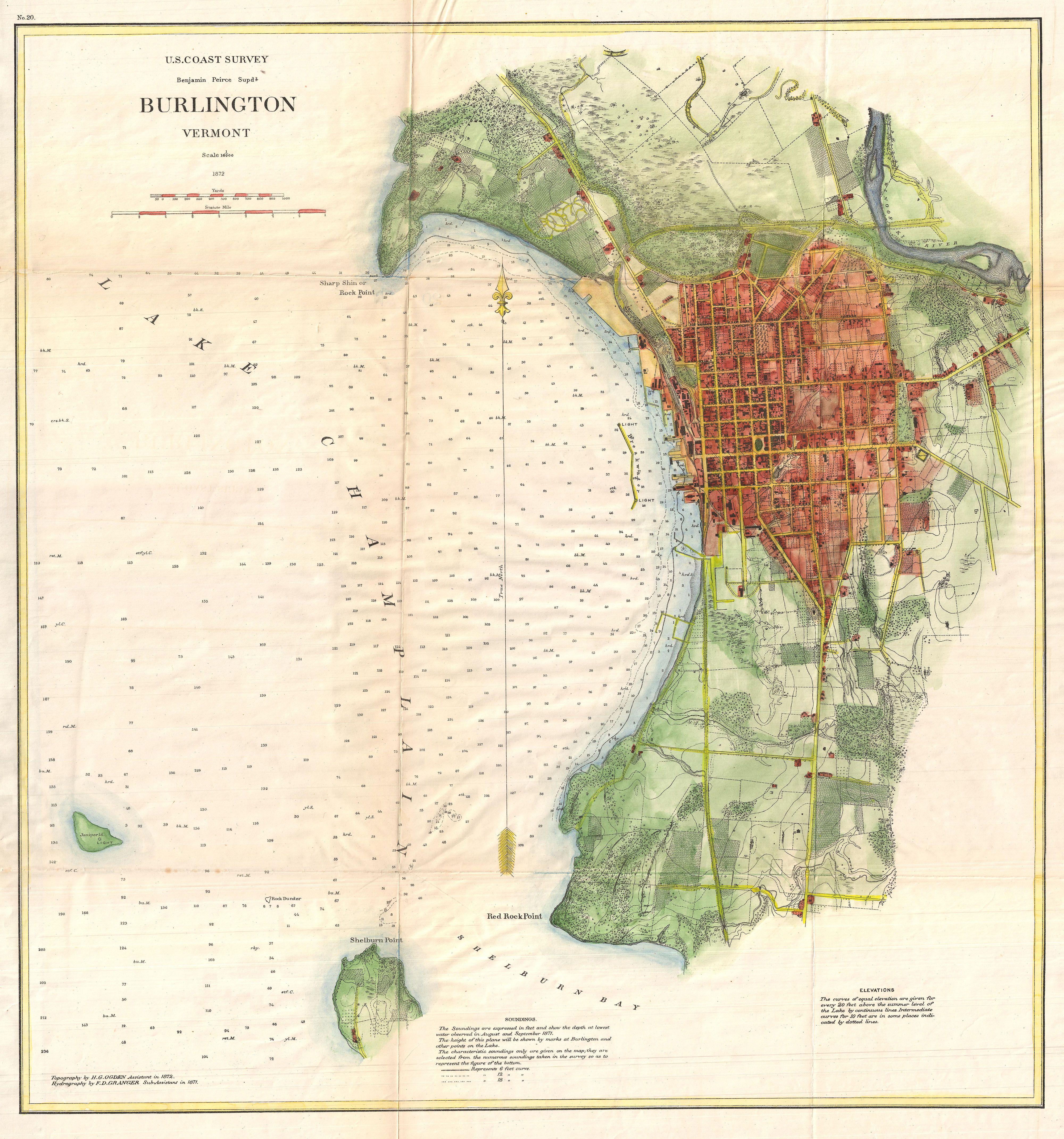
English: A very attractive example of the 1872 U.S. Coast Survey nautical chart or map of Burlington, Vermont. This map covers the urban center of Burlington as well as the surrounding areas as far south as Shelburn Point and as far north as far as Rock Point. Offers exceptional inland detail with important building, streets, and property lines shown. In Lake Champlain there are countless depth soundings as well as notes on reefs and shoals. The whole was produced under the supervision of Benjamin Peirce, Superintendent of the U.S. |
|||||
| Date | 1872 (dated) | |||||
| Dimensions | height: 20.5 in (52 cm); width: 19 in (48.2 cm) | |||||
| Accession number |
Geographicus link: BurlingtonVermont-uscs-1872 |
|||||
| Source/Photographer |
Report of the Superintendent of the United States Coast Survey, (Washington) 1872.
|
|||||
| Permission (Reusing this file) |
|
|||||
File history
Click on a date/time to view the file as it appeared at that time.
| Date/Time | Thumbnail | Dimensions | User | Comment | |
|---|---|---|---|---|---|
| current | 06:33, 25 March 2011 | | 4,000 × 4,280 (2.88 MB) | BotMultichillT (talk | contribs) | {{subst:User:Multichill/Geographicus |link=http://www.geographicus.com/P/AntiqueMap/BurlingtonVermont-uscs-1872 |product_name=1872 U.S. Coast Survey Map of Burlington, Vermont |map_title=Burlington Vermont. |description=A very attractive example of the 18 |
You cannot overwrite this file.
File usage on Commons
The following page uses this file: