File:1967 GB&NI TPO, ship and air service map.jpg

Size of this preview: 600 × 600 pixels. Other resolutions: 240 × 240 pixels | 480 × 480 pixels | 836 × 836 pixels.
Original file (836 × 836 pixels, file size: 239 KB, MIME type: image/jpeg)
Captions
Captions
Add a one-line explanation of what this file represents
Summary edit
| Description |
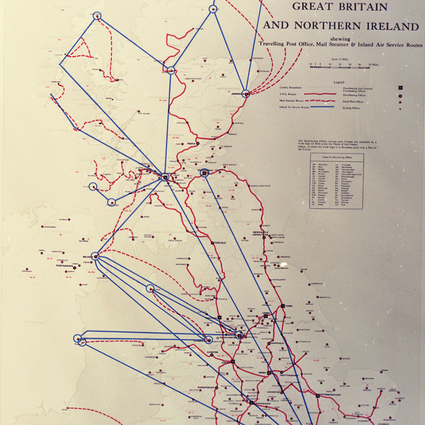
English: 1967 Circulation Map of Great Britain and Northern Ireland shewing Travelling Post Office, Mail Steamer & Inland Air Service routes |
| Date | |
| Source |
https://www.postalmuseum.org/wp-content/uploads/2019/06/Maps05_POST-21-175.jpg linked from https://www.postalmuseum.org/collections/maps/ |
| Author | General Post Office |
Licensing edit
This work created by the United Kingdom Government is in the public domain.
This is because it is one of the following:
HMSO has declared that the expiry of Crown Copyrights applies worldwide (ref: HMSO Email Reply)
|
 |
File history
Click on a date/time to view the file as it appeared at that time.
| Date/Time | Thumbnail | Dimensions | User | Comment | |
|---|---|---|---|---|---|
| current | 13:11, 10 August 2020 | | 836 × 836 (239 KB) | Ww2censor (talk | contribs) | {{Information |Description={{en|1967 Circulation Map of Great Britain and Northern Ireland shewing Travelling Post Office, Mail Steamer & Inland Air Service routes}} |Source=https://www.postalmuseum.org/wp-content/uploads/2019/06/Maps05_POST-21-175.jpg <br> linked from https://www.postalmuseum.org/collections/maps/ |Date=1967 |Author=General Post Office |Permission= |other_versions= }} == {{int:license-header}} == {{PD-UKGov}} Category:1967 maps [[Category:Phi... |
You cannot overwrite this file.
File usage on Commons
The following 3 pages use this file: