File:20080826035DR Dresden Pieschner Hafen.jpg
Size of this preview: 800 × 598 pixels. Other resolutions: 320 × 239 pixels | 640 × 478 pixels | 1,024 × 765 pixels | 1,280 × 957 pixels | 2,560 × 1,913 pixels.
Original file (2,560 × 1,913 pixels, file size: 5.75 MB, MIME type: image/jpeg)
Captions
Captions
Add a one-line explanation of what this file represents
Summary
edit| Description |
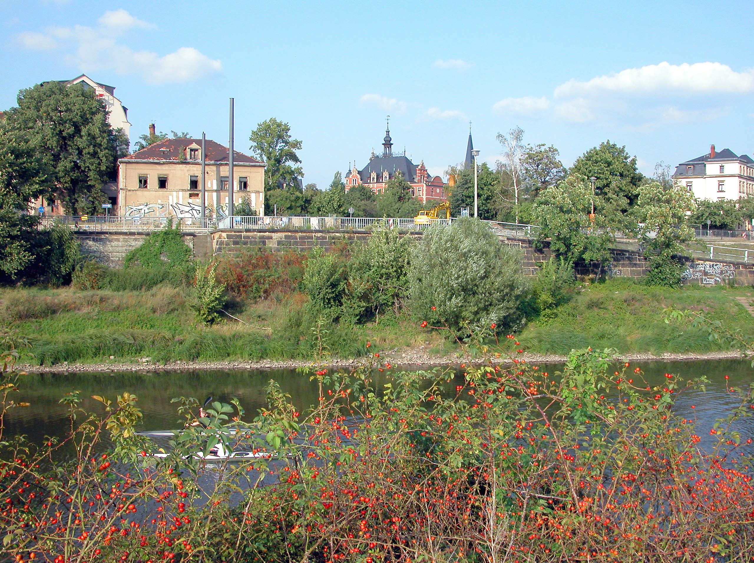
Deutsch: 26.08.2008 01127 Dresden-Pieschen (Neudorf), Moritzburger Straße 1: Pieschner Hafen (GMP 51.073821,13.721491). Der Hafen wurde zwischen 1856 und 1859 im Auftrag der sächsischen Staatsregierung wegen der starken Zunahme des Schiffsverkehrs angelegt. Das Hafenbecken ist 500 Meter lang und etwa 30 Meter breit und liegt überwiegend auf Neudorfer Flur. Es fanden bis zu 30 Schiffe Platz. Vorübergehend wurden hier in einer kleinen Werft Frachtkähne repariert. Mit Inbetriebnahme des Alberthafens 1895 sank die Bedeutung des Pieschener Hafens. Der Hafen wird heute nur noch als Winterhafen genutzt. Blick nach Norden zur Bebauung der Leipziger Straße. Links die Ruine Leipziger Straße 108 (GMP: 51.076507,13.719568). In Bildmitte das Rathaus Pieschen. [DSCN33925.TIF]20080826035DR.JPG(c)Blobelt |
||||||||||||||
| Date | |||||||||||||||
| Source | Own work | ||||||||||||||
| Author |
|
||||||||||||||

| Camera location | | View this and other nearby images on: OpenStreetMap |
|---|
| Object location | | View this and other nearby images on: OpenStreetMap |
|---|
Licensing
edit
This file is licensed under the Creative Commons Attribution-Share Alike 4.0 International license.
- You are free:
- to share – to copy, distribute and transmit the work
- to remix – to adapt the work
- Under the following conditions:
- attribution – You must give appropriate credit, provide a link to the license, and indicate if changes were made. You may do so in any reasonable manner, but not in any way that suggests the licensor endorses you or your use.
- share alike – If you remix, transform, or build upon the material, you must distribute your contributions under the same or compatible license as the original.
File history
Click on a date/time to view the file as it appeared at that time.
| Date/Time | Thumbnail | Dimensions | User | Comment | |
|---|---|---|---|---|---|
| current | 19:06, 14 July 2023 | | 2,560 × 1,913 (5.75 MB) | Jörg Blobelt (talk | contribs) | Uploaded a work by {{Creator:Jörg Blobelt}} from {{own}} with UploadWizard |
You cannot overwrite this file.
File usage on Commons
The following 4 pages use this file: