File:20080928175DR Freital Panorama nach Westen Zauckerode.jpg

Size of this preview: 800 × 530 pixels. Other resolutions: 320 × 212 pixels | 640 × 424 pixels | 1,024 × 678 pixels | 1,280 × 848 pixels | 2,535 × 1,679 pixels.
Original file (2,535 × 1,679 pixels, file size: 4.1 MB, MIME type: image/jpeg)
Captions
Captions
Add a one-line explanation of what this file represents
Summary
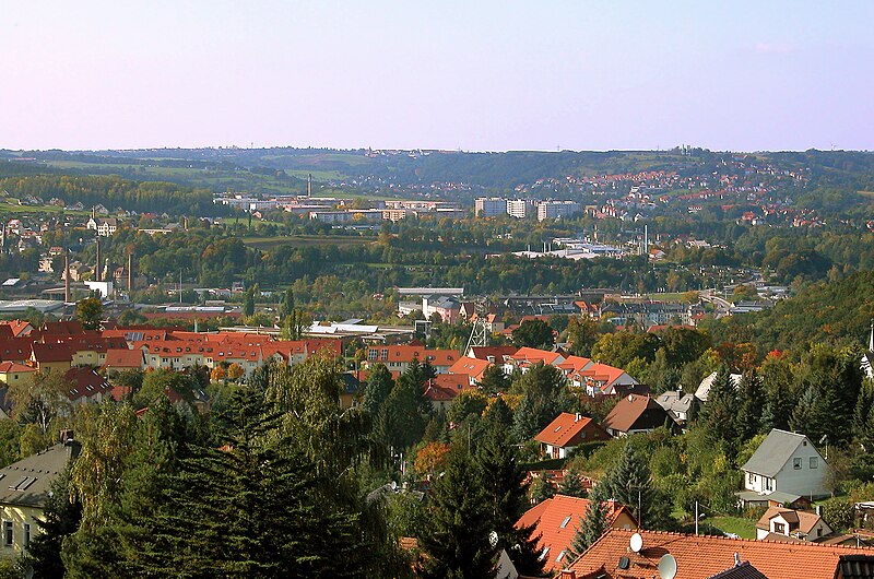
edit| Description |
Deutsch: 28.09.2008 01705 Freital-Burgk (Großburgk): Sicht vom Hartmannsberg (Straßenname) nach Nordwesten. Im Vordergrund Freital-Burg mit dem musealen Förderturm (GMP: 51.003471,13.665797). Im Bildmittelgrund das Plattenbaugebiet Zauckerode (GMP: 51.015051,13.636240). Rechts davon Potschappel, links Döhlen und Deuben. Der weiße
der Döhlener Schule links ist sichtbar. Im Bildmittelgrund zieht sich Freital-Wurgwitz den Hang zum Horizont hinauf, auf dem Kesselsdorf erkennbar ist. [DSCN34352.TIF]20080928175DR.JPG(c)Blobelt |
||||||||||||||
| Date | |||||||||||||||
| Source | Own work | ||||||||||||||
| Author |
|
||||||||||||||

| Object location | | View this and other nearby images on: OpenStreetMap |
|---|
Licensing
edit
This file is licensed under the Creative Commons Attribution-Share Alike 4.0 International license.
- You are free:
- to share – to copy, distribute and transmit the work
- to remix – to adapt the work
- Under the following conditions:
- attribution – You must give appropriate credit, provide a link to the license, and indicate if changes were made. You may do so in any reasonable manner, but not in any way that suggests the licensor endorses you or your use.
- share alike – If you remix, transform, or build upon the material, you must distribute your contributions under the same or compatible license as the original.
File history
Click on a date/time to view the file as it appeared at that time.
| Date/Time | Thumbnail | Dimensions | User | Comment | |
|---|---|---|---|---|---|
| current | 19:06, 26 July 2023 | | 2,535 × 1,679 (4.1 MB) | Jörg Blobelt (talk | contribs) | Uploaded a work by {{Creator:Jörg Blobelt}} from {{own}} with UploadWizard |
You cannot overwrite this file.
File usage on Commons
There are no pages that use this file.
File usage on other wikis
The following other wikis use this file:
- Usage on nl.wikipedia.org