File:20090829035DR Dresden-Friedrichstadt RAW-Bücke.jpg

Size of this preview: 800 × 593 pixels. Other resolutions: 320 × 237 pixels | 640 × 474 pixels | 1,024 × 759 pixels | 1,280 × 949 pixels | 2,522 × 1,869 pixels.
Original file (2,522 × 1,869 pixels, file size: 4.81 MB, MIME type: image/jpeg)
Captions
Captions
Add a one-line explanation of what this file represents
Summary
edit| Description |
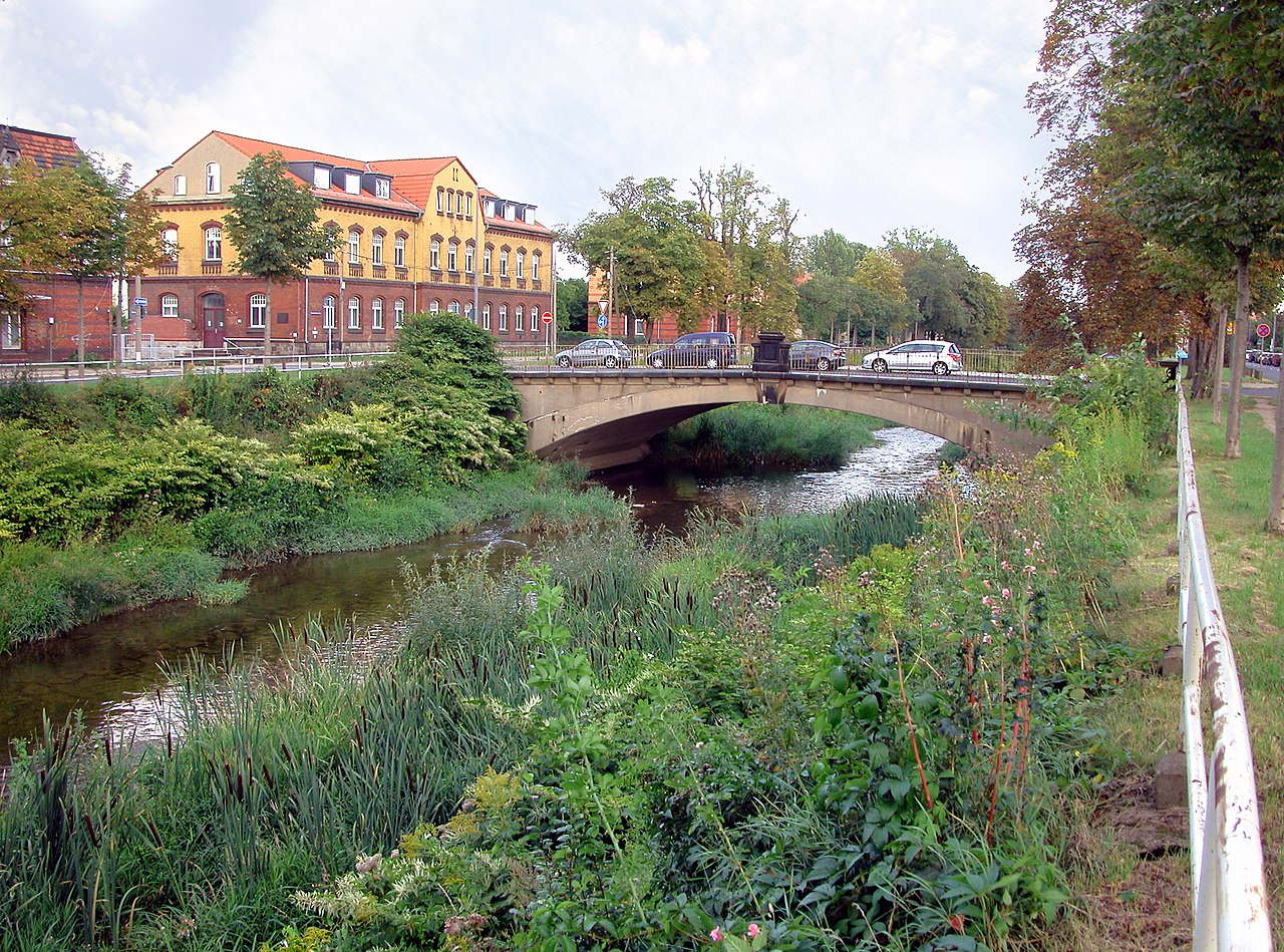
Deutsch: 29.08.2009 01159 Dresden-Friedrichstadt/Cotta: RAW-Brücke (GMP: 51.052469,13.698274), Straßenbrücke über die Weißeritz in Höhe Emerich-Ambros-Ufer 54. Die nach dem einstigen Reichsbahn-Ausbesserungswerk benannte RAW-Brücke wird im September 2009 abgerissen und 2010 durch eine 50 cm höher liegende Fußgängerbrücke ersetzt. Sie muß dem Hochwasserschutz weichen, weil ihr Durchlaß zu klein ist. Sicht von Westen. [DSCN38661.JPG]20090829035DR.JPG(c)Blobelt |
||||||||||||||
| Date | |||||||||||||||
| Source | Own work | ||||||||||||||
| Author |
|
||||||||||||||

| Object location | | View this and other nearby images on: OpenStreetMap |
|---|
Licensing
edit
This file is licensed under the Creative Commons Attribution-Share Alike 4.0 International license.
- You are free:
- to share – to copy, distribute and transmit the work
- to remix – to adapt the work
- Under the following conditions:
- attribution – You must give appropriate credit, provide a link to the license, and indicate if changes were made. You may do so in any reasonable manner, but not in any way that suggests the licensor endorses you or your use.
- share alike – If you remix, transform, or build upon the material, you must distribute your contributions under the same or compatible license as the original.
File history
Click on a date/time to view the file as it appeared at that time.
| Date/Time | Thumbnail | Dimensions | User | Comment | |
|---|---|---|---|---|---|
| current | 17:44, 25 April 2020 | | 2,522 × 1,869 (4.81 MB) | Jörg Blobelt (talk | contribs) | Uploaded a work by {{Creator:Jörg Blobelt}} from {{own}} with UploadWizard |
You cannot overwrite this file.
File usage on Commons
The following 3 pages use this file: