File:9153Urbiztondo San Carlos City Road 22.jpg

Size of this preview: 800 × 600 pixels. Other resolutions: 320 × 240 pixels | 640 × 480 pixels | 1,024 × 768 pixels | 1,280 × 960 pixels | 2,560 × 1,920 pixels | 4,608 × 3,456 pixels.
Original file (4,608 × 3,456 pixels, file size: 5.67 MB, MIME type: image/jpeg)
Captions
Captions
Urbiztondo-San Carlos City Road
Summary
edit
| Description |
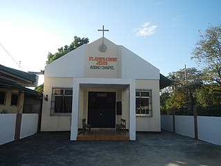
English: Agdao, San Carlos, Pangasinan Sitios Tokok and Nansangan Junction North Agdao Integrated School, San Carlos, Pangasinan Polo, San Carlos, Pangasinan Saint Joseph of Infant Jesus Agdao Chapel San Juan, San Carlos, Pangasinan San Juan Bridge, San Carlos City Martin P. Posadas Avenue (from San Pedro-Taloy Junction to the foot of San Juan Bridge eastern portion) Mestizo Norte, San Carlos, Pangasinan Palaris, San Carlos, Pangasinan along the Urbiztondo-San Carlos City Road (San Carlos City) Caoayan Kiling, San Carlos, Pangasinan Calobaoan, San Carlos, Pangasinan Abanon Central School, San Carlos City Abanon, San Carlos, Pangasinan Category:Sitios and puroks of the Philippines Subdivisions of the Philippines List of barangays in Pangasinan, Barangays Dalanguiring, Urbiztondo, Pangasinan Urbiztondo, Pangasinan bounded by Category:Sitios and puroks of the Philippines Subdivisions of the Philippines List of barangays in Pangasinan, Barangays San Juan, San Carlos, Pangasinan 15.9139, 120.3372 Mestizo Norte, San Carlos, Pangasinan 15.9012, 120.3438 Palaris, San Carlos, Pangasinan 15.9215, 120.3526 Malacañang, San Carlos, Pangasinan 15.8765, 120.3338 Agdao, San Carlos, Pangasinan 15.8979, 120.3350 Polo, San Carlos, Pangasinan 15.9012, 120.3313 San Carlos, Pangasinan, Pangasinan Province from or along Carmen Junction-Manat Road, KM 172+(-289) - KM 189+250 Barangays Carmen East and Carmen West, Carmen East 15°53'0"N 120°36'18"E Rosales, Pangasinan from or along the MacArthur Highway or Manila North Road Philippine highway network (Note: Judge Florentino Floro, the owner, to repeat, Donor Florentino Floro of all these photos hereby donate gratuitously, freely and unconditionally Judge Floro all these photos to and for Wikimedia Commons, exclusively, for public use of the public domain, and again without any condition whatsoever). |
| Date | |
| Source | Own work |
| Author | Judgefloro |
| Camera location | | View this and other nearby images on: OpenStreetMap |
|---|
Agdao, San Carlos, Pangasinan 15.8979, 120.3350
Licensing
edit
I, the copyright holder of this work, hereby publish it under the following license:
| This file is made available under the Creative Commons CC0 1.0 Universal Public Domain Dedication. | |
| The person who associated a work with this deed has dedicated the work to the public domain by waiving all of their rights to the work worldwide under copyright law, including all related and neighboring rights, to the extent allowed by law. You can copy, modify, distribute and perform the work, even for commercial purposes, all without asking permission.
|
File history
Click on a date/time to view the file as it appeared at that time.
| Date/Time | Thumbnail | Dimensions | User | Comment | |
|---|---|---|---|---|---|
| current | 07:16, 15 December 2019 | | 4,608 × 3,456 (5.67 MB) | Judgefloro (talk | contribs) | User created page with UploadWizard |
You cannot overwrite this file.
File usage on Commons
There are no pages that use this file.