File:Acer saccharinum range map.svg

Size of this PNG preview of this SVG file: 576 × 599 pixels. Other resolutions: 231 × 240 pixels | 461 × 480 pixels | 738 × 768 pixels | 984 × 1,024 pixels | 1,968 × 2,048 pixels | 1,300 × 1,353 pixels.
Original file (SVG file, nominally 1,300 × 1,353 pixels, file size: 686 KB)
Captions
Captions
Add a one-line explanation of what this file represents
Summary edit
| Description |
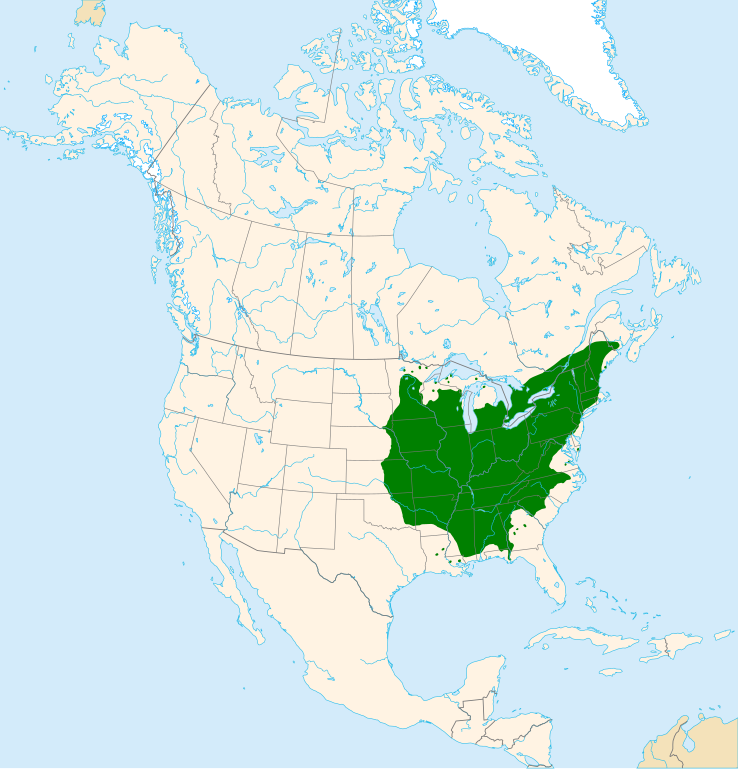
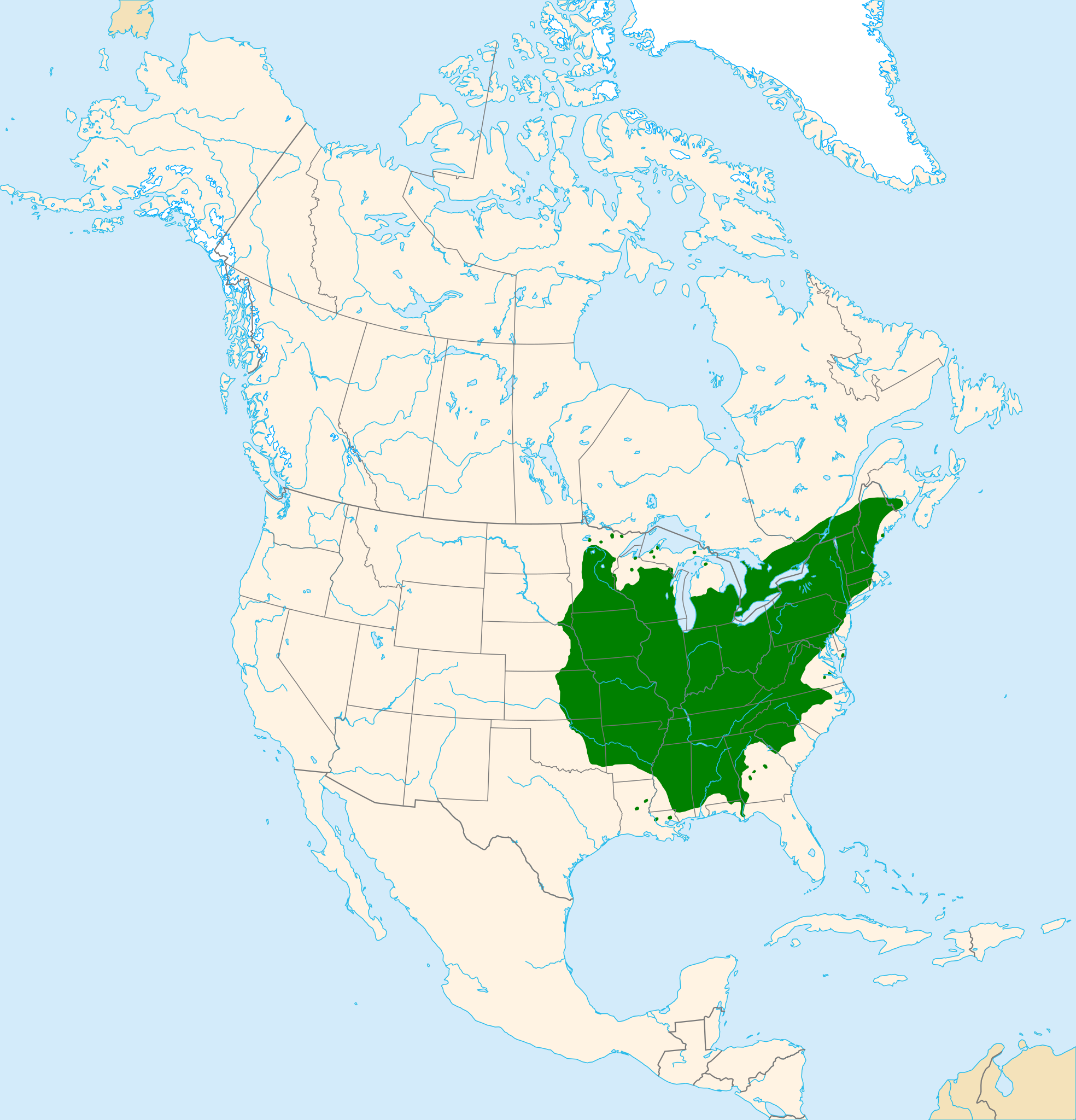
English: Range map of silver maple (Acer saccharinum).
Suomi: Hopeavaahteran (Acer saccharinum) levinneisyys. |
| Date | |
| Source | Own work |
| Author | Halava |
Data sources:
- Coastlines, lakes, rivers, glaciers and political borders are from Natural Earth.
- Distributional data is from U.S. Geological Survey.
Map projection: Lambert Azimuthal Equal Area Projection
Datum: North American Datum 1983
Licensing edit
I, the copyright holder of this work, hereby publish it under the following license:
This file is licensed under the Creative Commons Attribution-Share Alike 3.0 Unported license.
- You are free:
- to share – to copy, distribute and transmit the work
- to remix – to adapt the work
- Under the following conditions:
- attribution – You must give appropriate credit, provide a link to the license, and indicate if changes were made. You may do so in any reasonable manner, but not in any way that suggests the licensor endorses you or your use.
- share alike – If you remix, transform, or build upon the material, you must distribute your contributions under the same or compatible license as the original.
File history
Click on a date/time to view the file as it appeared at that time.
| Date/Time | Thumbnail | Dimensions | User | Comment | |
|---|---|---|---|---|---|
| current | 17:49, 22 August 2012 | | 1,300 × 1,353 (686 KB) | Halava (talk | contribs) | New color scheme and projection |
| 14:03, 22 August 2011 |  | 2,000 × 2,000 (415 KB) | Halava (talk | contribs) | {{Information |Description ={{en|1=Range map of silver maple (''Acer saccharinum'').}} |Source ={{own}} using Grass GIS and Inkscape. Data sources: * Coastlines, lakes, and borders are from [http://www.ngdc.noaa.gov/mgg/coast/ National Geophys |
You cannot overwrite this file.
File usage on Commons
The following 3 pages use this file:
File usage on other wikis
The following other wikis use this file:
- Usage on arz.wikipedia.org
- Usage on ca.wikipedia.org
- Usage on cs.wikipedia.org
- Usage on eo.wikipedia.org
- Usage on es.wikipedia.org
- Usage on eu.wikipedia.org
- Usage on fa.wikipedia.org
- Usage on fi.wikipedia.org
- Usage on hu.wikipedia.org
- Usage on it.wikipedia.org
- Usage on pl.wikipedia.org
- Usage on pt.wikipedia.org
- Usage on sv.wikipedia.org
- Usage on tr.wikipedia.org
- Usage on vi.wikipedia.org
- Usage on www.wikidata.org